You mean this ParaMagician head counter?
I’m grateful for AAV till the 24th
Yup. Fun times and thank god you keep your tracks. Very helpful now.
Current acreage?
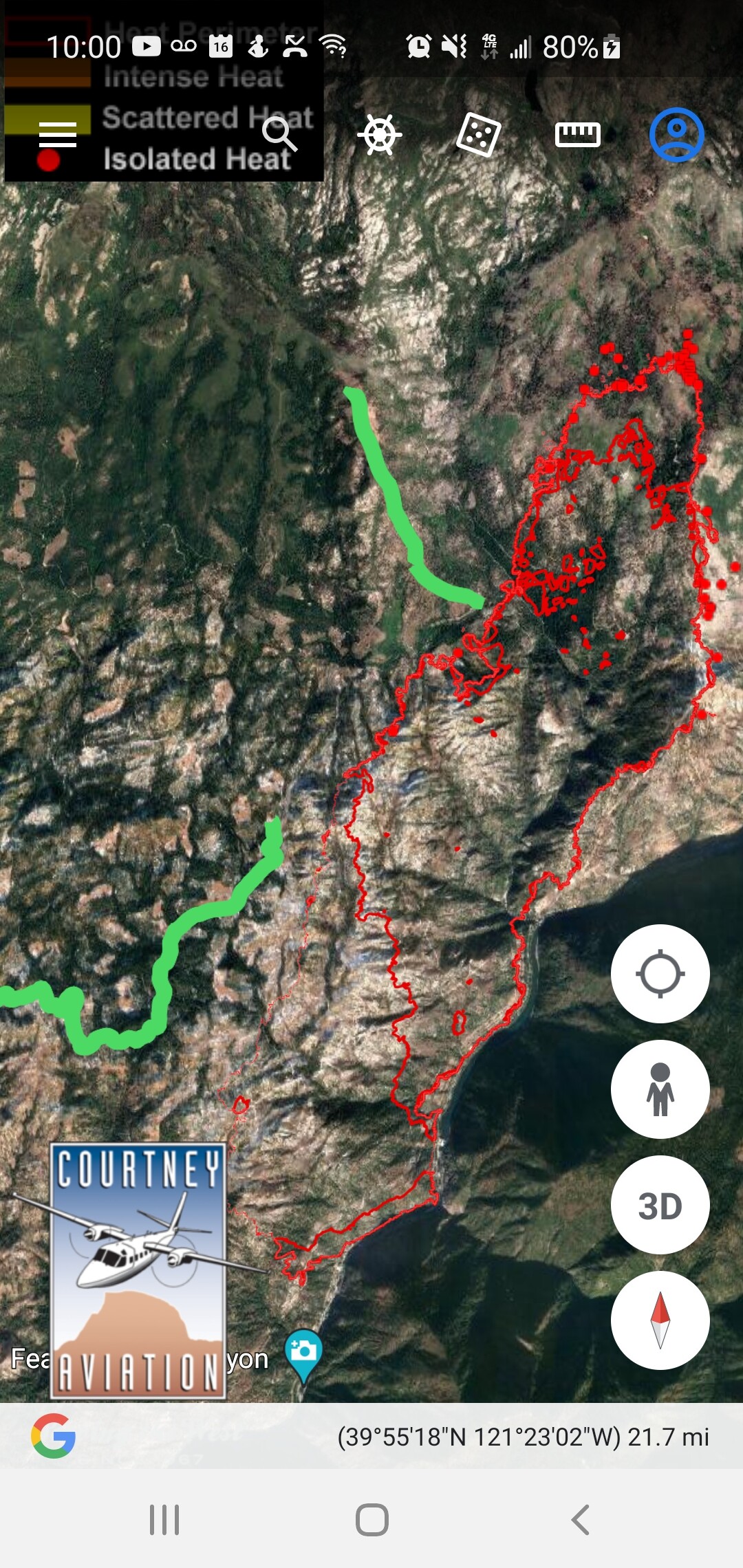
209 this morning said 7,000 and change. IR was 6 something
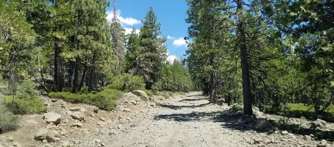
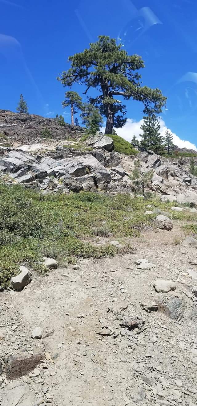
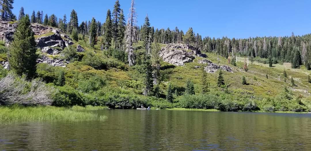
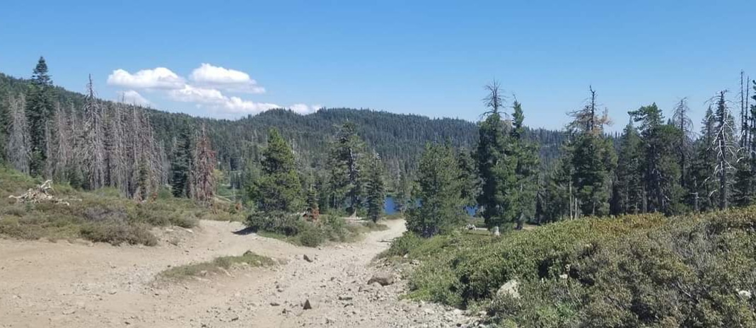
Here are a few pictures from the High Lakes area NW of the current fire perimeter that I took in 2018. Beautiful country, but very rocky and lots of areas of standing dead trees.
UP has moved a Fire Train into the Feather River line and it consists of 3 22,000 gallon tank cars with fire pumps.
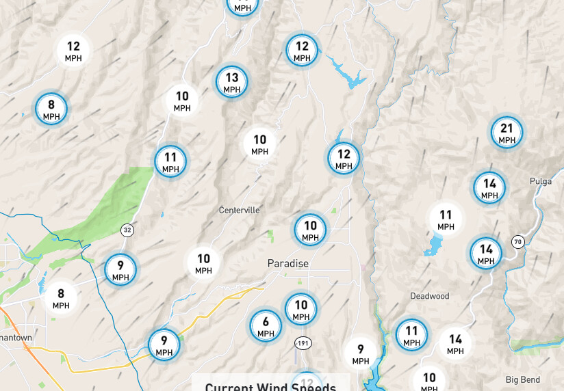
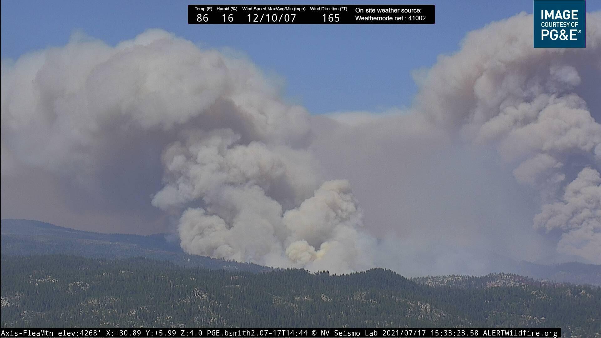
About an hour ago the winds here picked up and changed direction a little. Go and playback the cameras and about noon to 12:30 you can see the changes. As some one put it yesterday. Looks like she has her legs under her and she’s ready to run.
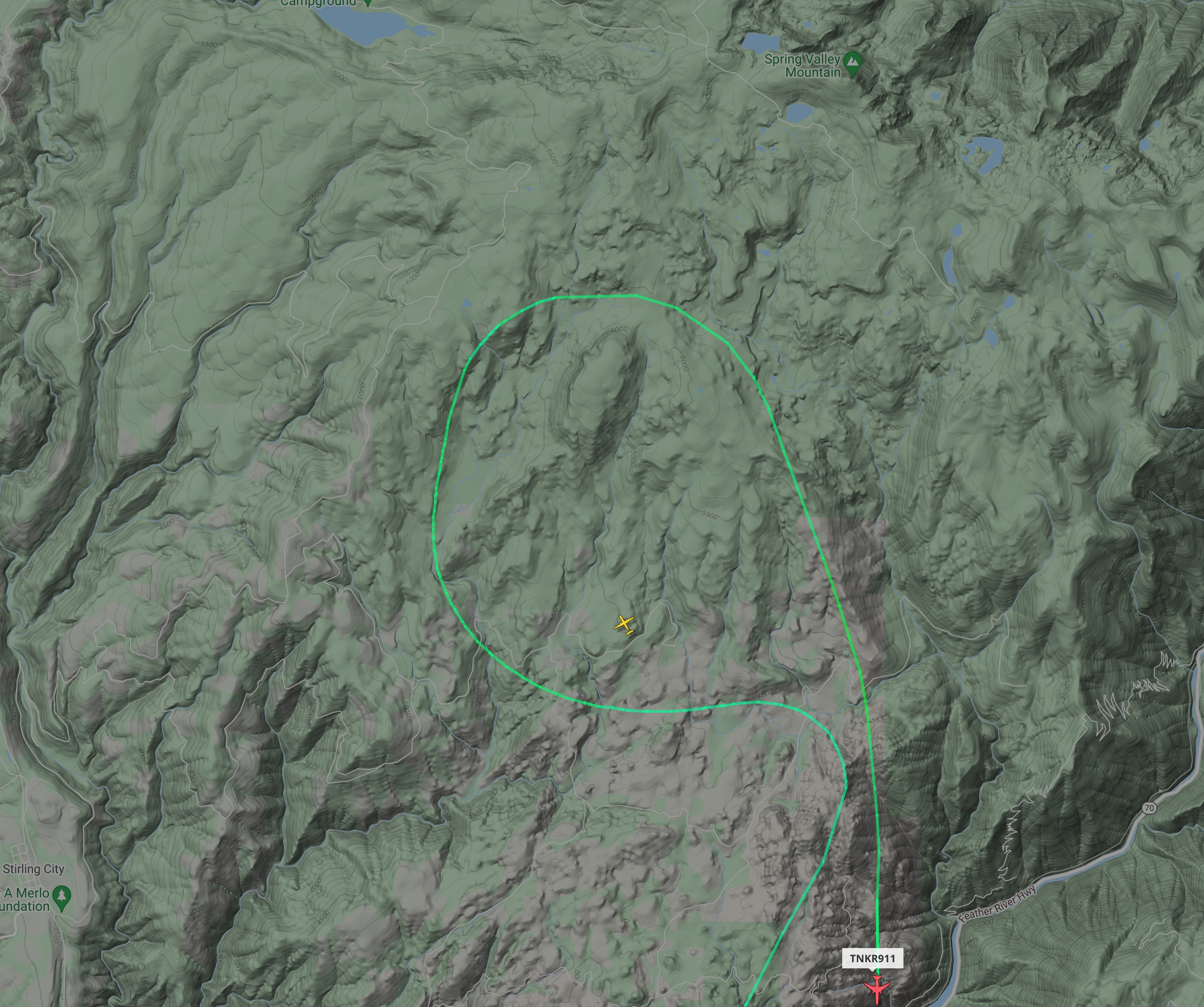
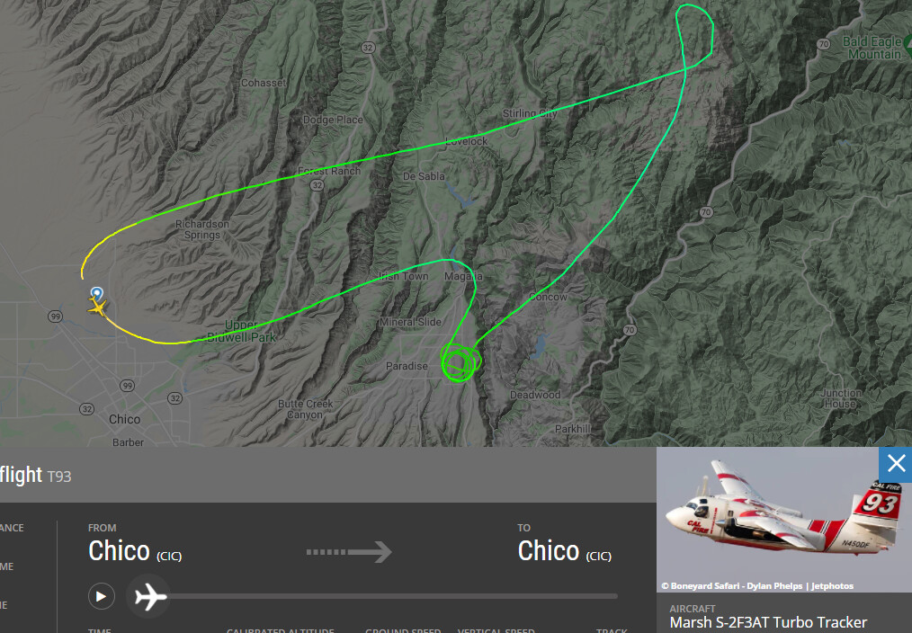
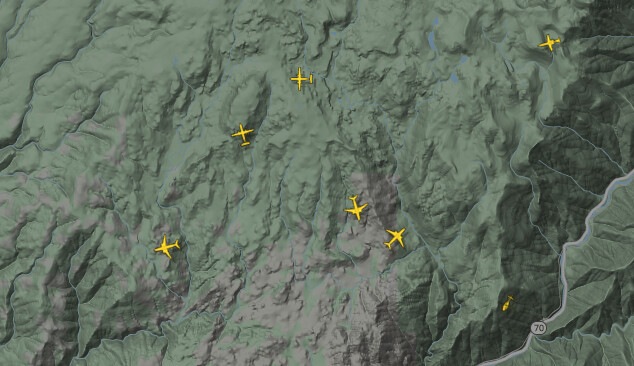
It looks like we have coverage from the air
Just checked with my sources from the railroad, both UP and BNSF have westbound traffic coming down the FRC in the next hour or so. I would expect the fire train to tie-up at either Portola or Marysville yards. Let me know if you have eyes on it inside the FRC. Thanks again for the update. I would expect the “Bronco” or high-railer to confirm the Main is clear for traffic.
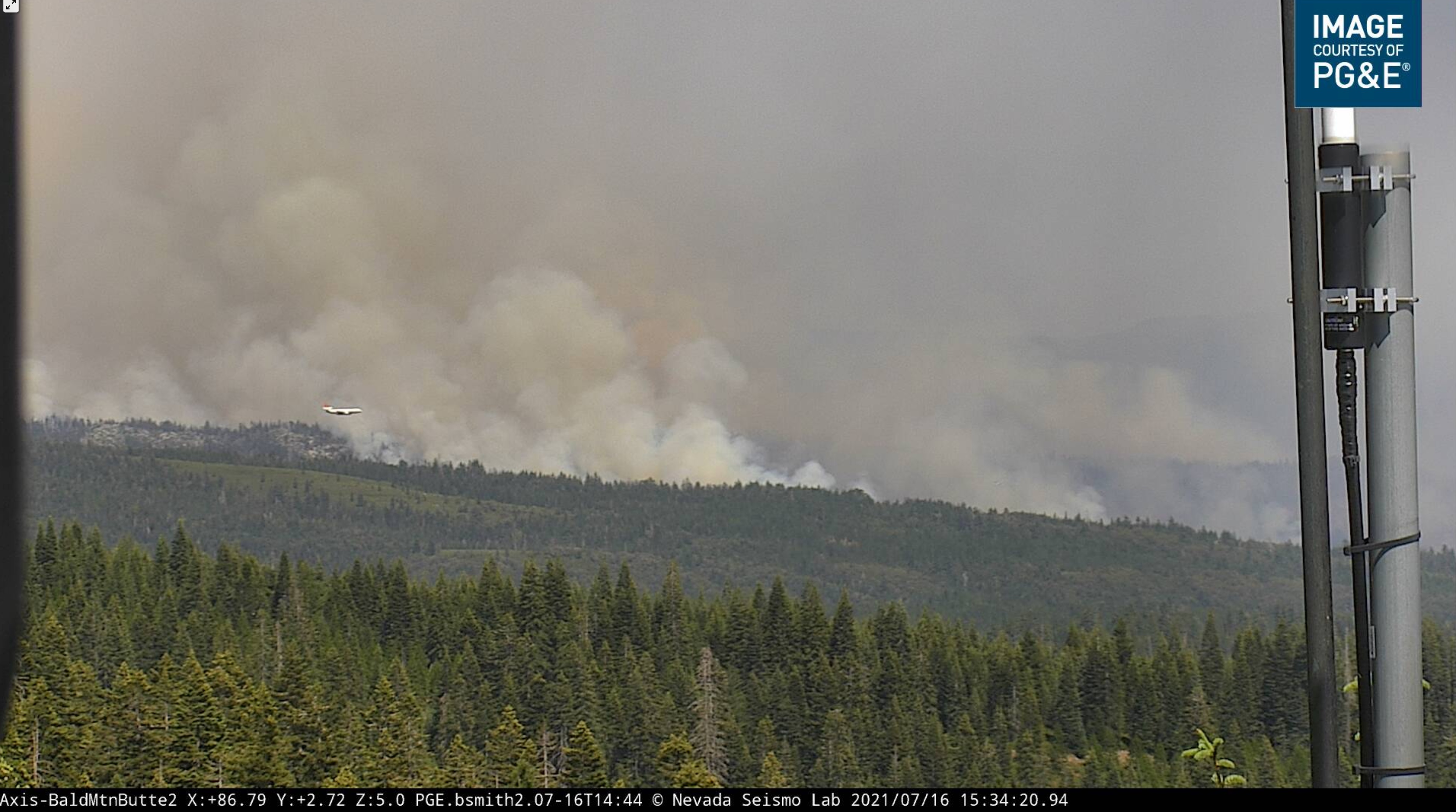
Looks like tankers are painting the slash-covered ridge I was talking about earlier.
One of the tankers spotted a fire just up the road from us. 2 Tankers were lining up to do a drop… but the locals got to it first… Cal Fire Cleaned up… Tankers did one last pass on us and went back to the Dixie
Owner clearing brush in maybe not the best of conditions. Got to grab the trusty McCloud and have some fun.
I listen to the UP operations net for that area. If I do find out anything I’ll post it here.
Index of /public/incident_specific_data/calif_n/!CALFIRE/!2021_Incidents/CA-BTU-009205_Dixie is a empty folder, is it somewhere else?
Update
The file folder names are now setup for the Dixie Fire, no files yet as of 1958.
The IMT-1 Dropbox has not populated yet either. Just looked at 1825.
9847 Acres and 12 % contained. The fire continues to burning in a remote area with limited access. Steep and inaccessible terrain are continuing to make containment difficult. Weather conditions are going to continue to gradually warm throughout the weekend. North East winds 10-15 mph will develop overnight with localized gusts 20-25 mph in the most exposed locations. Monsoonal moisture will begin spreading into the area Sunday bring scattered thunderstorms late Sunday night through Monday.
Here is the link to the rest of the Cal-Fire morning update
https://www.fire.ca.gov/incidents/2021/7/14/dixie-fire/
The Mid Day breeze is coming up and the skies are clearing. The smoke cloud is headed towards Lake Almanor So far it has been a helo type of day. We will see if More Air Cover develops shortly
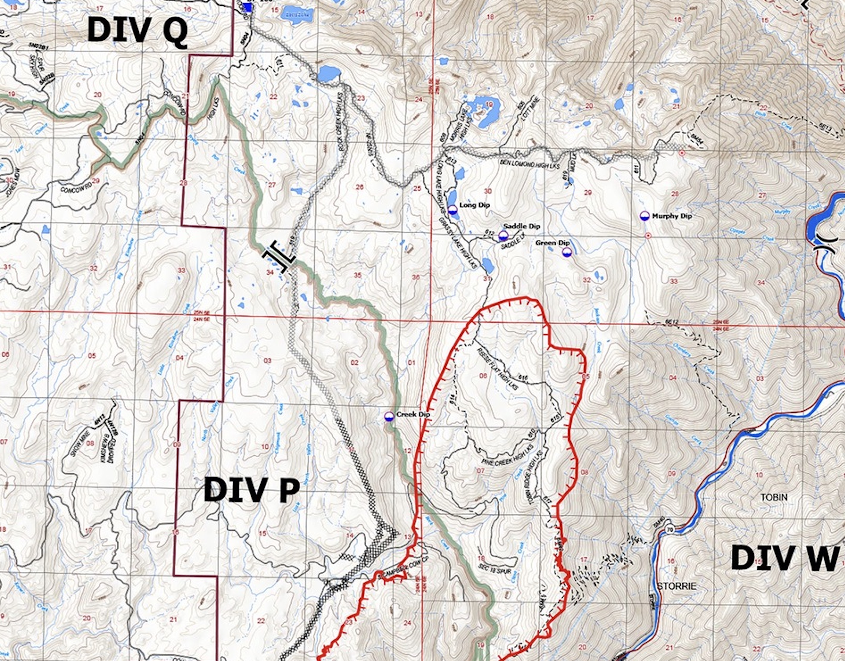
Looking at Flea cam, fire is cooking up hot in Rock Creek drainage. Helos were working hard in Div P to cool it down adjacent to the dozer line west of Creek Dip.
I wouldn’t call it near Lott’s Lake, but they are referring to that area on the scanner because they are working dozer line in from Lott’s. The fire is still quite a ways from Lott’s Lake, which is the larger lake near the “Q” in Pyrogeography’s map. It sounds like fire is closest to Morris Lake, which is one of the high lakes quite a bit to the east (horseshoe shaped lake in about the top center of Pyro’s map). An important difference to locals.