Yep, thank you for the clarification.
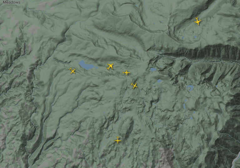
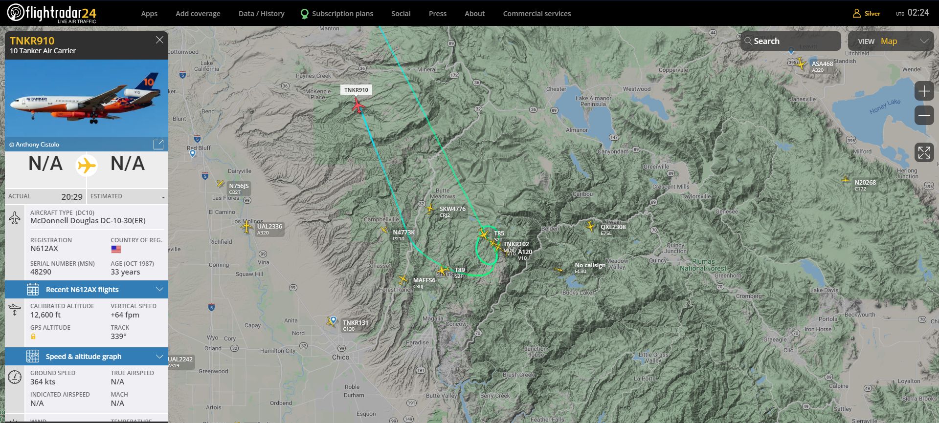
looks like the tankers are lining up to drop, The DC10 just left the frame and the MD80 just dropped her load and the MAFF is in line… 6 total tankers
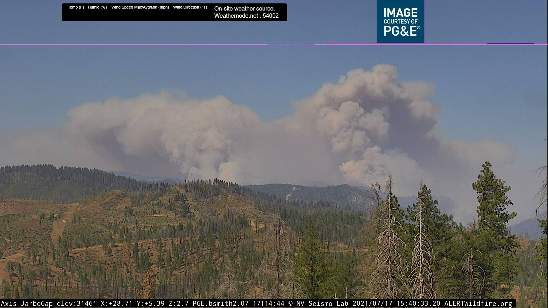
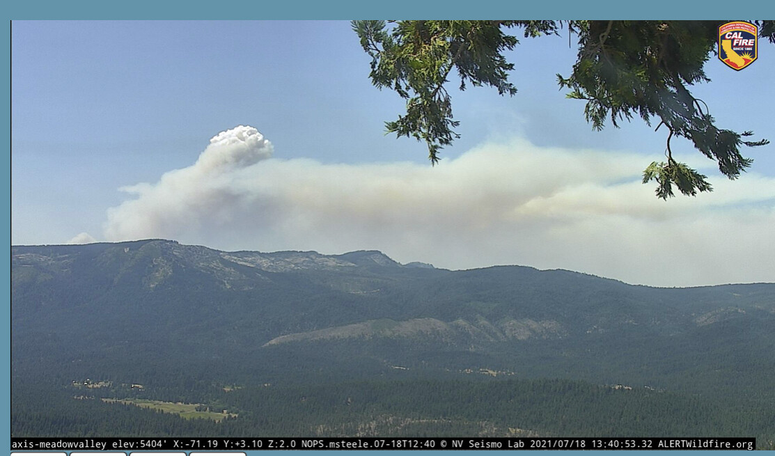
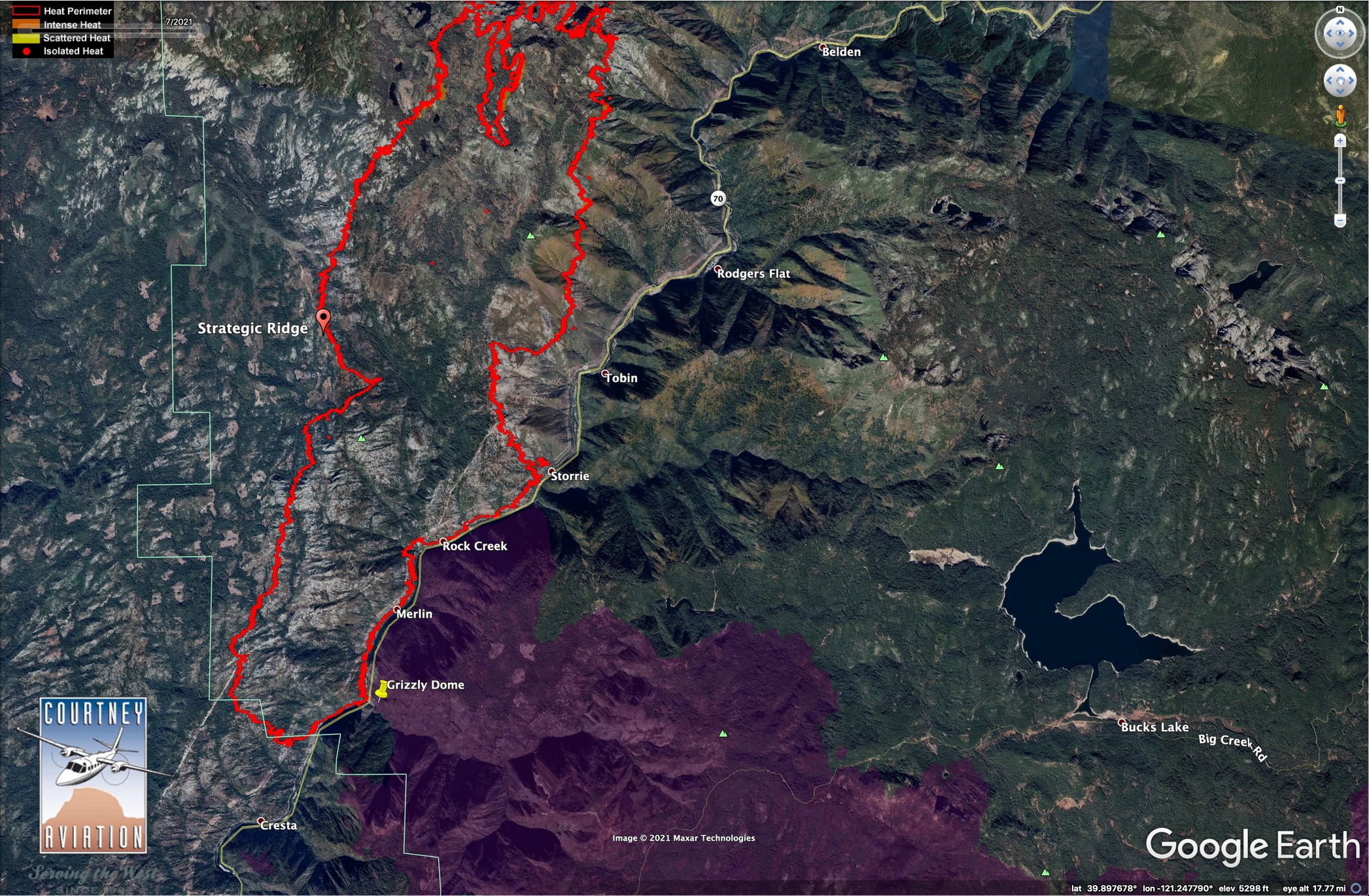
The tankers are starting to paint the ridges well to the west of the primary dozer line in Division P. Can’t see in the cameras what’s going on there, and what the spread is like up the east side of that ridge, but the fire has been ripping hard up Rock Creek all day.
Tomorrow’s IR should be a telling tale on both the Dixie and Tamarack
I just checked again … they’re still at it.
They had the MAFFS running an absolute circuit all day multiple days on the Beckworth, along with 102 & 103, and either 911 or 912, they’re doing it again here.
Here are todays Numbers
15,047 Acres 15 % containment
The Dixie fire continues to burn towards the Northeast, flanking and following the Feather River Canyon. Firefighters worked through the night to construct direct line and extinguish interior hotspots. The is burning in a remote area with limited access, extended travel times and steep terrain which are creating challenges with containment. A Fire Weather Watch is in effect in Butte County due to strong winds, low humidity, and high temperatures. Additional resources from throughout the State are arriving to help support local resources and manage the incident to protect the communities and values at risk.
The Link to Todays Cal Fire Update
https://www.fire.ca.gov/incidents/2021/7/14/dixie-fire/
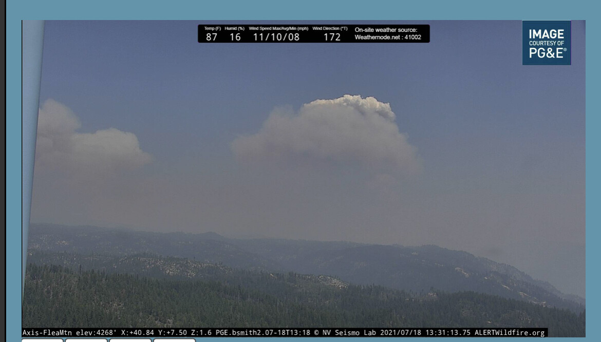
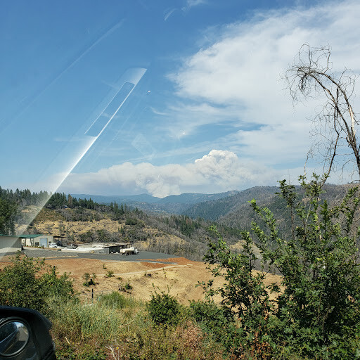
It is very smoky here this morning. Air Quality numbers are up to 500 . waiting for last nights downslope to run into todays winds. Air Cover seems light this morning. It is just soupy in the canyons and valleys this AM
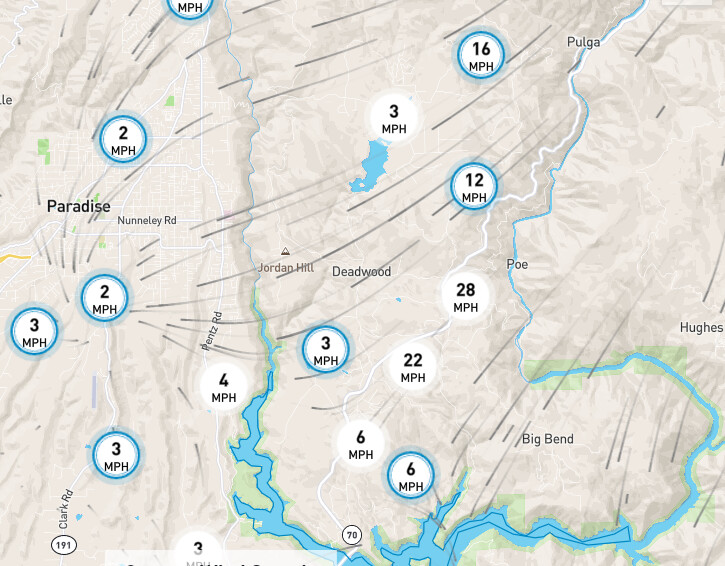
It does not look like it is going to be a good day up on the fire. Winds are already picking up in the Feather River Canyon
Is there a good scanner for this fire , I found a couple . One doesn’t seem to have Dixie Comms and the other I hear Butte SO traffic
Well, that depends on where you are. In Chester, visibility just plummeted to fairly smoky half-mile, maybe out to a mile to make out large, dark objects like treelines. The Air Attack and the SEATs left a little while ago during semi-clarity, but I seriously doubt they’re coming back today, not without a drastic change in the wind.
The smoke is actually even worse than during the North Complex, and that’s saying a lot. Still not as bad as the Chips Fire, when it was literally raining chunks of burnt cinder and large flakes of white ash (more of a gentle shower of very fine ash right now).
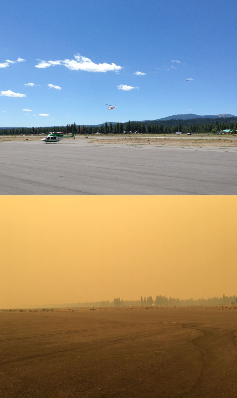
Quick and dirty before and after, with the bottom pic about five minutes ago:
Seeing on Facebook that the fire jumped Hwy 70 and is now burning on the south side of the canyon.
We do an Air Swap With Lake Almanor. In the Morning Paradise looks like a soupy mess. By afternoon when the wind picks up Almanor socks in and Paradise is clear. Every day for the last 4 days like clock work. at the 11’s AM and PM
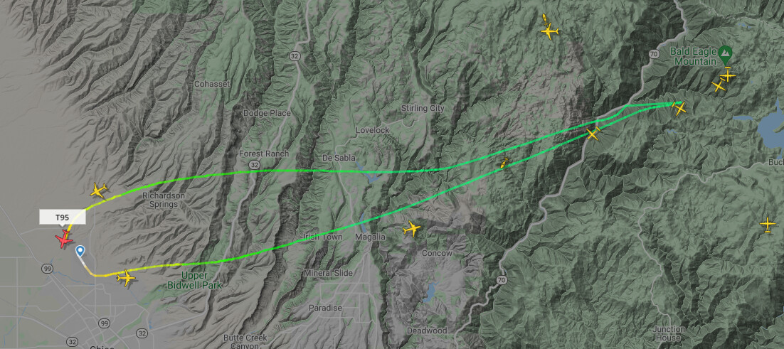
Looks like they are hitting it hard. Look at the trail of one of the tankers and you can see where it jumped 70… Looks like around rock creek camp and Bucks creek. It has a straight shot at Bald Eagle Mt and Bucks Lake . there are a heck of a lot of tankers and AA at the same time… must be crazy up there
Here is a shot from Paradise Lake about 30 minutes ago
Hi SIXONENINE
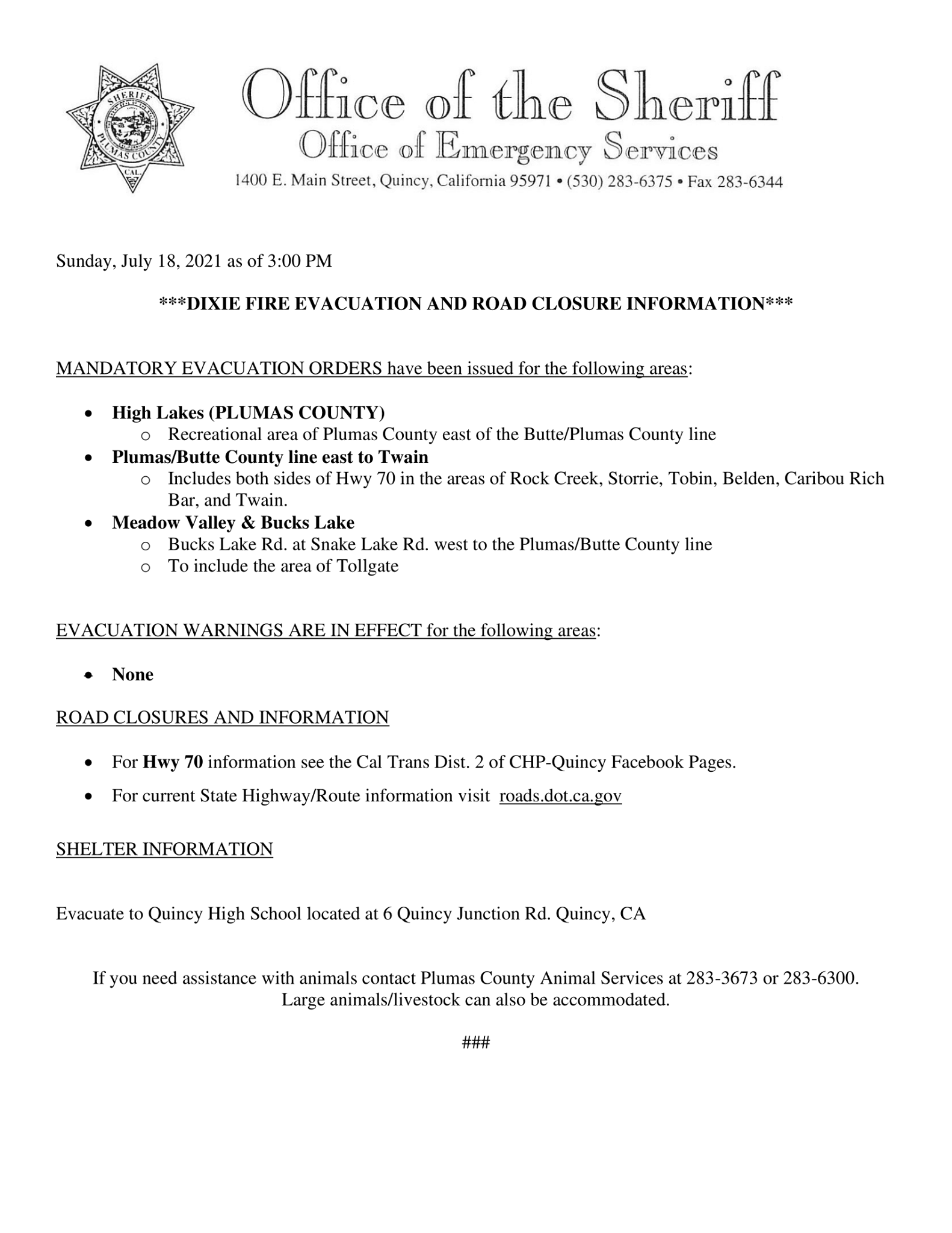
Can you reference your source for “Mandatory Evacuation Alert for the communities of Bucks Lake…”? I’m looking at Plumas County Sheriff Facebook page, post as of 12:30 PM today, mentions no order or warning about Bucks Lake, just the older High Lakes order and newer Hwy 70 corridor order.
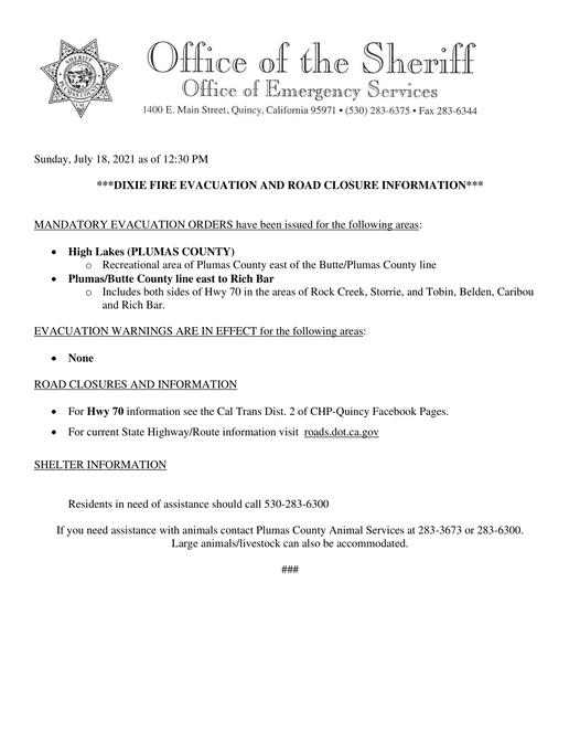
Updated 21 minutes ago on their Facebook.
It has alignment with slope, hot slopes, and upcanyon winds to really blast up the south side of Bald Eagle Mtn if it gets on that slope. Bald Eagle Mtn is little green icon east of Tobin on the map.
Here is a map showing location of 2020 Bear Fire.
Thank you! I guess they were a bit slow to get it on their Facebook page and must have posted it just a few minutes after I looked.
2 posts were merged into an existing topic: Mobile App Support
Also adding new evacuations on the north-west side of the fire
Butte County Sheriff @ButteSheriff
](https://twitter.com/ButteSheriff)
EVACUATION ORDER
7.18.21 4:00 p.m.
The Butte County Sheriff’s Office is issuing an EVACUATION ORDER for Jonesville and Philbrook areas, due to a wildfire burning in the area.
A post was merged into an existing topic: Mobile App Support