So what is going on in the fire? What burned last night?
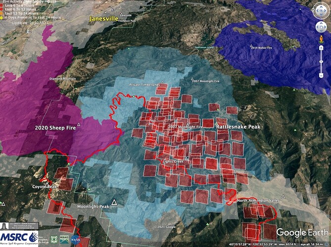
yeah, Looking at google earth and the the current position of the fire, I think I have an idea what the 37 dozer shift to the east side is going to be used for. it a bold plan if they can get the line completed in time to do it before the spotting threat can occur.
I think protecting the image was out about 250,000 acres ago.
Simple IR map. But you can see where the major heat was being generated
Last night’s IR had to avoid the blowup in Lights Creek, but we got MODIS at 3am that shows it pretty well.
Fire seems to have been moving slower in the plantations on private timberland (light blue) that may buy a little time. Or not… Maps and commentary here:
Dixie Fire – 8/10/2021 Morning – The Lookout
Any idea where I can find the IR overflight data for today.
I have been looking in ftp.wildfire.gov/public/incident_specific_data, but there is no folder for August 10th.
Thanks
Courtney hasnt posted their overflight data from last night(if they had any). NIROPS has some data from ~midnight last night posted here: https://ftp.wildfire.gov/public/incident_specific_data/calif_n/!CALFIRE/!2021_Incidents/CA-BTU-009205_Dixie/IR/NIROPS/20210810/20210810_Dixie_KMZ.kmz
Yea, I found that, I guess I have just been spoiled by multiple posts per day of IR data (vs. twice a day satellite updates). Thanks!
They couldn’t fly the big blowup last night.
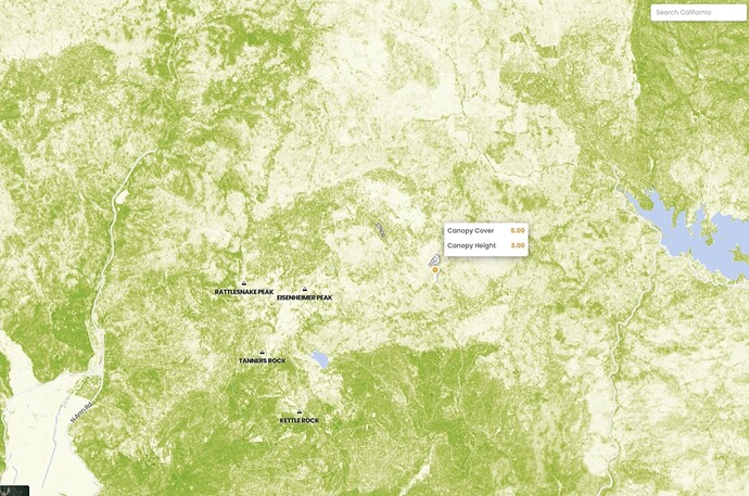
Next road system to the south seems to be Beardsley Grade, with Peters Creek splitting the difference. We are just about out of the Moonlight Scar on the southern edge, with pretty thick forest and scrub southwest of Taylor Lake.
Yeah, you’re right about the heavy veg there. Check out the California Forest Observatory website, it’s really good for mapping out canopy fuels. It’s one of the better tools I have found for picking out past thinning projects. https://tinyurl.com/yexnelxq
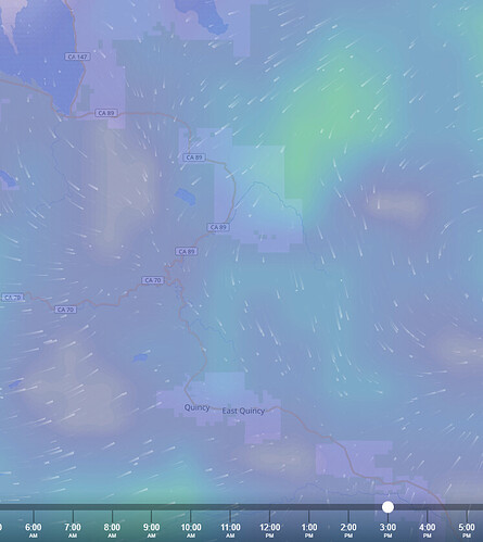
Given that, and the Ventusky predicted afternoon winds, this could get real interesting for the North Arm.
I am not finding anymore CalFire video updates. Anyone have a new link?
Stupid question: There is nothing in today’s IAP for the east zone in this link. I’ve looked back through the thread as best I can, but don’t see anything specific to the east zone. Can anyone point me in the right direction?
Different management team. I dont have the link off hand.
Just look up IMT4 Dixie Fire should get you there.
Last post in the Dixie thread for continuing incidents has a link.
Thank you very much.
You will have to follow this link to YouTube to view:


