Thank you for keeping this site for factual updates and current info on the fire. There is no need to allow posts such as red vs green, or other personal opinions here. Thank you!
Dixie Fire - 8/10/2021 Evening Update.
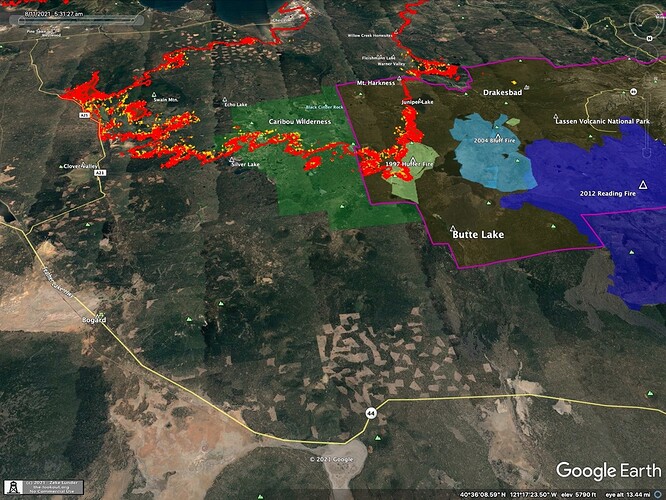
The fire burned actively today, with runs on the east side of Lights Creek, southern tip of Keddie Ridge, south side of Dyer Mtn, the Mud Creek Rim north of Chester, Kelly Mtn, and undeveloped area of Warner Valley.
https://the-lookout.org/2021/08/10/dixie-fire-8-10-2021-evening/
IR mapping from 8/10/2021 at 6:30 pm.
You are mistaken about the affected area in Warner Valley being “undeveloped”. There are homes there, and engines/crews were in the area last night doing structure defense. In addition, the expansion of the fire in this area seems likely to cause a major expansion of the fire in Lassen National Park. The movement across Kelly Mountain, driven by SE winds, seems particularly problematic since it opens the doors to Sifford Mountain, Drakesbad, and beyond. Similarly, if the fire moves up Warner Valley and into the Kings Creek drainage, you can expect another node of expansion.
VIIRS Anomoly?
Yesterday morning on CalTopo in the Lone Rock Valley area the VIIRS show a very regular configuration of signatures headed toward Antelope Lake. I thought the fire had taken a turn, aggressively moving in that direction. Last night’s and this morning’s pass does not prove that out.
Any ideas if that might have been an anomoly during processing of the data or other possible explanation?
Is their a site where I can just find out what happened last night or yesterday. I would like to get info on this fire without the arguments and mumbo jumbo. Just the facts man.
I believe that may be artifact off of the column, as there is no lingering heat. I also remember reading, I think in this thread, that uniform, linear patterns are a tell tale of false hits.
Official updates are released on Facebook on the Lassen National Forest page.
I have seen that many times. It has been mentioned on here before. It seems to be the way the satellite interprets a hot column laying over in that direction and once it clears up it seems to disappear. Pretty much if you see a big blowout looking thing with regularly spaced points, it is not real.
Looks like that is what they did. On today’s map it shows completed dozer line down to the pavement.
Thats was VIIRS picking up heat in the column. Column was gone, which means VIIRS heat signatures are gone.
There are updates here with maps on the fire’s progress in the AM and PM.
https://the-lookout.org/2021/08/10/dixie-fire-8-10-2021-evening/
Fire information updates should be in the continuing incidents thread for this fire. The Questions and Discussions thread (this one) may have discussions, which can have important learning moments. I have earned a ton over the years from Q&D threads on this site and the old hotlist.
Check out this site for an unofficial update on the Dixie morning and evening. Can’t vouch for his info but seems pretty dialed…
The lookout is @pyrogeography.
Zeke is a wealth of knowledge.
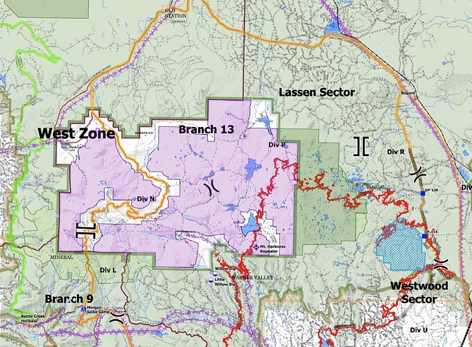
The fire in the Lassen NP is a sleeping giant. Does anyone have a any feel for the proposed action to contain the Park portion of the fire? How many acres of NPS have burned to date ?
It hasn’t been moving too fast up in the high-country. About 10,000 acres burned in LVNP so far.
I think the past managed wildfires are helping there, but I agree. Once it gets out of the sparse, true fir high country it’ll be back to the races.
SPI has all the clearcuts in the foreground. They can’t be too happy seeing planning maps that show Highway 44 to Old Station being the primary control line.
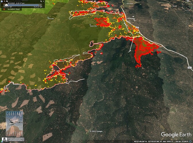
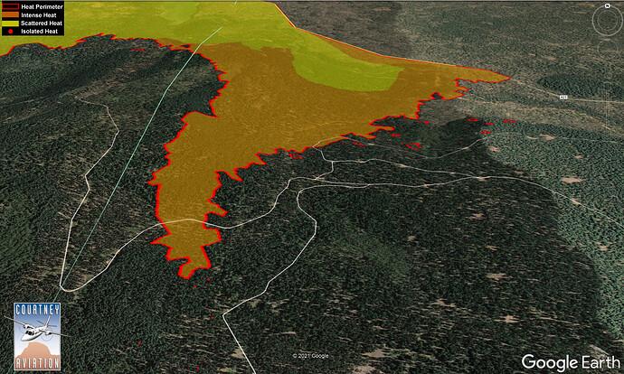
Anyone have any intel what is going on at the firing operation on A-21? Overnight IR shows the fire moved 2 miles south onto Brush Hill. Was this a continuation of the firing show, or did the fire take ‘independent action’?
I was wondering similar. Swain Mtn RAWS is at the northern base of Swain Mtn just NW of this, and showed no wind events. PGE Twin Pines WX, just west of Westwood, showing nothing either.


