still north of hiway 36 it appears
3 Likes
Susanville has 2 burn scars (the Sheep and hog fires) from last year protecting a majority of the west side of it.
Any update? Did it make it to the Penninsula?
1 Like
Dixe Fire Scanner is up and running this morning on broadcastify under butte county. This only has west zone command traffic on it, nothing else competing for airtime: Dixie Fire West Zone
12 Likes
The last live stream I saw at 4 am it was just north of 36 and they had a ton of engines lined up on 36 to hold it. Lots of single tree torching but no crazy fire.
3 Likes


10 Likes
Zeke if you look at the VIIRS 375M S-NPP, I feel like it gives a little bit better accuracy on those layover spots.
What’s your favorite site for that data?
1 Like
I am using this site for KMLs:
https://firms.modaps.eosdis.nasa.gov/active_fire/#firms-kml
3 Likes
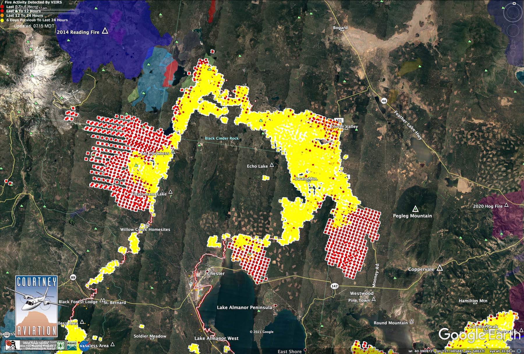
IR maps as of 8:05am 8/13/21 recently uploaded here:
5 Likes
Breaking News on KCRA (Sacramento) noon news: Repopulation of Chester set for today has been cancelled , due to fire activity on the Dixie.
3 Likes
Yea they also put out a last call for holdouts in Pine Town, Westwood and Clear Creek to leave ASAP. that was at noon today
5 Likes
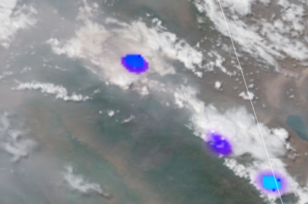
The weather satellite is showing buildup at almost the identical rate as yesterday. Not a meteorologist, but it doesn’t seem unlikely we are going to see a similar round of chaos this afternoon. Things were pretty much fully capped out at 1800 yesterday.
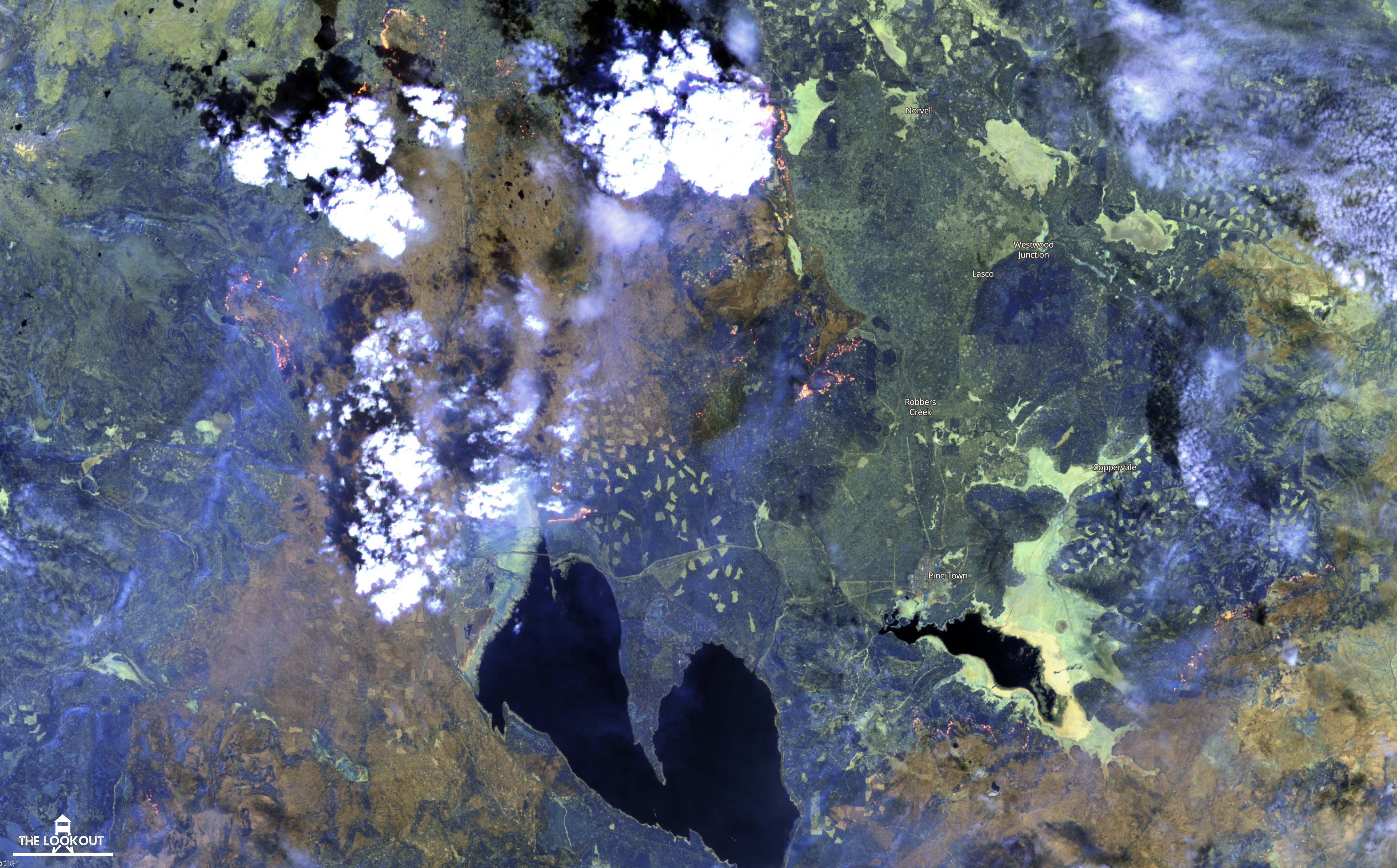
In related news, I just posted some satellite images captured yesterday showing fire severity. You can see how well the cumulus were developed at 12:00 hrs,and interesting to check out what the West Zone of the fire was up to at noon yesterday before things went to hell.
https://the-lookout.org/2021/08/13/dixie-fire-severity-8-12-2021/
If you want to do a side-by-side geek-out on the evolution of today’s cumulus buildup vs yesterday’s here are two links.
Yesterday’s GOES-17
Today’s GOES-17
15:00 update - if anything, the cumulus buildup seems to be a little ahead today of where it was at this time yesterday. There is a cell building over Mt. Harkness, which pretty much looms over where the fire is burning at A-13 and Hwy 36.
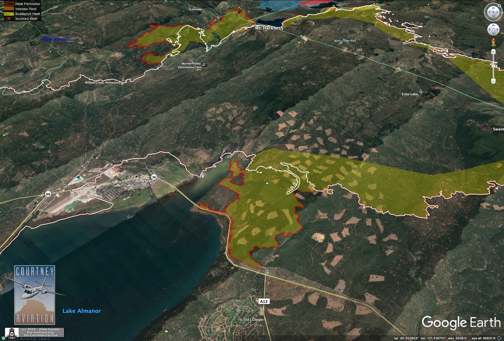

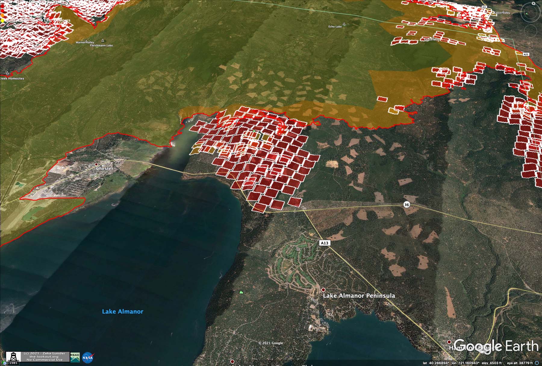
Updated IR maps from today’s 8am flight: Dixie Fire – 8/13/2021 Morning – The Lookout
18 Likes
Things are heating up in the direction of 36/A13.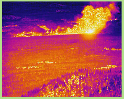
3 Likes
That damn FLIR stuff is gonna scar me for life. Not sure I needed to see Westwood burn down in sickly tones of purple, yellow, and flame.
12 Likes
PyroCum over the fire and the cell to the south east are starting to kick out energy. Flashes being reported on GOES.
5 Likes
Mostly/completely in-cloud lightning strikes in the smoke plume/pyroCb for now, but I suspect that will likely change in the next hour or so.
7 Likes
The cell over Davis Lake is going to be problematic for the east side if it holds together. Weather stations in the Loyalton/Beckwourth area were reporting winds near 40mph as the storm pushed through.

2 Likes
Came down to Susanville from 36/A13 about two hours ago and fire activity was picking up. In Susanville right now and winds are starting to push.
I’ve heard mention of the “north arm” can anyone tell me where that is
1 Like