DATA PACKAGE IS POSTED FOR THE DIXIE - MAPS.TAKSERVER.US
NO NEW IR DATA.
PLEASE BE SAFE TODAY FOLKS.

DATA PACKAGE IS POSTED FOR THE DIXIE - MAPS.TAKSERVER.US
NO NEW IR DATA.
PLEASE BE SAFE TODAY FOLKS.
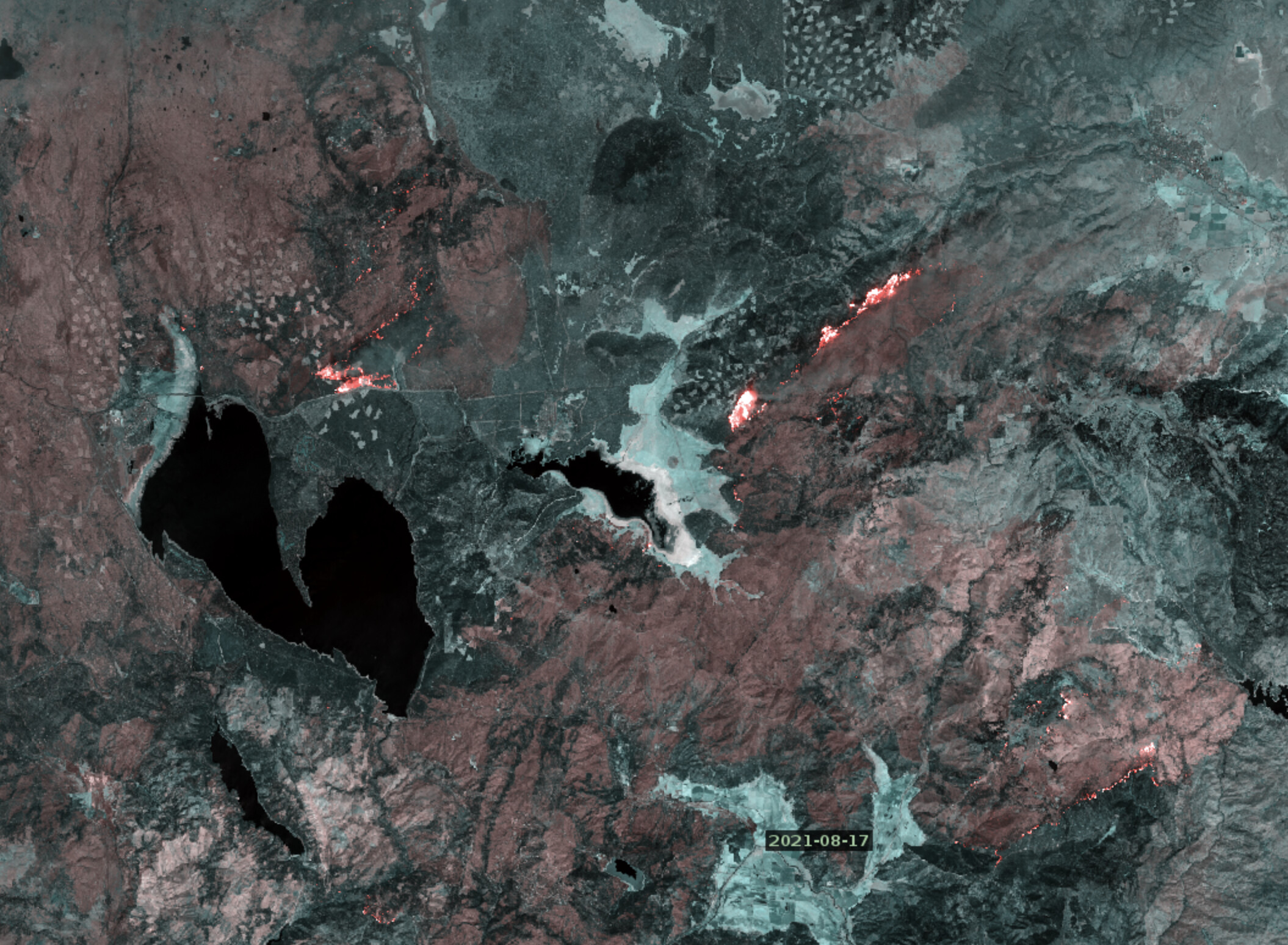
Dixie Fire - 8/17/2021 Update
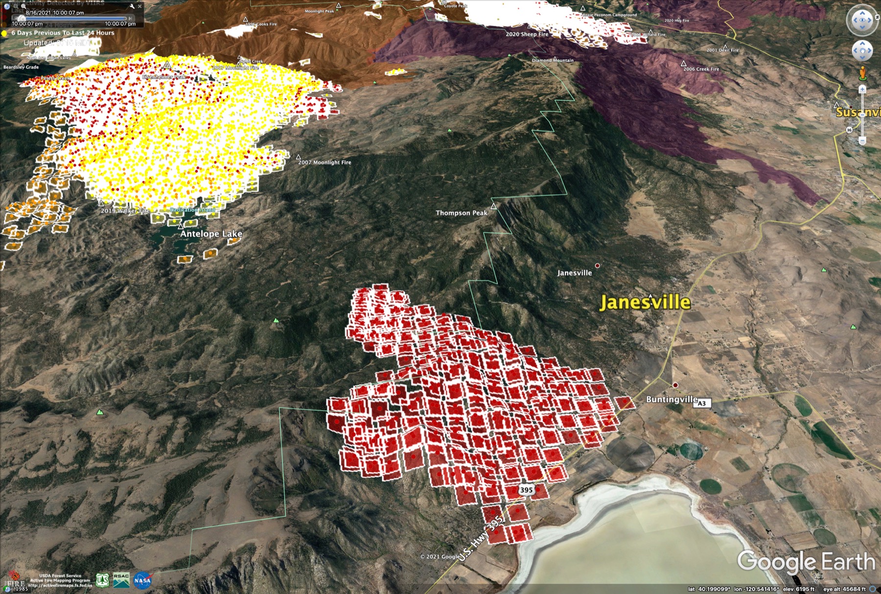
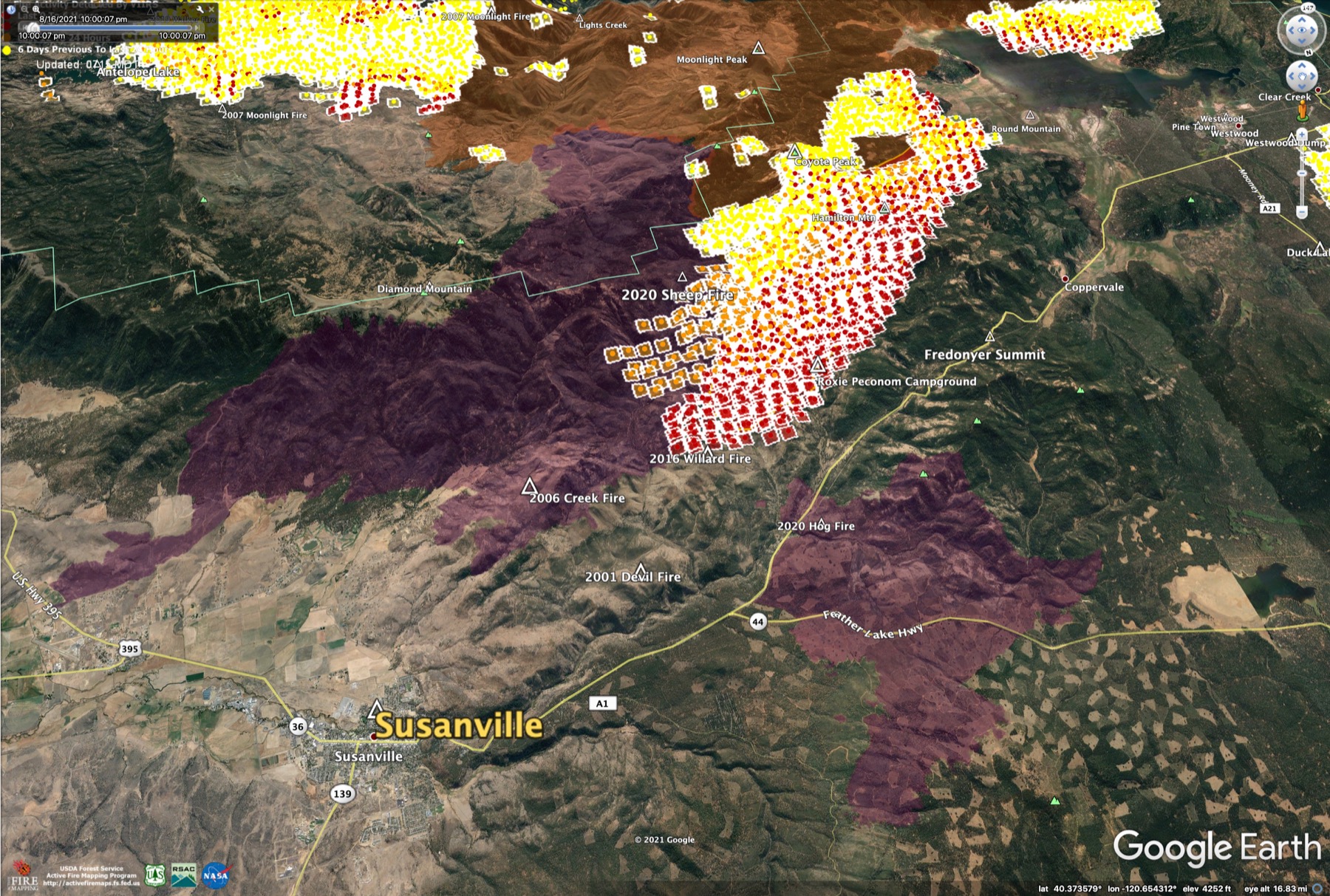
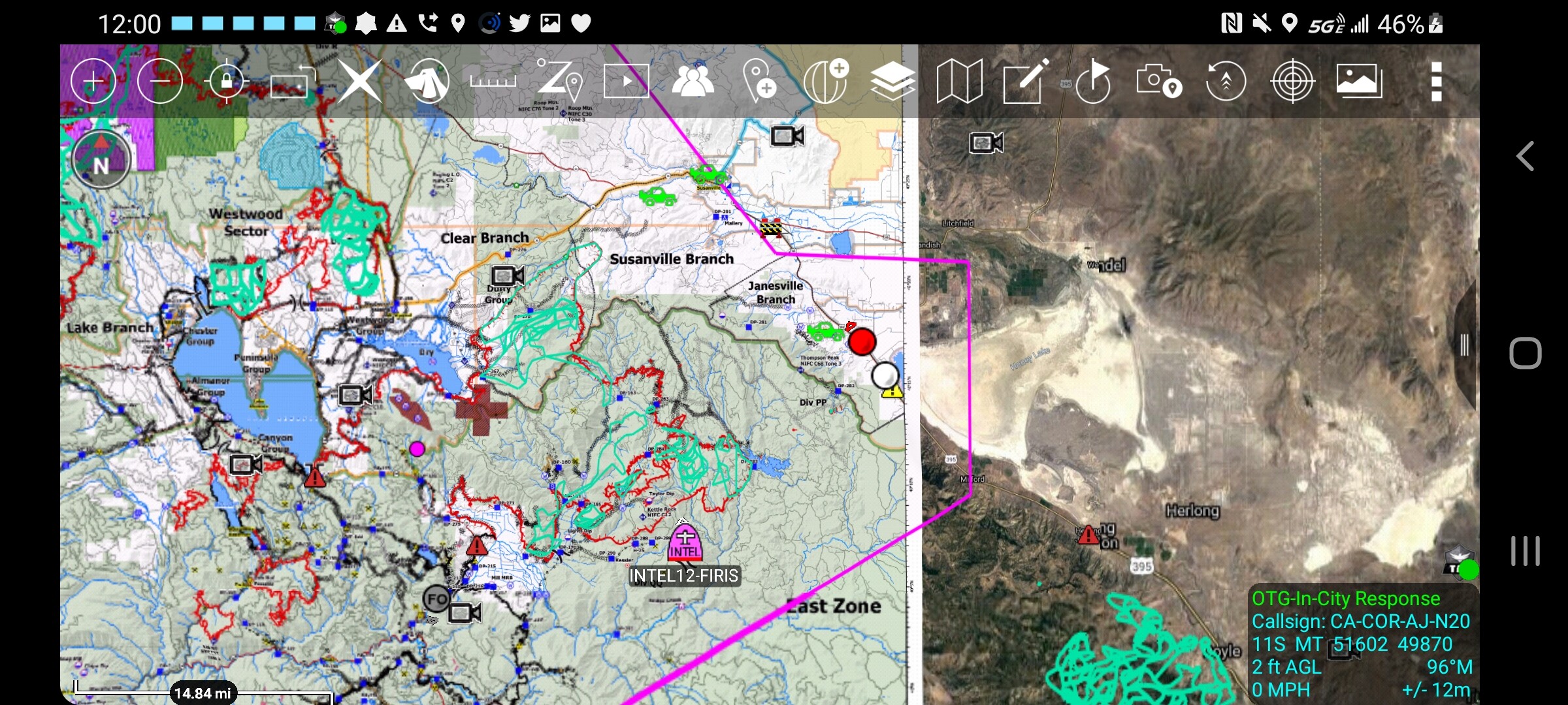
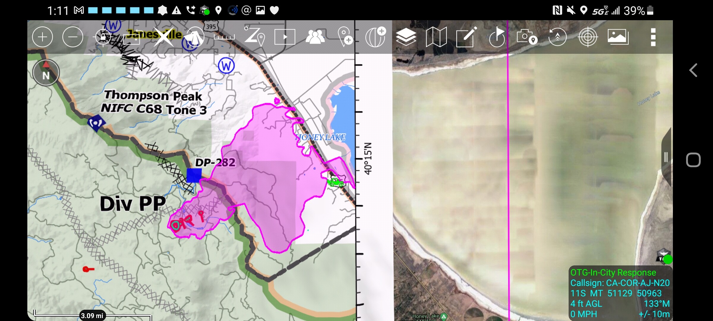
The fires on Morgan Summit grew to 10,000 acres yesterday, and are joining with Dixie. Fire spread over the escarpment into Janesville and toward Susanville. No fire in Westwood, Clear Creek, Peninsula, or Hamilton Branch, yet. Chester and West Shore still safe.
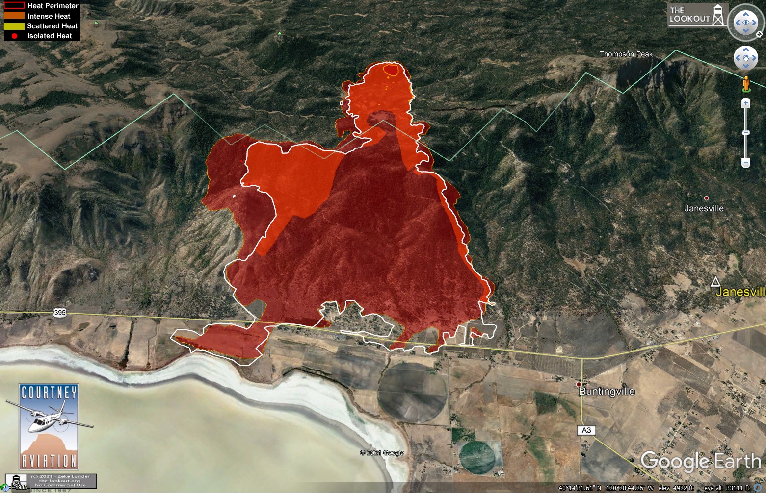
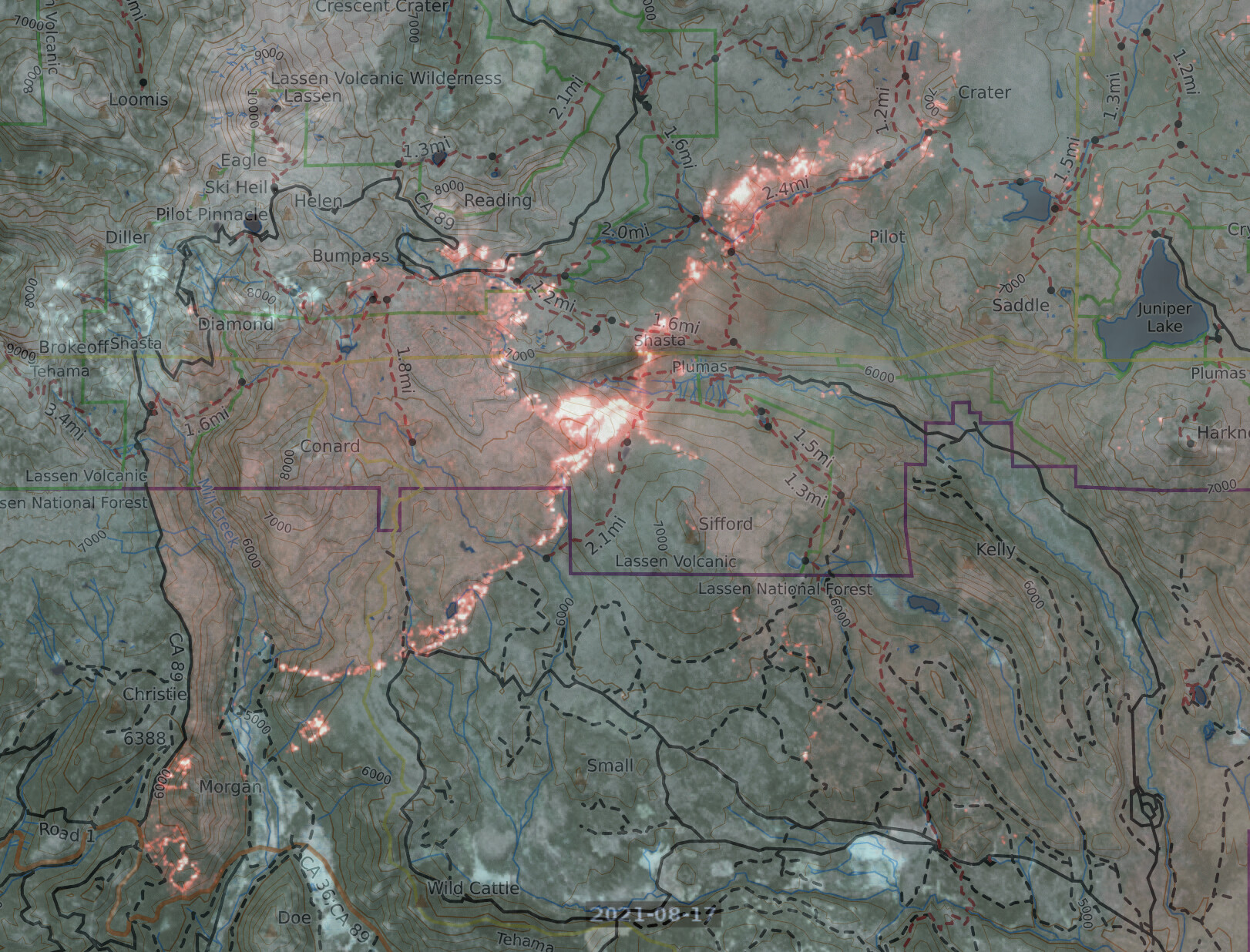
Satellite heat maps from 2 am, 8/17/2021.
More maps and commentary on The Lookout.
Drone Flight? Nothing showing on Flightradar.
Found it, N57B, Beech C-12 Huron.
Some changes have been made to the Broadcastify feeds covering the incident.
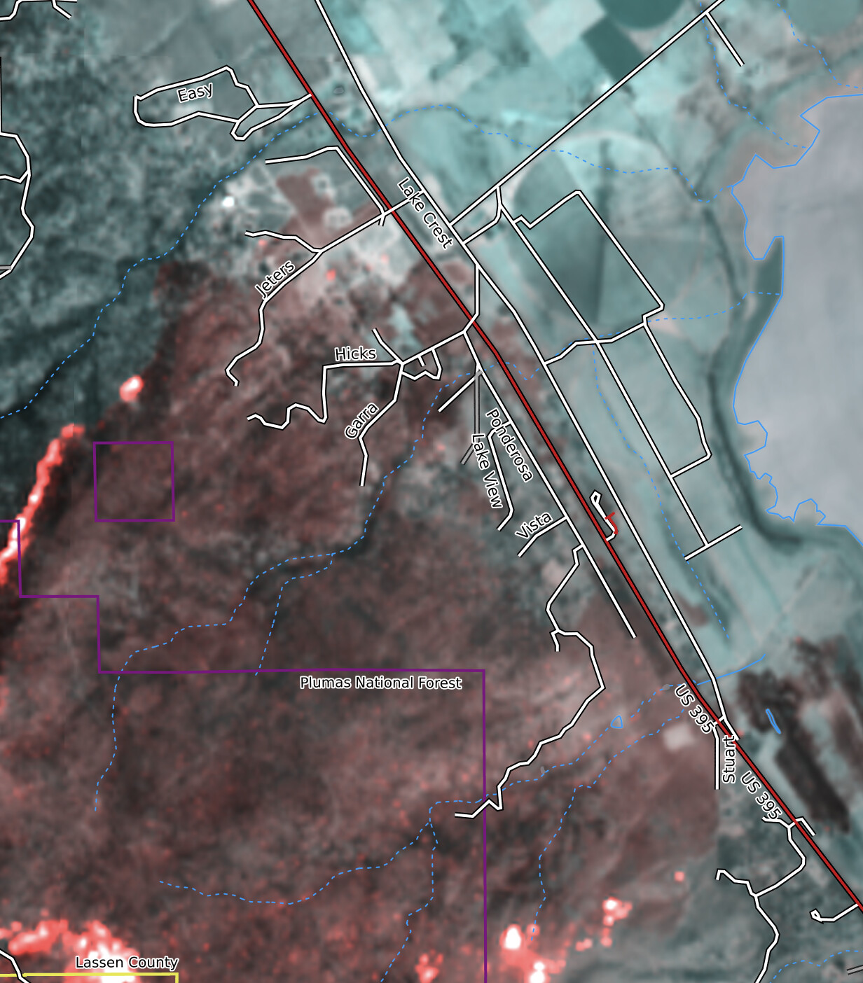
False-color long-wave IR images from the Sentinel satellite pass at noon today - Lassen, Almanor and across from the 395 rest area. https://caltopo.com/map.html#ll=40.30607,-121.01672&z=11&b=mbt&o=sentinel_burn-0&n=1
635,728 acres and 33% contained.
8/18/2021 Evening Update
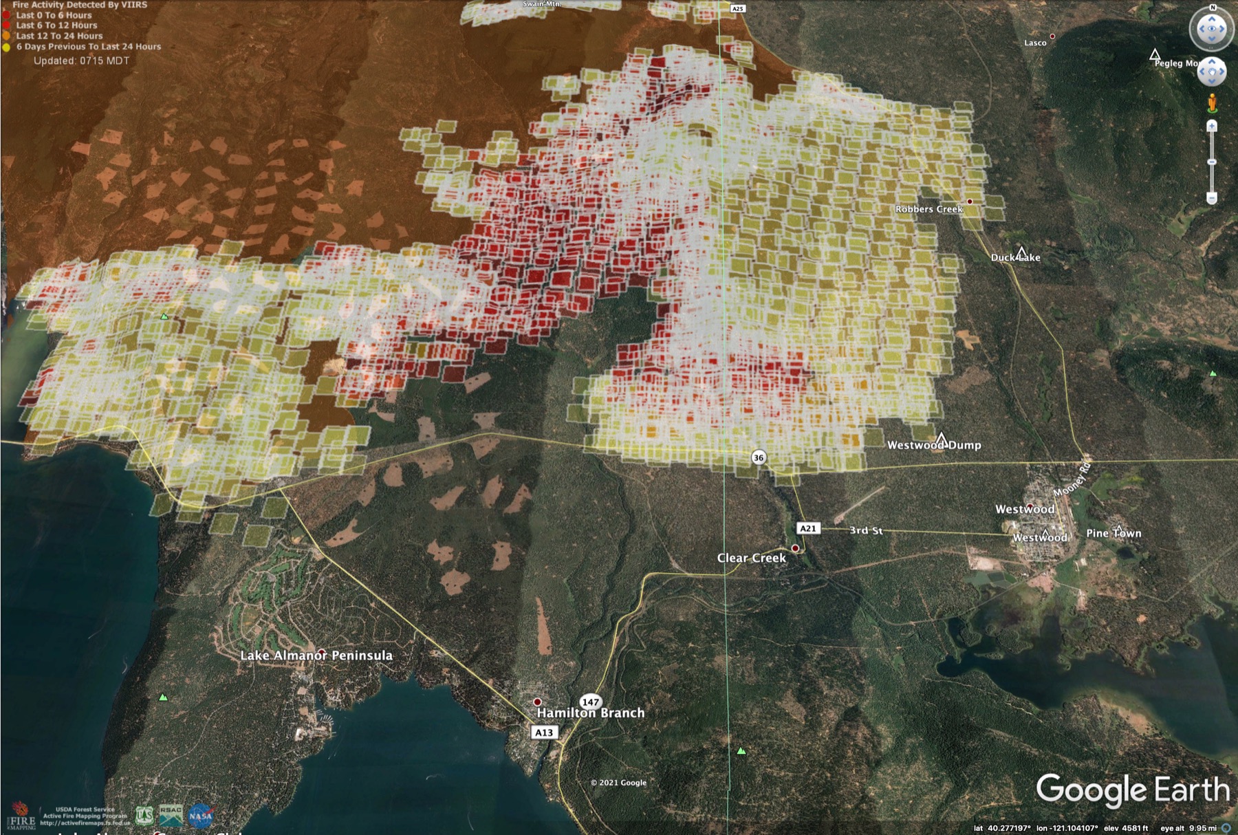
As of 3pm firing on Hwy 36 near Westwood was holding. Active fire spreading back toward Mountain Meadows south of Fredonyer Pass. New spread toward Genesee about a mile, slopover on firing at Beardsley Grade. Fire looks well-established on south side of Hwy 36 at Highlands Resort in Childs Meadows.
Maps and commentary at https://the-lookout.org/2021/08/18/dixie-fire-8-18-2021-evening
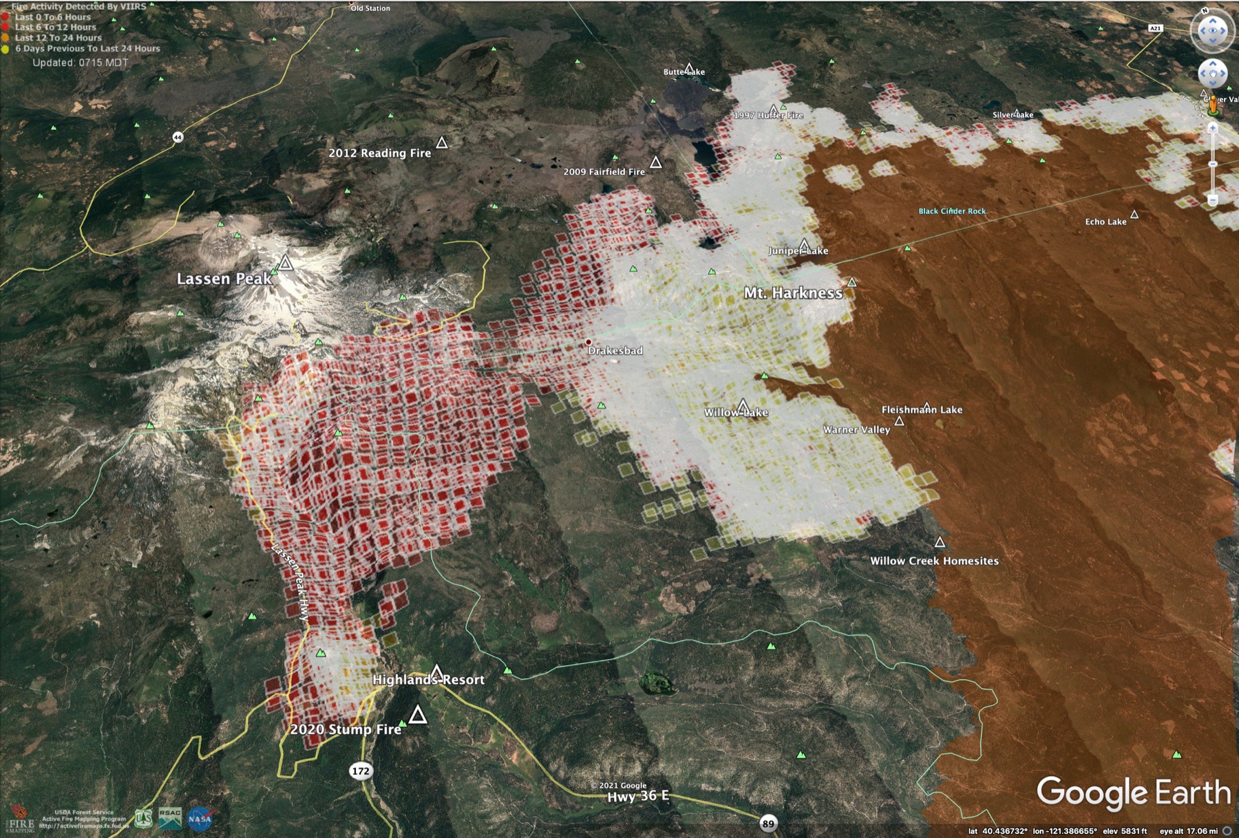
West, DIV K, good 50 acre spot over (south of) Hwy 36 across the creek from Wilson Lake Road in Sec 36, just SE from the 2020 Stump Fire. It blew past the dozer line at Wilson Lake at 2pm and got into the timber. The spot is off to the races.
This is not good, is an understatement. @pyrogeography
Wow! I saw this as a Pro option for sartopo but had no idea what it looked like. Thank you.
#DixieFire - 8/19/2021
Fire crossed Hwy 36 at Highlands, established on Mill Cr. Plateau. Still active on Fredonyer Pass and Beardsley Grade. Firing along Hwy 36 at Westwood has held, very good news for Peninsula, HB, Westwood. No spread toward Susanville.
Maps and commentary here:
https://the-lookout.org/2021/08/19/dixie-fire-8-19-2021/
Anyone have access to the IAP for Dixie today? Mine is not loading properly
New IR maps posted on The Lookout.
Firing underway on Fredonyer Summit, fire moving SW at Highlands, fire backing down toward Genesse, new spot fire on Grizzly Ridge, minor spread in Janesville. Susanville, Westwood, Mill Cr, Mineral OK. https://the-lookout.org/2021/08/19/dixie-fire-8-19-2021/