DATA PACKAGE POSTED - MAPS.TAKSERVER.US
2 Likes
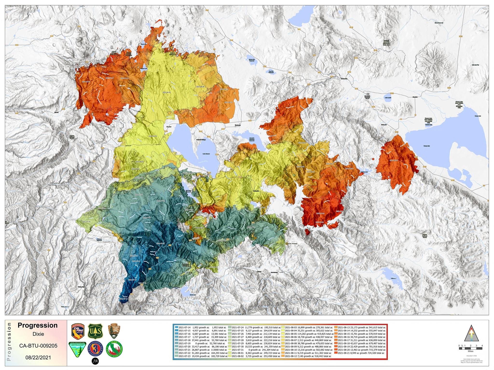
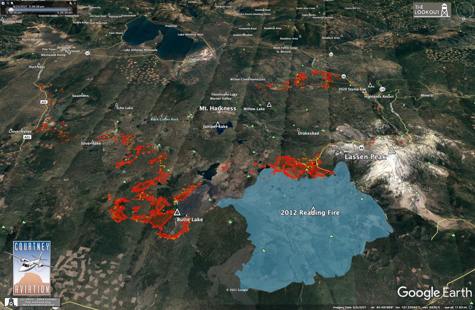
#DixieFire - 8/19/2021
Fire crossed Hwy 36 at Highlands, established on Mill Cr. Plateau. Still active on Fredonyer Pass and Beardsley Grade. Firing along Hwy 36 at Westwood has held, very good news for Peninsula, HB, Westwood. No spread toward Susanville.
Maps and commentary here:
https://the-lookout.org/2021/08/19/dixie-fire-8-19-2021/
13 Likes
Anyone have access to the IAP for Dixie today? Mine is not loading properly
1 Like
New IR maps posted on The Lookout.
Firing underway on Fredonyer Summit, fire moving SW at Highlands, fire backing down toward Genesse, new spot fire on Grizzly Ridge, minor spread in Janesville. Susanville, Westwood, Mill Cr, Mineral OK. https://the-lookout.org/2021/08/19/dixie-fire-8-19-2021/
11 Likes
2 posts were merged into an existing topic: CA-BTU-Dixie?
DATA PACKAGE IS POSTED FOR THE DIXIE - MAPS.TAKSERVER.US
4 Likes
A post was merged into an existing topic: CA-BTU-Dixie?
DATA PACKAGE IS. UP FOR THE DIXIE - MAPS.TAKSERVER.US
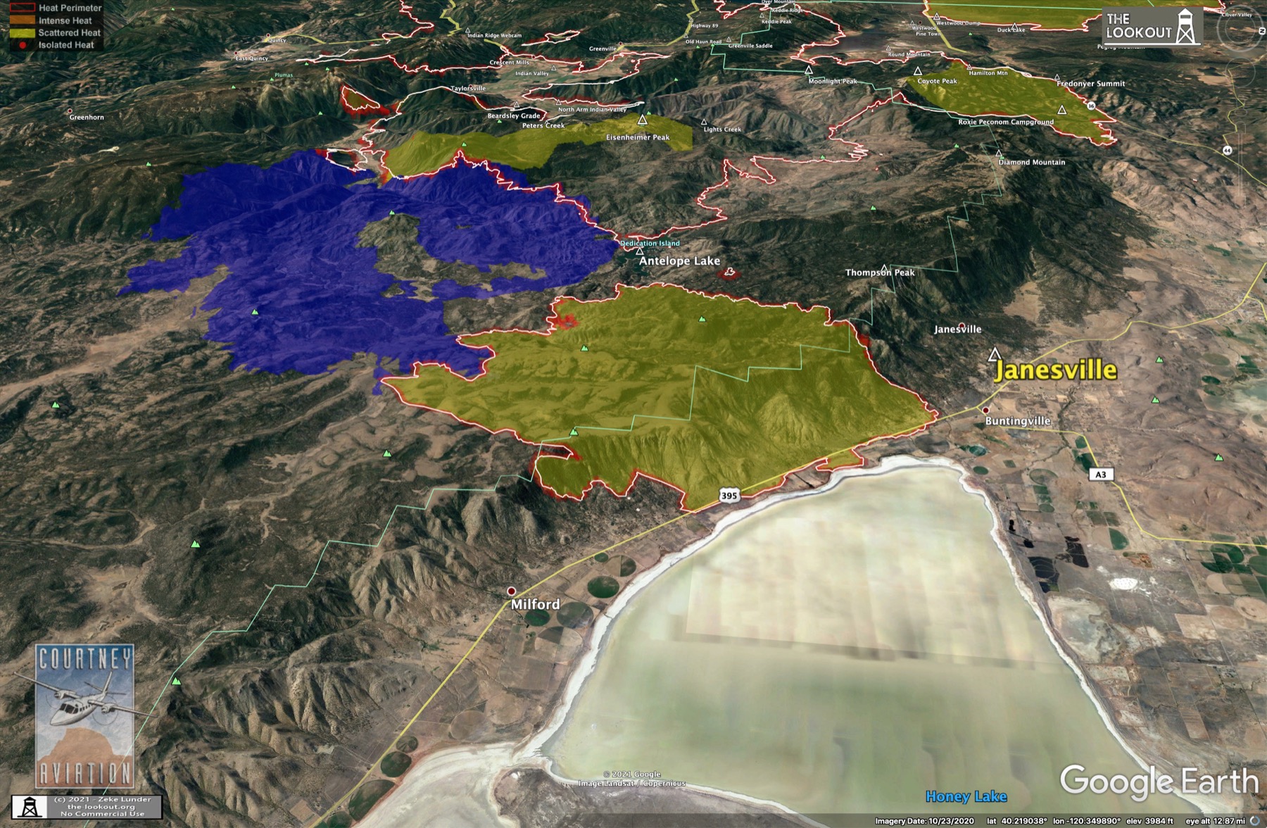
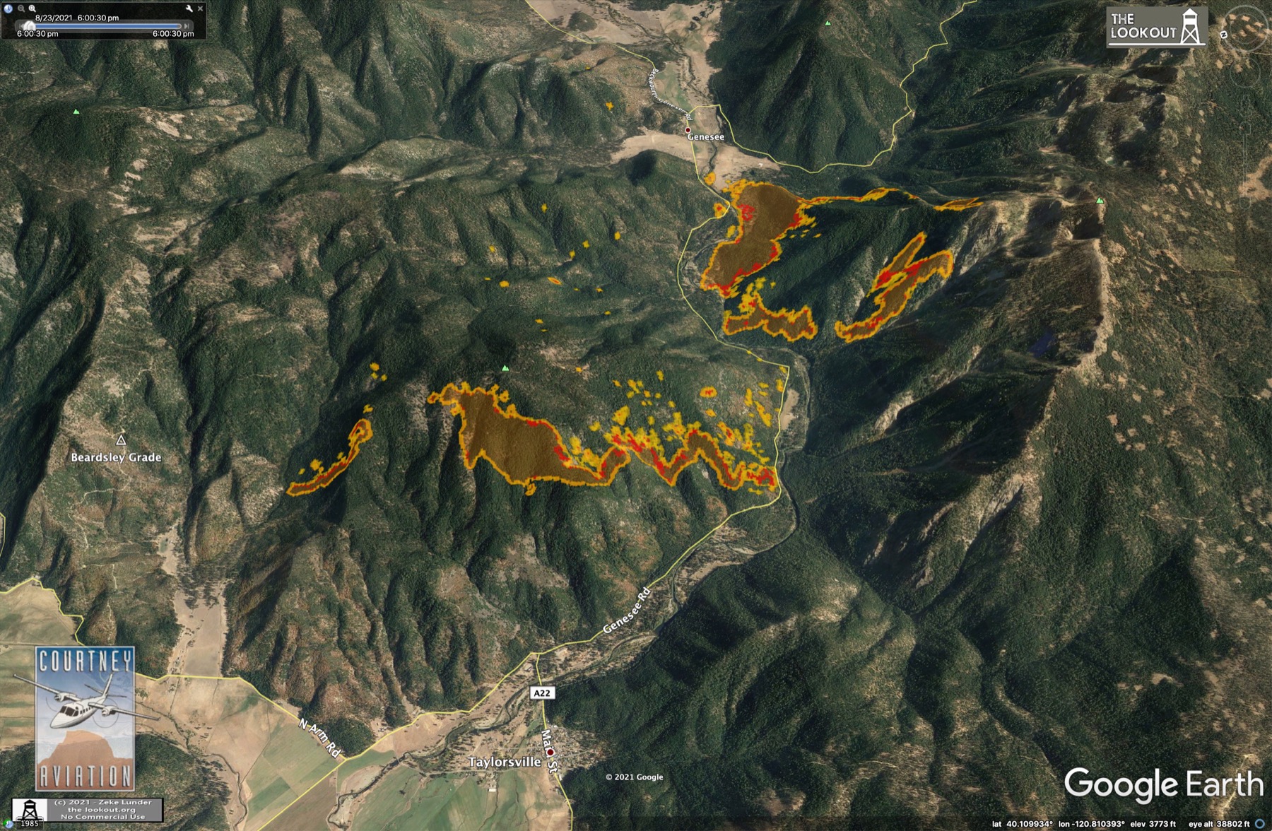
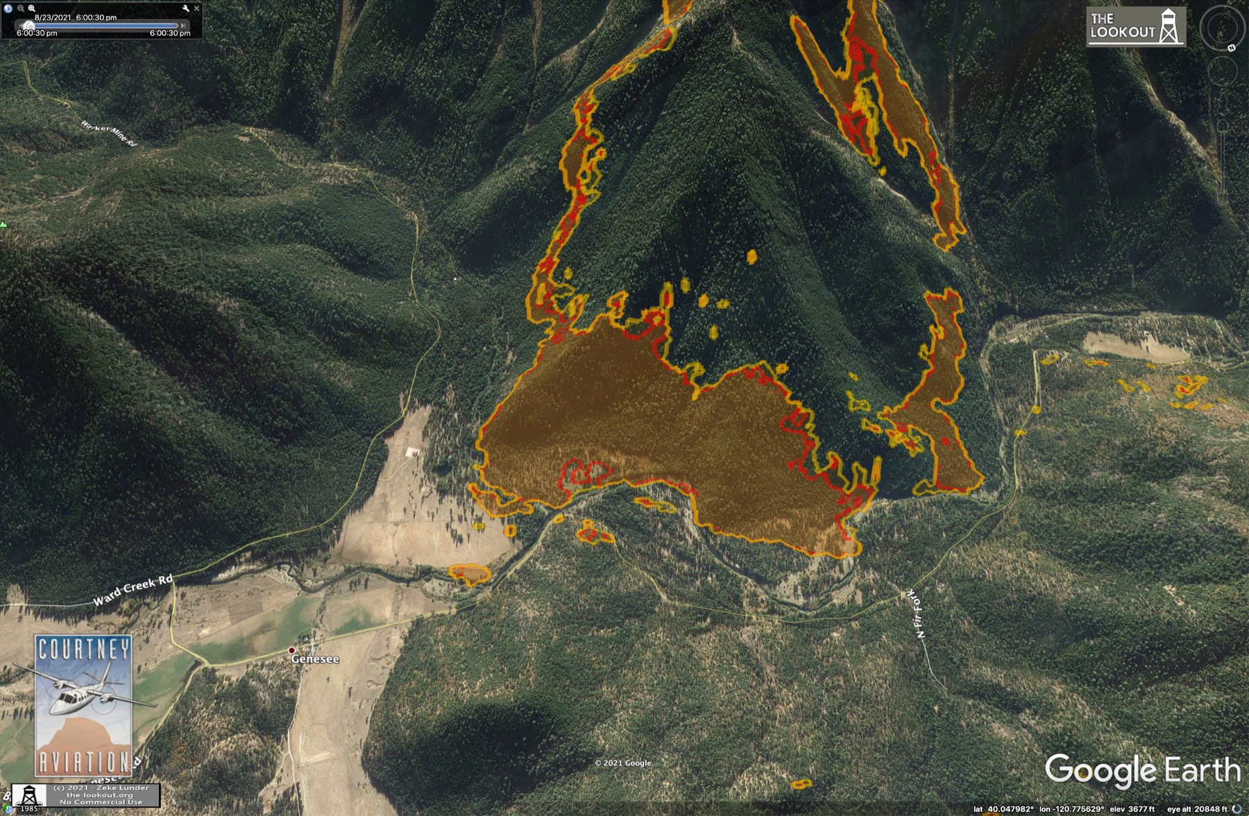
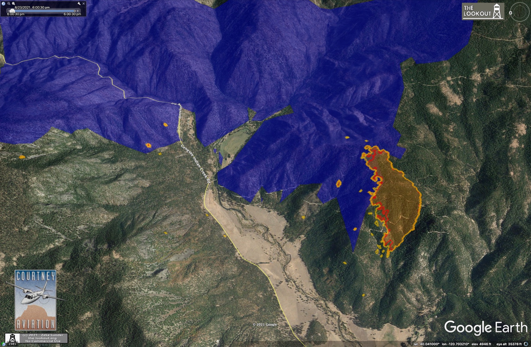
Fire burns in Genesee Valley. Daniel Kearns reports no structures lost! Fire reburning in 2019 Walker Fire at Heart K Ranch, still a little hot along Hamilton Mtn Road on Fredonyer, Janesville looks better. IR mapping trivia.
https://the-lookout.org/2021/08/21/dixie-fire-8-21-2021
The reburning of 2019 Walker Fire is a surprise to me. Will be interesting to check it out - I watched that part of the fire back down slowly of course of a couple days. Very low intensity. Wondering how it’ll look now.
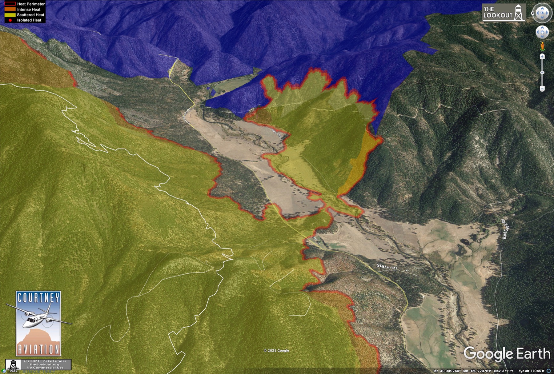
2019 Walker Fire Intensity
7 Likes
Genesee Valley was the hub of much of the action today. Mill Creek/Highlands area looks like it is cooling down. Minor spread on N side of Lassen Park, and Fredoyer Summit. Some movement south toward Milford. Maps here:
https://the-lookout.org/2021/08/21/dixie-fire-8-21-2021/
10 Likes
Dixie Fire - 8/22/2021 Evening Update.
Fire continues to back into Genesee Valley. Fire east of Highlands has not crossed Highway 36, Mill Creek looks to be cooling down. Minor fire spread south along the Escarpment. Biggest runs were inside Lassen Park. Maps here: Dixie Fire – 8/22/2021 – The Lookout
EDITED TO ADD:
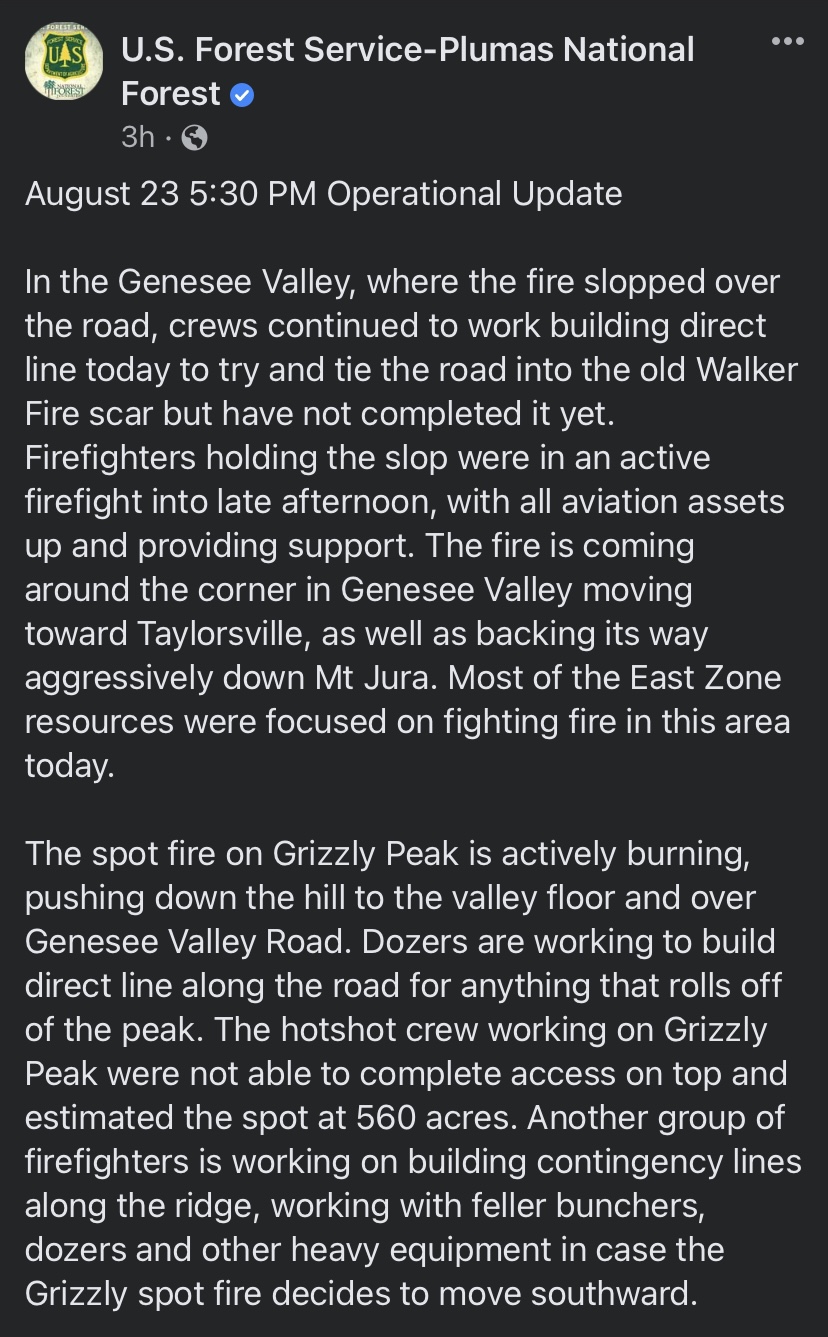
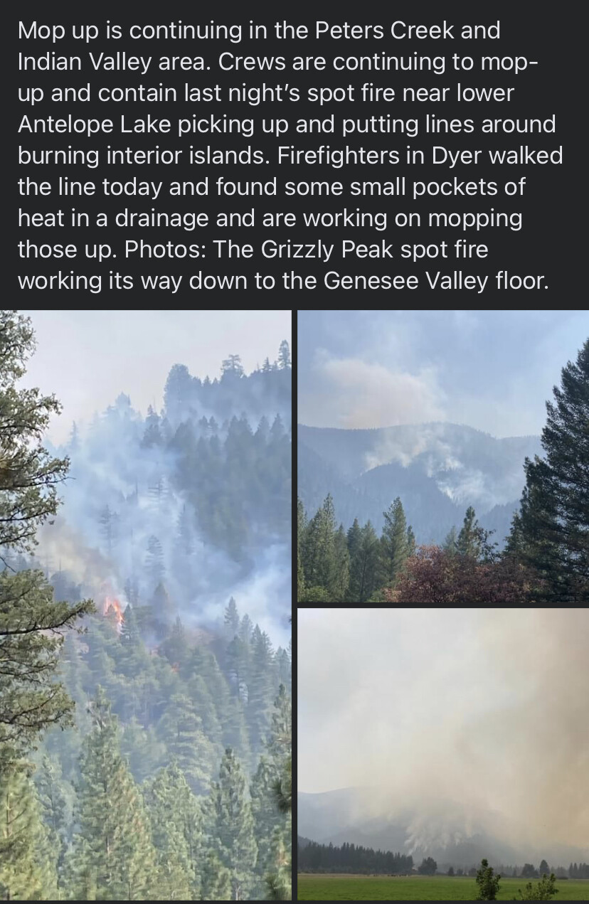
DixieFire - 8/23/2021 Morning Update
Genesee Valley is still the center of action. Just about everywhere else on the Dixie is really slowing down, including Escarpment, Mill Creek. Cooler temperatures have helped. Also, dozer-mania. Read more: Dixie Fire – 8/23/2021 – The Lookout

15 Likes
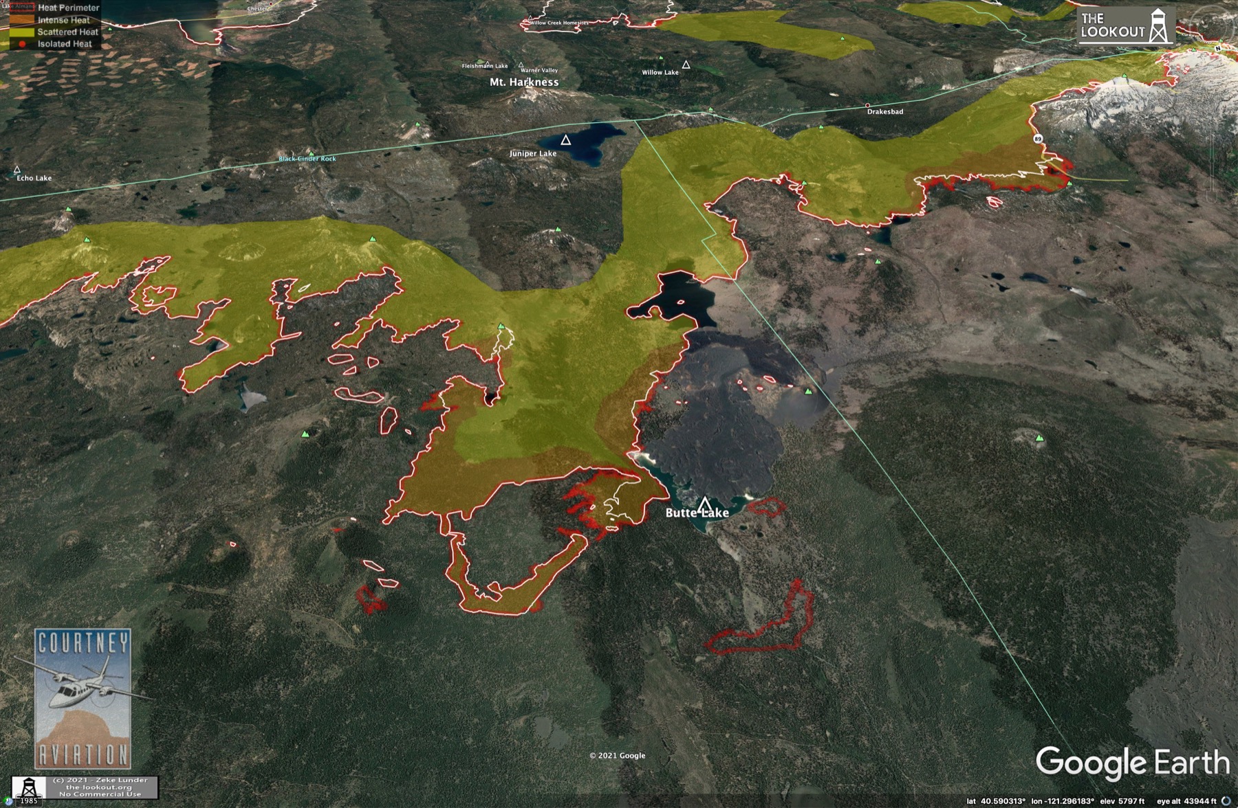
8/23/2021 Evening Update
Fire continues to be most active in Genesee Valley and Lassen Park. Some heat showing elsewhere but no large runs.
11 Likes
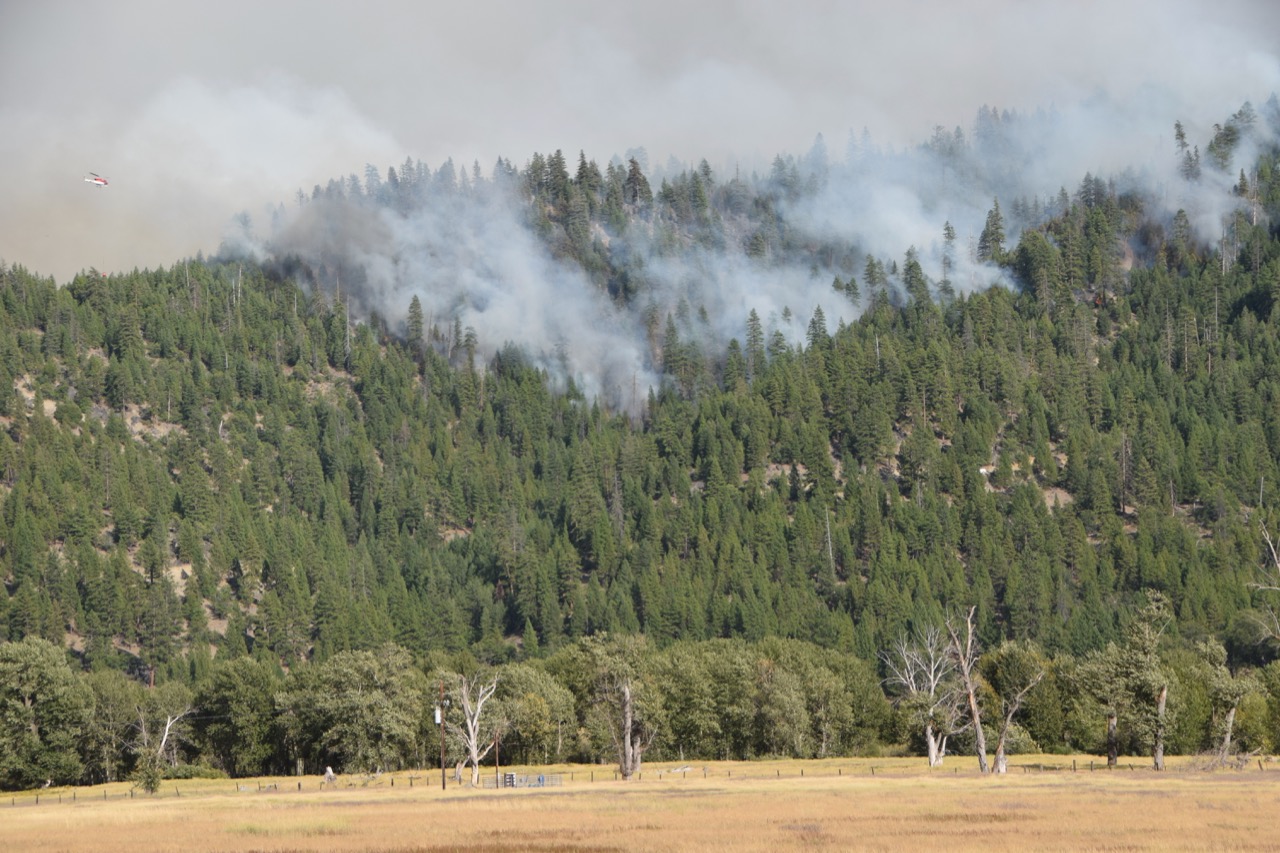
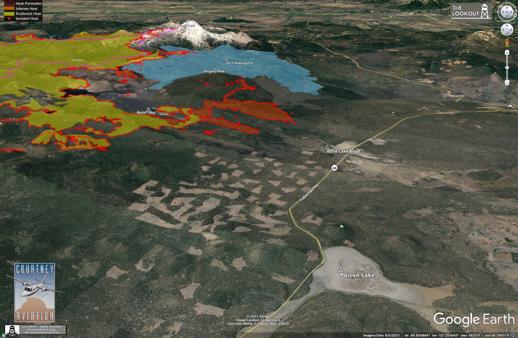
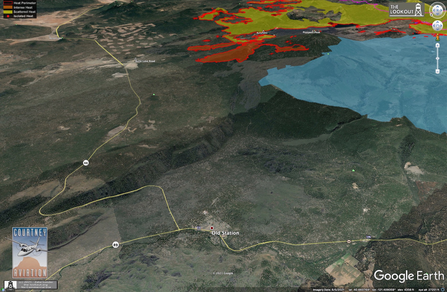
Fire has left Lassen Park and is headed north toward Highway 44. Yesterday, a firing operation NW of Prospect Peak jumped the dozer line and added about 1,700 acres. This has potential to be a big problem. Dixie Fire – Ongoing Updates – The Lookout
11 Likes
Per CHP website a few minutes ago:
|2:55 PM|6|[28] A38-011 PER CALFIRE THEY ARE PULLING PERSONNEL AND EQUIP OUT OF THE FIRE ZONE CURRENTLY 1 MI FRM 44 AND ADVANCING NORTH|
|2:53 PM|5|[27] A38-011 44/BUTTE LAKE ADV BY FIRE APPROX 1 MI FRM 44|
3 Likes
PGE WX Bootleg Reservoir station is 6 miles to the north of this piece of fire approaching 44. It will give a good indication of influences at the head. Same elevation, terrain and vegetation. 10 min resolution. 330pm had WSW 8G17 RH19 and dropping.
PGE WX Feather Lake Highway station is 4mi east along 44, good indicator of right flank influence. 340pm WNW 6G13 RH28
4 Likes
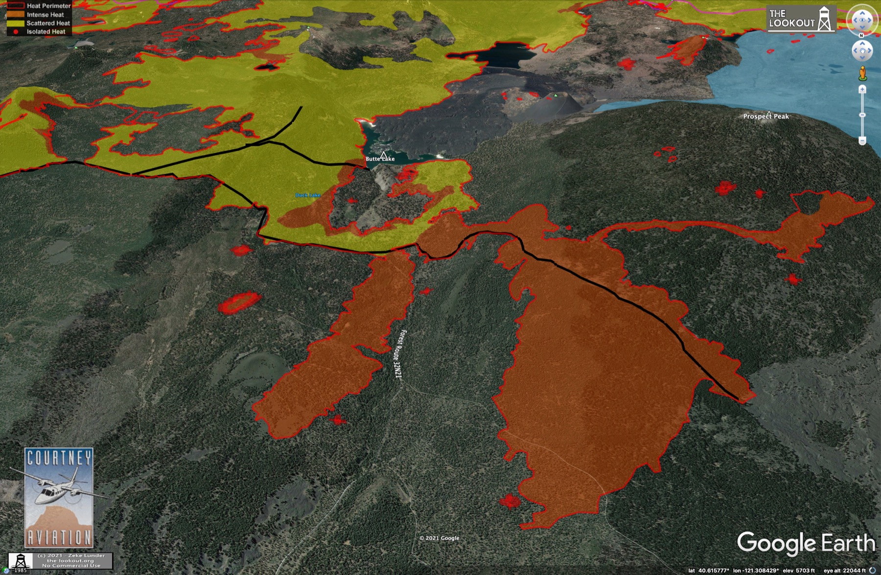
From this morning’s data package. For north end of Lassen Park and Old Station area::
Orange = Fire.
Blue = Completed Lines, all types.
Cyan = Planned Dozer Line.
Red = Planned Hand Line.
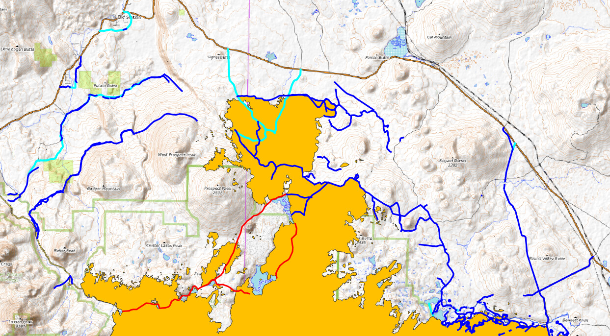
6 Likes
KML files filtered from 083021 data package found here:
https://ftp.wildfire.gov/public/incident_specific_data/calif_n/!CALFIRE/!2021_Incidents/CA-BTU-009205_Dixie/GIS/IncidentData/20210830/
For import into CalTopo, Google Earth, etc. Can’t vouch for how accurate they keep the data vs what’s really on the ground.
Completed Dozer Line:
Completed All Types Of Line:
Planned Dozer and Hand Line:
1 Like