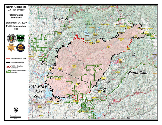
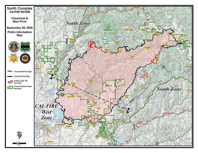
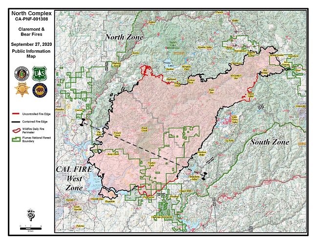
Total acreage of the North Complex is 301,752 acres @ 78% contained. *83,605 acres included in the 301,752 acres total.
Current Approximate Acreage: 304,492
Approximate Containment: 78%
Total acreage of the North Complex is 304,492 acres @ 78% contained.
*84,580 acres included in the 304,492 acres total.
*WEST ZONE - 84,580 acres- 73% contained
https://nifc.maps.arcgis.com/apps/webappviewer/index.html?id=ca653bfb634a4f46af21a3243238fa9d
this is a new feature on inciweb for the fire. Shows the progression of the fire in steps. check it out
Was looking at the satelite video from the rammb/cira slider and you can see the two northern columns changing directions and sending the smoke southwest indicating an easterly flow at the surface.
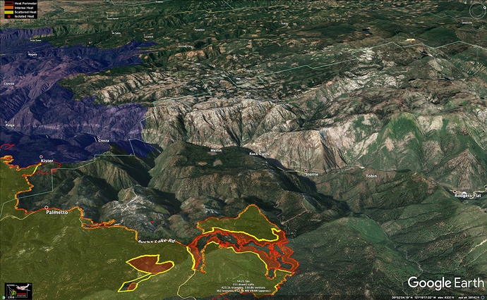
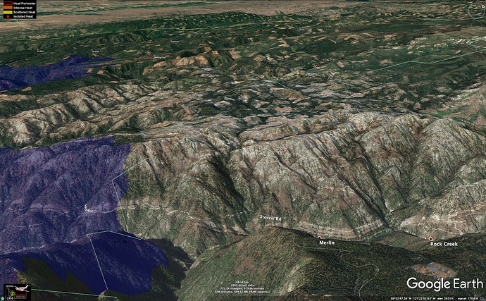
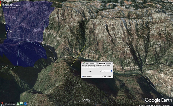
I got a little concerned once the Bear Fire out-flanked the Camp Fire scar (blue on map) on northwest side. The nightmare scenario there is a run down the Grizzly Creek w NE winds, jumping the Feather at the Elephant Butte Tunnel/Cresta Diversion Dam (Merlin on this map), and running to the ridge there. This could give us Camp Fire v2.0, heading toward Stirling City and Forest Ranch.
The fuels coming out of the North Fork are different than Concow area - less brushy, higher, and cooler, and it is granitic and sparse, as you can see on the aerials, but there is a lot of dead fuel from the 2008 Butte Lightning Complex, access is non-existent on the west side of the Canyon, and the fire would spot all over the top of the ridge when it came out of North Fork Feather. Let’s hope Grizzly Creek is tucked in enough to keep this from happening.
Winds here in Paradise have differently turned directions and are picking up
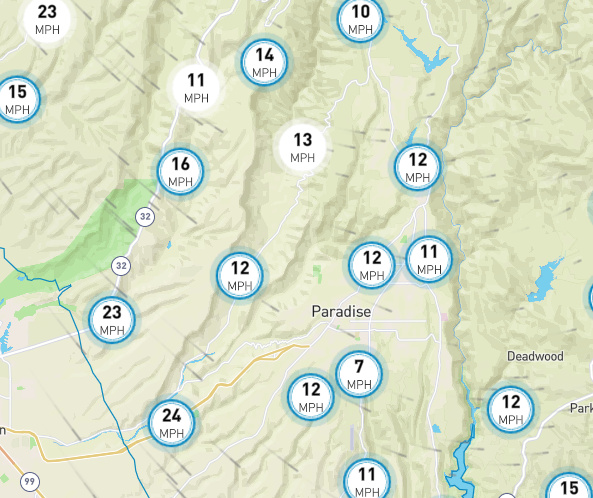
I have been watching the fire slowly get above us for a couple of days . Drove up past Flea mountain yesterday for a look. You can see where if it jumped the lines once the winds turn tonight to a more NE direction we will be in a dangerous place i Lots of stuff out there to burn. Small trees , brush and the debris left from the 2008 and 2018 fires.The brush in the west branch drainage has grown to 6 ft-ish in places as well. With a PSPS starting sometime over night it is starting to get the feel of the night before the fire took a run at Oroville. You think this is a possibility? We are expecting winds at Jarbo Gap and Flee Mountain to gust at 50 mph tomorrow . It made an old firefighter nervous . Most of Paradise and Magalia is still littered with debris from the fire and growing brush in the increased sunlight to a good height . Enough to make it interesting if events line up. Blind to the world without electric with a fire within reach of us again… Was up by DeSabla resv this morning. Been a while since it burned up in there… growth is thick . Few people practice defensible space up there
Agree with your thoughts Zeke. This is a very real possibility, which I hope doesn’t materialize…
When you drive thru Elephant Butte Tunnel on Highway 70 it is so barren and rocky it is pretty hard to imagine the fire jumping the canyon there, but the Canyon is a pretty extreme place.
If anyone is interested in geeking out on the North Fork Feather River, I built a Google Earth tour of it with all of the dams, penstocks, powerhouses, transmission lines, etc about 15 years ago, available as a KMZ file here: https://web.archive.org/web/20080507135457/http://sierrainstitute.us/wq_data/wqtour.kmz
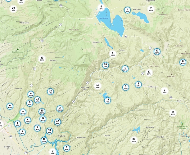
Using Windy.com, the forecast winds don’t look easterly enough for a scenario that would push anything straight toward Stirling City. It looks like a fire across the Canyon could push SW toward Magalia, which would put it into timbered portions of the Camp Fire scar. So that’s a good thing.
https://on.windy.com/45spb
Too close for comfort for me. Rather see it stay on its side of the canyon. Possible but maybe not so probable ? Could make for a interesting morning. I really liked the presentation you put out there. Not sure I have ever seen the entire system mapped out . Really very cool . Thanks for the link to Windy.com. Fun software to play with. Geeking out indeed… Nice 
The North Complex IR is showing no perimeter growth yesterday on the north or northwest flanks (IR was at 4am, 9/27/2020).
Lines held strong in the West zone last night. Coming off the line right now, concerning how much smoke seems to be coming off the Fed’s side…
Federal morning update says their lines held. But you can see the smoke . I triangulated the views from a couple of the cameras and it looks like it is up towards the Bucks Lake Area. Winds have really picked up here in the Last 30 minutes . Wind direction is all over the place. Thanks for the great info this morning. It helps. As the day heats up I think the worst could be yet to come…
Federal responsibility North / South Zones
Current Approximate Acreage: 304,881 Total acreage for all zones
Approximate Containment: 78%
Cal Fire Responsibility West Zone
*WEST ZONE - 84,595 acres- 82% contained
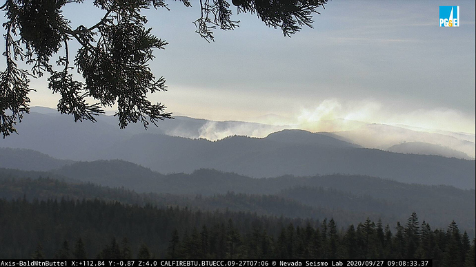
A little more action on the Bald Mtn cam, now. Seems to be pushing more to the south than anything.
http://www.alertwildfire.org/shastamodoc/index.html?camera=Axis-BaldMtnButte1&v=81e004f
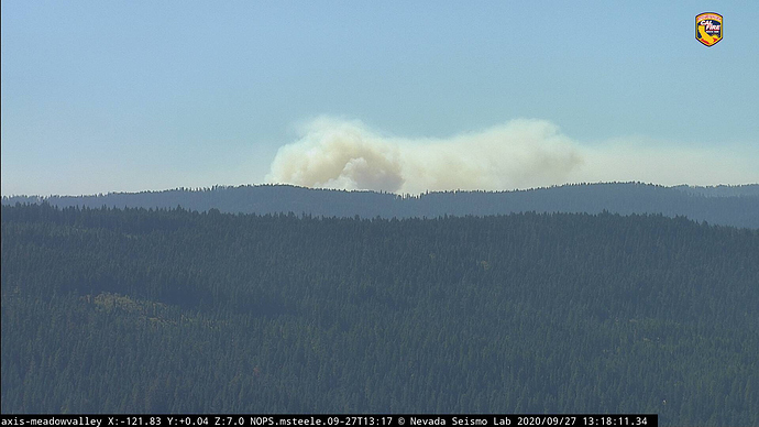
Getting a good shot from Meadow Valley
http://www.alertwildfire.org/shastamodoc/index.html?camera=Axis-MeadowValley
Column building…
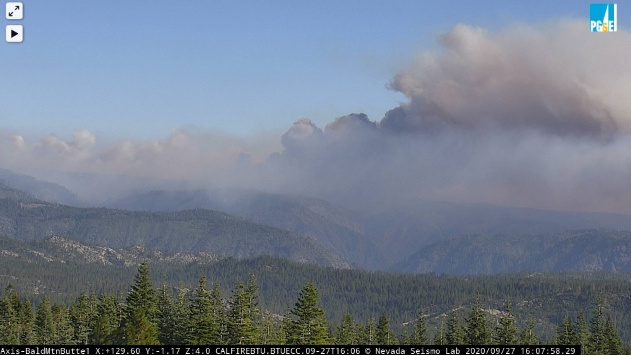
Looks like it’s really flaring up again - pretty distinct and growing plume visible from here in Chester.
Looks like it is North Complex North Zone, not the West Zone.
