
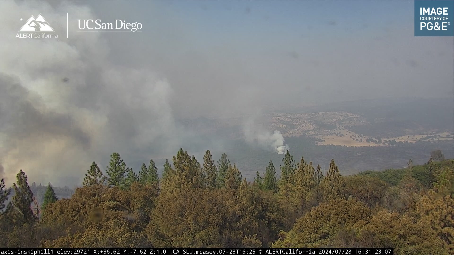
Looks like spot fire on Inskiphill1 camera.
Is the burning on the Inskip Hill cam for the last 3 hours on the interior?
https://ops.alertcalifornia.org/cam-console/2690
Sure hope the north end isn’t off to the races again.
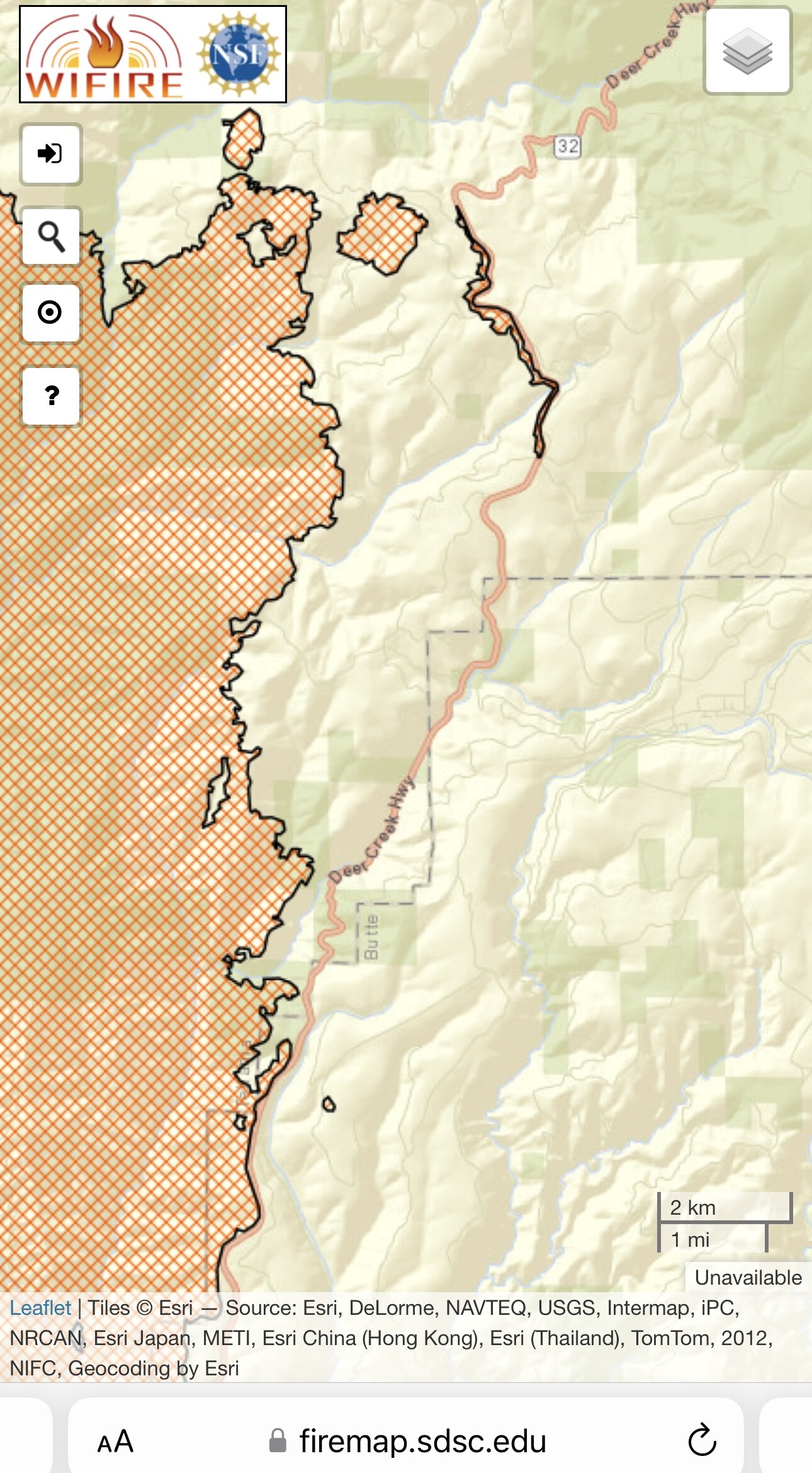
The fire is now 360,141 acres per CAL FIRE.
Radio traffic indicates some increased activity in the Mill Creek drainage on the N/E side of the fire.
Additionally current camera views from Inskip Hill show some increased fire activity in that area as well (Northern section).
If its a spot its not alone!
I believe so. Very dirty burn in that area it looks like.
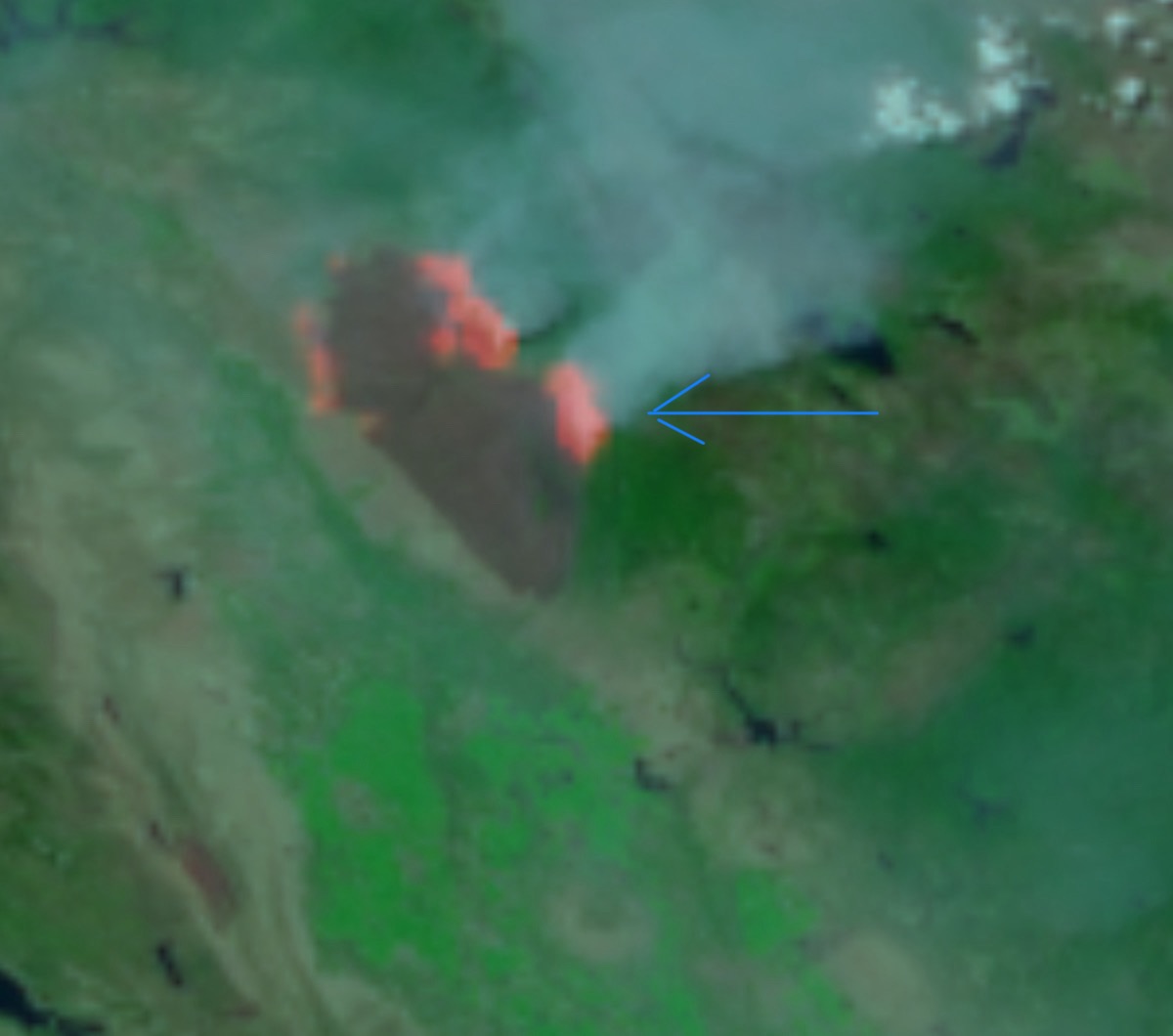
Looks like black to the right of it when you zoom in. Maybe just a little pocket going off ?
Yes that’s the area. Its not far from the main fire and running parallel.
I may b wrong, but doesn’t look like it’s in then black. Is that he spot I see in adsfish’s map??
No, the spot to the north on that map was established yesterday morning. This one is closer to the ‘B’ in the Butte County label next to Hwy 32. See the placemark with lat/long in my post above - CA-BTU-PARK-2024??? - #716 by pyrogeography
I cannot say for sure either. Here is a screenshot of Inskip I took Friday night and you can see how the fire progressed around that area based on where the camera was pointed .

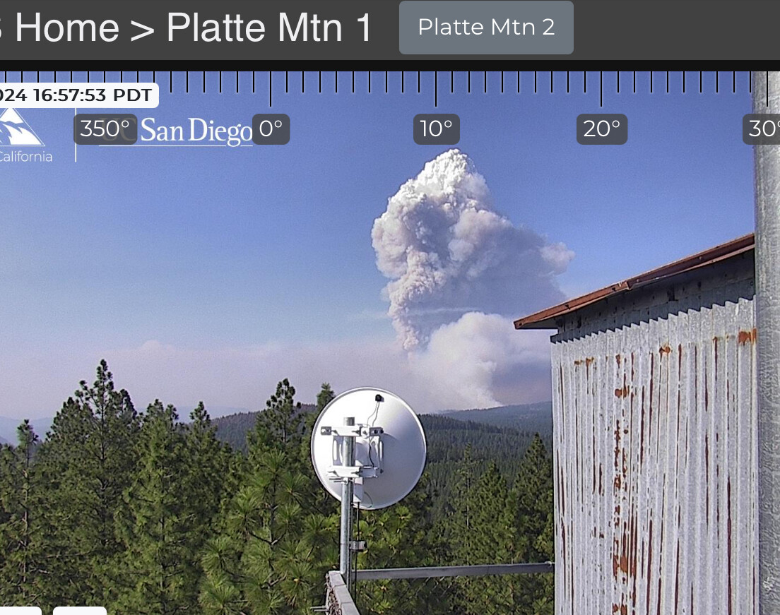
Influence from a “normal” sw flow very evident right now. Makes me reflect on all the alignment issues & concerns our troop’s are facing…
Has this burned enough on fed ground for the FS to throw a team at it ?
The Feds don’t have many teams available.
I noticed , many were not avail , but not many are assigned I’m assuming a rostering problem??
I mean 14 North Ops crews are/will be assigned according to the SIT-500, with LNF IMT
I think it might be a work/Rest thing. They should start popping up soon