Edit: Red does not mean cold/no heat! Most of the fire, including the west side still has heat in it.
From IR last night. Note that in these images yellow signifies high heat, not progression. The majority of the fire still shows moderate heat or scattered heat. I eliminated those for clarity.
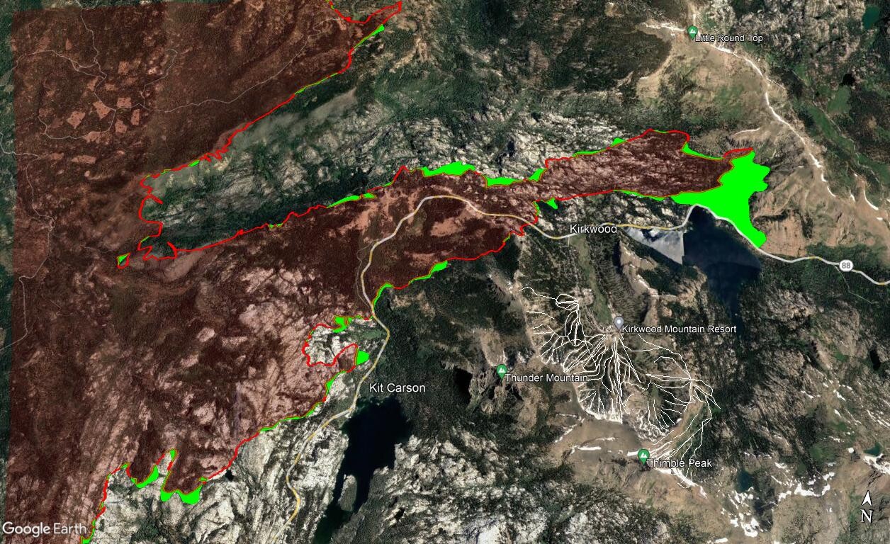
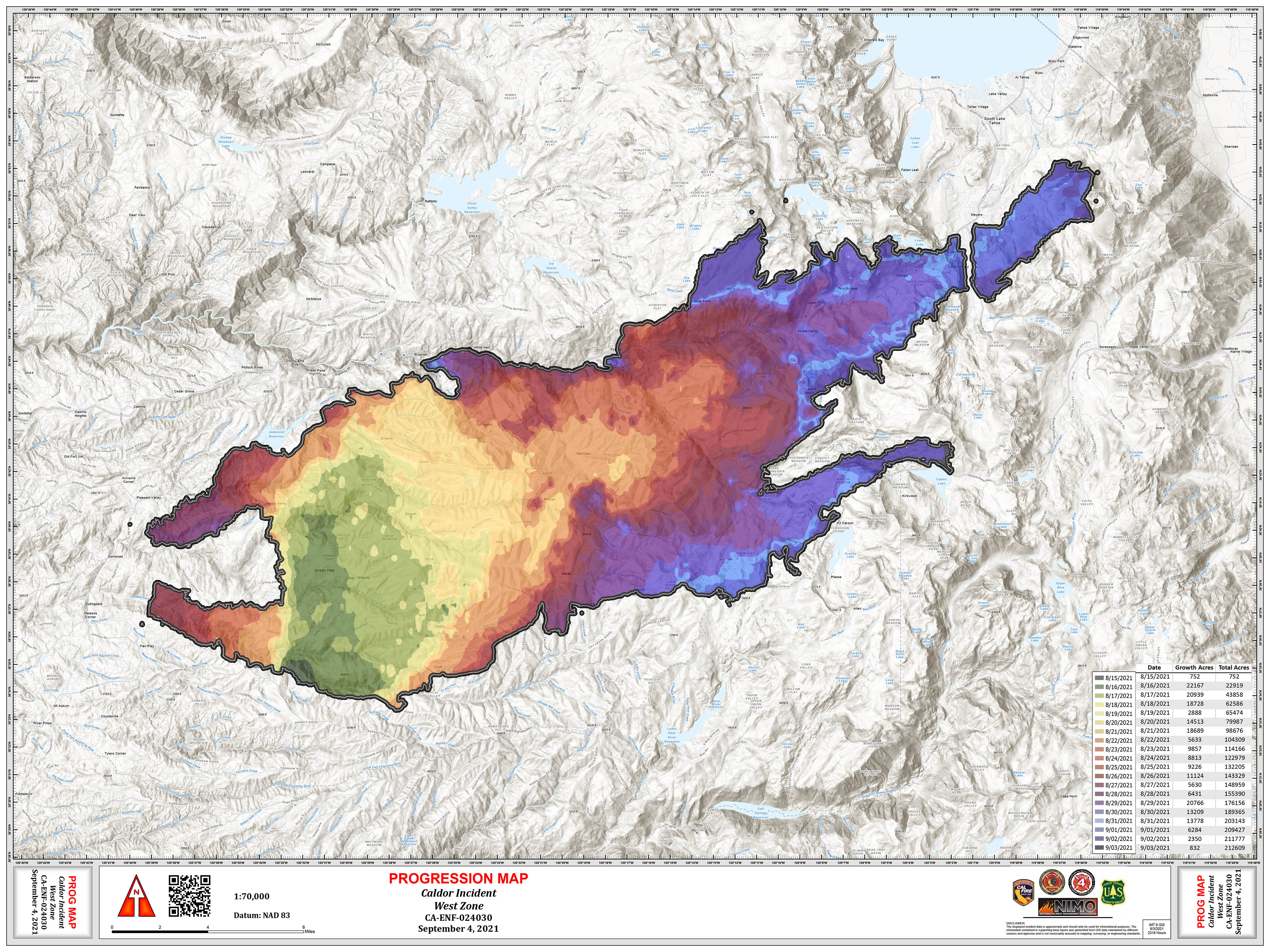
Progression from yesterday. Green shows increase in acreage. You’ll notice that comparing these to the previous maps above, even though the fire didn’t increase much, there is still a lot of heat (FFs like to call “potential” inside the lines)
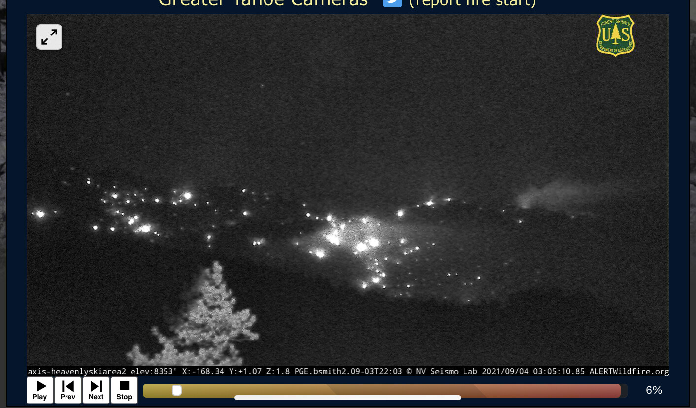
The 12 hour loop on the Hawkins camera shows a lot of active fire throughout the night. Tumbleweed your maps have been very helpful and appreciated. Intervening Post.
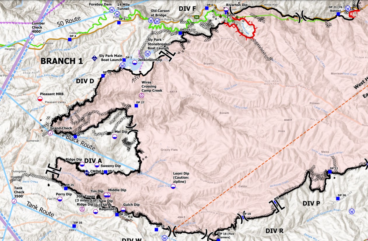
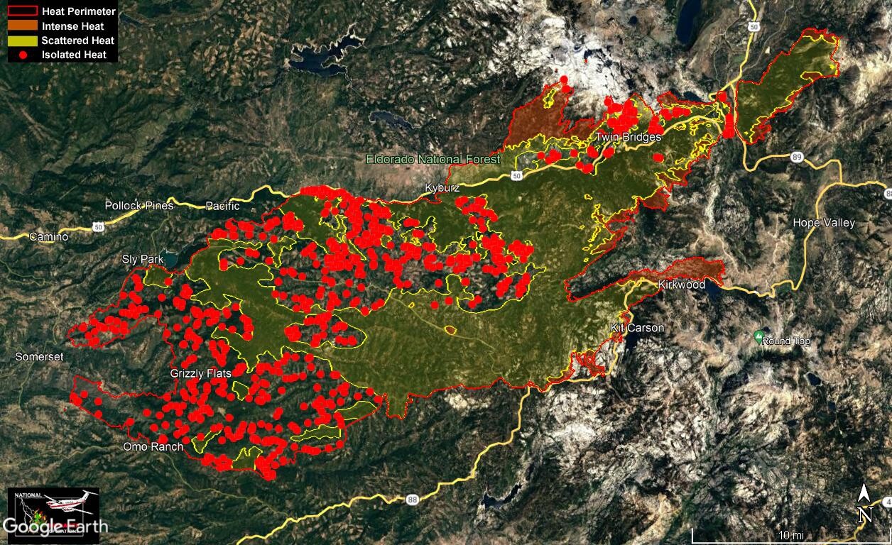
Some of this morning’s intel, still a large number of outstanding resource needs but good to see as much black line on the map as there is, considering the resources on hand.
Per ONCC News & Notes this AM:
CA-ENF Caldor Fire:214,107 acres brush and timber, 37% contained. Active fire behavior overnight with short-range spotting, smoldering and torching observed. Evacuation Orders and Warnings remain in effect. Many schools in El Dorado County are either evacuated or cancelled. Substantial damage to utility infrastructure reported. Repopulation occurring where safely possible with multiple communities threatened.
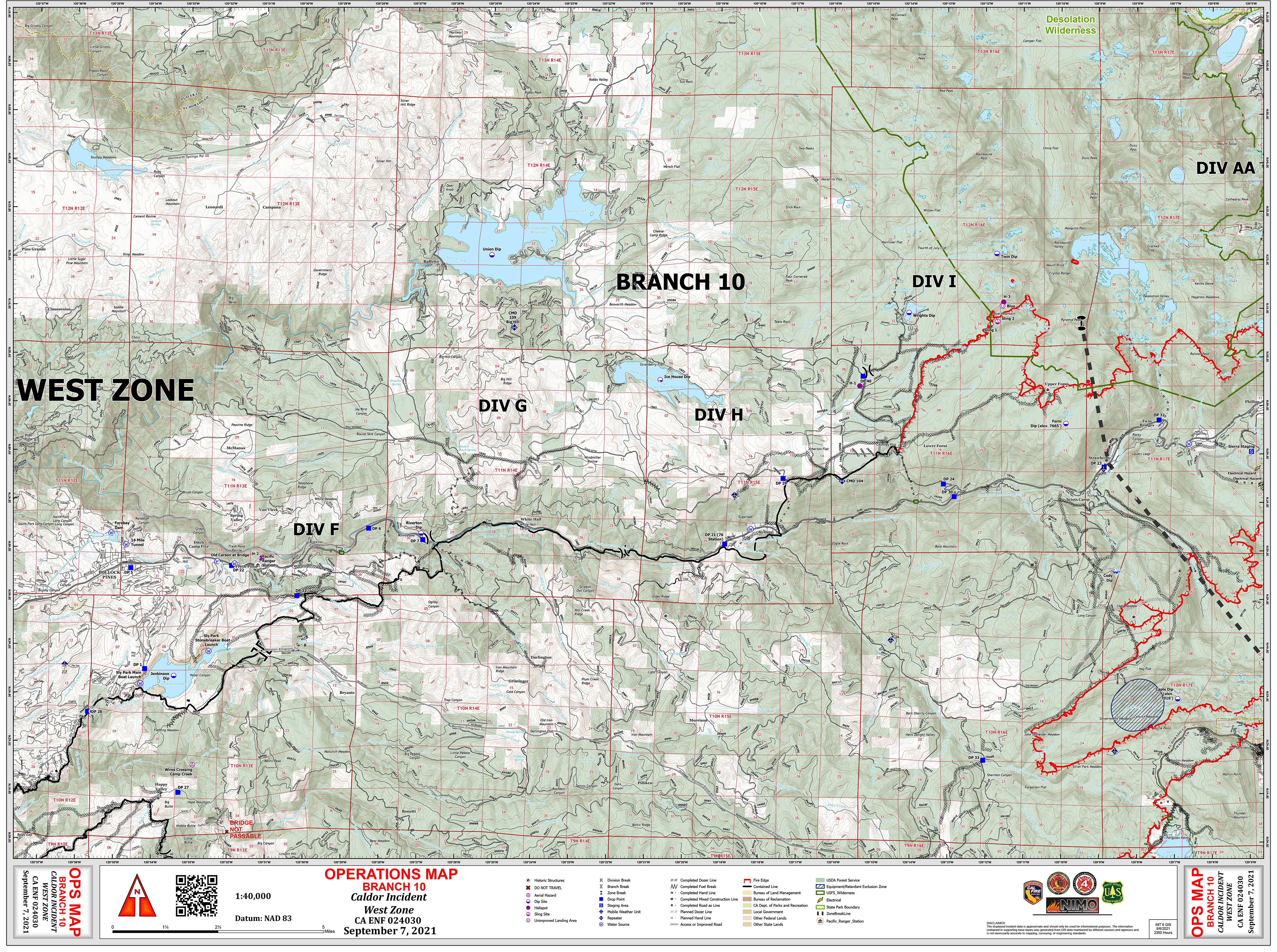
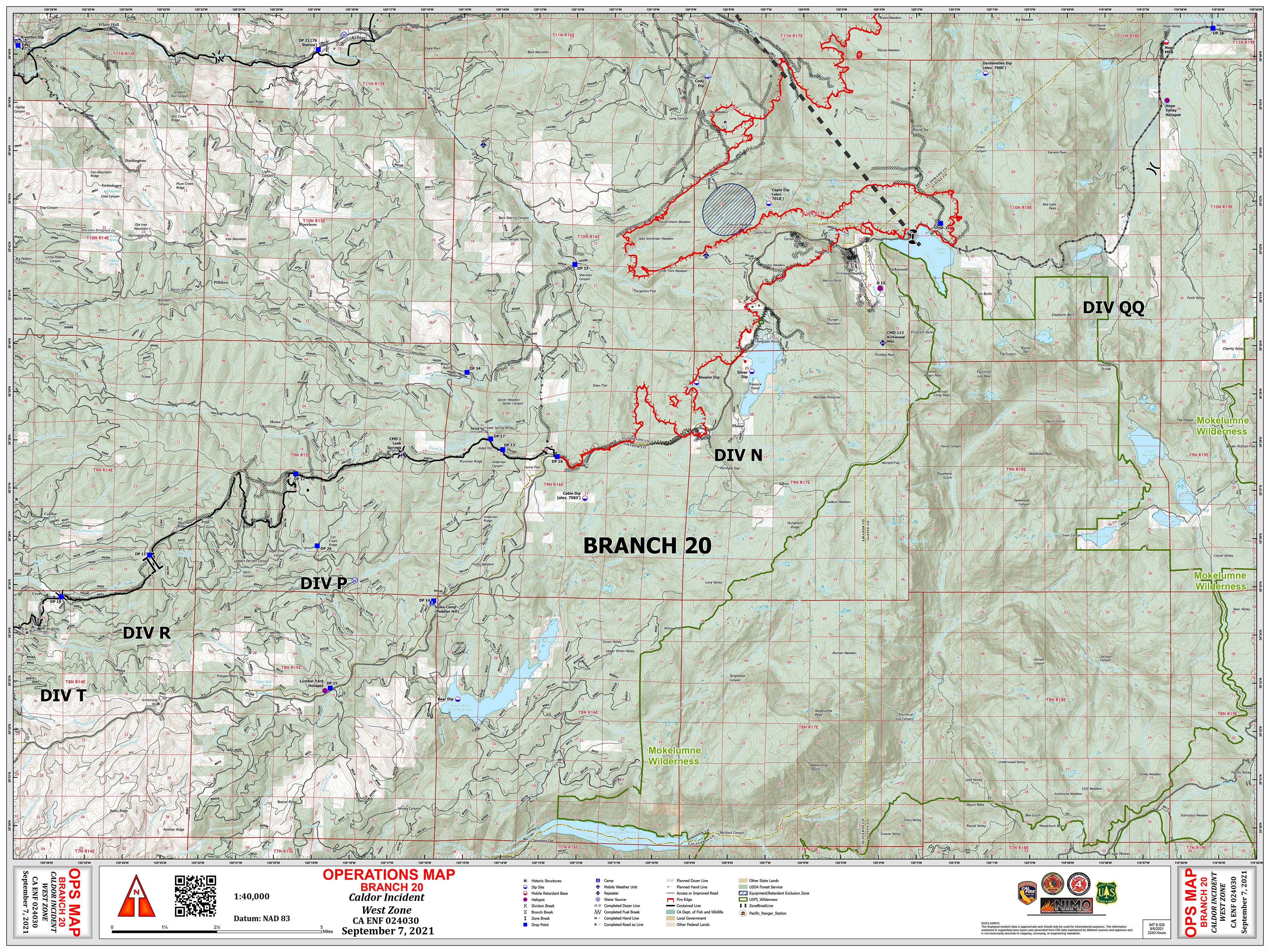
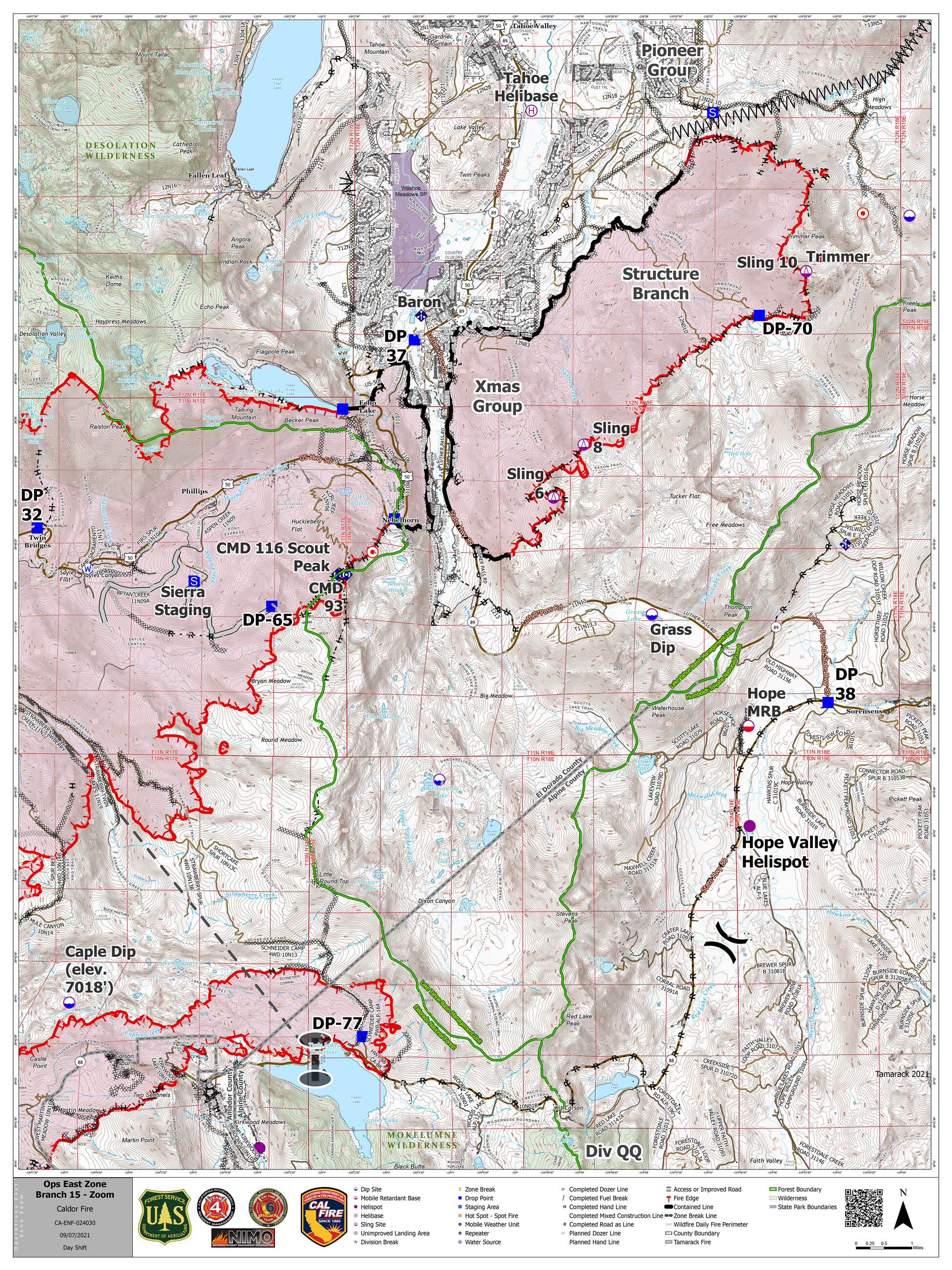
Unified Command: Type 1, CA Team 4 (Opliger), NIMO Team 2 (Reinarz) and Cal Fire Team 6 (Veik). NIMO Team 2 (Reinarz) and Cal Fire Team 6 (Veik) in command of West Zone. Type 1, CA Team 4 (Opliger) in command of East Zone.
Critical Resource Needs 12hr: As of this AM 209:
East Zone:
(2) SOFR (2) SOF2 (1) REMS (4) EMPF (4) EMTF (1) LTAN (1) ABRO (1) STAM (2) FOBS
(6) Type 1 Hand Crews (2) Type 2IA Hand (9) Type 2 Hand Crews (15) Type 1 Engines (25) Type 3 Engines
(15) Type 6 Engines
(4) Water Tenders Type 2
(1) FELB
(23) TFLD (Qualified or Trainee) (22) HEQB (Qualified or Trainee) (1) OSC1 (Qualified or Trainee) (2) OSC2 (Qualified or Trainee) (1) SITL (Qualified or Trainee) (1) WFMU (2) OPBD (2) STPS
(14) DIVS (Qualified or Trainee) (10) Engine Strike Teams 3/4/6 (1) FUDL (1) ORDM (3) RADO (1) FACL
(3) BCMG (2) Camp Crew
West Zone:
(1) STA (14) STC (2) STF (2) Type 1 ENG (4) TYPE 3 ENG (5) TYPE 6 ENG (8) STG
(5) CRW Type 1 (9) CRW Type 2 (5) IHC (8) HEQB (2) OPBD (9) DIVS (3) LIMA (5) MAST
(2) FELB (14) EXC (9) SKD (1) FALM (2) VLATS (2) Type 1 Helicopter
(1) Type 2 Helicopter, x1 Standard, x1 Limited (1) UAS Aerial Ignition Module
(1) HLCO-Qualified (4) HCWN (6) HECM (4) EMTF (1) REMS (1) THSC (5) TFLD (1) CHIP
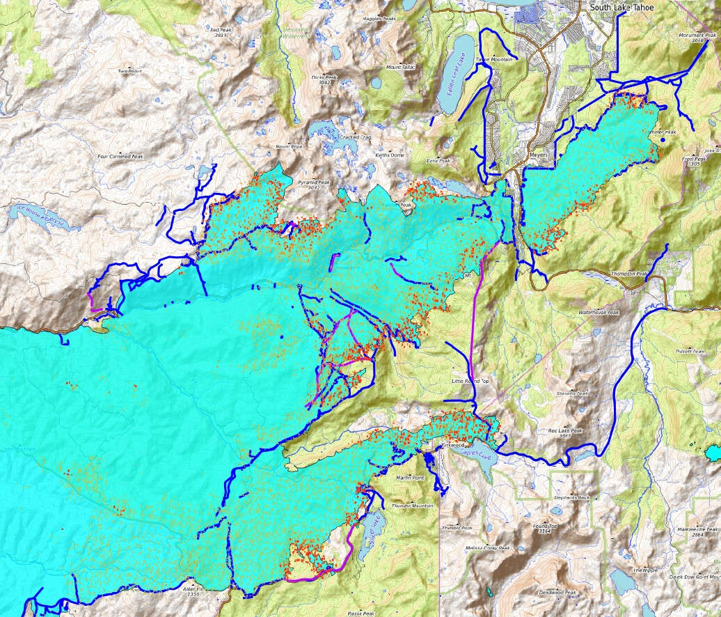
Latest VIIRS along with some of today’s data package:
Red dots = Detection last 24 hours.
Dark Orange dots = Detection Last 48 hours.
Light Orange dots = Detection Last 72 hours.
Cyan = Fire Perimeter.
Dark Blue lines = Completed All Types Of Line.
Purple lines = Planned All Types Of Line.
Please continue with the west side. There’s still heat showing up and residents evacuated…and pissed. One of your maps would be fabulous to share where there’s still heat. Thanks!!
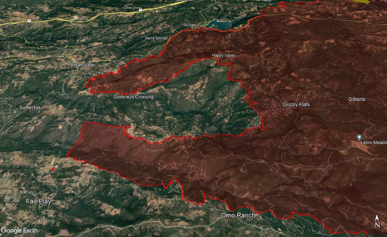
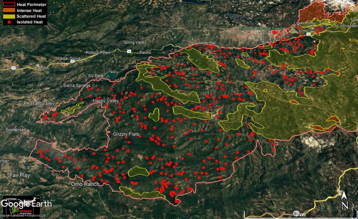
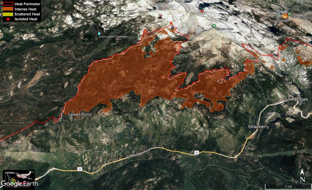
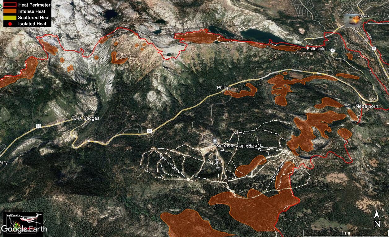
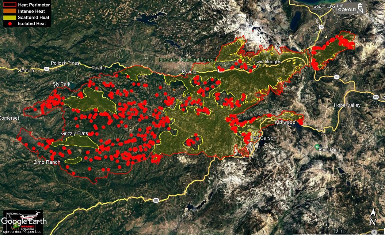
Here’s an overview of the fire including all heat signature from the IR run. It should be noted that isolated heat sources can be rather large. Not all heat sources are detected by the IR flights (some reappear after disappearing from previous runs).
One should not use these maps for information to support a view that an area is “safe” to repopulate.
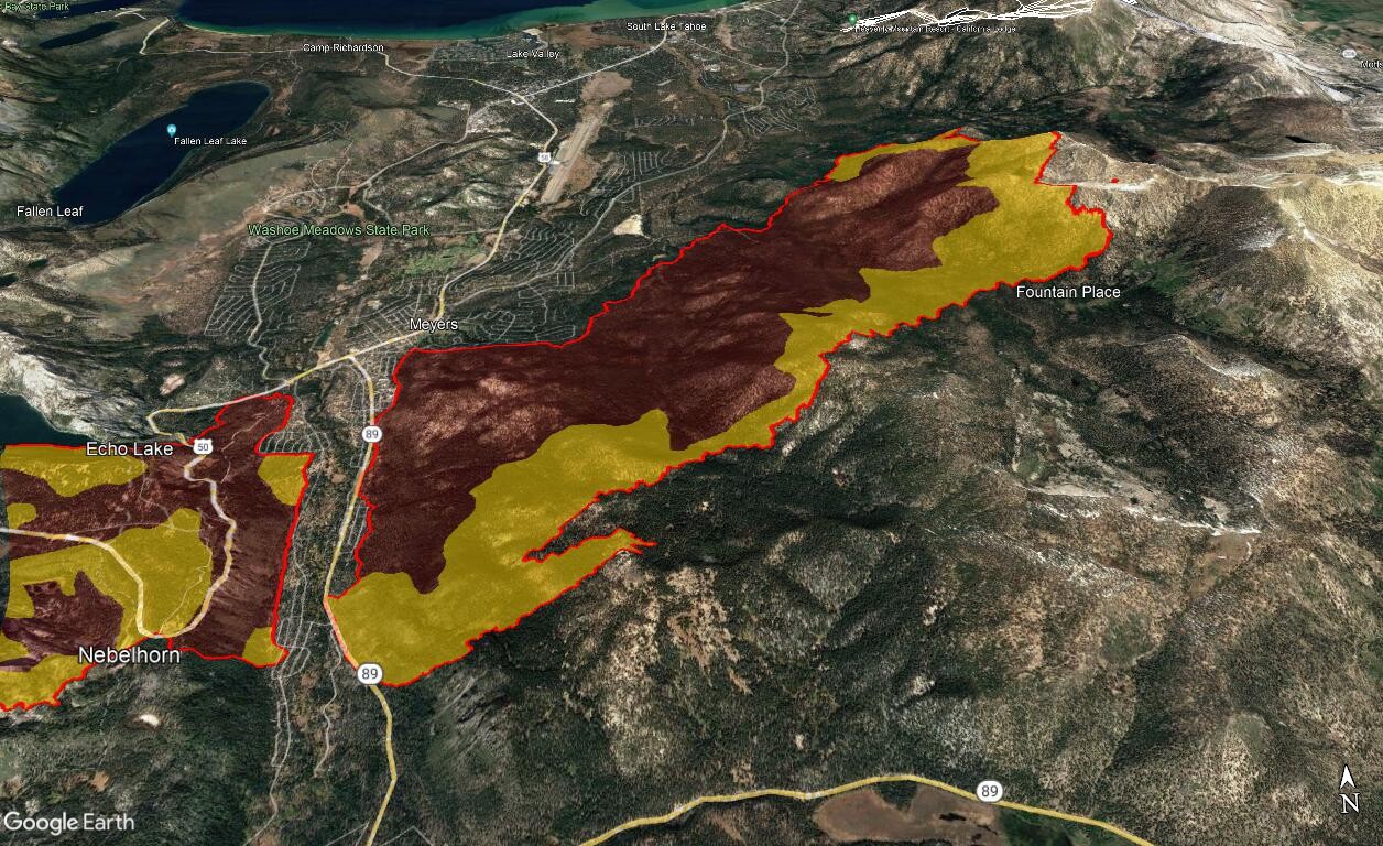
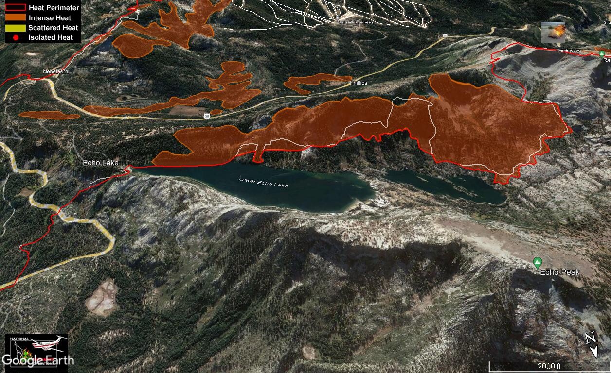
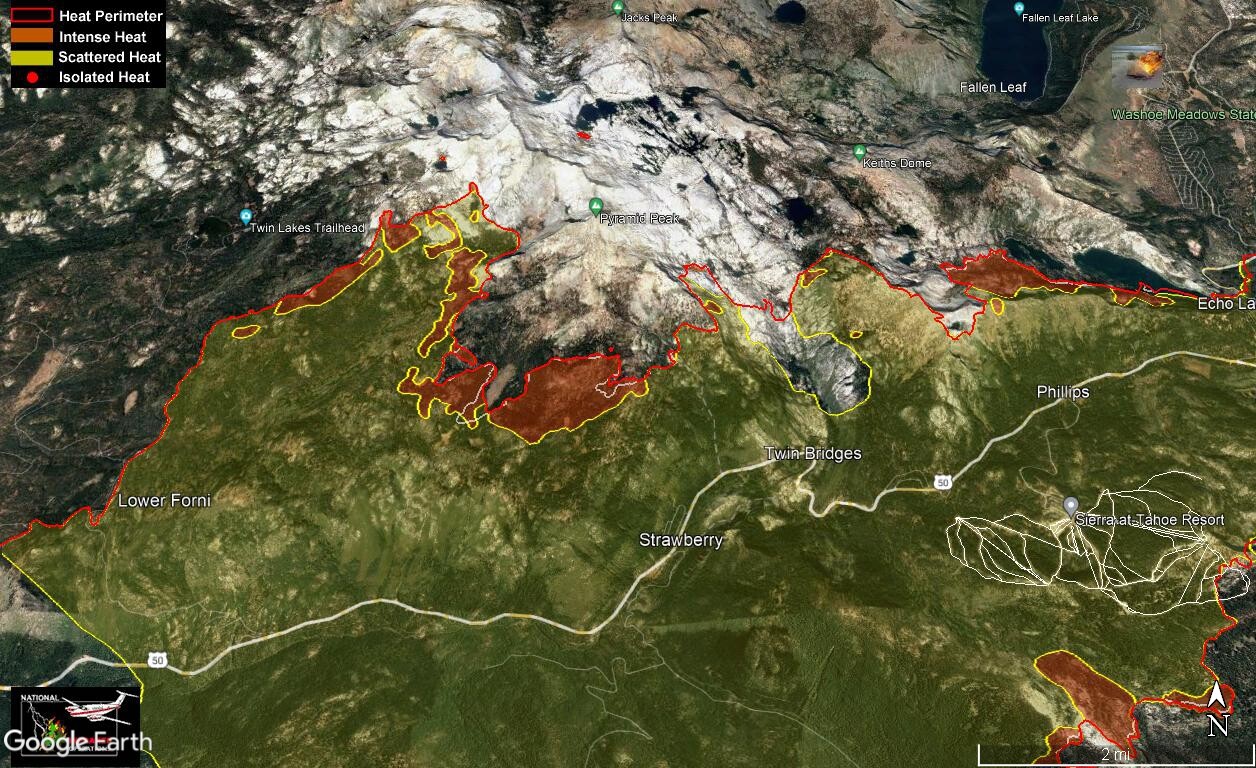
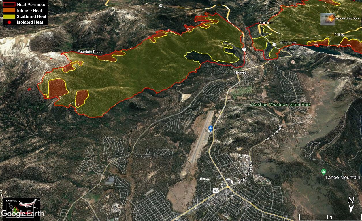
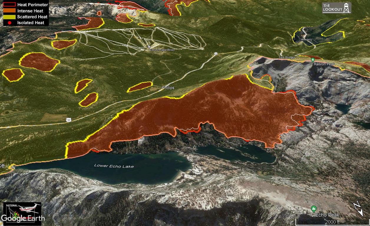
IR from 2341 last night. Isolated heat has been removed for clarity. Clear areas do not indicate no heat, many reasons for heat not showing on IR runs. Only eyes on the ground can determine when it is safe to enter an area.
Feint white line indicates previous fire perimeter
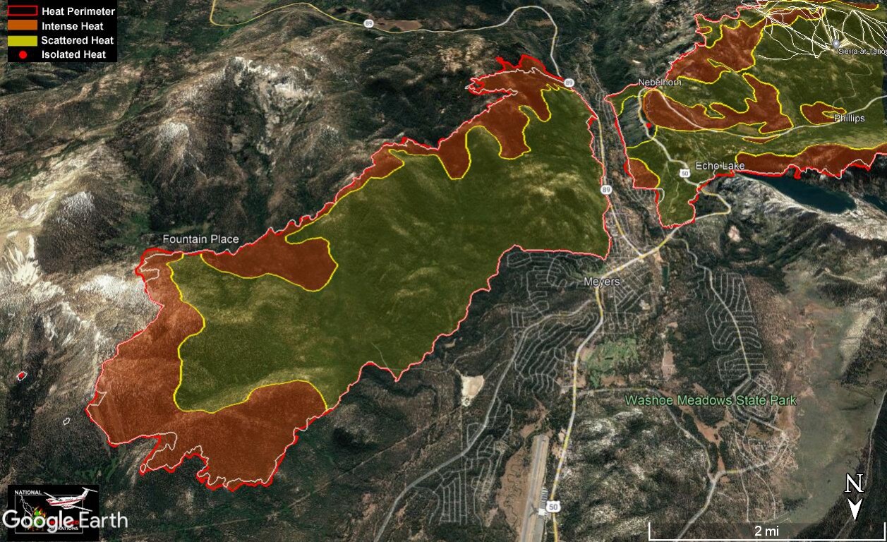
Above 50 at Kyburz/Strawberry. Finally the top has started to cool down (relatively).
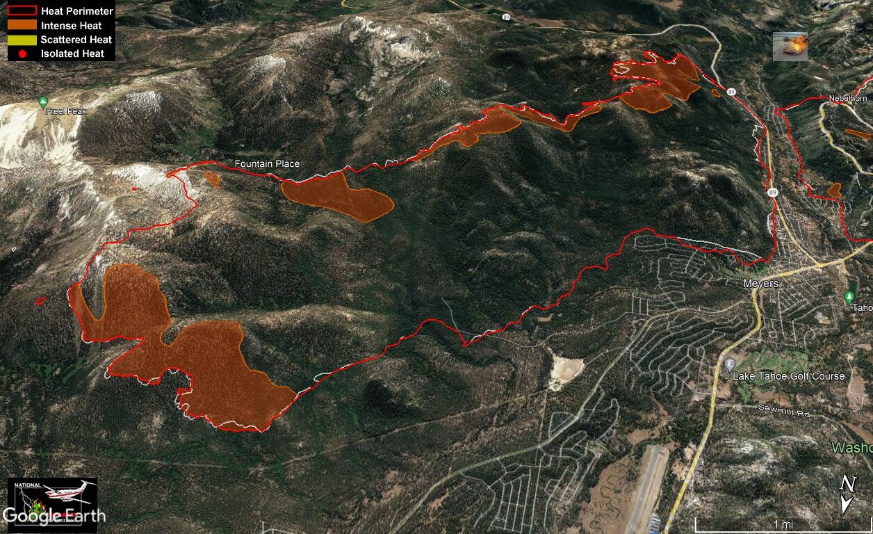
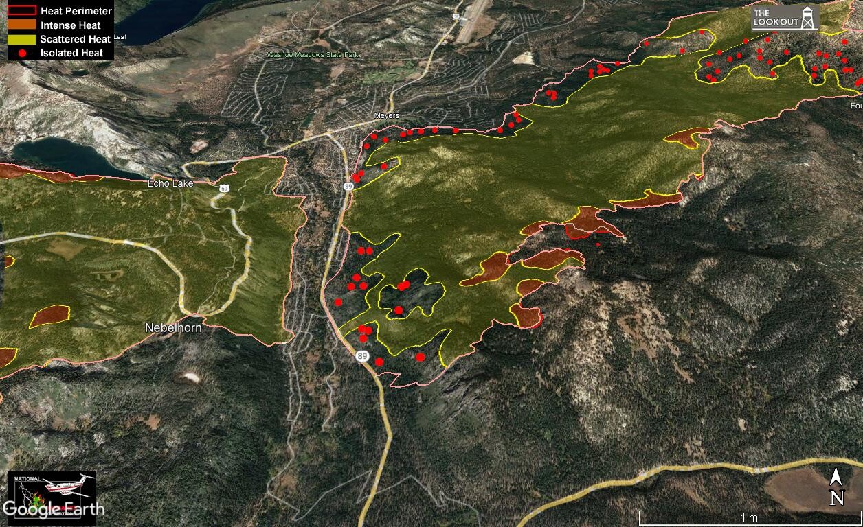
They’ve reduced the evac order to advisory in the City of SLT, but as you can see there is still plenty of heat near the county areas. They are still on mandatory evacs. Looks like they have the head pretty much boxed in. Good Job!
CA-ENF Caldor Fire: 216,646 acres brush and timber, 49% contained.
Cal Fire IMT 2 assigned, Planned transfer command West Zone on 9/8. Unified Command: Type 1, CA Team 4 (Opliger), NIMO Team 2 (Reinarz) and Cal Fire Team 6 (Veik). NIMO Team 2 (Reinarz) and Cal Fire Team 6 (Veik) in command of West Zone. Type 1, CA Team 4 (Opliger) in command of East Zone. Cal Fire IMT 2 (Blankenheim) assigned, Planned transfer command West Zone on 9/8 at 0700.
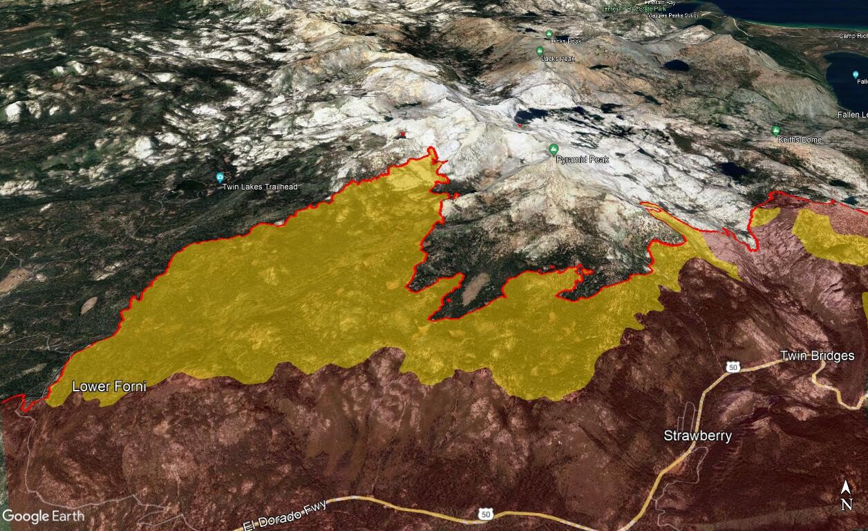
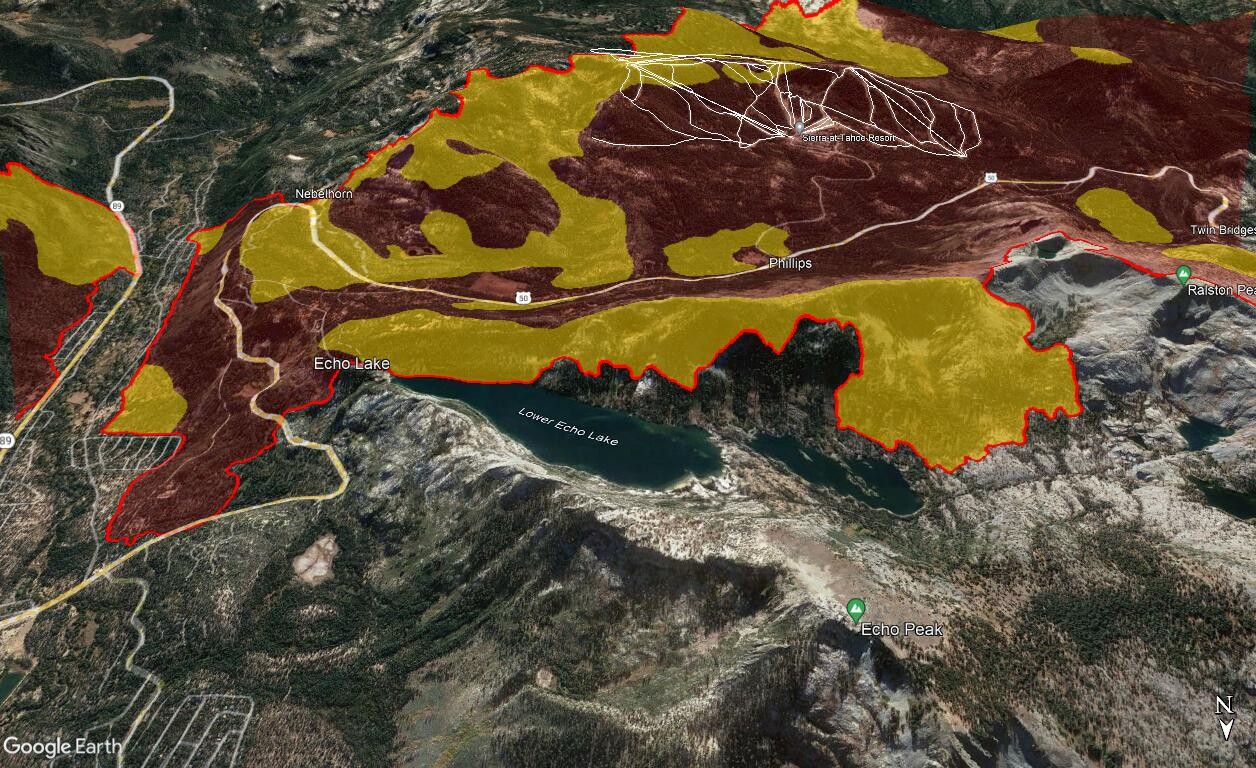
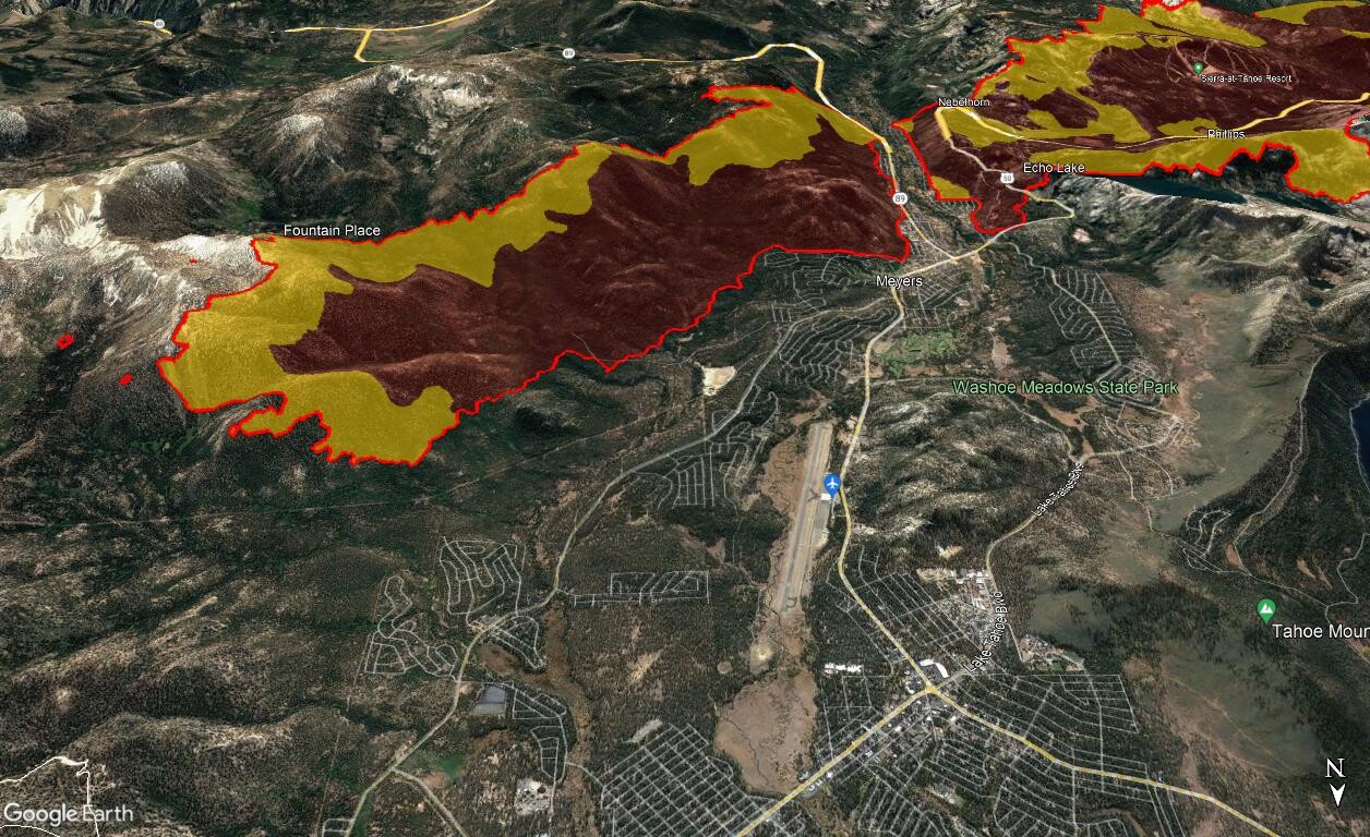
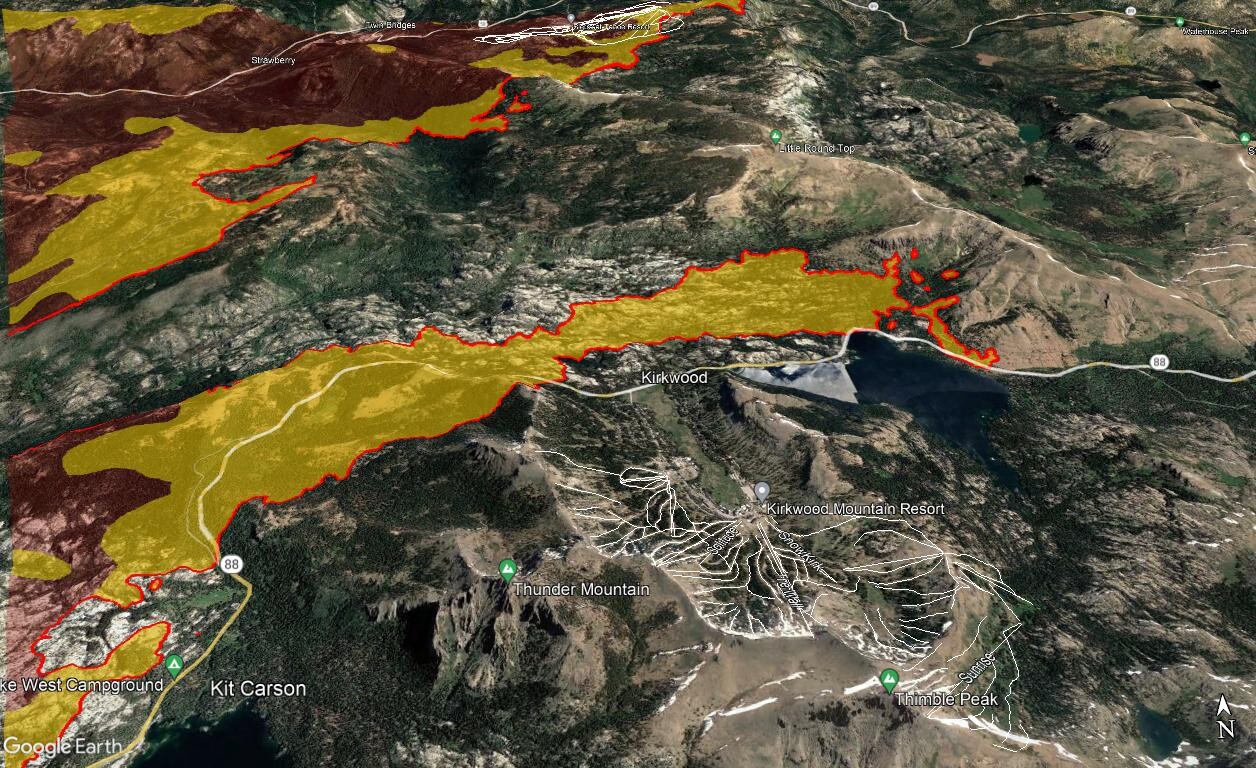
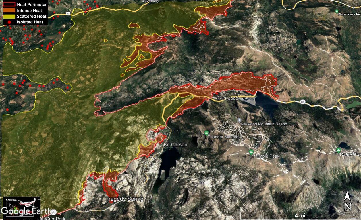
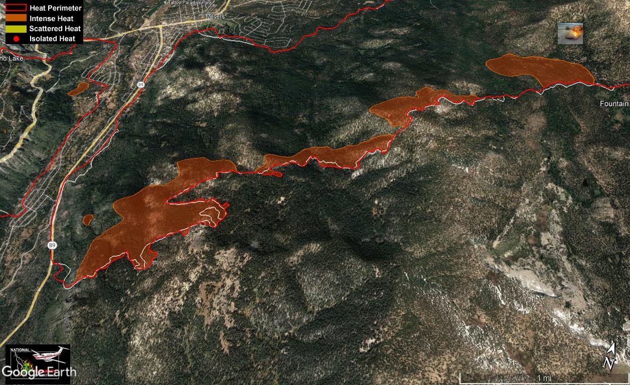
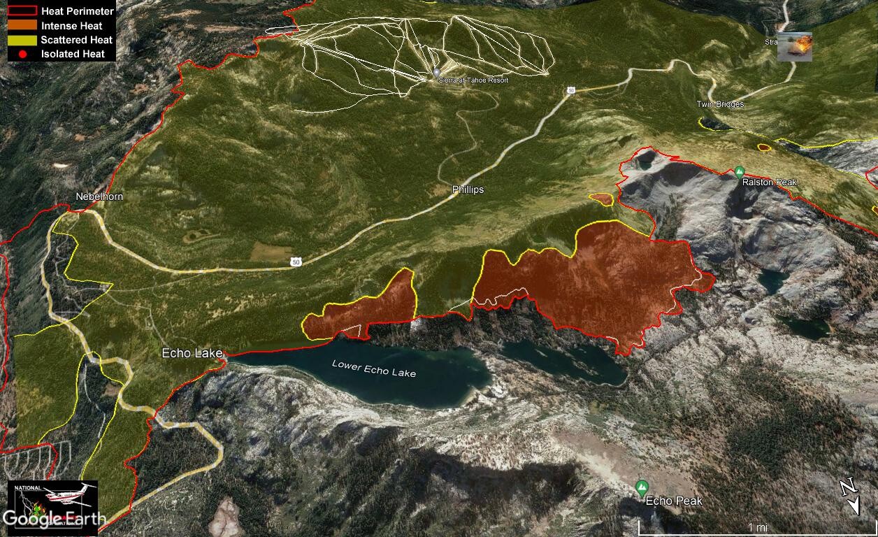
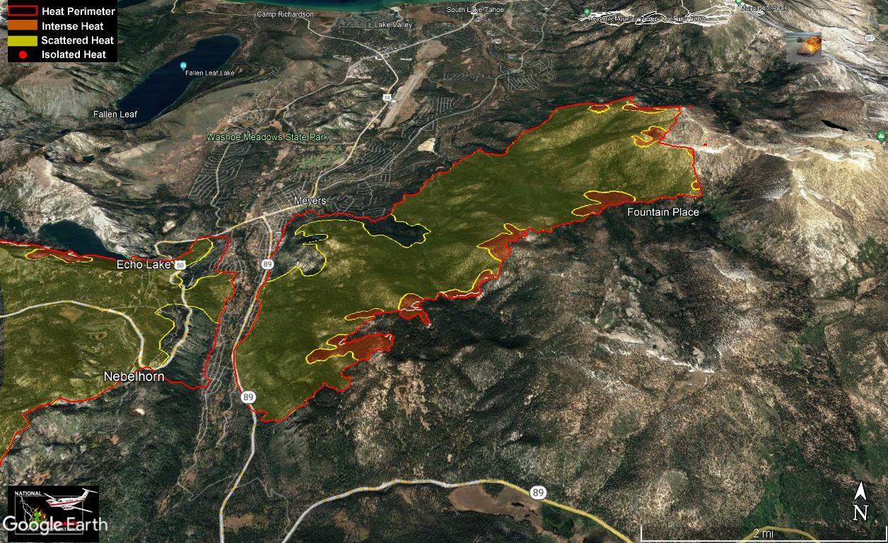
IR from 2309 last night. Isolated heat has been removed for clarity on some pics. Clear areas do not indicate no heat, many reasons for heat not showing on IR runs. Only eyes on the ground can determine when it is safe to enter an area.
Feint white line indicates previous fire perimeter
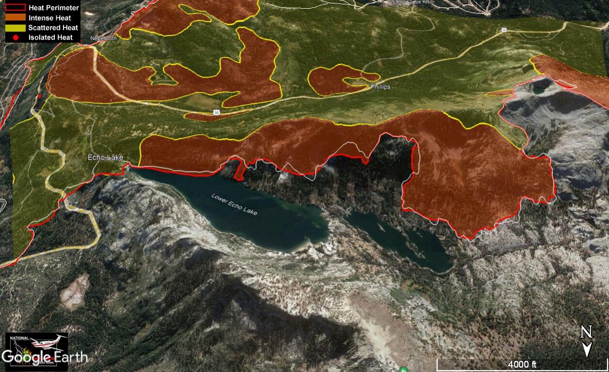
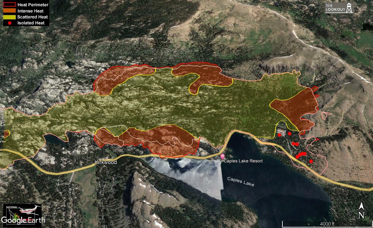
Above 50 at Kyburz/Strawberry. They used some Super Scoopers (Planes that skim the water to fill up) to assist with this area yesterday. The results are obvious. Very helpful to cool things off, having 1600 gallons of water dumped on your line 3 or 4 times an hour. They filled out of Lake Tahoe.
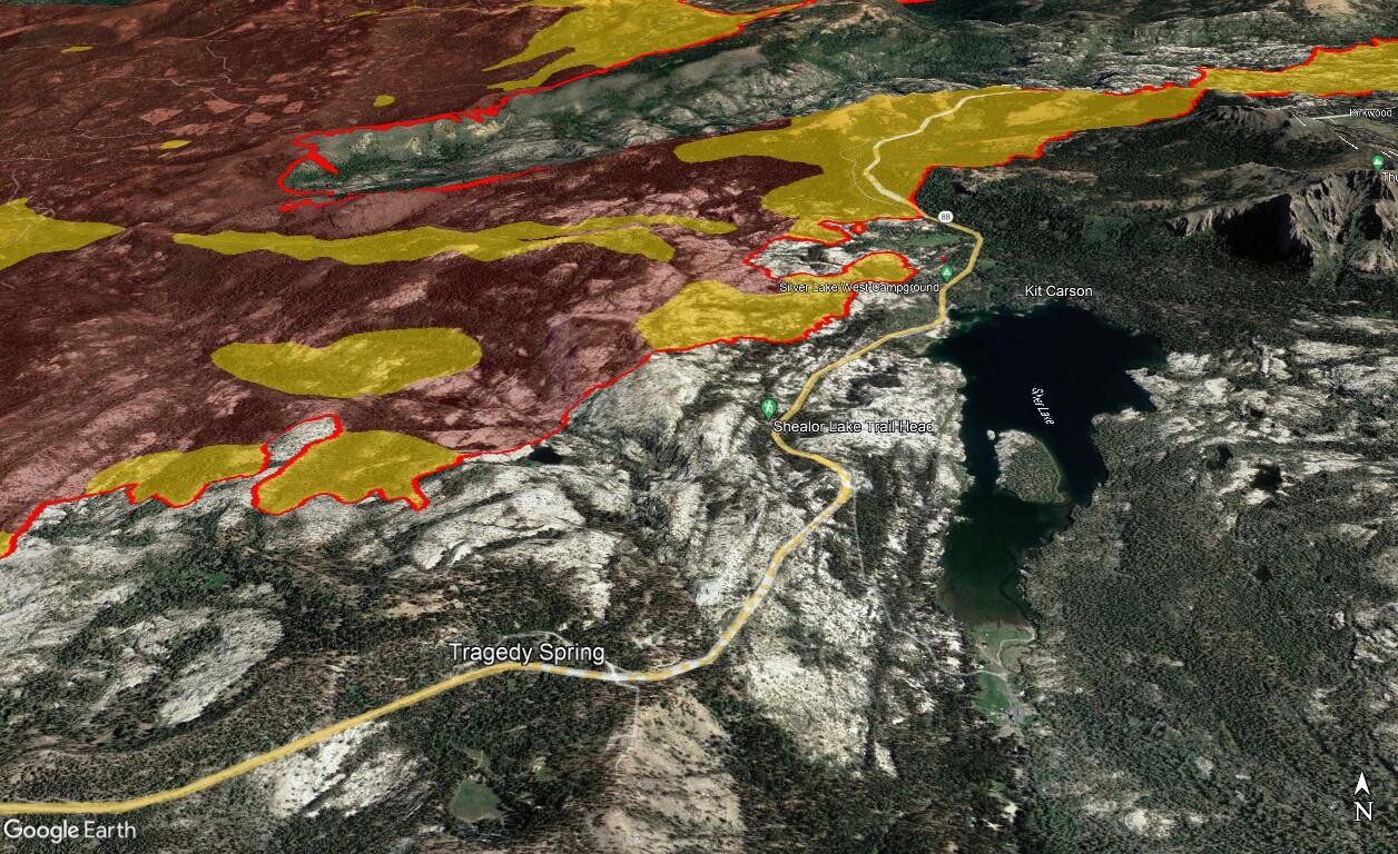
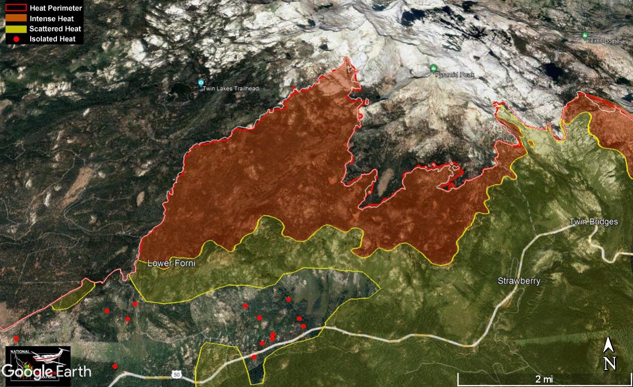
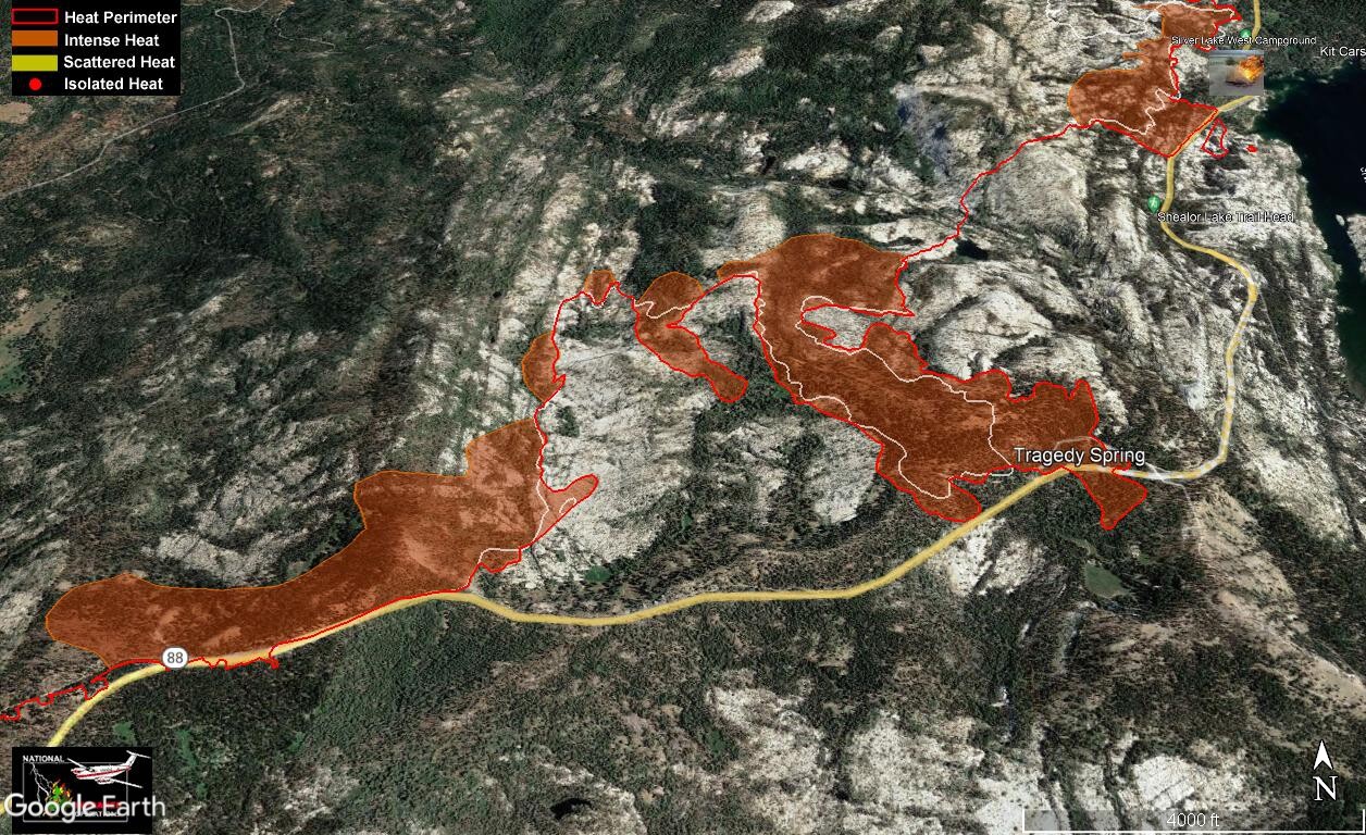
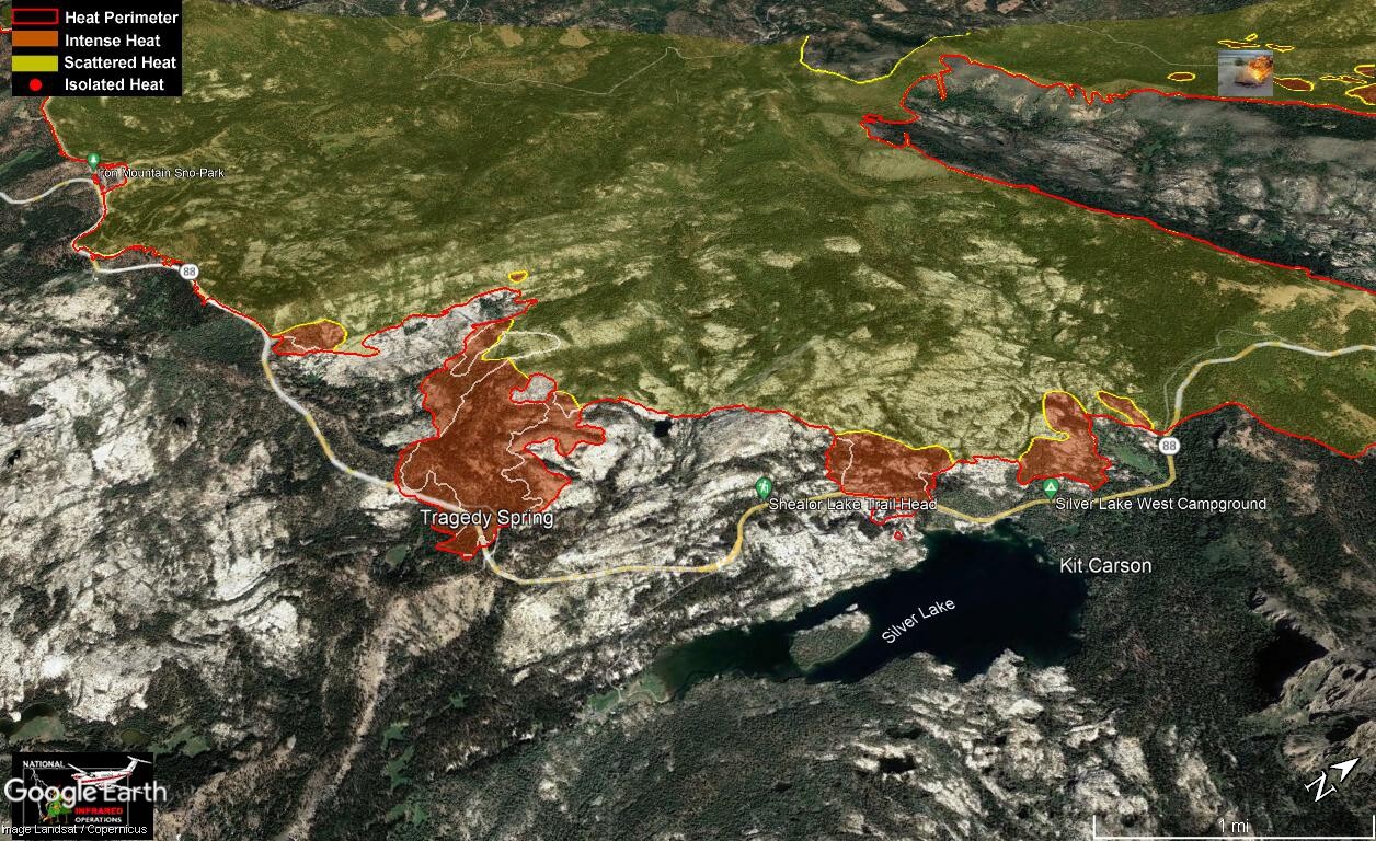
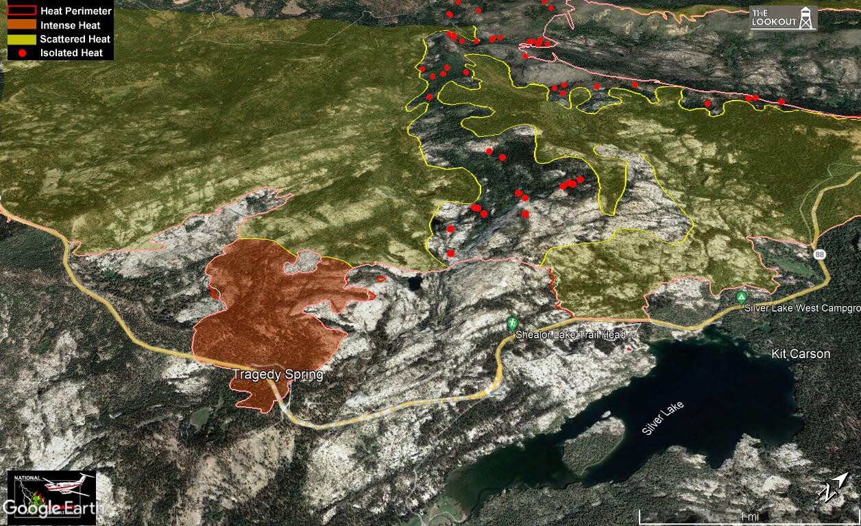
Again, the place the fire is spreading (rather slowly) is in areas with no good access. Requires dozers and handcrews to get in and scout areas to put in lines. Hard work. Looking NNW over the upper finger.
Not sure if they brought the line down to 88 here or just corrected data in the IR. I don’t have info about this area, possibly if someone knows they can pass it on. Looking north over Kirkwood.
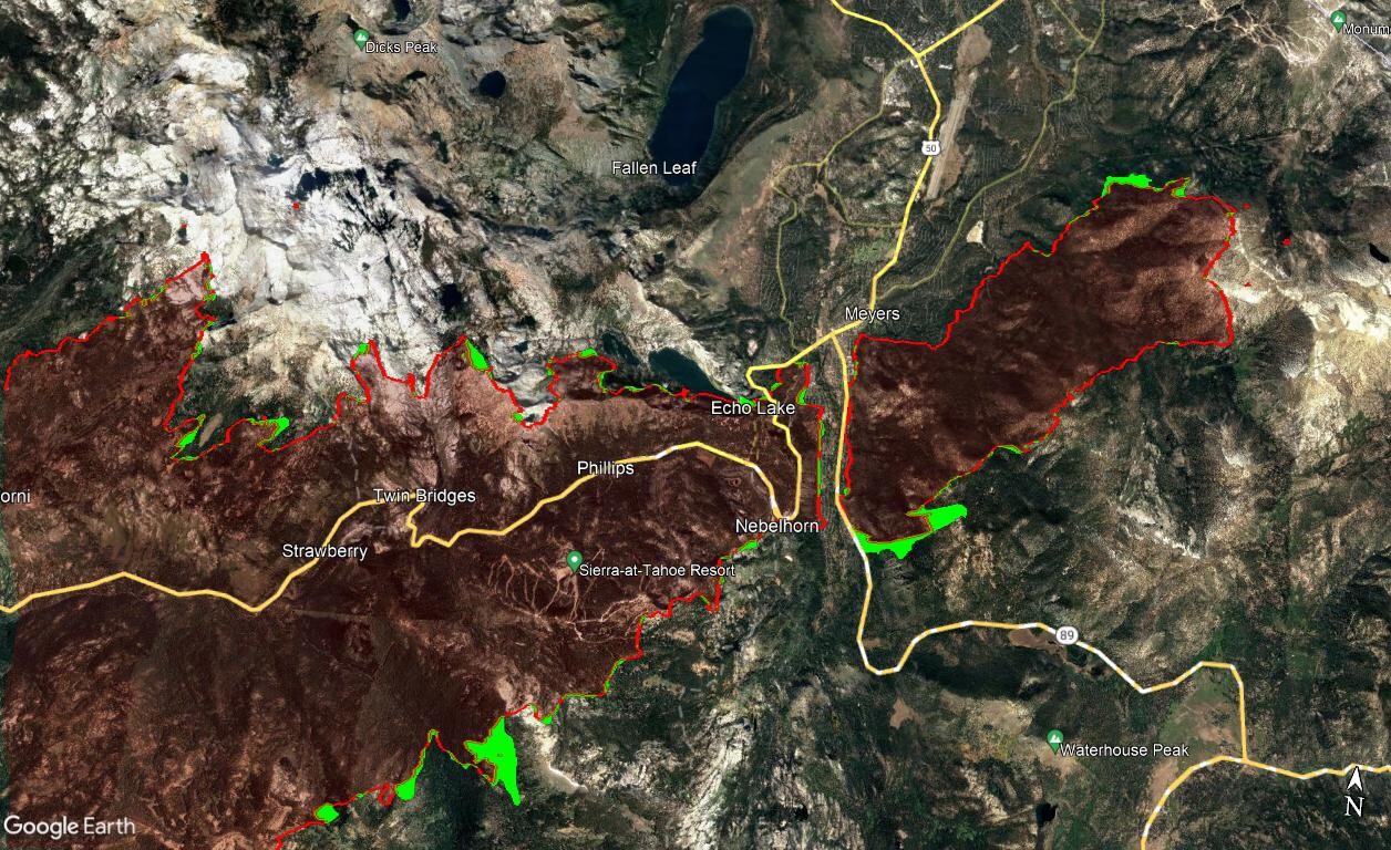
Overview of entire fire shows hot spots throughout. Most likely it will take a rain event or the IR plane not flying to see most of these red spots go away. As time goes on, their location will move away from populated areas as they continue to burn out on their own.