CA-ENF-Caldor (Contained)

Caltopo showing a slop over north of Silver lake Hwy88 route. Perhaps heading toward Kirkwood ski area:
https://caltopo.com/map.html#ll=38.68296,-120.09864&z=14&b=t&o=f16a%2Cr&n=1,0.25&a=fire%2Cmodis_mp%2Cwxd_wspd-01

UPDATED 2000, 8pm:
Fire heading towards and probably bumping Hwy 89:
Caltopo seems to be updating this very quickly (normally a 3hr refresh)

https://caltopo.com/map.html#ll=38.82393,-120.06057&z=13&b=t&o=f16a%2Cr&n=1,0.25&a=mba%2Cfire%2Cmodis_mp%2Cwxd_wspd-01

3 Likes

A post was merged into an existing topic: CA-ENF-Caldor?

Here’s 6pm perimeter from FIRIS.

5 Likes

I can confirm that tbe fire has spotted across 89 and is burning south of Apache. Got pictures from my security cameras.

4 Likes

Spot fire showing on the heavenly 2 cam appears about the 3 am time frame. Stay safe today folks.

IR mapping from 1:51 am. Going to be a long day, indeed.

14 Likes

191,607 acres 15% containment

1 Like

From 0540. Last image to match @pyrogeography last image from above to show growth.


5 Likes

Today’s Branch 10 Ops Map:

4 Likes

Wind appears to have shifted to be more out of the S than SW over the last hour

6 Likes

Liberty Power has a WX station east of the airport on their transmission line in the northern half of Sec 14. (Northwest “base” of Trimmer Mtn, at 6500ft) Has a 10min resolution like PGE stations.

Currently giving good indicator of conditions on the left flank of the GOES heat signature there pushing towards NV. Currently at 76F, I’m sure it’ll be a good canary to tell if flames reach that site.

5 Likes

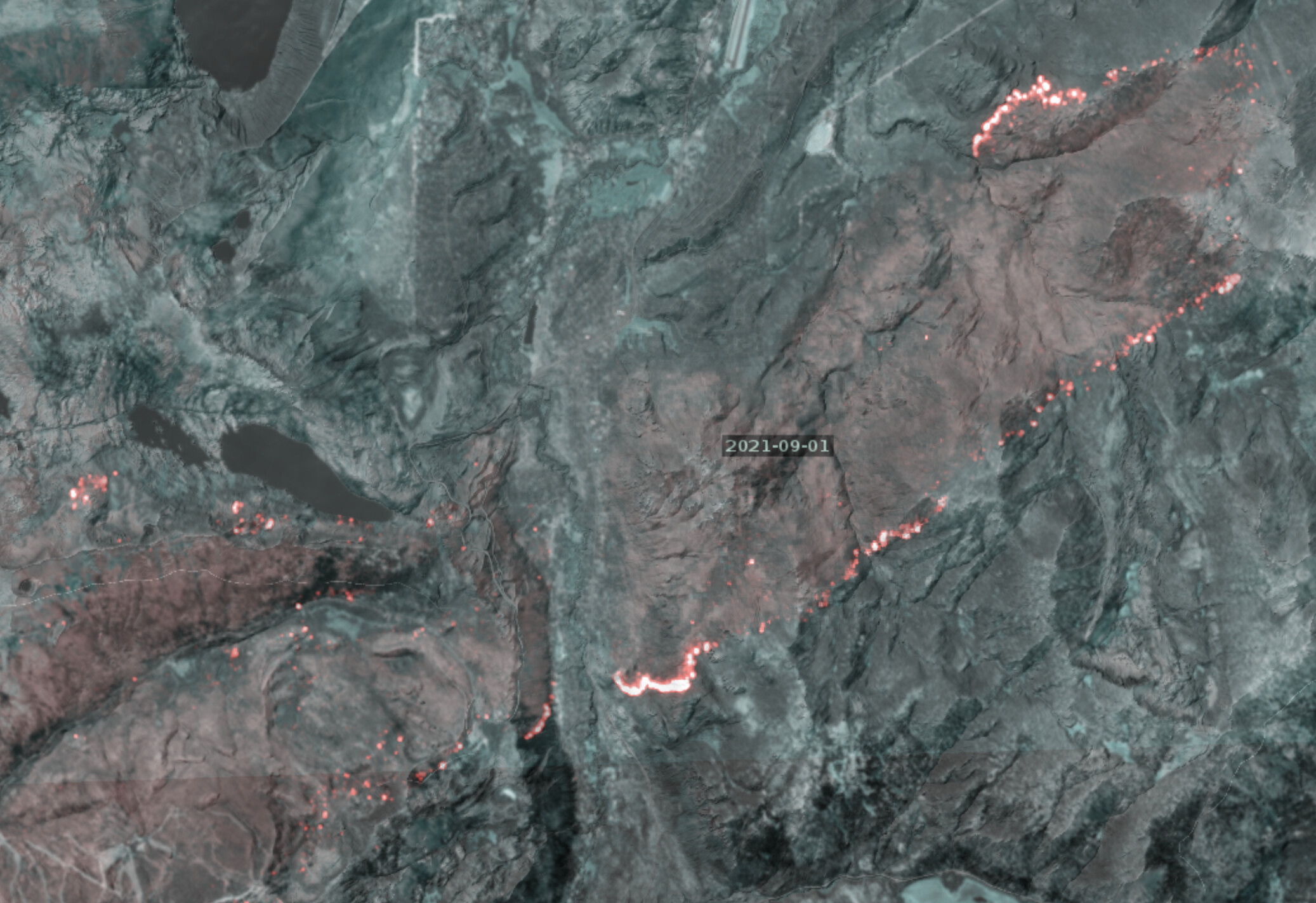
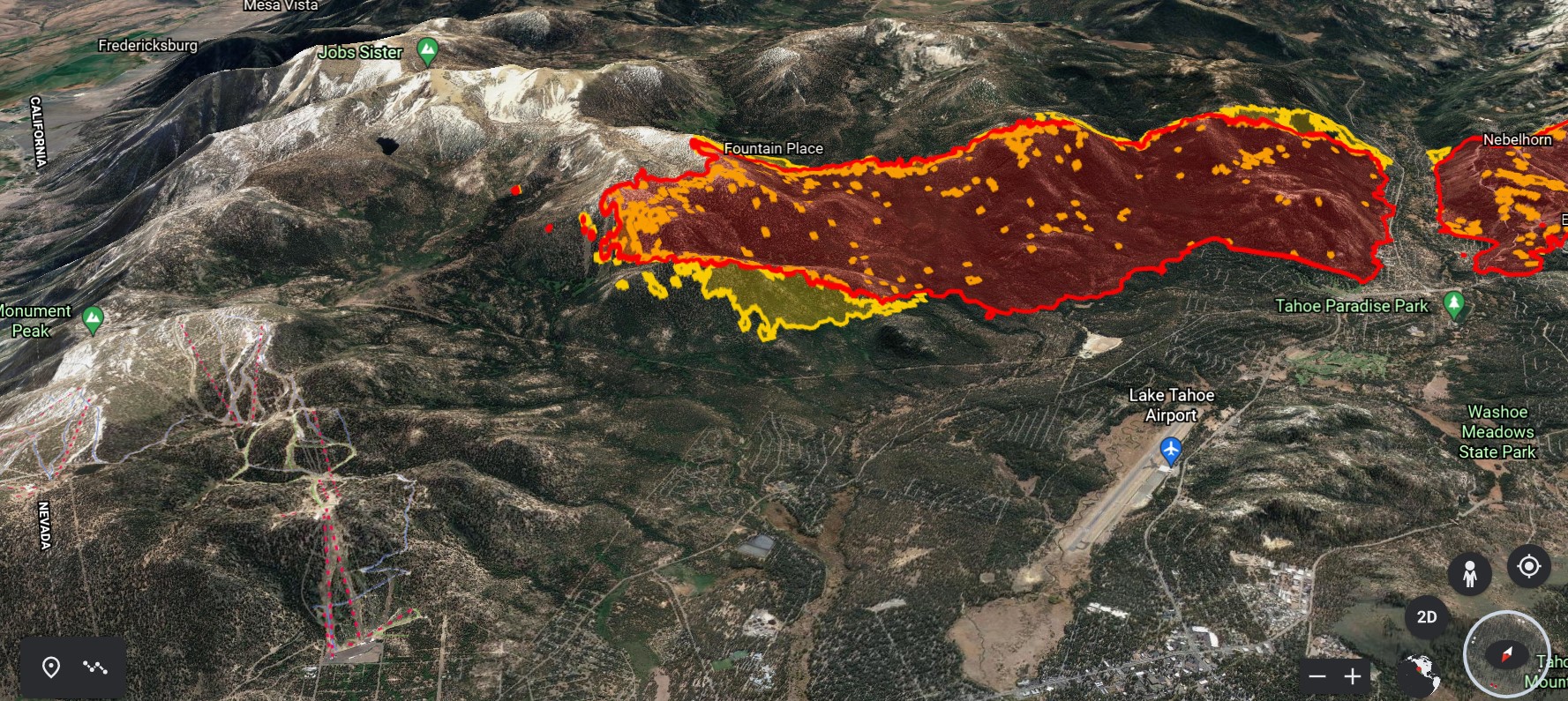
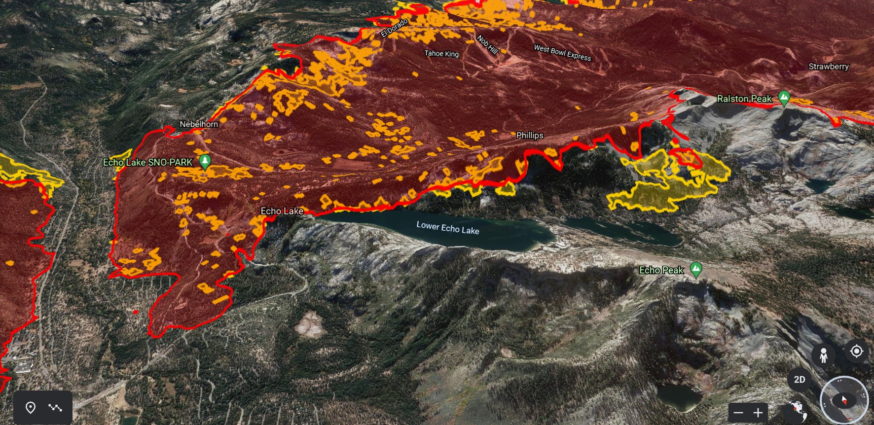
Here is a 4:45pm IR map of the fire from FIRIS project.
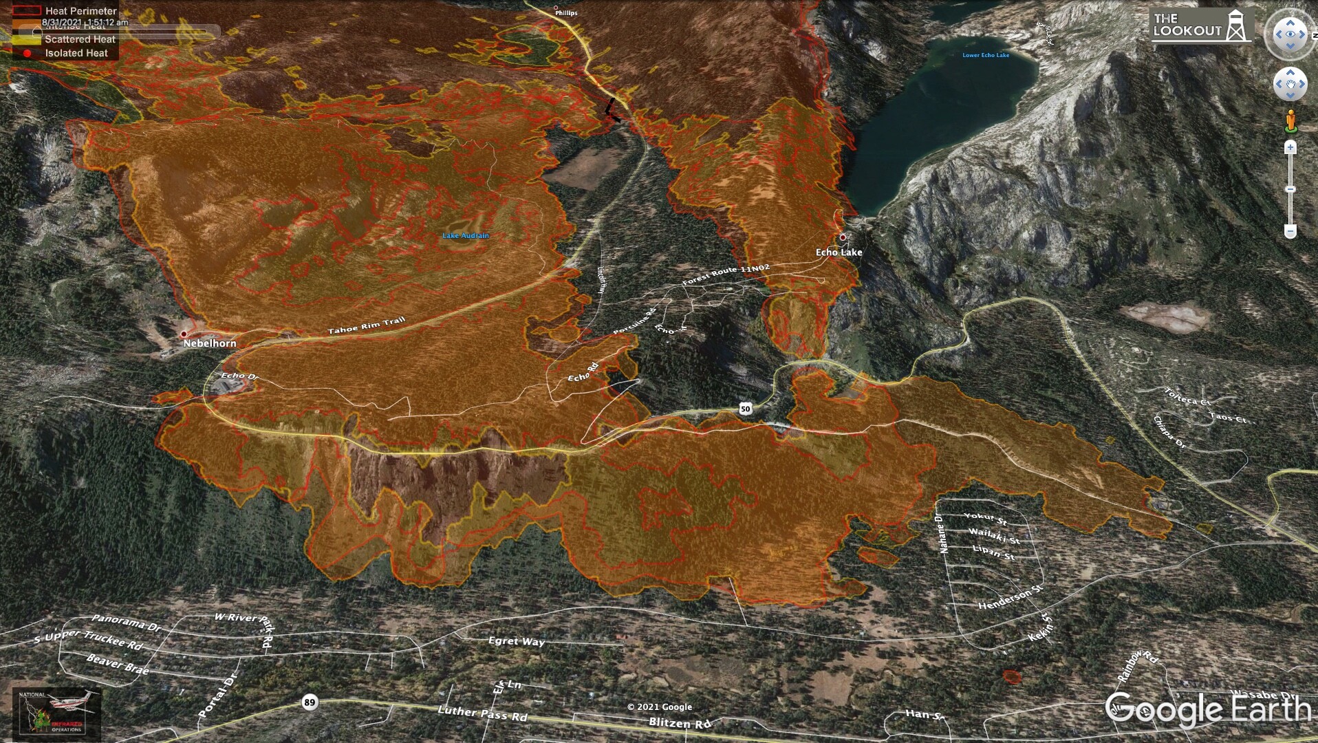
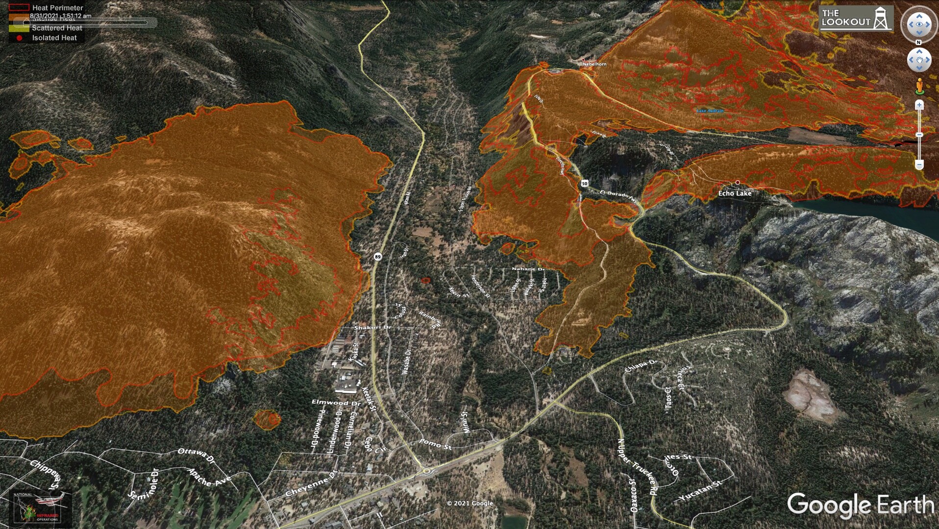
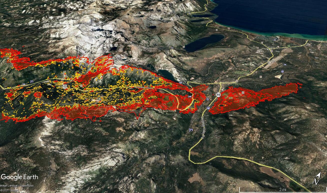
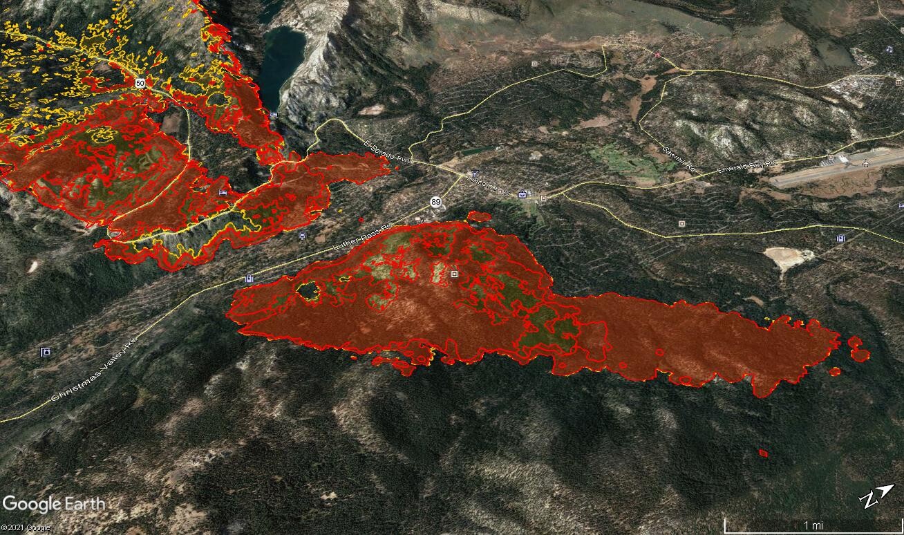
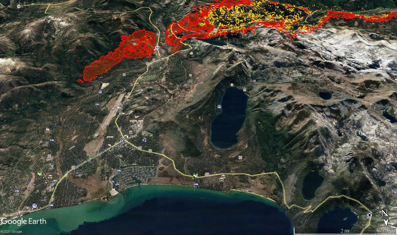
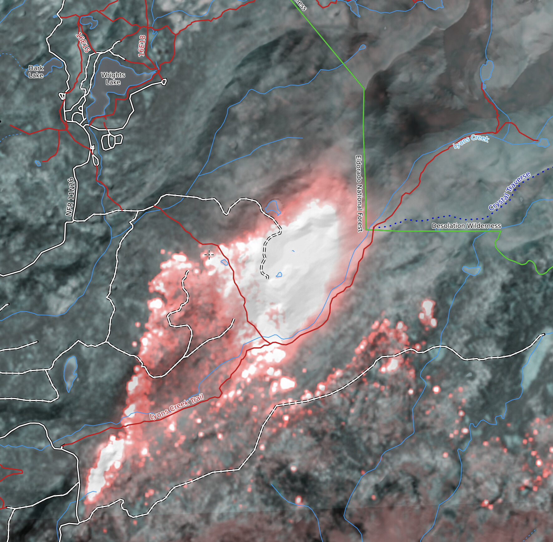
No fire spread visible in the flats. The slopover northeasst of Kyburz wasn’t very noticable at that time. No major spots showing north of Ralston Peak, either.


Video briefing here: Caldor Fire - 8/31/2021 Evening Update - YouTube

11 Likes

204,390 acres 20% containment

4 Likes

KML files filtered from 20210901 data package found here:
https://ftp.wildfire.gov/public/incident_specific_data/calif_n/!CALFIRE/!2021_Incidents/CA-ENF-024030_Caldor/GIS/IncidentData/20210901/

For import into CalTopo, Google Earth, etc. Can’t vouch for how accurate they keep the data vs what’s really on the ground.

Completed Dozer Line:

Completed All Type Of Line:

Planned Dozer And Hand Line:

5 Likes

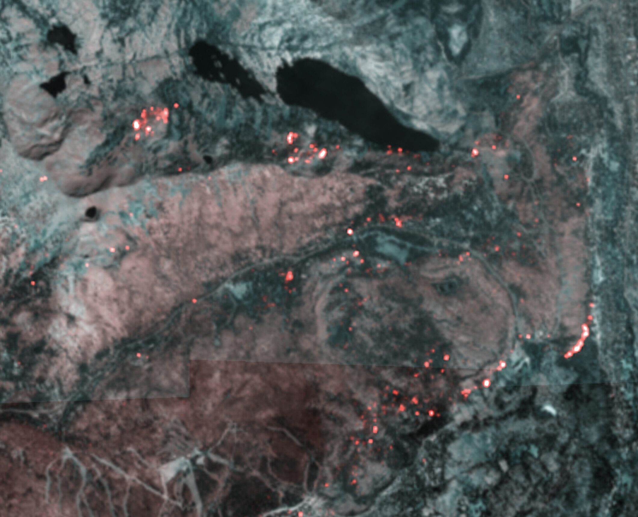
False-color long-wave IR images from today’s Sentinel pass at 12pm. With frequent IR flights, these aren’t really useful for perimeter updates, but they do provide a qualitative view unburned areas and fire activity: CalTopo - Backcountry Mapping Evolved.

Wright’s lake:

Tahoe basin:

Kirkwood:

Echo lake / summit:

19 Likes

From the overnight IR

Spread south of SLT, looking SE

Spread into the Echo Lakes basin, looking south

Slop over the northern line above 50, looking north

Small spot near Lake Aloha

Spread to the east, north of Kirkwood, looking west

Spread near Silver Lake looking west

12 Likes

KML files filtered from 20210902 data package found here:
https://ftp.wildfire.gov/public/incident_specific_data/calif_n/!CALFIRE/!2021_Incidents/CA-ENF-024030_Caldor/GIS/IncidentData/20210902/

For import into CalTopo, Google Earth, etc. Can’t vouch for how accurate they keep the data vs what’s really on the ground.

Completed Dozer Line:

Completed All Type Of Line:

Planned Dozer And Hand Line:

5 Likes

Latest IR from 11 this morning show relatively little increase in acreage from prev. If I am intepreting it correct :crossed_fingers: they have a good amount of some type of line in on the north side as there shows no spread in more than 2/3 (swag) of the line. Most of the increase is on the east and wrapping around on the south in SLT and in the Kirkwood area. And again, those look to be relatively small.

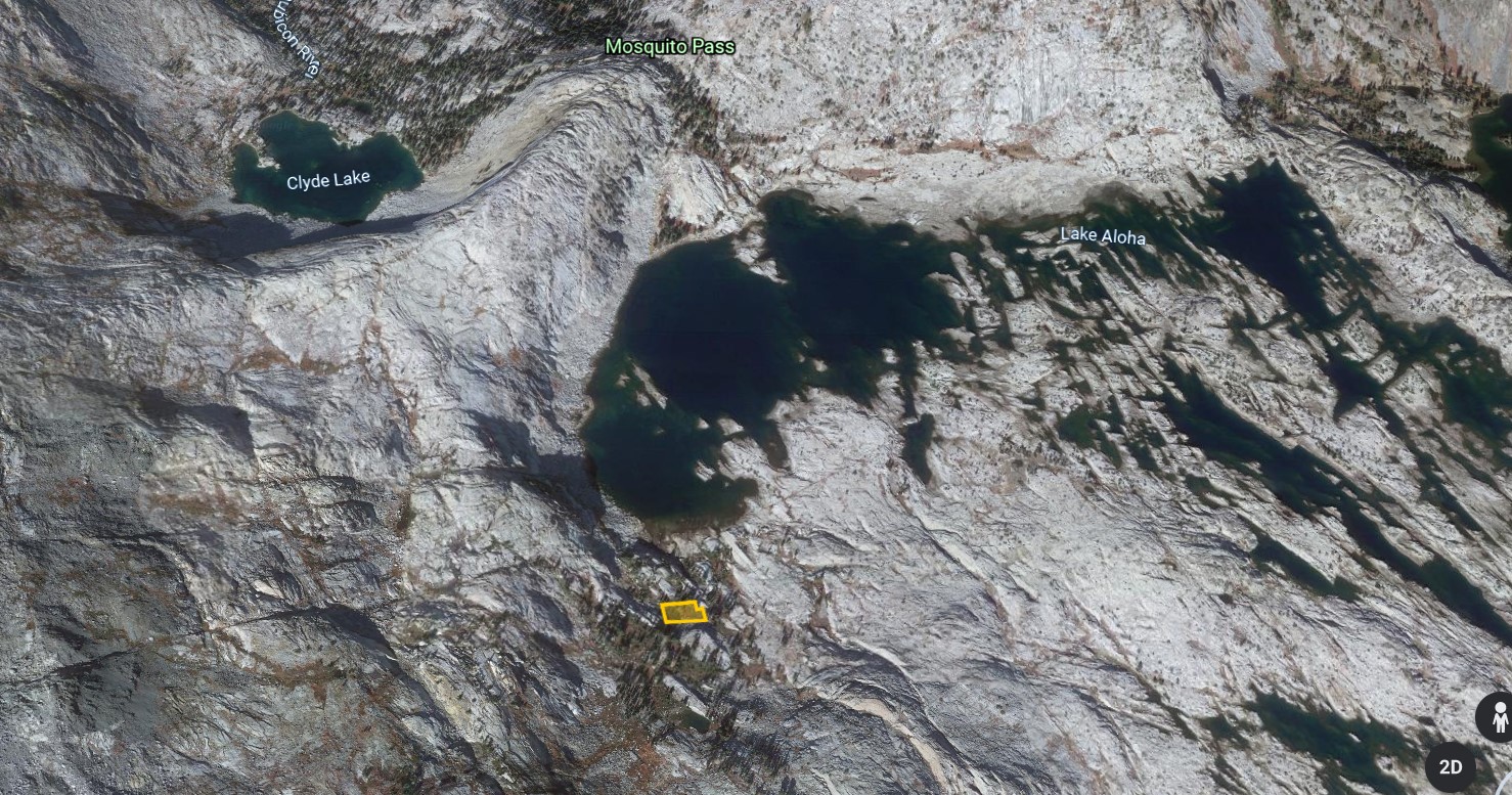
Also looked like the pockets SE of White Hall and SE of Kyburz burned out.

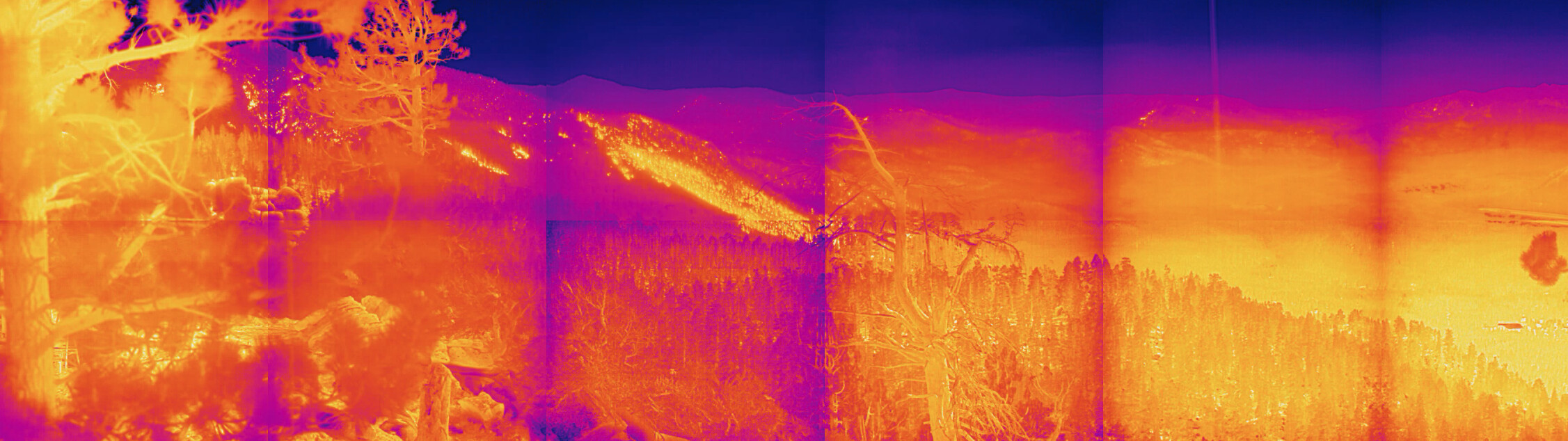
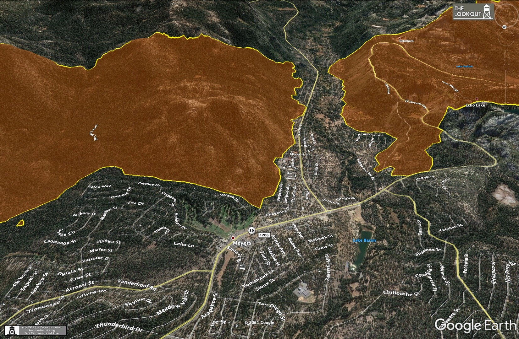
Curious if anyone who has eyes on it could describe what they’re seeing in SLT, cameras are too smoky.
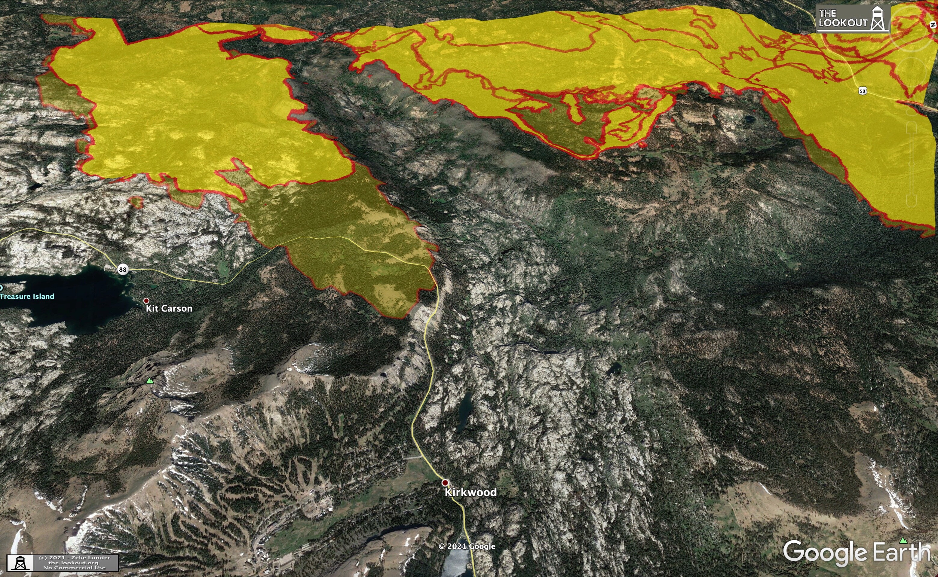
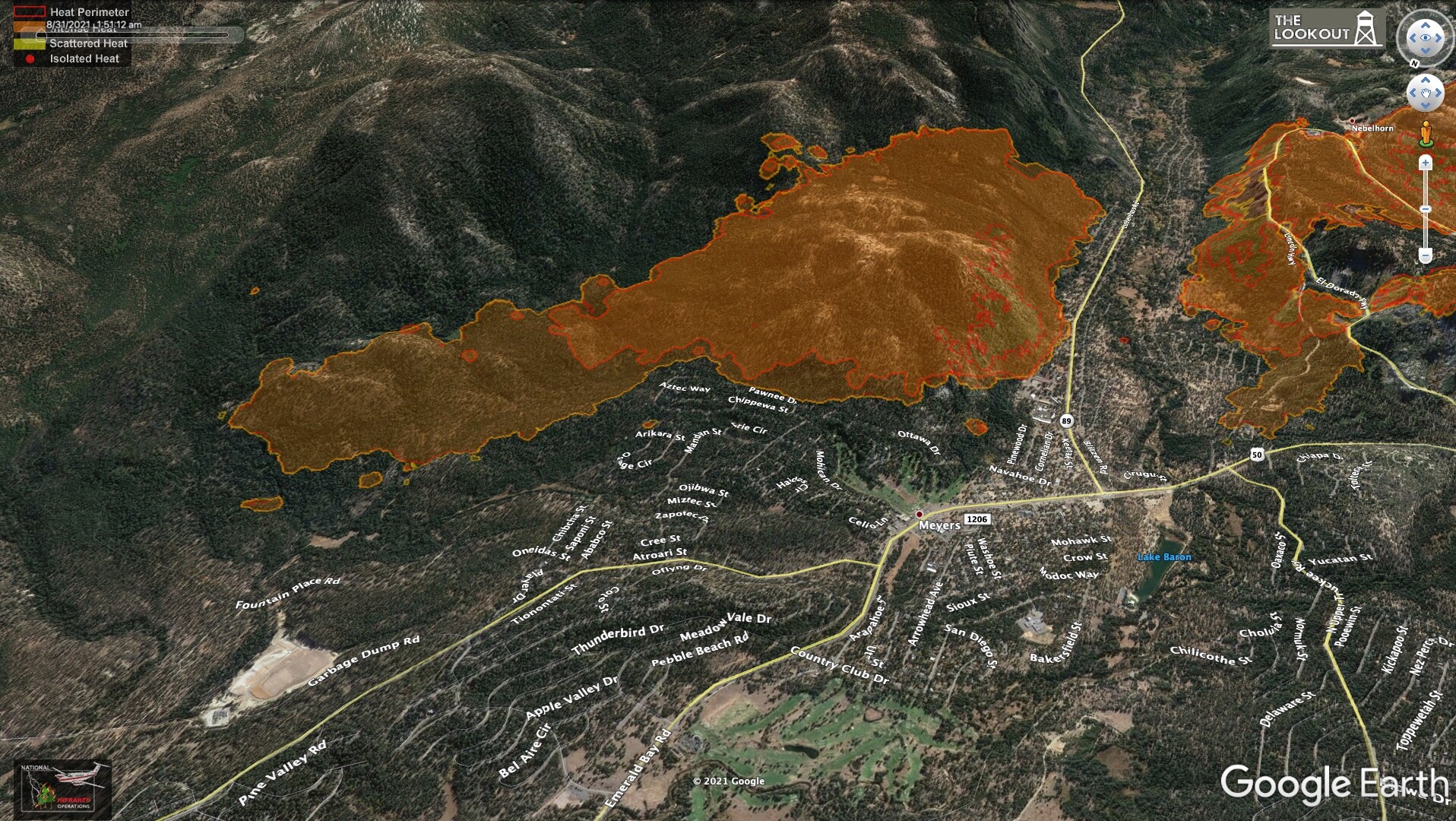
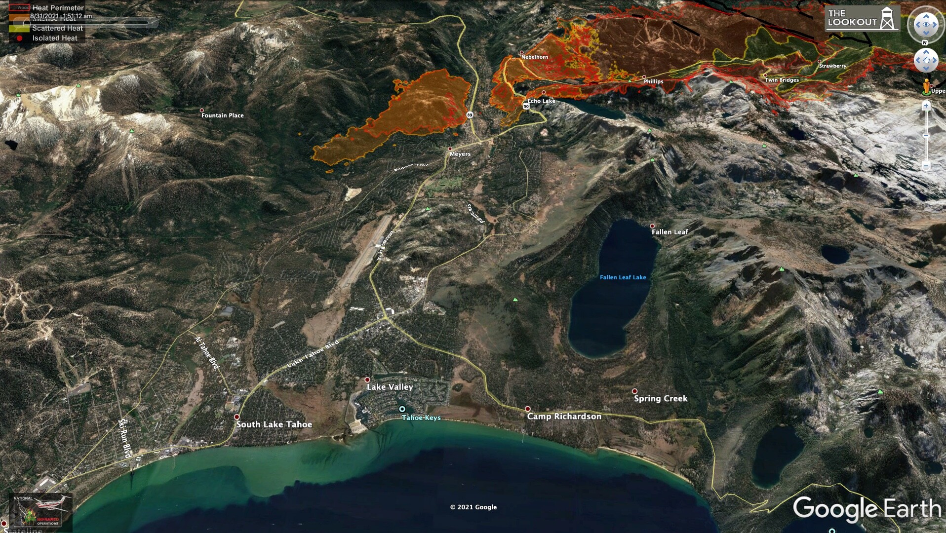
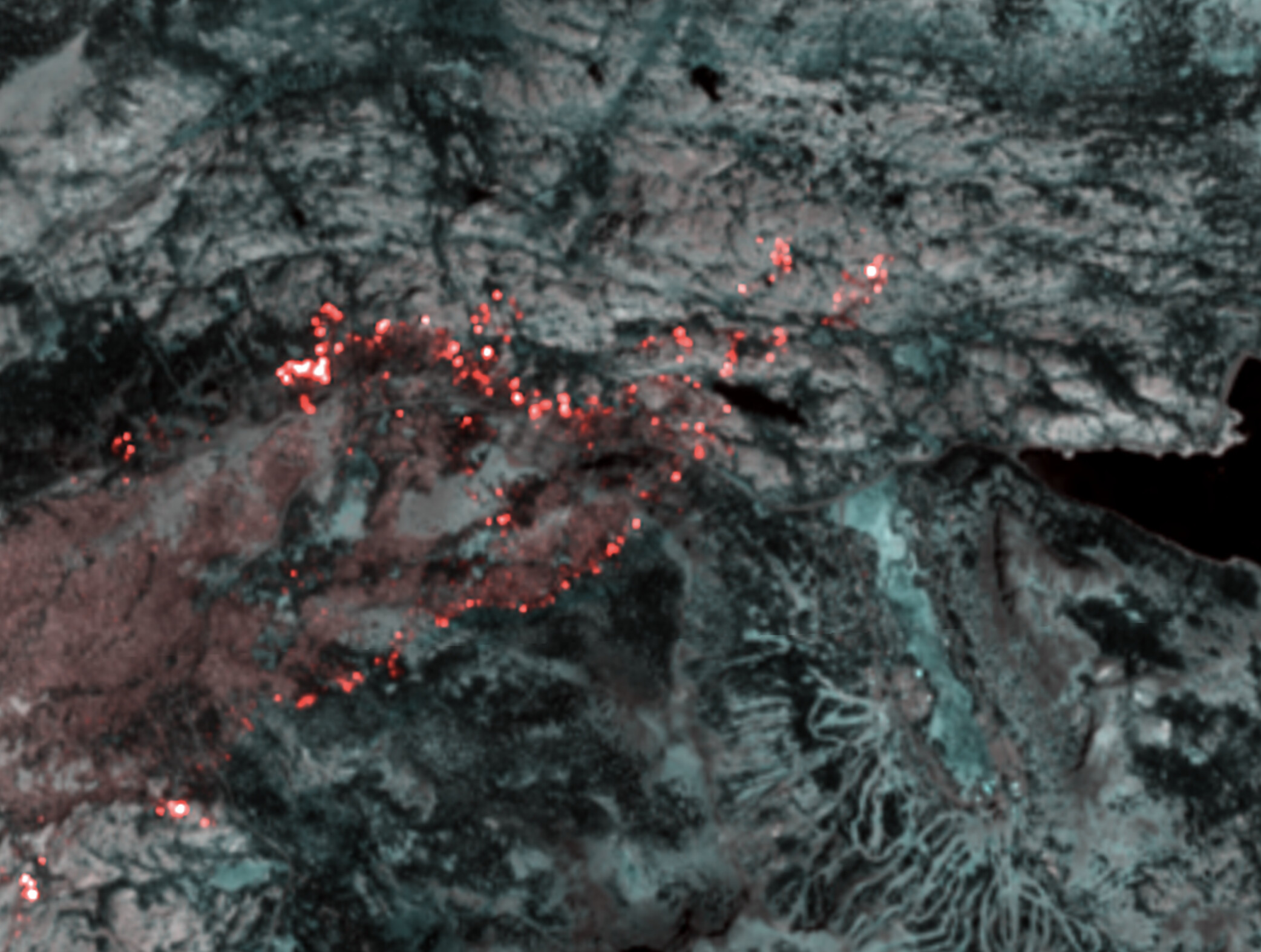
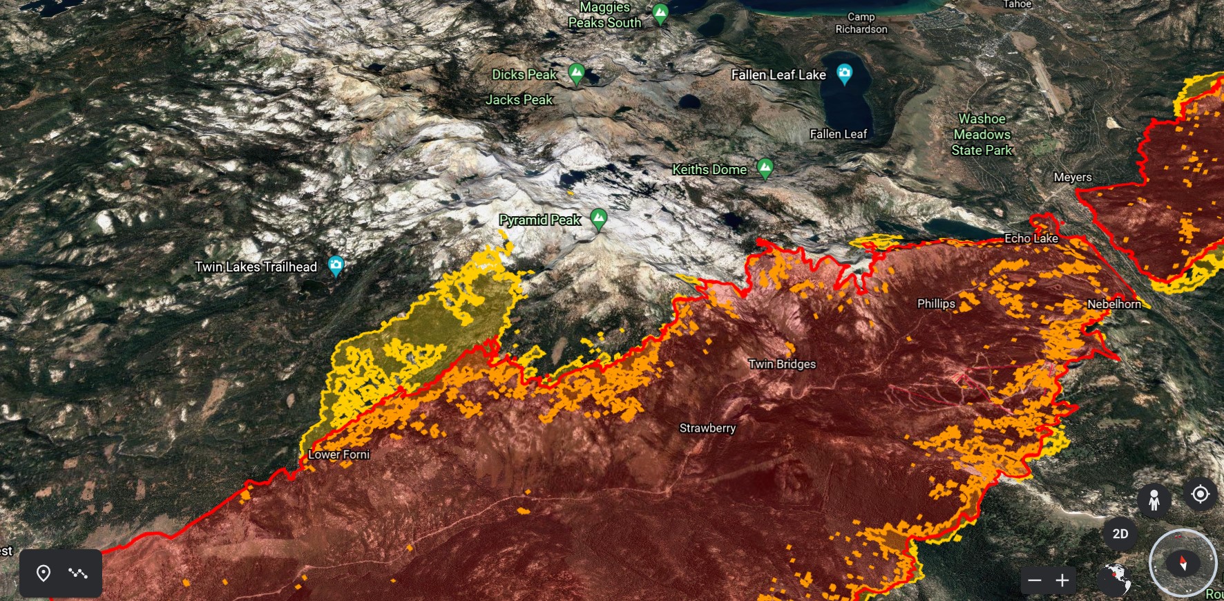
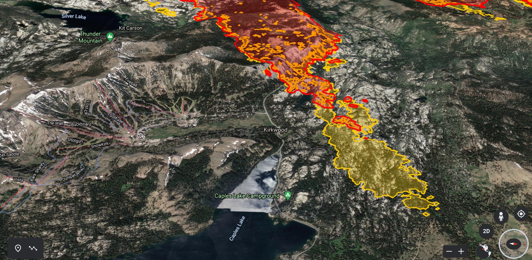
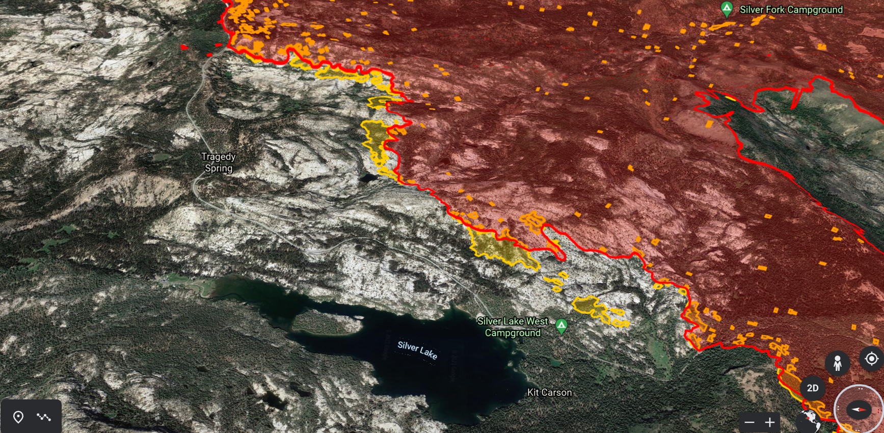
7 Likes

I won’t use the Q word…

4 Likes

2 posts were merged into an existing topic: CA-ENF-Caldor?