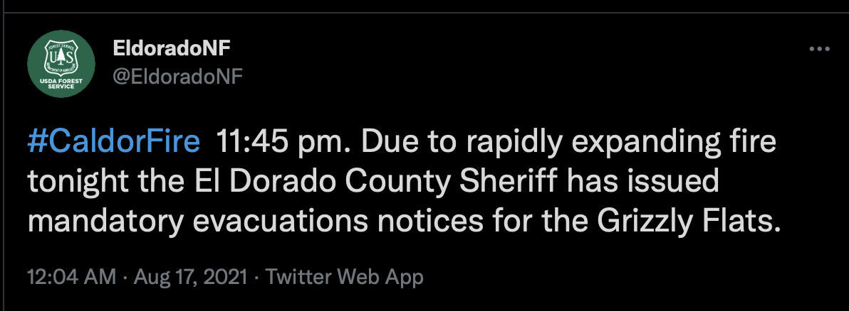
New Evacuation Information
2 Likes
1/4-1/2 acre spot fire over Dog Town Creek 38.59500,-120.53350
6 Likes
Posted 19:34 3,000 acres
2 Likes
EVACUATION WARNINGS In the Community of Grizzly Flat
o East of the intersection of Grizzly Flat Rd and String Canyon Road
o The area east of Sciaroni Road and Capps Crossing
o North to String Canyon Road
1 Like
Quick link to a one hour video capture from Armstrong Lookout 1 . You can see Shingle Springs and or Diamond Springs in the background.
Fire is expected be active all night in between the Dog Creek and Cosumnes River Drainage. Moving eastward and widening in very steep country and next to “0” significant fire history. New EVAC have been posted on several sites and may change as fire size, complexity, and progression changes. Find the info at Cal fire, ENF, and EDSO twitter and Facebook, and of course HERE in the continuing and questions discussion thread. As the fire changes rapidly, so do the evacuation orders. Use these resources to stay informed. Stay Safe…to all!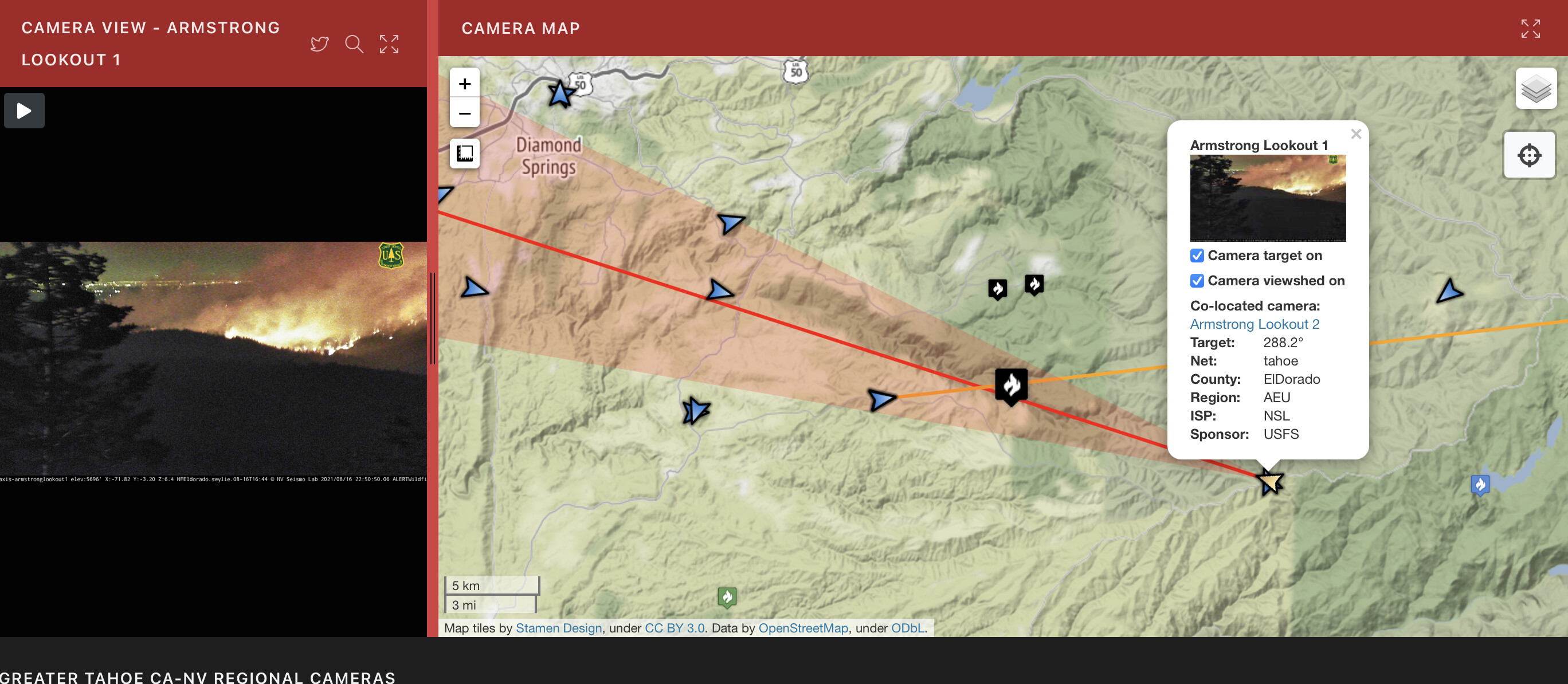
3 Likes
From scanner, evacuation of Grizzly Flats has been ordered. I don’t know if it is for all of Grizzly Flats or just the areas that were under the warning. That portion was broken off. The fire looks to be just ripping on many of the cameras.
3 Likes
Heard the same traffic!
1 Like
2 posts were merged into an existing topic: CA-ENF-Caldor?
Camino ECC just toned six engines to respond to Grizzly Flat for structure protection. AEU must be just about stripped of state resources by now.
5 Likes
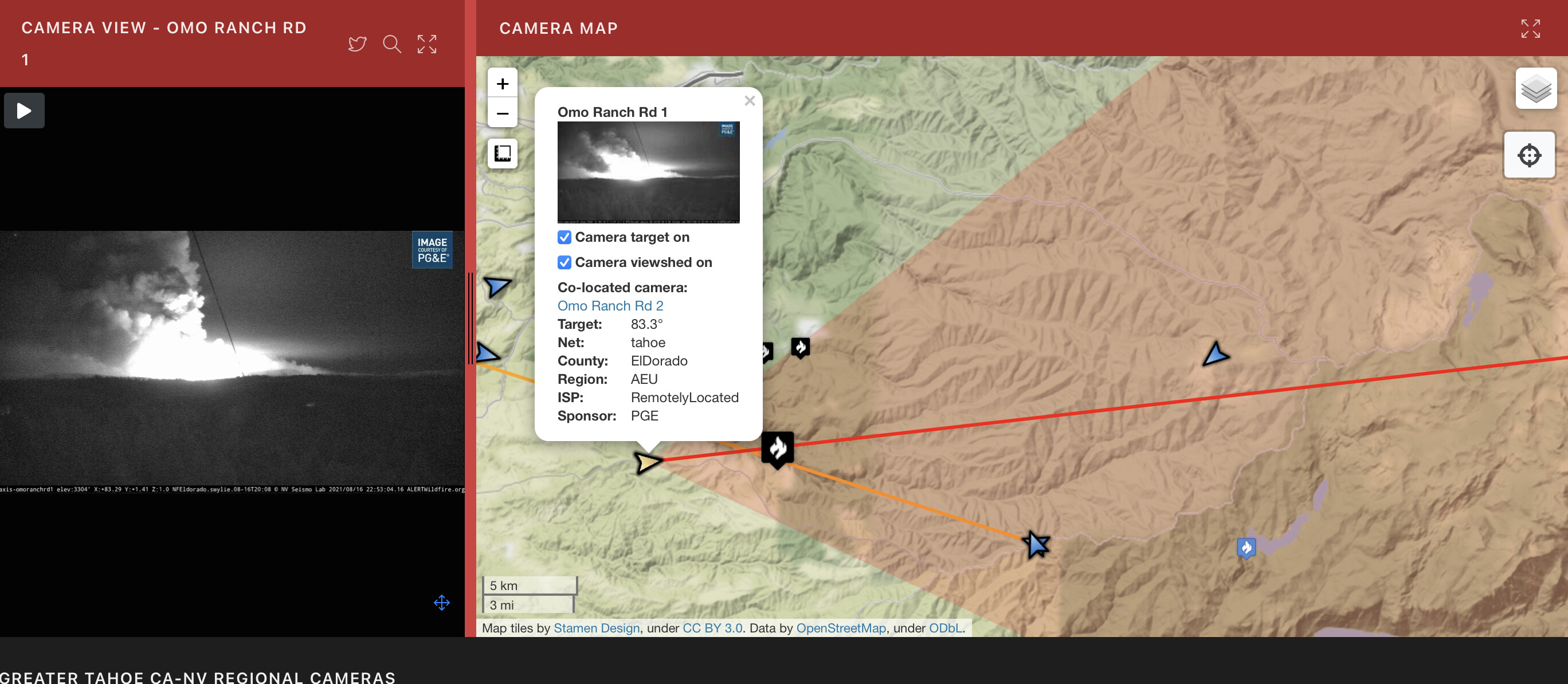
For any folks watching the fire from locations along Omo Ranch Rd and surrounding areas, PLEASE dont block any portion of the roadway. Fire traffic had a really difficult time today driving around these folks, making it an unsafe situation getting fire folks to the fire area. The fire is very visible from Omo Ranch rd and portions of hwy 88 tonight as it is burning very actively in areas. Grizzly Flat did get the official evacuation order from night operations due to increased activity and threat to the community.
4 Likes
They’re continuing to dispatch local government engines from both El Dorado and Amador Counties - All Code 3 to Grizzly Flats, probably another 7 or 8 engines, though I’ve lost track of exactly which engines.
1 Like
I copied E349, E28, E25, E319, E389, E2781, E338, E7783. I’m sure I missed a few.
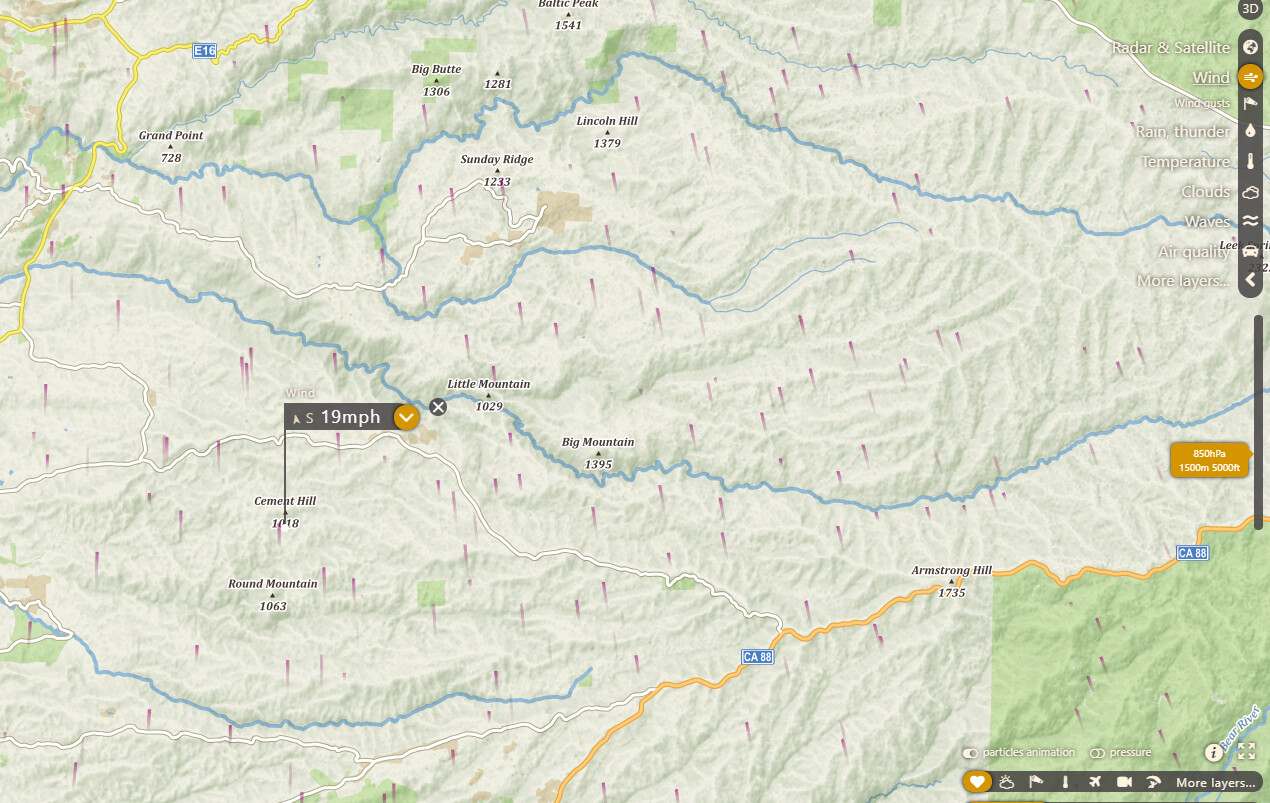
Per “www.windy.com” winds aloft 250 to 3000 all pointing north by north west… Cal Top map pulls in the same data and shows the same…
1 Like
It’s snowing ash here in Pollock Pines. Right now it’s headed our way.
Depending where you are in Pollock, you are about 8-10 miles away… which used to be no big deal but not any more. Fire is now about 9/10ths of a mile northnortheast of Leoni meadows.
2 Likes
It’s now being reported well north of that across the Steely Fork on Capps Crossing rd east of town 38.62277, -120.501872
Another deputy reports fire at the bottom of Mt Pleasant which would mean the fire has jumped the river on both sides of town. EDSO is now worried about being cut off.
2 Likes
Fire is now spotting just south of Grizzle Flats rd west of the community
1 Like
Evac warnings for Happy Valley. Another structure protection strike team just toned out to respond into Grizzly Flats. No word on where the safety zone is in that town.