CHP CAD has started posting since about 4:24pm
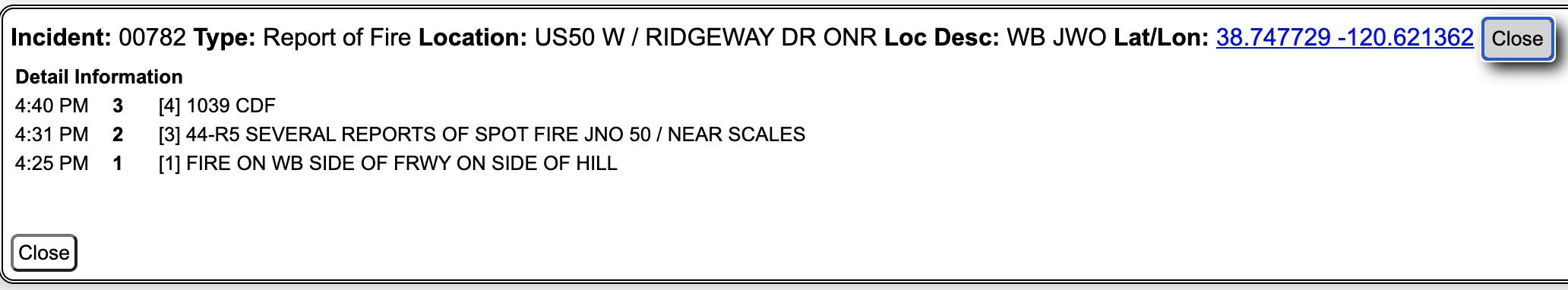
You can get this from here: CHP Traffic
Choose ‘Sacramento’ as the area.
CHP CAD has started posting since about 4:24pm
You can get this from here: CHP Traffic
Choose ‘Sacramento’ as the area.
Planes completed for the night. Visibility.
The box grows. Evacuation Warning for much of Amador County came out about an hour ago.
Evacuation Warnings have been issued for the following areas south of the El Dorado-Amador County line from:
• Shenandoah Road at the Amador County line west through the River Pines community, continuing west on Shenandoah Road to Ostrom Road.
• South on Ostrom Road to Jibboom Street, west on Jibboom Street to Fiddletown Road.
• East on Fiddletown Road to Hale Road.
• South on Hale Road to Shake Ridge Road.
• East on Shake Ridge Road to Charleston Road.
• South on Charleston Road to the intersection of Charleston Road and Rams Horn Grade.
• Due east to Highway 88 at Tiger Creek Road.
• Tiger Creek Road east to Salt Springs Reservoir Road.
• East on Salt Springs Reservoir Road to the east end of the Salt Springs Reservoir.
• Due north from the east end of Salt Springs reservoir to Highway 88. From this location
Wind shift starting. PGE Spring Valley
They launched for night helicopter ops on DIV T, but had to abort due to visibility concerns.
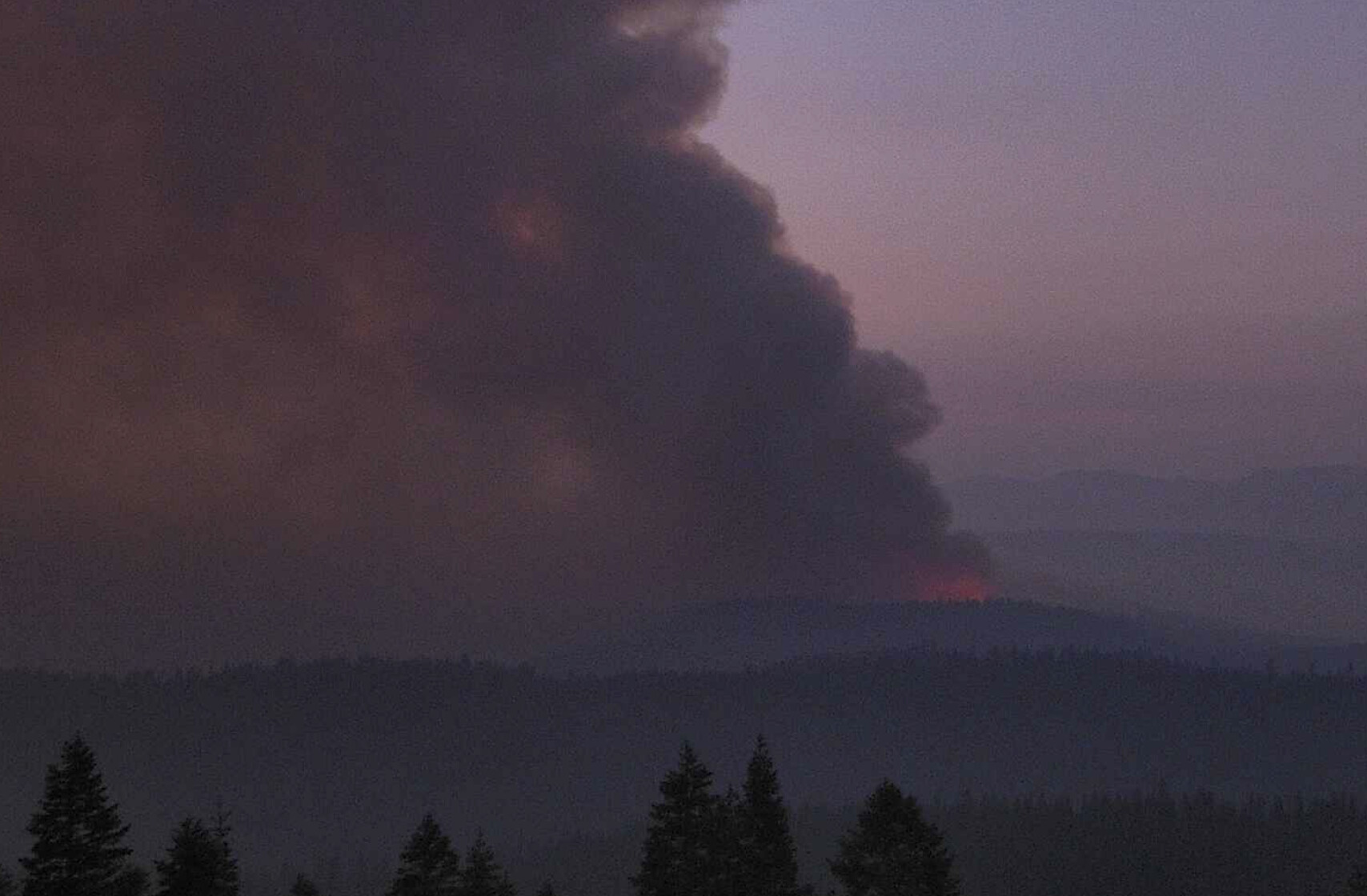
Fires picking up pretty good to the south. Smoke is really thick tonight. Bummer, was hoping to see these bad boys in action
DATA PACKAGE POSTED FOR THE CALDOR - MAPS.TAKSERVER.US
2 posts were merged into an existing topic: CA-ENF-Caldor?
Request just went out for a UAS module with IR and aerial ignition capability.
A post was merged into an existing topic: CA-ENF-Caldor?
Copters are up doing an orientation for night ops for tonight.
68,630 Per Evening Update
68,630 acres
While the offshore push did not surface with much more certainty the strong onshore push will on Saturday…
Leek Springs Lookout - good view (go back an hour)
http://www.alertwildfire.org/tahoe/index.html?camera=Axis-Leek&v=fd40735
From the morning update, 73,415 acres with 0% containment. 104 structures destroyed with damage assessment ongoing. 1118 personnel assigned with 109 engines, 11 water tenders, 18 copters, 21 crews and 21 dozers.
Helico is starting up for the day with copters, concentrating on the SW corner of the fire near Grizzly Flat.
Waiting for smoke to clear so AirAttacks can start on the NE side. Not good enought yet.
Per KCRA 3, Highway 50 closing at 1600 between Sly Park rd and Meyers.
Sounds like the heel of the fire is heating up. Branch 30 just asked Div T to send and engines he could to Div W. Some talk of pulling at leas some resources back to Omo Ranch and Slug Gultch Rds.