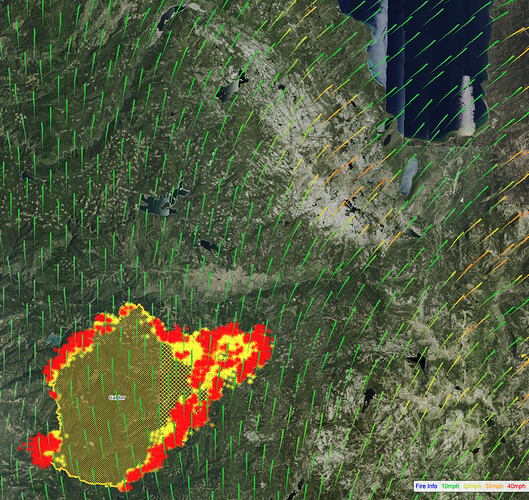
Anyone have the most recent IR imagery? Curious as to what that front near Jenkinson is doing.
It’s awake already.ALERT Wildfire
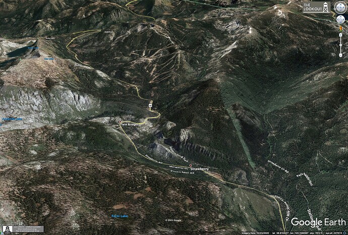
I’m not predicting it will run to Tahoe, just pointing out the topography and fuels legs of the fire triangle are in place if the weather were to happen.
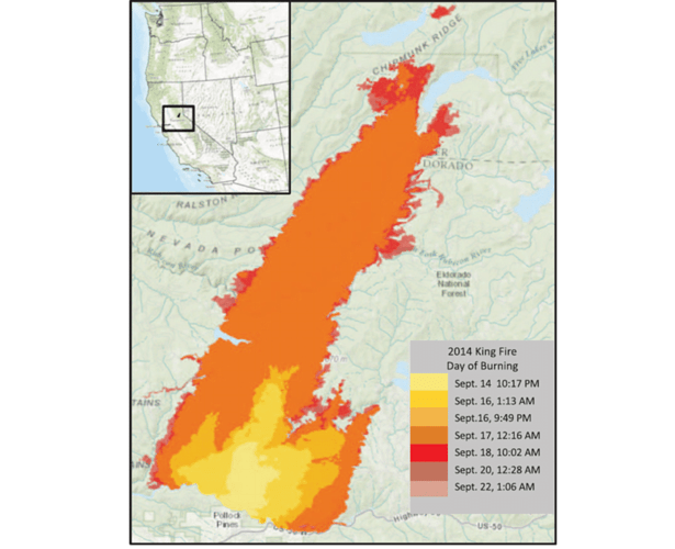
I agree it’s a fine line between giving people an early warning and alarming the hell out of them, and my post above might be better as PMs between colleagues here. I don’t want to be alarmist. But it is hard to know how to weigh past fire experience - a lot of us watched the King Fire run 15 miles in an afternoon just a few miles north of here in 2014 on a day with winds that weren’t really very exceptional.
And we watched the fires on Chester Flats run from from Highway 36 to Lassen Park in a day last month, so it is hard to turn off that radar. Does anyone have acces to an FS Pro run for this fire?
The king fire did not hang up. We got lucky and just enough moisture hit it followed by significant moisture a week after. It allowed ground resources and dozers to wrap it.
…and we watched the North Complex run about 40 miles downhill from Claremont and the Middle Fork to Oroville at night for about 200,00 acres. Nothing is “impossible”…
Every place that the Dixie fire could “sneak” through, it has…
If I remember correctly the FS base became a soupy mess
Yep,
Forest was a big mess, every night run to the sleeper trailers.
Tumbleweed, Words well spoken and well worth taking to heart for preparedness. Thank you.
A lot of Fire History from White Hall/Kyburz up towards the summit on the ENF North and south of Hwy 50 in the last 50 yrs. Myself I would be asking some old timers about the fire history and weather/fuel conditions were at those times. And where they put lines in etc. Like on the STF two old timers for the shots Greg O and Greg L. Those two have cut line in every river canyon and Hilltop on the STF. Some of the old timers have a wealth of knowledge and experience to back it up.
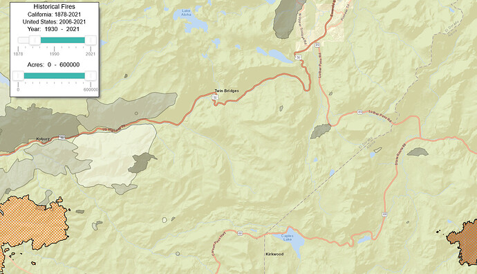
Actually, there is very little fire history along Highway 50 east of Strawberry. There is a reason for that…lots of granite and broken / sporadic fuel beds.
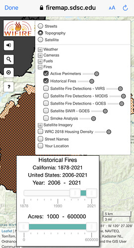
This is the fire history map dating back to 1930.
In general the west slope below from the Wrights Lake Fire in the 80’s.
You’re right about the sporadic fuel beds. My worry is the spreading we’ve been seeing all season is from long-range spotting as much as anything, so those sporadic beds just end up being hop-scotch pads for the fire. Saw this on Keddie Ridge 2 weeks ago above Greenville where Dixie just nuked over patchy red fir at 7,500 feet, or where she has been chunking her way through Lassen at similar elevations.
As an FBAN for the last 22 years I would be the first one to look at past fire history to tell you what a fire may or may not do. 2021 is different. I spent two weeks on Dixie and I have no slide in my tray for what is happening this year. Everything on the forest floor being consumed and lifted into the column. Spotting anywhere from 1 to 5 miles a day. When I say spots, burning material larger than charcol briquets droping to the ground. So, could the Caldor reach the basin the answer is yes. I have seen fires spot over the crest of the Rockies that everyone was sure to be a barrier. It will be all about timing when and how hard the fire hits the right location. I pray it doesn’t happen but prayer is not part of the plan.
NVPFE, could you please post a link to that map?
Pyrogeography, I agree that there is a fine line. However, I would encourage you not to resort to using PMs with your other cohorts. The new and less tenured folks on this site absolutely must understand that they are like spectators in an arena, witnessing a highly technical discussion of possibilities using a number of variables. No one should ever be reposting this discussion on other sites and stating that “I heard this is going all the way to Tahoe.“ Experts need a forum to discuss and work through possibilities. Others must understand it is a privilege to observe and learn, but not repost the discussion. Some have suggested that this is a good training day. That is an excellent idea. This year the fires are doing things that are not anticipated or previously seen. Learn from this.
Turn on layers to display active perimeters and historical year range perimeters
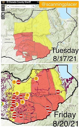
EDSO is probably contributing to the speculation of SLT being impacted given the new evac mandates/advisory boundaries.
https://www.arcgis.com/apps/webappviewer/index.html?id=c995bf3816964e948d7d831d3ba938ff
!