Are the 209’s posted publicly or are they from folks in the inner circle? Just curious.
They are public
IMT 6 Caldor Current Incident (PUBLIC) | Powered By Box
Impressive Fire Behavior today… Can we tell if the column that is capping out on the Mt Danaher and Somerset cameras is in the Camp Creek? or Sly Park Creek Drainage? Based on the axis and crossing points it could be in the intersection of those two…
Dramatic increase in fire activity this afternoon visible on both the North Mokelumne and Red Corral #2 cameras.
http://www.alertwildfire.org/tahoe/index.html?camera=Axis-NorthMok&v=fd40740
http://www.alertwildfire.org/tahoe/index.html?camera=Axis-RedCorral2&v=fd40740
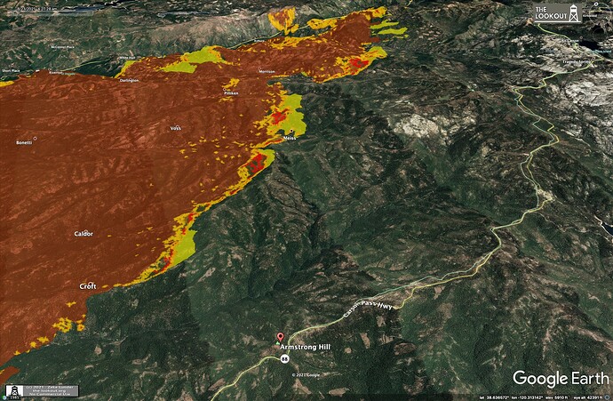
https://col.st/luUwv bird’s eye view
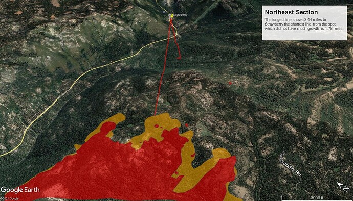
Is the very top of the picture just right of the fire perimeter showing the start of the 90 degree bend in highway 50 just before it heads into Strawberry? Looking at the Leeks Spring camera in its current postilion of 31 degrees the target runs right through Strawberry. There’s a significant column building right in the middle of the image, though it certainly could be south of 50.
A summary report of all 209s for NOPS fires is posted here: https://gacc.nifc.gov/oncc/predictive/intelligence/lg_fire_summary/Large_Fire_Summary.pdf
It’s usually posted about 0800 and 2000 hrs each day.
Is this the same 1500 IR run?
Affirm. Measurements are approximate.
Mod Note: Until there is an official causal determination made and released, please refrain from posting conjecture and speculation with regard to the ignition of this or any other fire.
Please carry on with actual fire information
5 posts were merged into an existing topic: Emerging Technology
Keep doing what you’re doing. Can’t tell you how much I appreciate it. I do GIS for a water district in the Basin and it’s been very helpful in keeping us informed. Thanks again!
Put the “North-up” maps on hold until we survive this siege (so, Dec/Jan?). I agree with @Eweturn - I struggle a bit unless N is straight up on the maps. I can adjust… You need to focus on continuing to produce the valuable intel/maps you are doing !
Any updates on outstanding orders?
a quick IROC search shows the following currently pending
26 crew
8 ST crew
56 ST engine
38 engine
8 dozer
119 OH
Was in pleasant valley, at station 19. Looks like they have helo fill site there. Steady helo traffic filling and then dumping. Anyone know where they are dumping on? Sly park, div D? Or Div A? Looks like good smoke production from camp creek drainage but it’s hard to tell


