CA-ENF-Caldor?

I am trying to get a verified source of this information. Until that time please consider that a unofficial source. We are working on it.

EDIT 1450 hrs: Contacted the poster, the post was misworded and has been edited. The map remains in place as it is a published document a few days old. No change to the Tahoe Basin by EDSO.

14 Likes

Anyone have an idea of why the IR flights haven’t been going? Or at least aren’t being uploaded to arcgis?

I’m asking about the the helicopter that does night ops.

1 Like

Those are two different things, I can’t speak to where the IR flight data is available. But usually the fixed wing IR or mapping planes have flown every night it’s usually a king air or and aero commander. The helos working at night have been performing firefighting operations not mapping. Hope that helps

2 Likes

It looks like an active night was had by all. Breezy and humidity hovering around 30%.

1 Like

It’s spotted beyond the ridge and heading into strawberry creek .
http://www.alertwildfire.org/shastamodoc/index.html?camera=Axis-Sierra&v=fd40730

1 Like

The winds are generally higher east of the creek, right?

Leek Springs cam…any chance that is a firing operation?

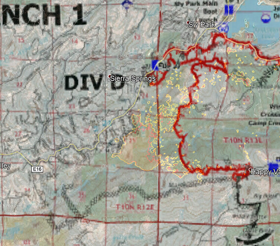
Looks to be in DIV J or maybe DIV L. Nothing about a firing op for either division in today’s IAP. The ops maps show dozer line running south from hwy 50 in sections 24 and 25 and then continuing south. This morning’s MODIS shows the fire east of the dozer line though.

2 Likes

Here is last nights IR map.

4 Likes

The IR data and information is uploaded to the FTP site.

https://ftp.wildfire.gov/public/incident_specific_data/calif_n/!2021_FEDERAL_Incidents/CA-ENF-024030_Caldor/IR/

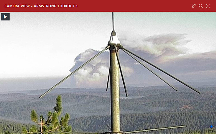
Given the time of day, looks to be some serious heat popping in the Camp Creek/Sly Park Creek drainages area (If I’m reading the cam target cross correctly)

Any intel on what’s up there?

Edit: Correct location naming (ugh)

1 Like

I think it hit the confluence of Sly Park Creek and Weber Creek. That’s just a guess I think maybe they did a firing op to mitigate damage. Again this is just speculation. I just know that Sly Park Creek runs right up next to Sierra Springs, and it’s probably the last big threat. Again speculation.

1 Like

08:45 EDIT to remove previous comment/graphic

The latest IR KMZ provides a bit of clarity:

I put up some closeups of the 3am IR on The Lookout.
https://the-lookout.org/2021/08/26/caldor-fire-8-26-2021/

16 Likes

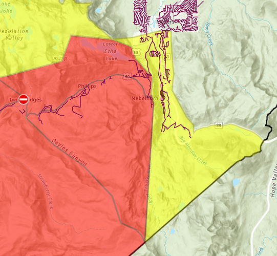
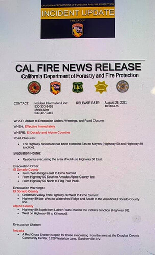
Looking like Christmas Valley and Meyers are under new evac warnings, evac orders to Echo Summit

4 Likes

4 Likes

From SLT CHP… new post around 11am

4 Likes

Friend’s cabin, #11 there. updates would be greatly appreciated.

The evacuations have been expanded to the top of Echo Summit. Christmas Valley has moved to voluntary evacuation warning. Expected to change to mandatory later today or tonight. I know this because a friend was just notified via Sherriff coming to the door. Here’s the official word per Office of Emergency Services

Zeke Lunder is always a good source. This is via twitter, but he has a blog called the Lookout which is excellent. https://twitter.com/wildland_zko/status/1431008295414767617?s=20
The Lookout- Caldor
Caldor Fire – 8/26/2021 – The Lookout

5 Likes