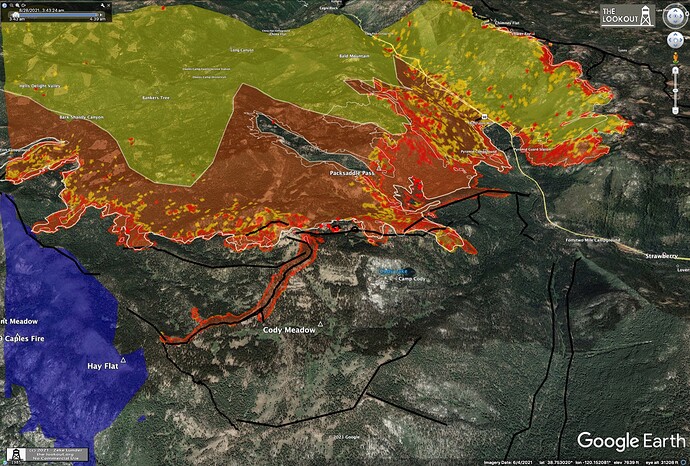
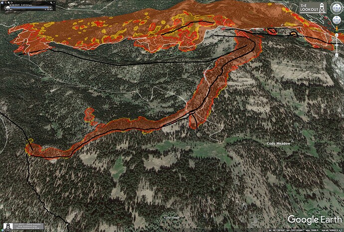
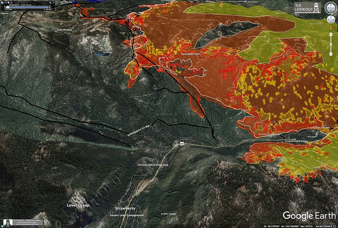
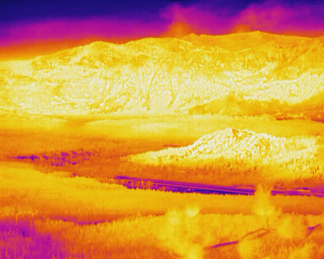
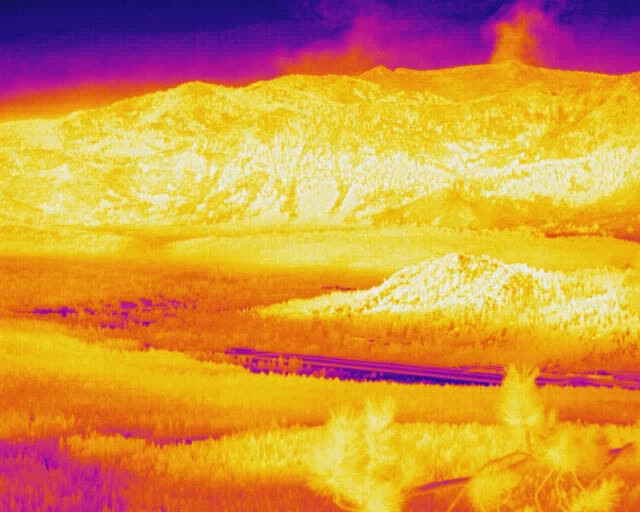
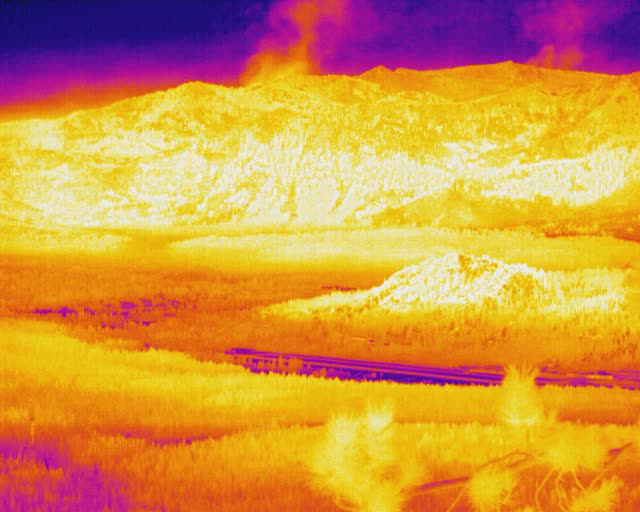
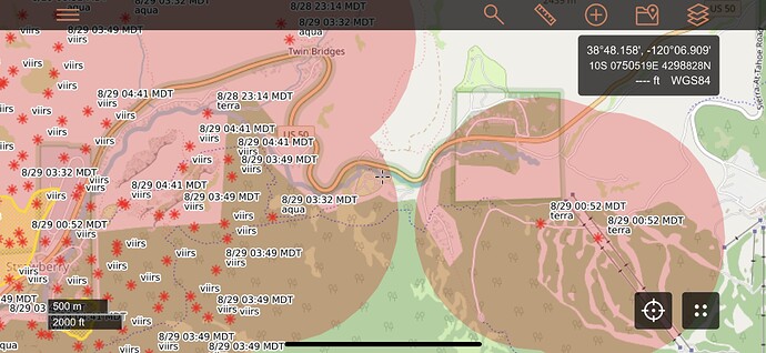
Quite a bit of firing last night on east flank of the fire.
Hard to tell on this morning’s IR if the firing stayed on right side of lines. Anyone got any intel?Humidity recovery was only to the low 30% range. Winds were relatively calm, so a good weather night to fire.
That’s a facebook link and can’t be watched if you don’t have a FB account. Any way that you can link the non FB version? Thanks,
Sounds like they are shutting down the fixed wing air show, due to (pending) IFR conditions at MCC. I also believe they are shutting copters down, both at Kirkwood and Placerville, due to visibility, but not 100% sure of these closures.
That is disappointing. It seems to either be too smokey over the fire or too smokey over the airport for the planes to fly.
Fire Weather Forecast for: Camino ECC Dispatch
National Weather Service - Reno, NV
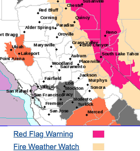
…Red Flag Warning or Fire Weather Watch in Effect for All or Portions of this ECCDA Zone…
Click on the link(s) below to go directly to the forecast segments
Tahoe Basin Management Unit
Eldorado NF West of the Sierra Crest
Sierra Foothills
Eastern Sacramento Valley
Dispatch Area Discussion…
108 PM PDT Sat Aug 28 2021 Poor to moderate midslope recoveries will extend into the week ahead with breezy to gusty southwest to west winds returning Sunday through Wednesday. Critical conditions possible Monday and Tuesday with gusty southwest to west flow expected with a Fire Weather Watch in effect for these two days. Ridgetops and exposed slopes could remain gusty over Monday night as well. No precipitation is forecast for the next seven days.
What Division is getting beat up?
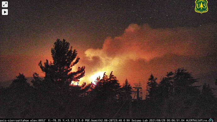
Sierra at Tahoe camera looking pretty sporty for the midnight hour, looking West. Media ground reports have the fire pretty active around Strawberry and to the SE with individual and group torching.
A busy 72 hours coming on the Caldor…
http://www.alertwildfire.org/tahoe/index.html?camera=Axis-NorthMok&v=fd40729
A stronger onshore flow/southwest winds will get going Monday, which should push the smoke eastward out of the Valley and much of the foothills. However, the deepening trough will enhance southwest ridgetop winds and could bring critical fire weather conditions to ongoing wildfires. West to southwest wind gusts of 20 to 35 mph, strongest over the higher elevations with minimum humidity of 8 to 25 percent and moderate to poor overnight recoveries are expected. A Fire Weather Watch has been issued for the higher elevations of the northern Sierra and southern Cascades from 11 AM Monday through 11 PM Tuesday, given the potential for rapid spread of new or existing wildfires. A brief period of critical fire weather conditions may also occur late this afternoon over ridgetops, as trough forms off the Coast. Despite the developing trough higher heights will remain over the area keeping temperatures on the hot side today, with widespread readings from 100 to 105 at Valley locations.
From satellite heat detection it looks like they may be firing off around Sierra Ski Resort… anyone have intel on if that is the case?
Scoopers 283, 284 off Chico enroute to Caldor. S281 and 282 also off McClellan and coming in from the Westover IP. Apologize if this isn’t news, I don’t recall scoopers working this yet. That’ll be nice asset to have with the lake, if visibility holds up.
I think they tried to use scoopers very early on like day 2 if I remember right but I think the visibility wasn’t there
What are the rules with using retardant in the wilderness?
Tnkr 911, 912 up, approaching along HWY 88 
Normally there is no retardant and no dozer work in the wilderness. I would imagine that the way these fires are burning they are going to allow both in these instances.
If the fire is moonscaping everything it doesn’t make much sense to not let them get some work in there
They tried on the second day but didn’t have good visibility at the time.

