
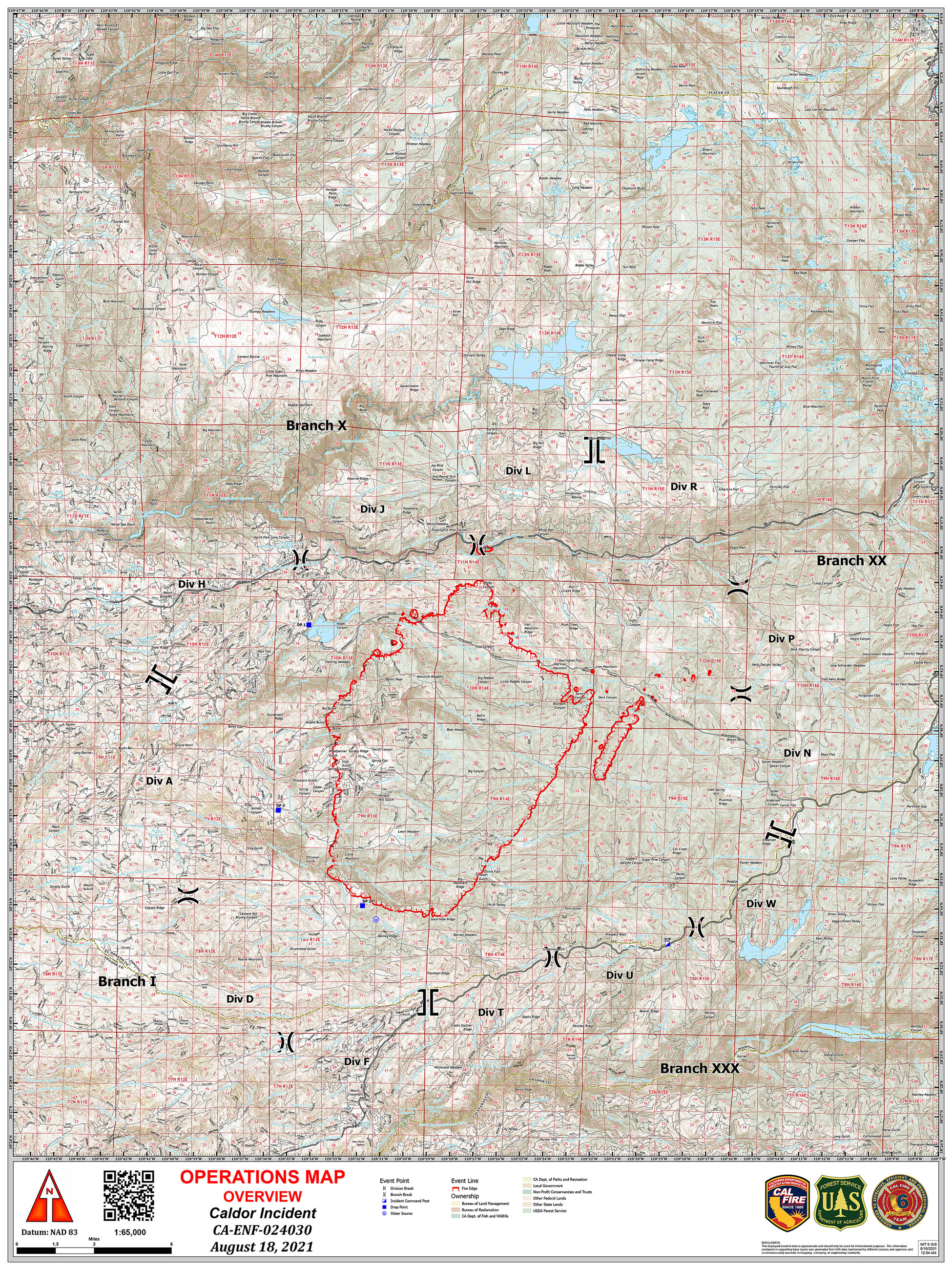
Today’s Ops Maps 60,000 acres does not seem unreasonable as of the time the maps were made.


11 Likes

Last night the entire South Zone Quick Reaction Force of night flying aircraft mobilized to this incident. The S-76 intelligence aircraft, 2 Chinooks, and an S-61.
10 Likes
the placement of the town of 'El Dorado does
not make sense to me. the town of El Dorado, in the county of El Dorado is much south of Camino…actually south east of Placerville.
1 Like
I believe you meant southwest…
I’m guessing on @Baldy map that is either in reference to the “El Dorado” highway (50) or it is how that particular map has inserted a place name for the county.
2 Likes
ok, you are right, south west. at any rate, the labeling is misleading.
Green lettering on Google maps or earth indicates national forest, park, or outdoor point of interest.
5 Likes

Here is the 24hr Pyrecast prediction on movement. (Purple & Blue currently and already burned). Hopefully this holds up considering the weather forecast with much less movement in the next 24hrs vs the last.

5 Likes
Pyrecast is underpredicting fires by a factor of 2-3x this year. Looking at forecast wind gusts for tonight it could make a monster run to the west.

11 Likes
Do you have an estimate for time of wind shift? From the line, that would be helpful. All estimates have been way off.
1 Like
I am using the Windy.com website. @anvilhead recommends using the NAM model. Zoom in and click on the map where you want the forecast, then pick NAM on the bottom-right of the screen, and you turn on wind gusts on the menu on the right-hand middle of the screen.
Use the time slider lower left to pick a time, or click Play button to animate.

8 Likes
One source said it will start to turn @ 2000 to a 3 mph E wind and around midnight intensify to 7mph E. But I think everyone is just guessing
3 Likes
Official NWS Sacramento forecast for the fire area suggests shift toward “prevailing northeast winds 5 to 15 mph with gusts to around 30 mph” overnight. While those are not strong winds, they may well be enough to cause major problems on the western flank fire (especially at the higher end of sustained 15/gust 30). That’s largely consistent with the NAM forecast via windy.com above–suggesting the potential for a rough night ahead.
6 Likes
A bit of a report from upstream. The wind has been from the NE all day in Reno and it has not been dropping off. It’s only 60 degrees F here. That tells you that we are in the air from that inside slider.
Good change the the winds will develop.
2 Likes

2 Likes
