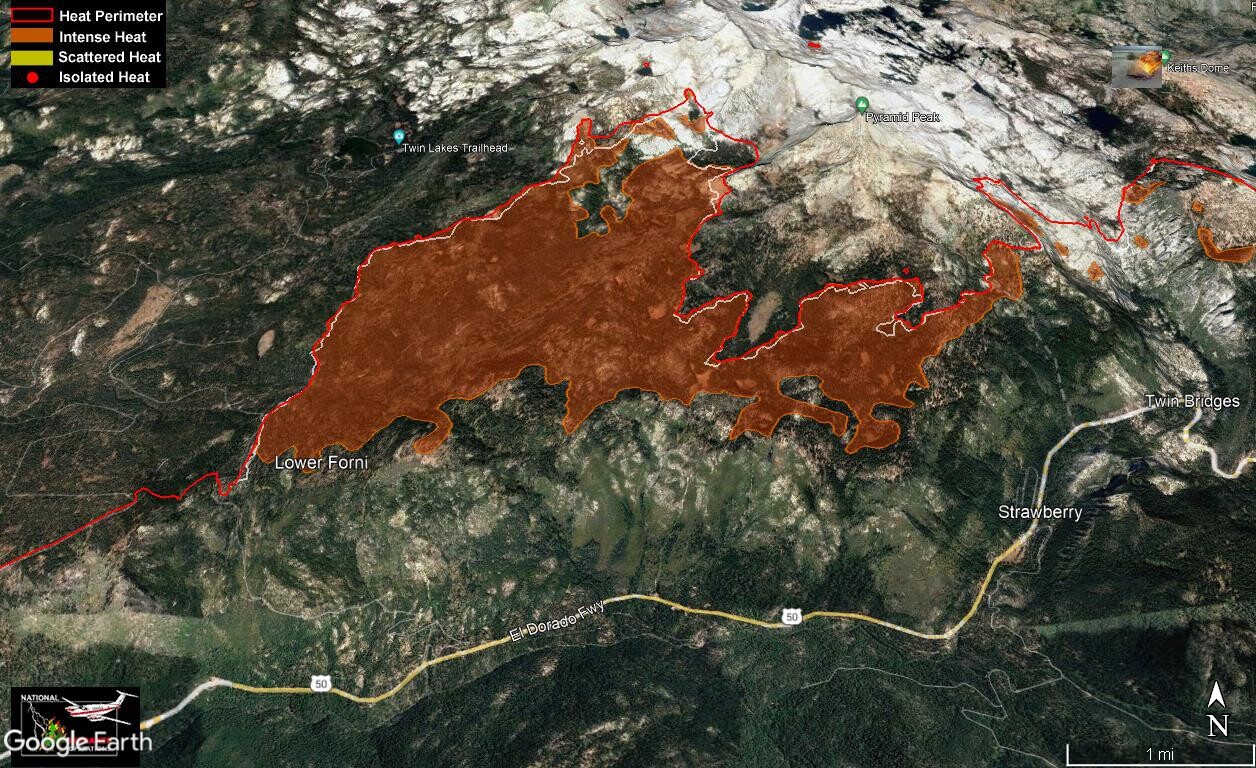
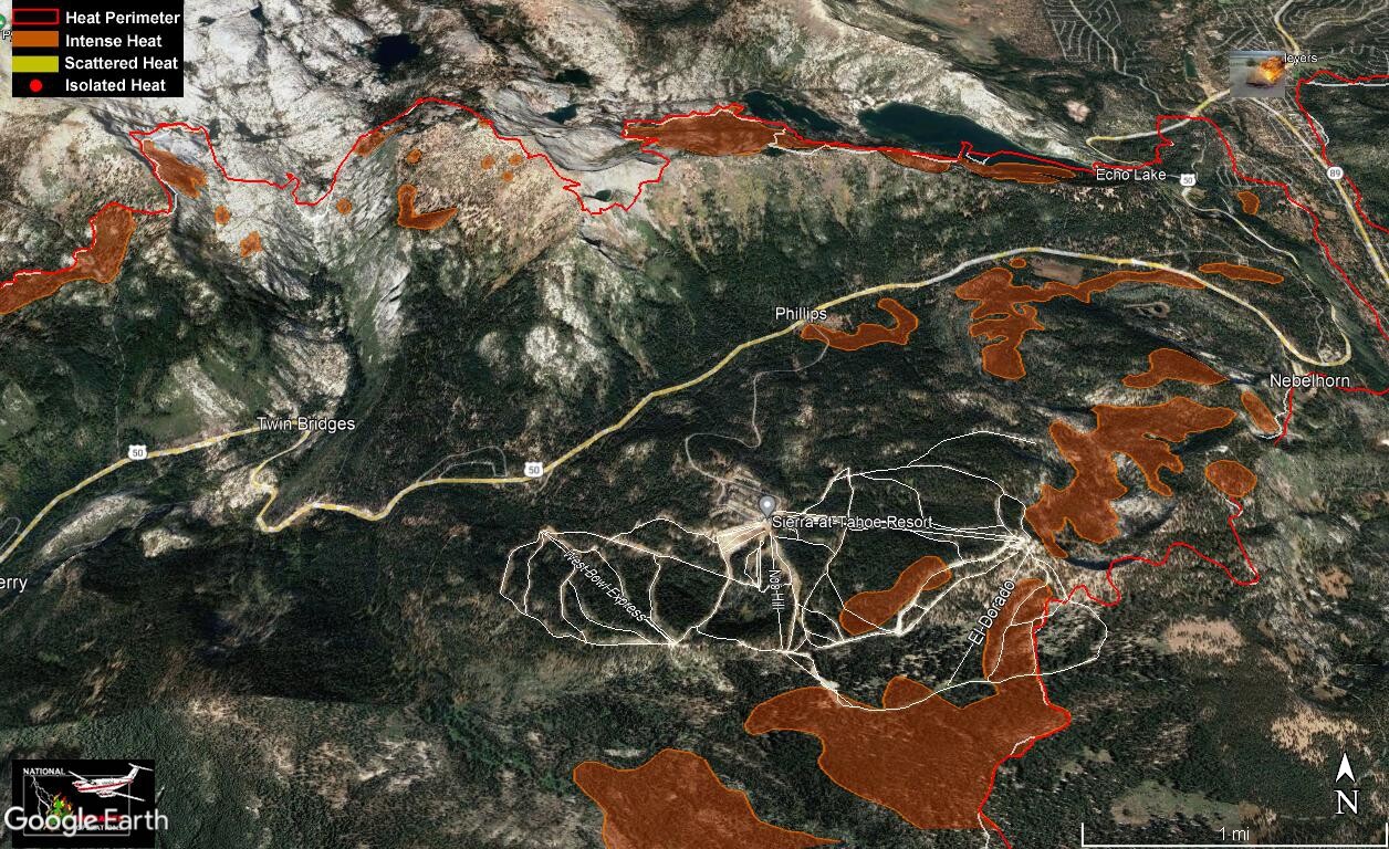
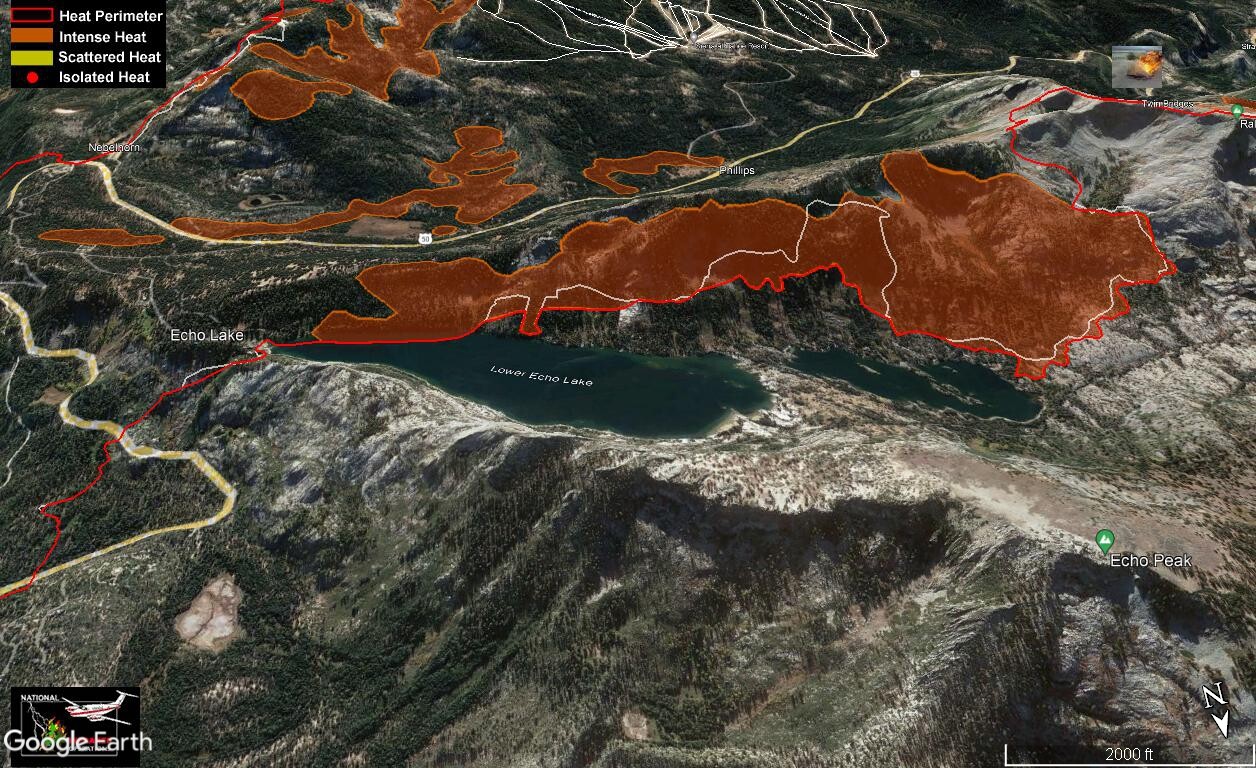
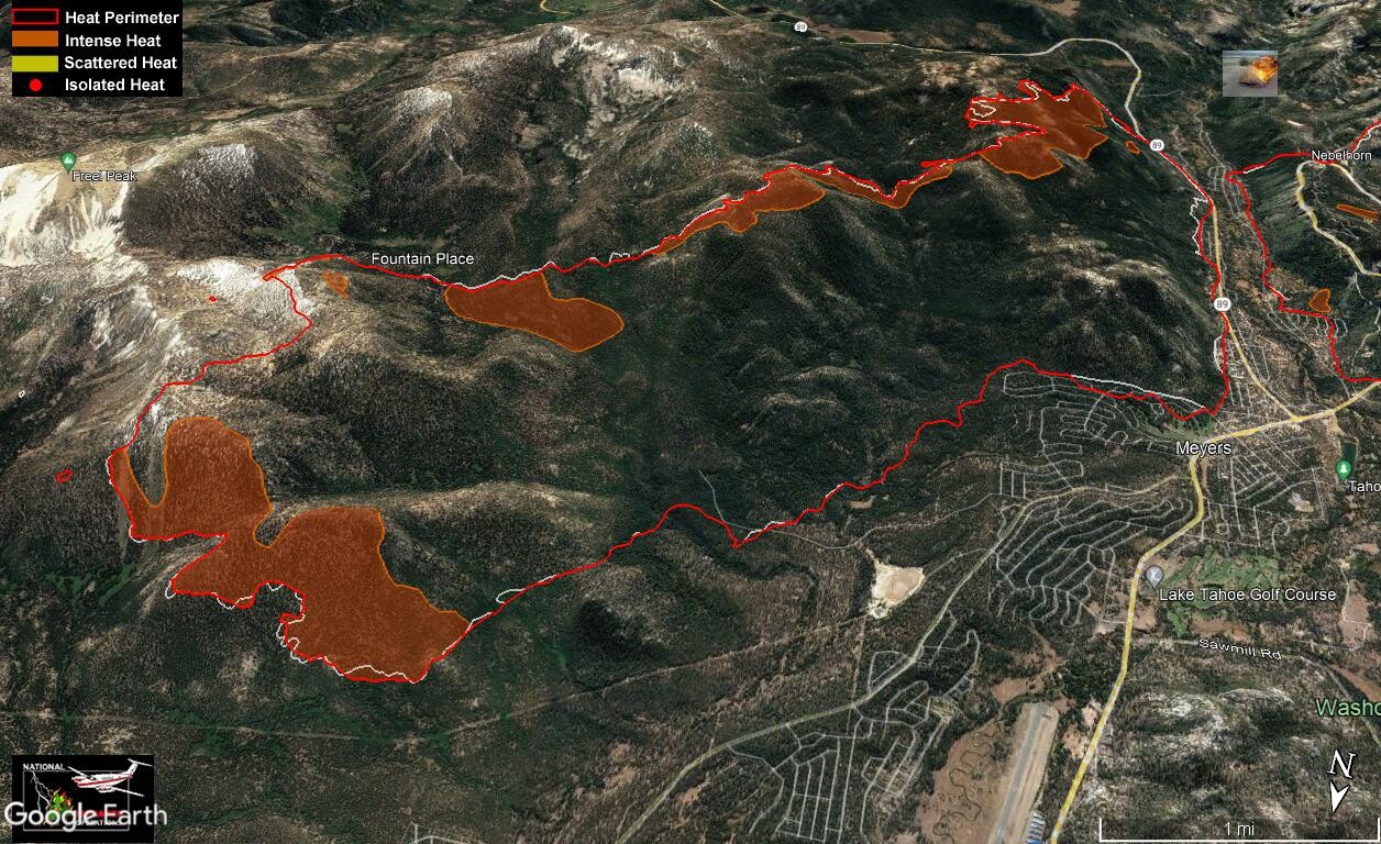
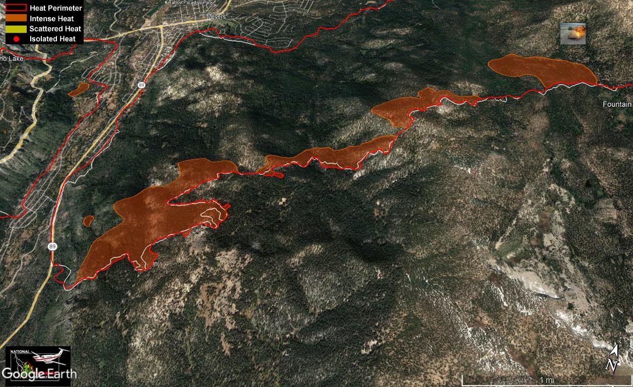
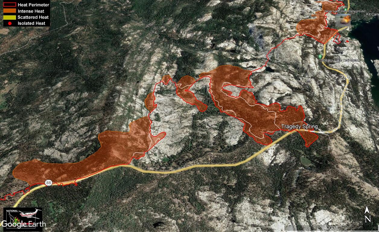
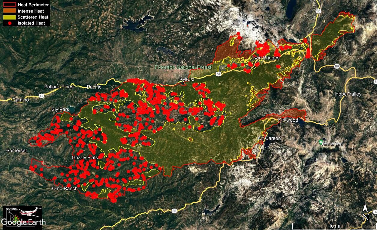
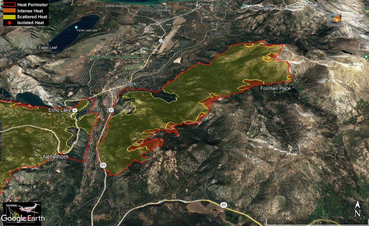
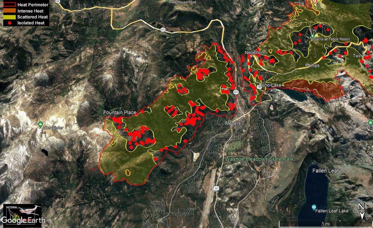
IR from 2233 last night. Isolated heat has been removed for clarity on some pics. Clear areas do not indicate no heat, many reasons for heat not showing on IR runs. Only eyes on the ground can determine when it is safe to enter an area.
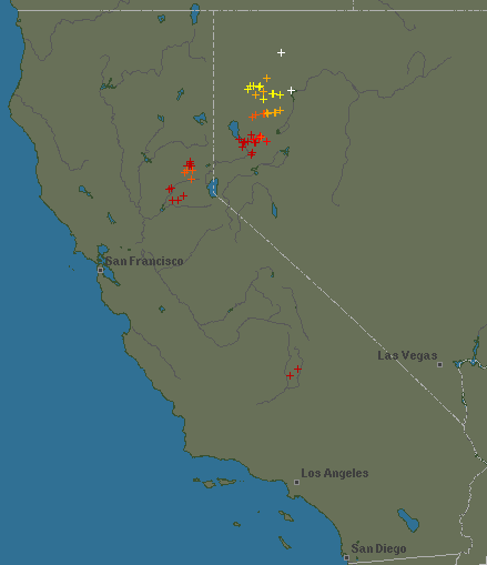
Feint white line indicates previous fire perimeter
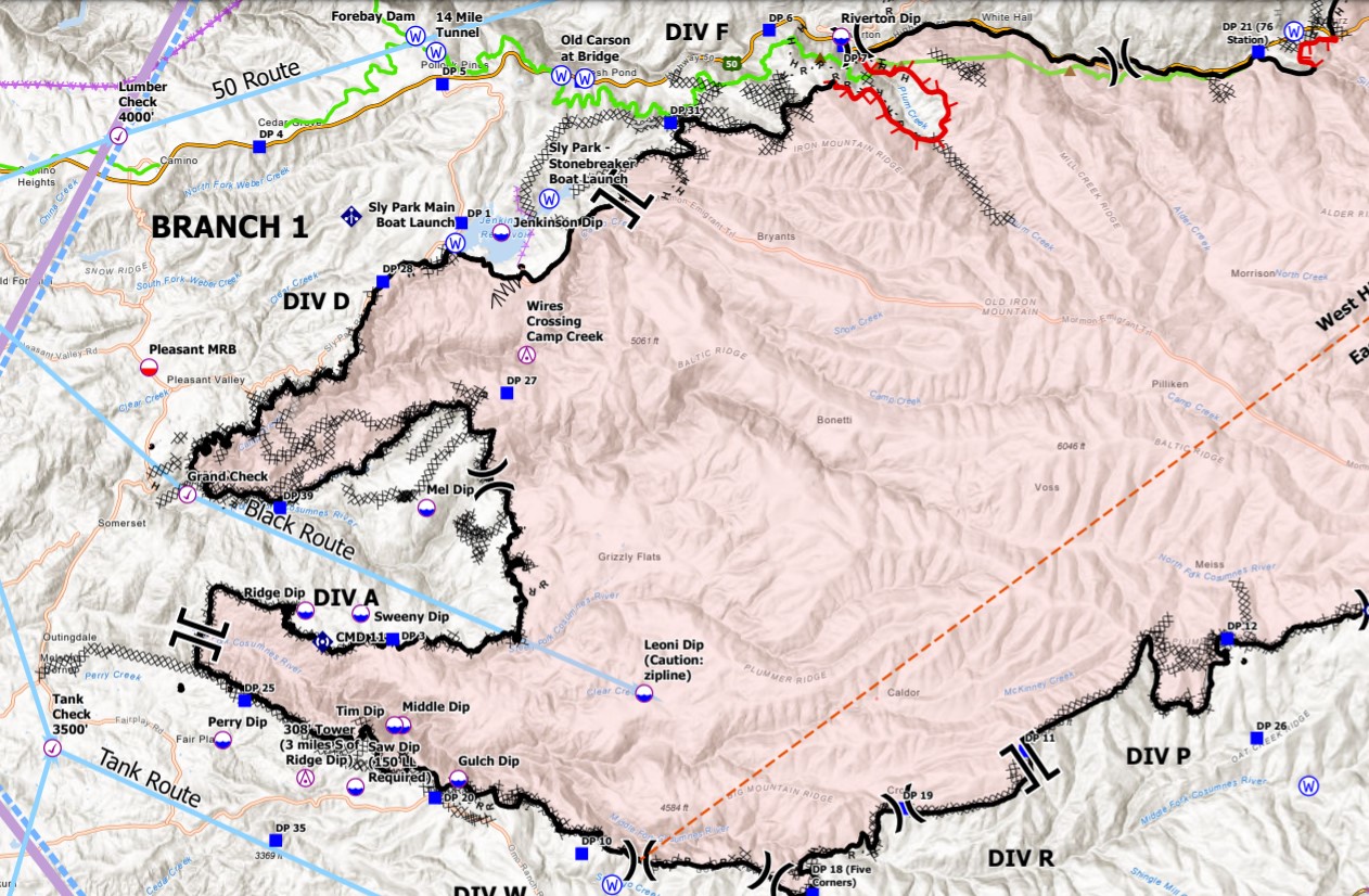
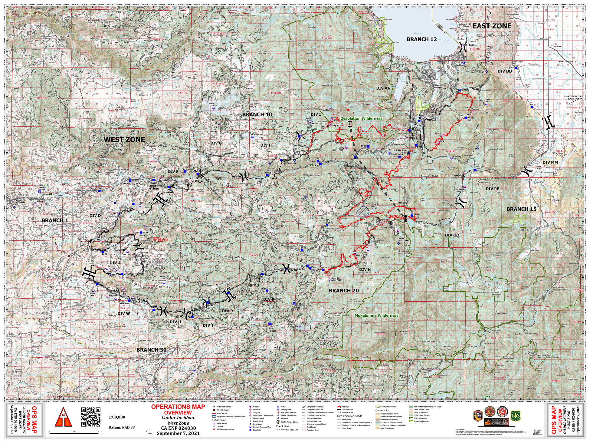
*** Note *** Today we’re supposed to have the start of pattern of possible thunderstorms in this area, both wet and dry. Thunderstorm can bring very erratic and strong winds. A good chance some of the lines will be wind tests today/tomorrow. Any uncontrolled edges can have explosive growth. Head on a swivel!
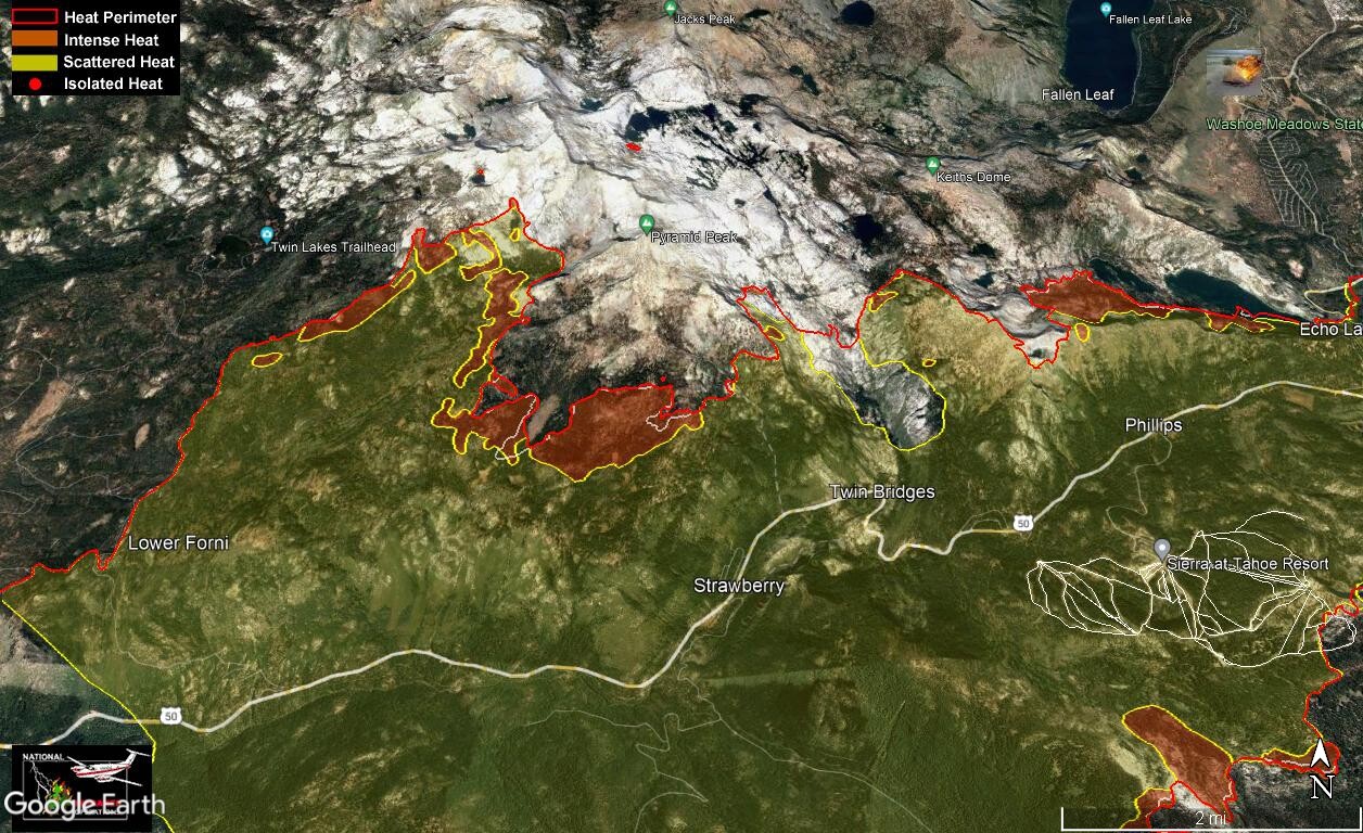
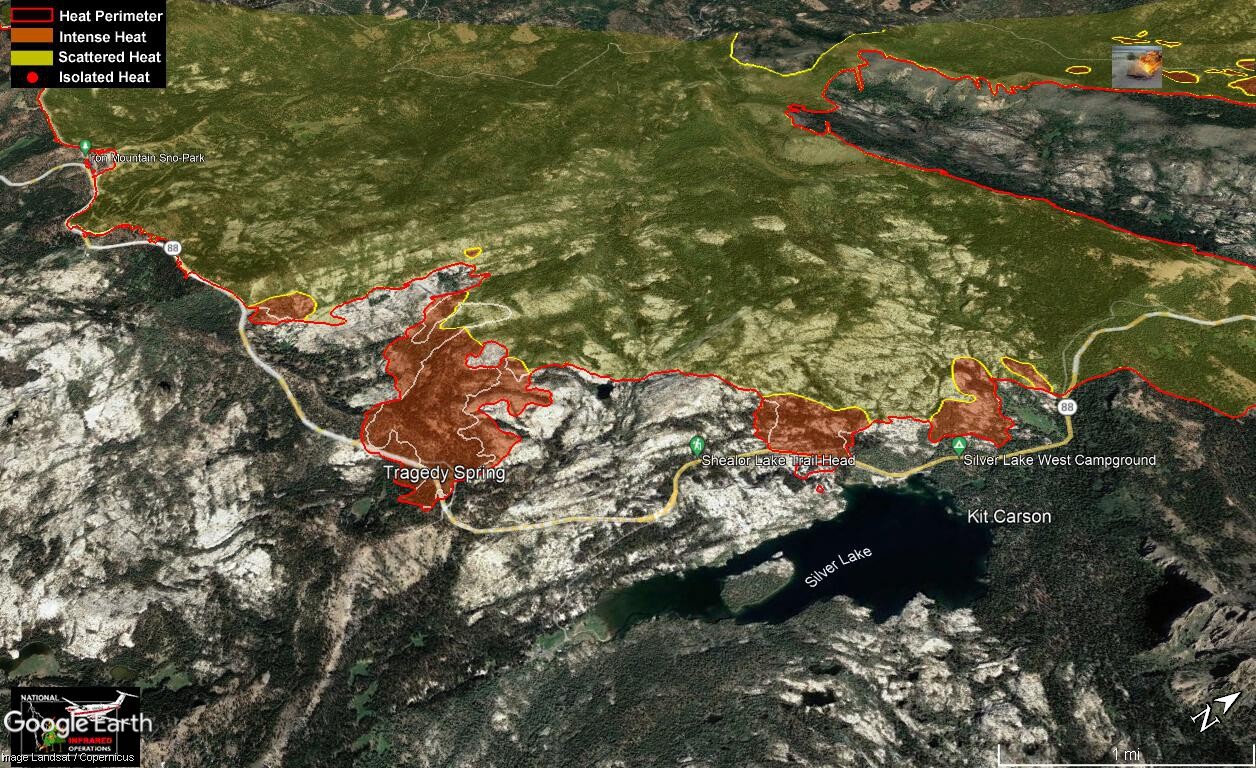
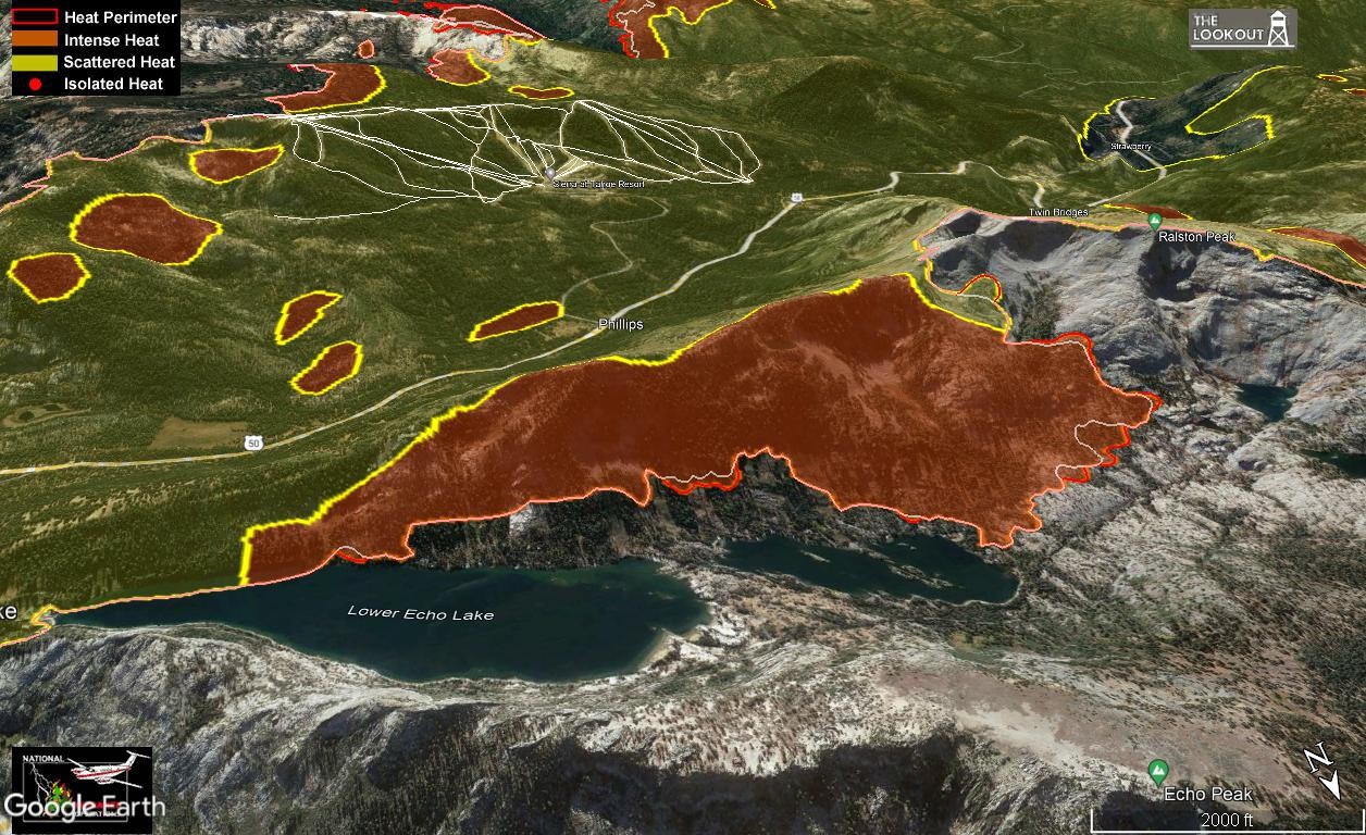
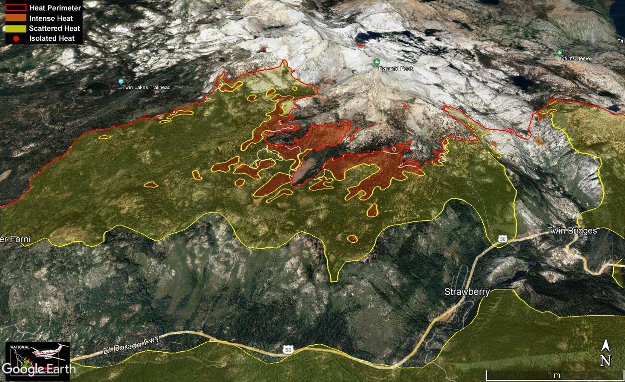
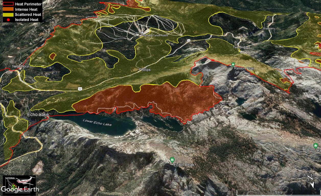
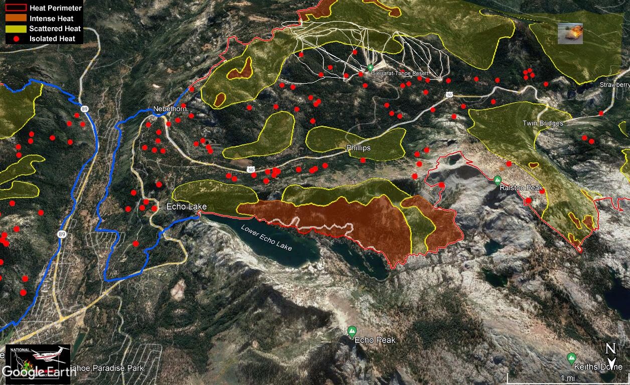
Still some heat over Hwy 50 and near Wrights lake. They are bringing handline up into the granite. Not expecting much to happen up hear (except a lot of grunt work by firefighters). Not many areas for it to grow as granite doesn’t burn. But interesting enough it does melt at 2300 degrees. This will be the last shot of this area unless something changes.
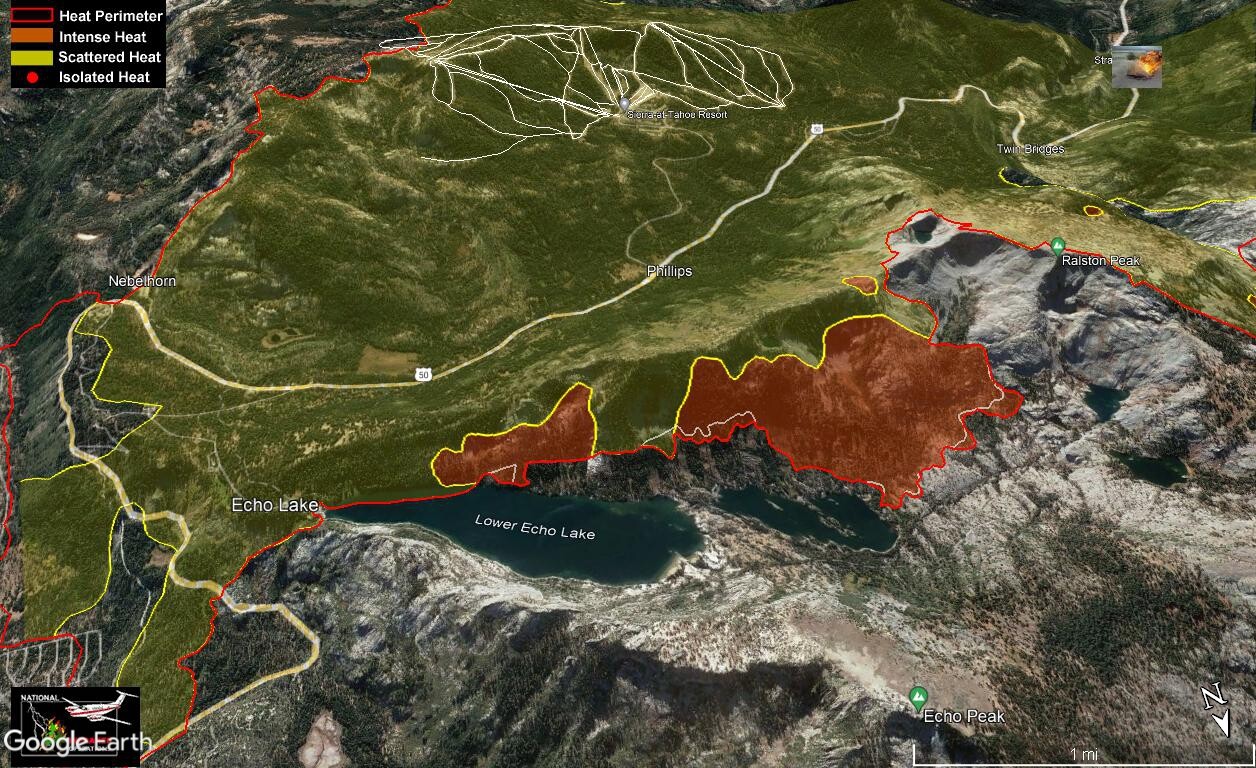
From @TheBrushSlasher comment yesterday. They have handline down by the lakes in the Echo Lake basin and are letting the fire slowly creep down to it. Hopefully this is doing beneficial work by cleaning up the forest floor and not damaging the trees. Crews are all around this area preventing damage to cabins in the area.
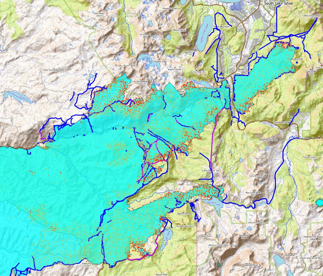
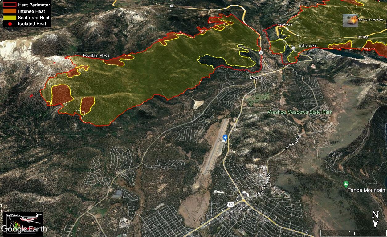
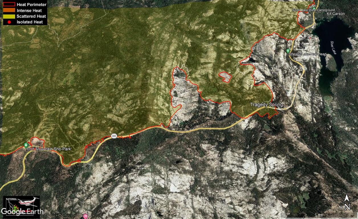
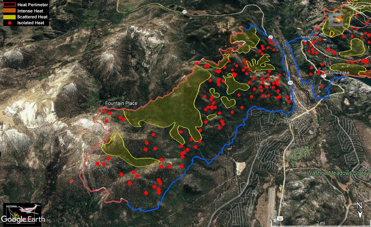
The blue line indicates controlled fire line edge (“blackline”), I tried black but it was difficult to see in some places. Not much to say hear, mop up time.
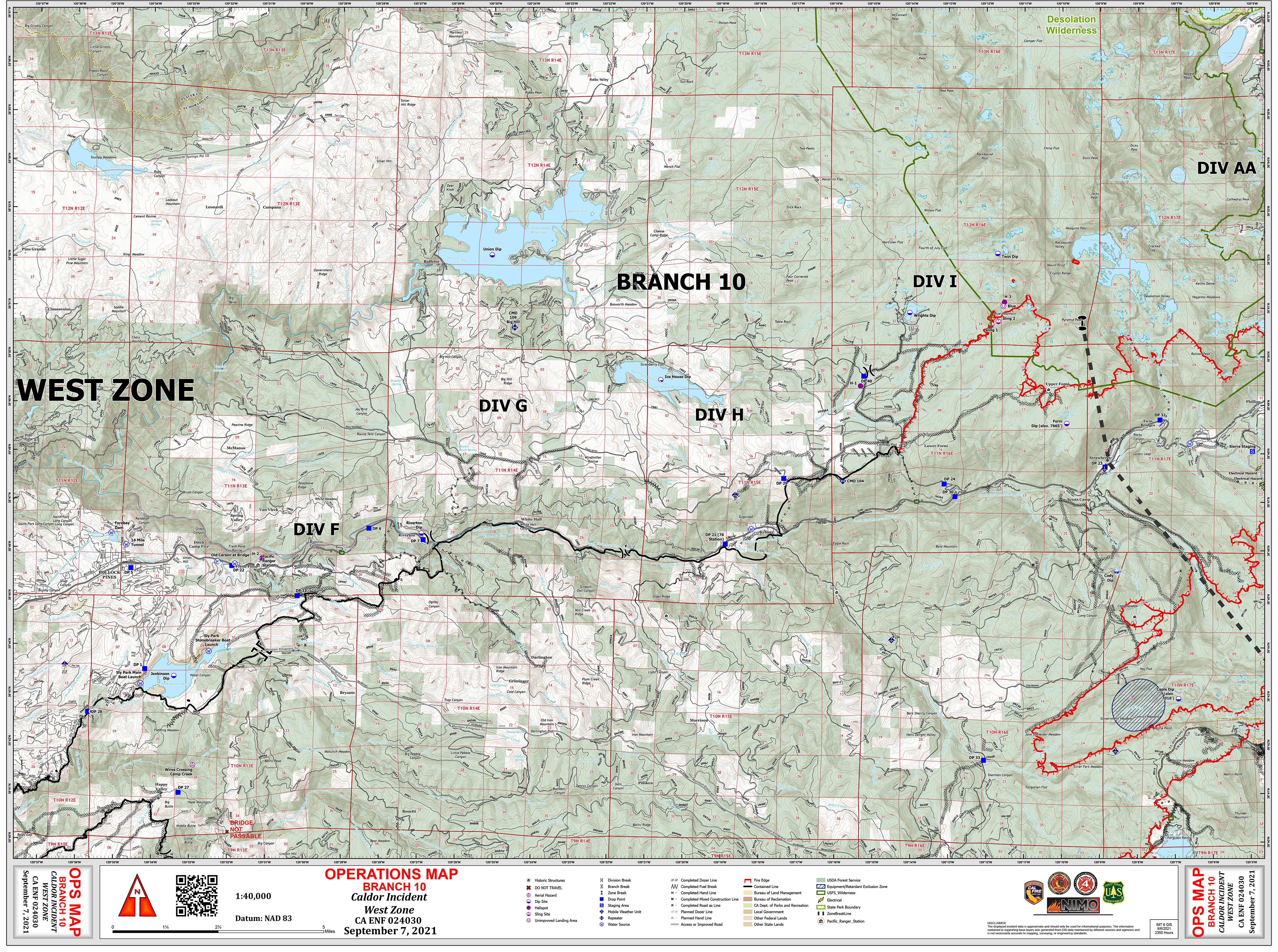
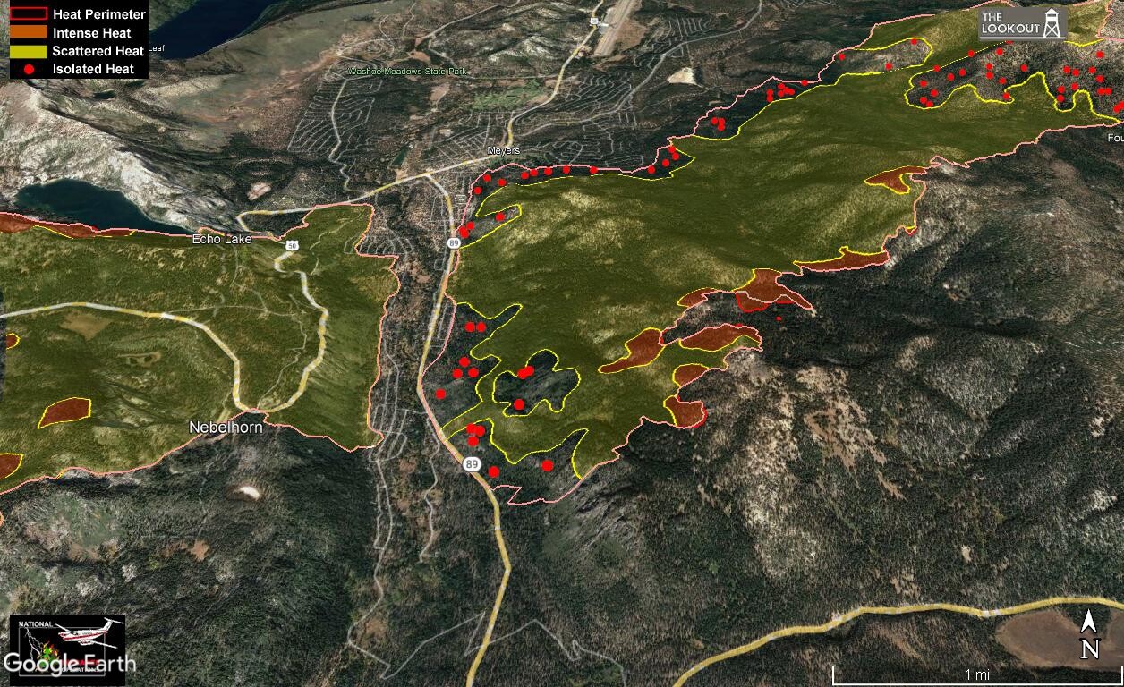
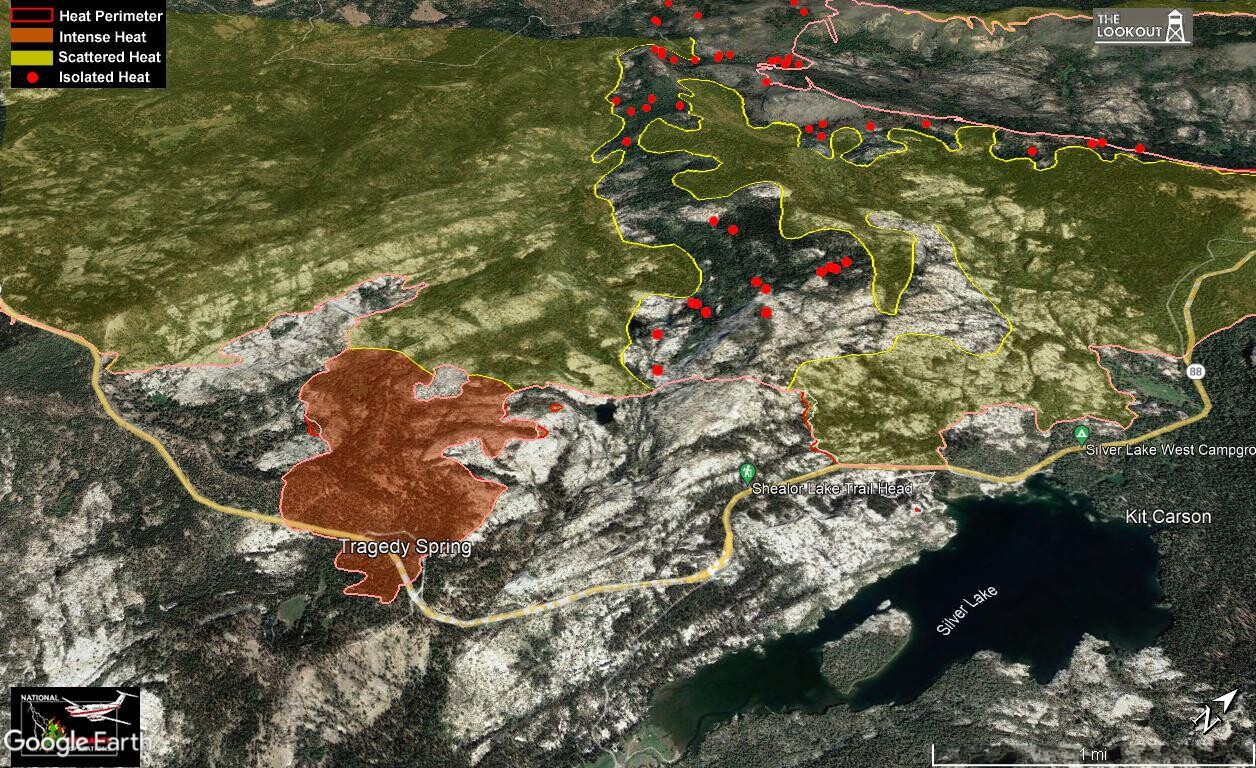
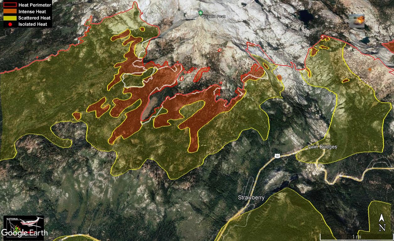
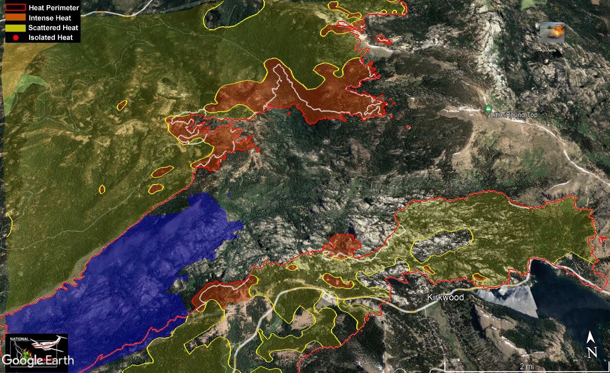
This is the pocket between the two eastern fingers. Yesterday a larger smoke column than recent was seen. Looks like that finger of unburned fuel in the upper finger didn’t last. In addition some additional spread of the perimeter a little west of that.
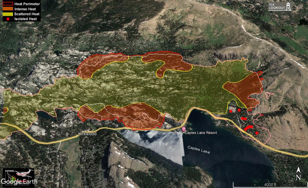
Looking over the lower eastern finger. Some additional spread to the north from it. Interesting to see the fires stopping closely to the edge of the 2019 Caples burn (blue area). Reduced fuel load assists with containment in an area.
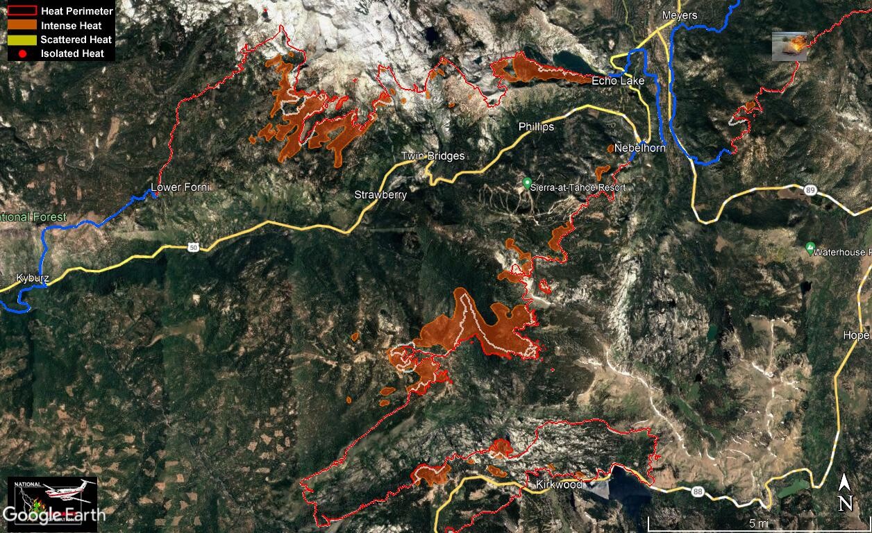
Not a lot of intense heat left in the fire (scattered and isolated removed for clarity). This is also where that 50% of open line remains.