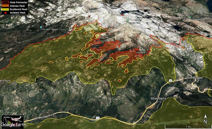
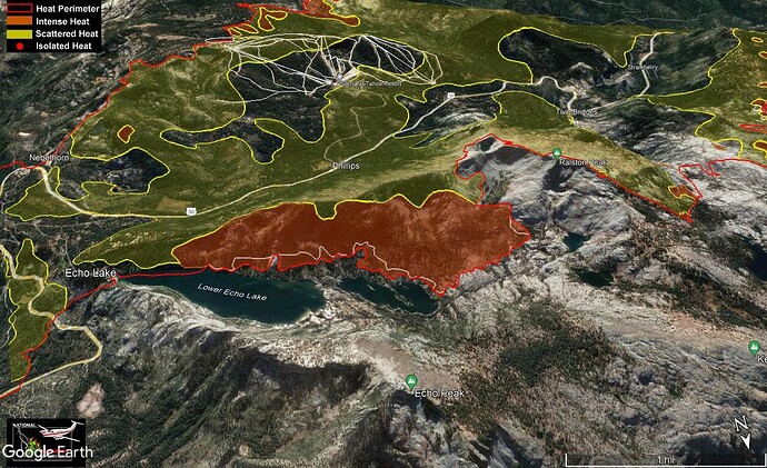
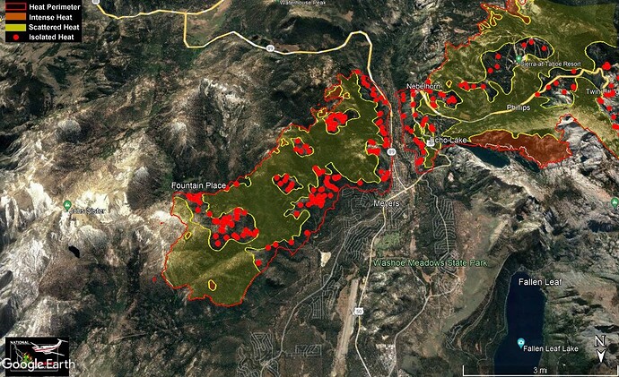
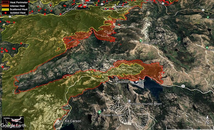
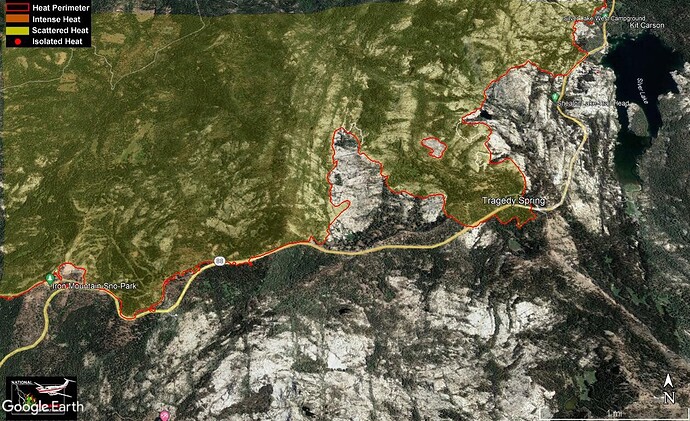
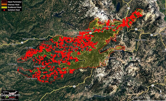
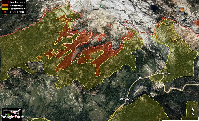
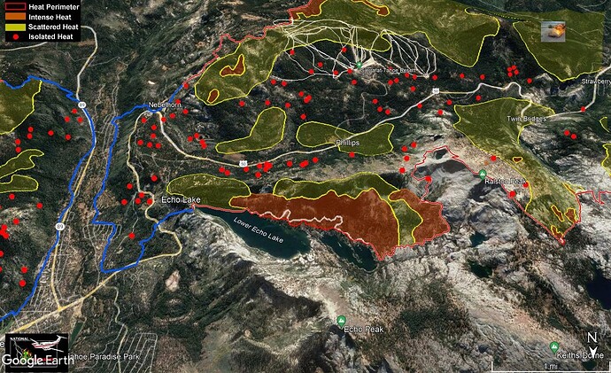
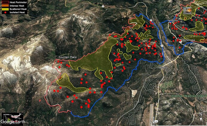
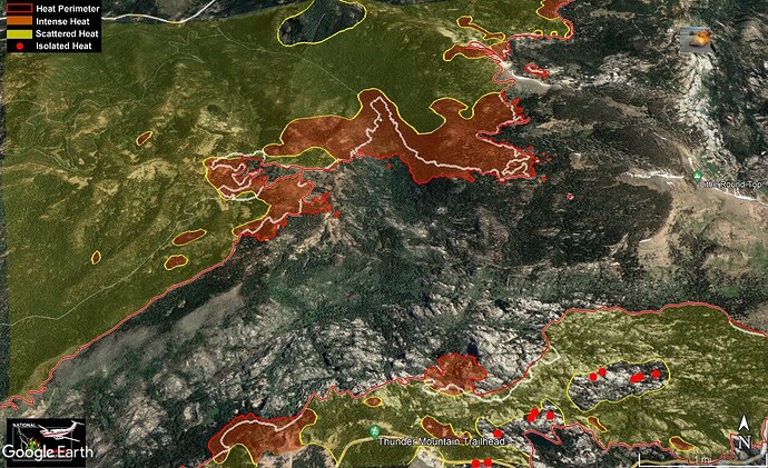
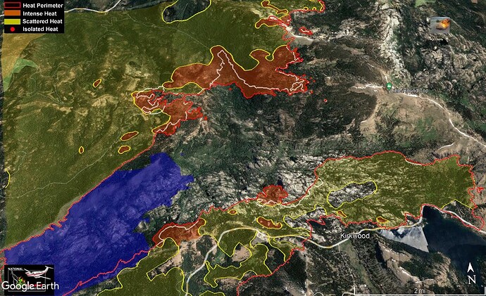
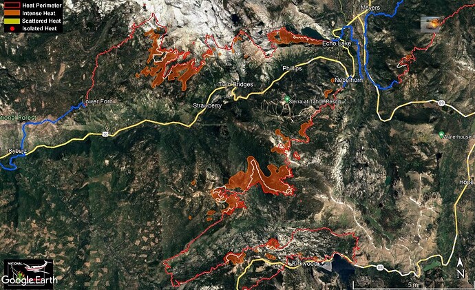
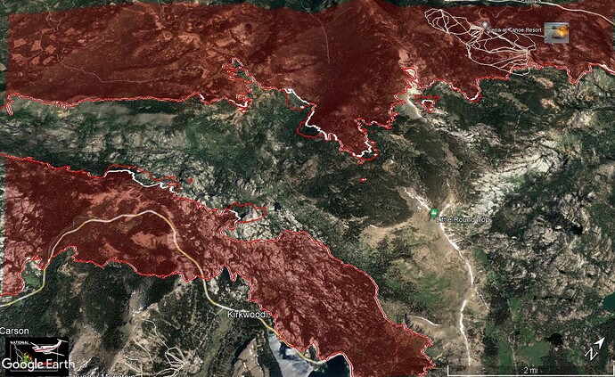
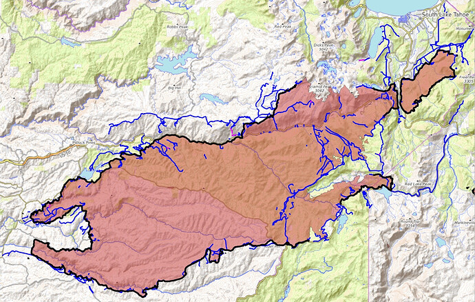
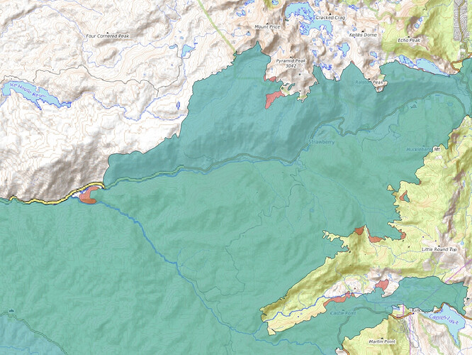
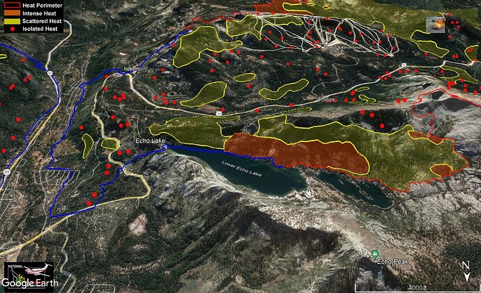
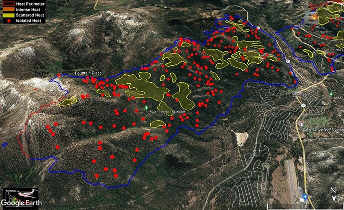
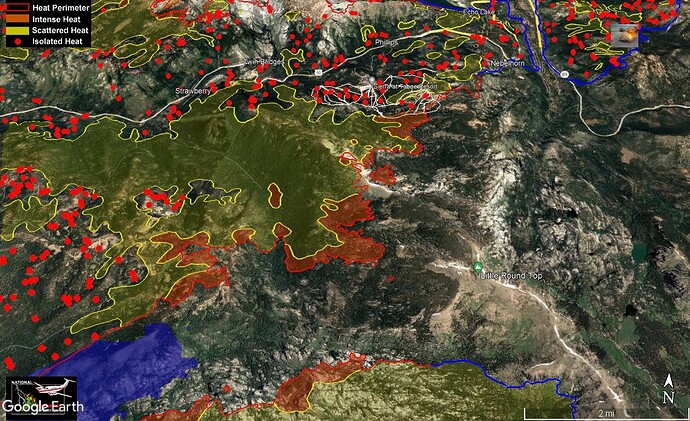
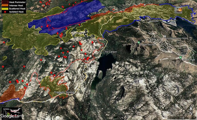
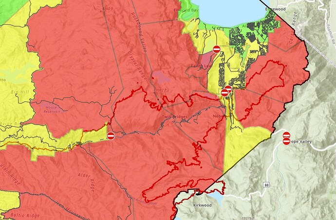
IR from 2240 last night. Isolated heat has been removed for clarity on some pics. Clear areas do not indicate no heat, many reasons for heat not showing on IR runs. Only eyes on the ground can determine when it is safe to enter an area.
Feint white line indicates previous fire perimeter
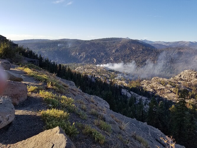
Continued cooling off above 50. A lot of timber on these side slopes can burn through and roll down posing a threat to vehicles on Hwy 50
Crews doing close in work around all the cabins in the Echo Lakes basin. Minimizing structure damage. Some of the ‘advancement’ of the fire could be the IR plane with just a slightly different angle when its doing its overflight in this steep country. It could also be my Google Earth not cooperating. Tactical decisions are best made with eyes on the ground by the DIVS that roam the areas.
Sounds like they have at least handline around the entire perimeter of the fire in the basin. Now its mop up, mop up, mop up.
The lower finger looks to be pretty much contained. Its that pesky upper one that continues to give them problems. Looks to be at least a couple of spots out ahead, where the fire advanced yesterday.
Unless something changes, this will be the last shot of the slop over Hwy 88.
Less intense and scattered heat and more isolated heat. This is a progress.

