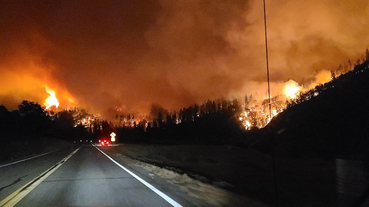
Shot from Hwy 96
15 Likes
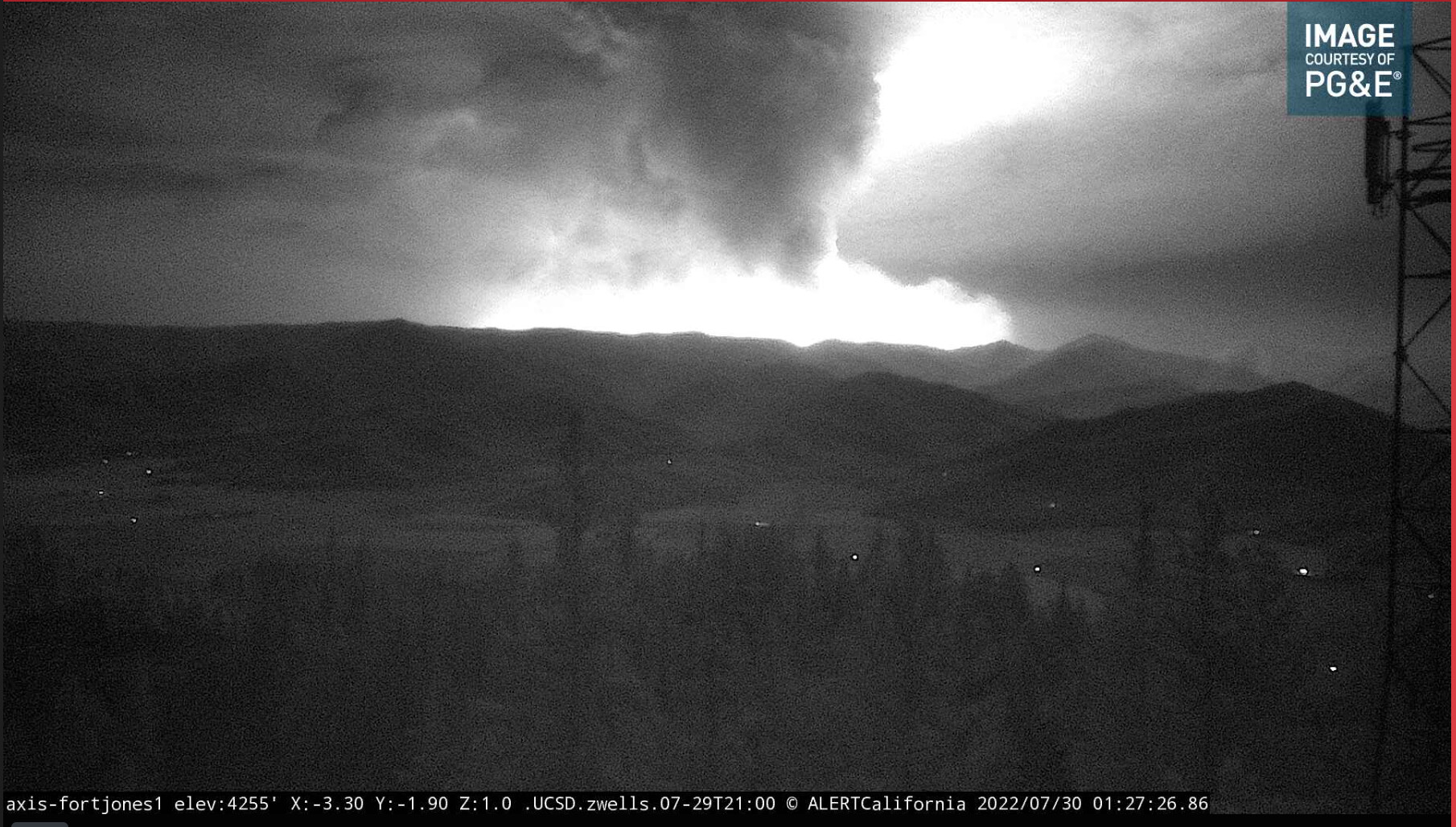
IC is saying he thinks they have an active thunderstorm overhead, asking dispatch to check the radar…but it’s probably the pyrocumulus that’s capped out 50k feet over their head
2 Likes
Lightning map is showing lightning over there right now
3 Likes
Top sitting at 40,000+ feet and the cameras and radar are showing a pyro cb cell.
5 Likes
A couple of lightning flashes in the 15 time lapse.
4 Likes
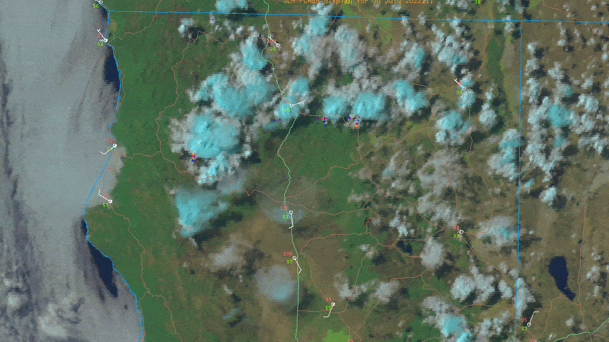
Here’s a pretty detailed view of the lightning over the past 10 or so hours. Strikes are all of the plusses on the image. Gonna be rough tomorrow…
7 Likes
Is the t storm causing this thing to cap out at 11 o’clock at night ? That’s really intriguing.
1 Like
Nothing much showing up on MODIS/VIIRS this morning, GOES shows something, could the clouds be getting in the way?
2 Likes
Haines Index of 6 today. When combined with outflow winds and critical 1000 hour fuel moisture expect extreme fire growth. The heat release when combined with the moisture in the atmosphere will allow columns to climb well above 25,000 feet and perhaps as much as 40,000 feet. Once that occurs the cold cloud tops will allow for the debris laden dense air to condense into liquid and rain or hail to form. Once it does and becomes heavy, it will fall based on gravity. As it does it will drag air with it. All that hail falling will convert to rain as it nears 5000 feet and then continue towards earth. The air being dragged down will push out beyond the column creating outflows, the air being drawn in from the fire will create inflows.
I would expect any new or existing fires to be problematic today.
15 Likes
The 4am VIIRs I saw on the FireMppers site seemed suspect, had fire all the way to Deadwood Camp, +/- 45k acres, showed no heat at the origin. I’m not using it for anything unless I can get another source to verify.

7 Likes
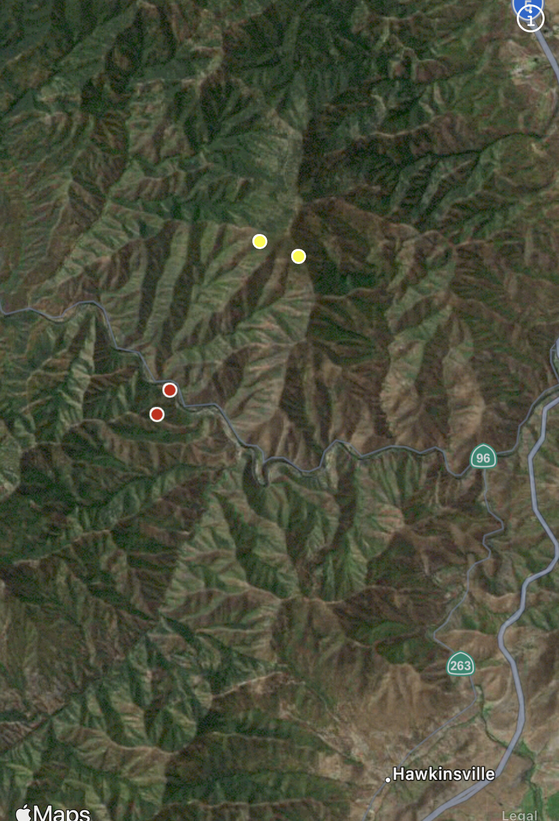
@pyrogeography 45k in the first burn period would be exceptional! Here is a fire history map of the area, of note going clockwise would be 2014 Happy Camp Complex to the west, 2016 Gap, and 2014 Beaver to the north. McKinney is burning in very heavy fuels coupled with extreme steep slopes, that have not seen fire in a very long time. As the saying goes in the Klamath, it will burn till the rains come.

11 Likes
MCKINNEY Extended frequencies
Air Tactics 166.600
Air/Grounds 167.0625 and 166.9375
Rotor Vic 118.725
4 Likes
Lead 55 and Tanker 16 off of Redding looks like they’re gonna get the air show started up
4 Likes
AA advised the ridge system they were planning to paint has been compromised, working on a new plan. Will also be doing infrastructure protection for the Gunsite Peak radio towers.
5 Likes
Are there any 209s posted publicly for this incident yet?
1 Like
McKinney 209 7_29.pdf (92.8 KB)
Minor mistake on the name of the pdf- it is the 209 not a 202… apologies
2 Likes
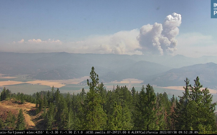
The amount of rise and expansion in the column right now is super impressive.
6 Likes