Getting very uglier…
https://www.alertwildfire.org/region/shastamodoc/?camera=Axis-HerdPeak2
5 Likes
flames are visible on the fort jones cam now. also 1hr loop shows a wind shift as it zooms in
2 Likes
Very spooky outflow winds captured on 1 hr Fort Jones loop!
https://www.alertwildfire.org/region/shastamodoc/?camera=Axis-FortJones1
12 Likes
Grabbed a couple video clips off the Mac…hopefully @ALERTWildfire can capture some of these from the source for training/demonstrations. Would be great to have a repository of 30sec clips of things like this that Training folks can include in their presentations.
Last night’s sundown 1hr loop from Antelope Cam
The outflow from the 1hr loop just now on Fort Jones cam
15 Likes

`
`Footage from
—
Pilot Witham this morning above the #McKinneyFire
that has grown to nearly 30,000 acres as of 11:45am today, burning on
the Klamath National Forest just West of #Yreka.
pic.twitter.com/R0sBRspvTZ
NorCal Air Operations (@NorcalAirOps) July
30, 2022
8 Likes
`
`—
Message from
Siskiyou County‼️
Yreka Police Department informing residents
of Yreka this is not a notice of evacuation. Residents living west of
North & South Oregon St to prepare themselves for possibility of
evacuation if the fire progresses towards Yreka. #knowyourzone
Siskiyou County OES (@SiskiyouOES) July
30, 2022
6 Likes
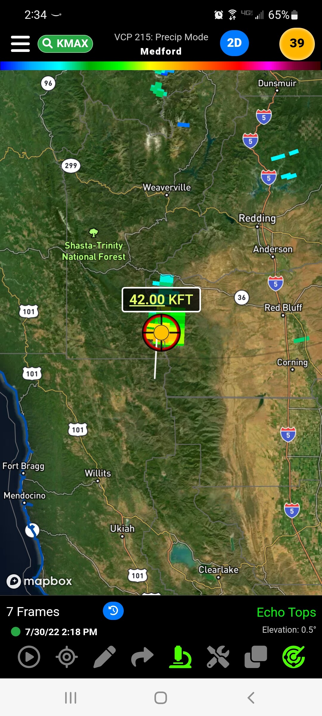
Throwing strikes in the Beegum Creek and Post Creek drainages, another cell just formed west of Hayfork tossing strikes. Hayfork Bally reports rumbles and virga
2 Likes
CAIIMT 2 (Johnny) assigned to the McKinney Inbried 7/31 @1200
3 Likes
Plenty of lightning activity with it along with more in northern Siskiyou and some east of Redding 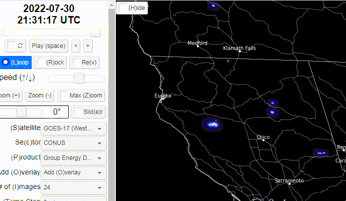
5 Likes
what program is that? Blitztorn is not showing any strikes in the area.
1 Like
That’s showing satellite detections of lightning pulses, so it picks up every flash that happens at any level in the clouds.
2 Likes
is there a way to tell if any of them are groundstrikes?
1 Like
Thanks, BrushSlasher!
1 Like
Antelope caught the outflows as they moved towards Yreka. Any word as to what it did to the fire? Looks like it would have spilled it everywhere.
2 Likes

Re "is there a way to tell if any of them are groundstrikes? Not from satellite. I read they had figured out a way to tell a difference between ground strikes and the rest from the radio static signature created, but I don’t know if anything has been put into service and available to the public???
2 Likes
Any current command freqs?
1 Like