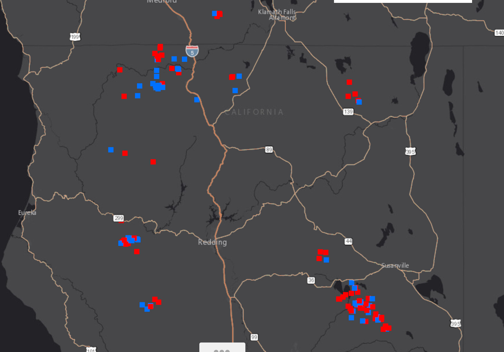
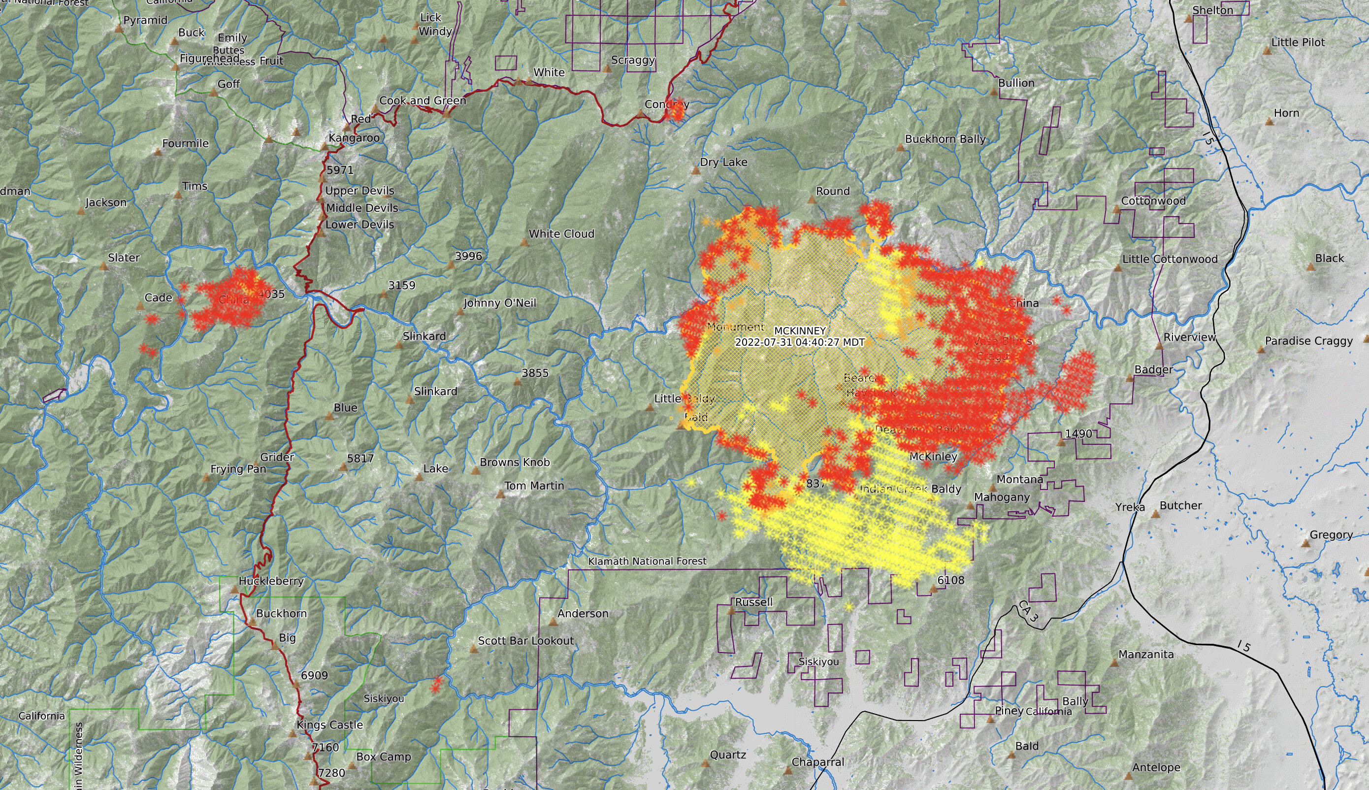
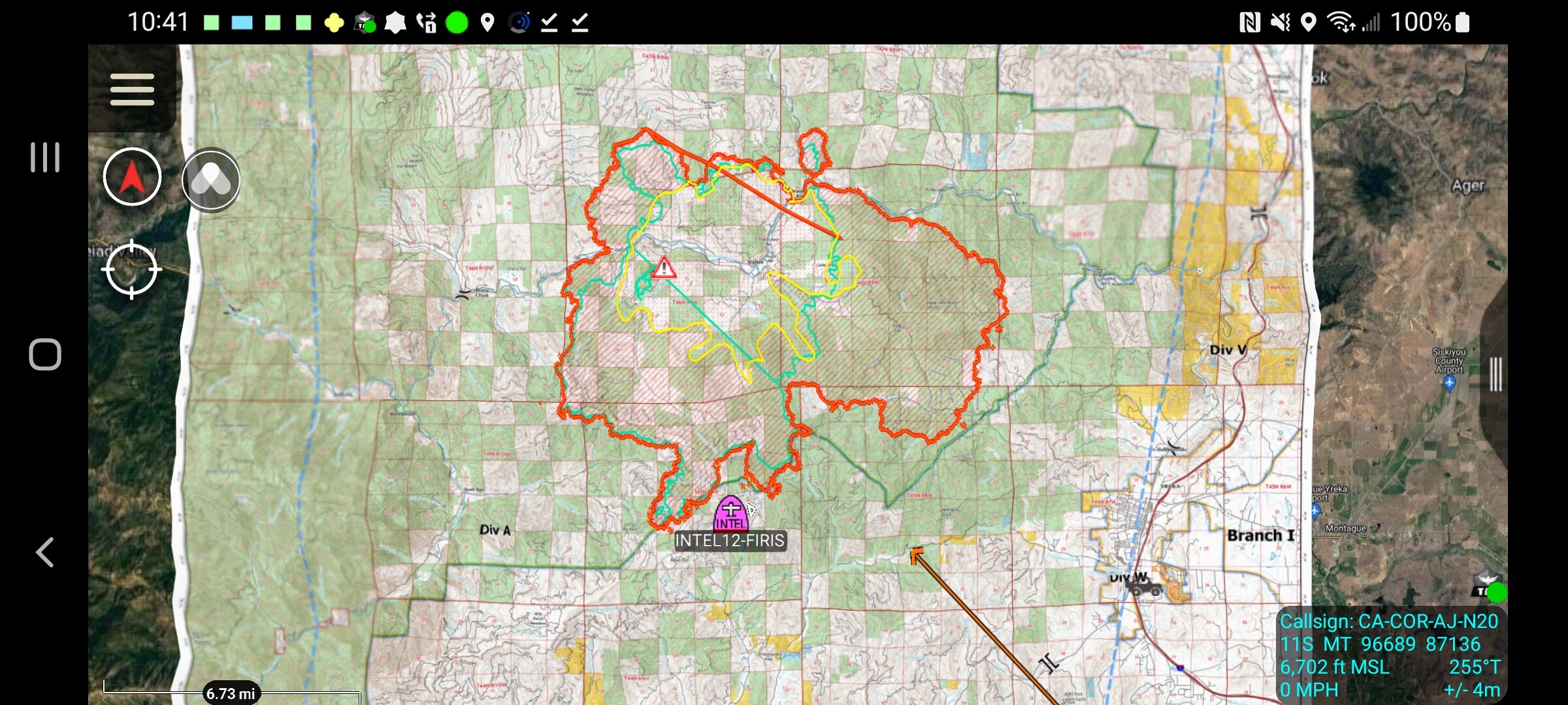
Caltopo map I have posted zoomed out: (refresh this every hour or two for better heat mapping)
FYI- Smoke columns may present false heat signatures and these maps are behind by 2-3 hours.

Caltopo map I have posted zoomed out: (refresh this every hour or two for better heat mapping)
FYI- Smoke columns may present false heat signatures and these maps are behind by 2-3 hours.
Hopefully next orbit has less error. Better perimeter data out there for now. Firemappers site has an 1145am perimeter.
Some updates from 1800hrs 209 report. ***Note: Take with a grain of salt at this stage of an incident this size, also note that the ICS 209 is not a “wildland incident” specific reporting form but an “all risk” ICS form so some of the information descriptions may not make 100% sense:
30,000 Acres @ 1% Contained, 508 personnel assigned
Observed Fire Behavior:
Fire continues to move with high ROS driven by strong winds, steep slopes, short and long range spotting. High temperatures, poor RH recovery and low fuel moistures allowed burning conditions to continue through the nighttime hours. Fire has also been burning through the 2014 Beaver fire scar due to available fuels.
Primary Fuel Model/Hazard Info:
Thundercell development last night contributed to extreme ROS and increased spotting distances. ERC’s are above the 97th percentile.
Public Status Summary:
1,313 persons evacuated
Life Safety/Health Status:
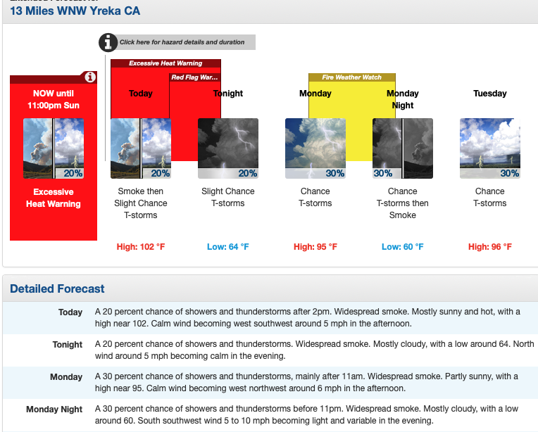
Evacuations in effect for the Highway 96 corridor, communities of Oak Knoll, Klamath River from Interstate 5 to the town of Seiad. Vital communication, water and phone infrastructure immediately threatened. Point protection and structure defense operations on- going along the Highway 96 corridor. Red Flag warnings for thunderstorm and dry lightning in the fire area. Strong gusty outflow winds with associated high temperatures and single digit RH have driven fire behavior.
Weather Concerns:
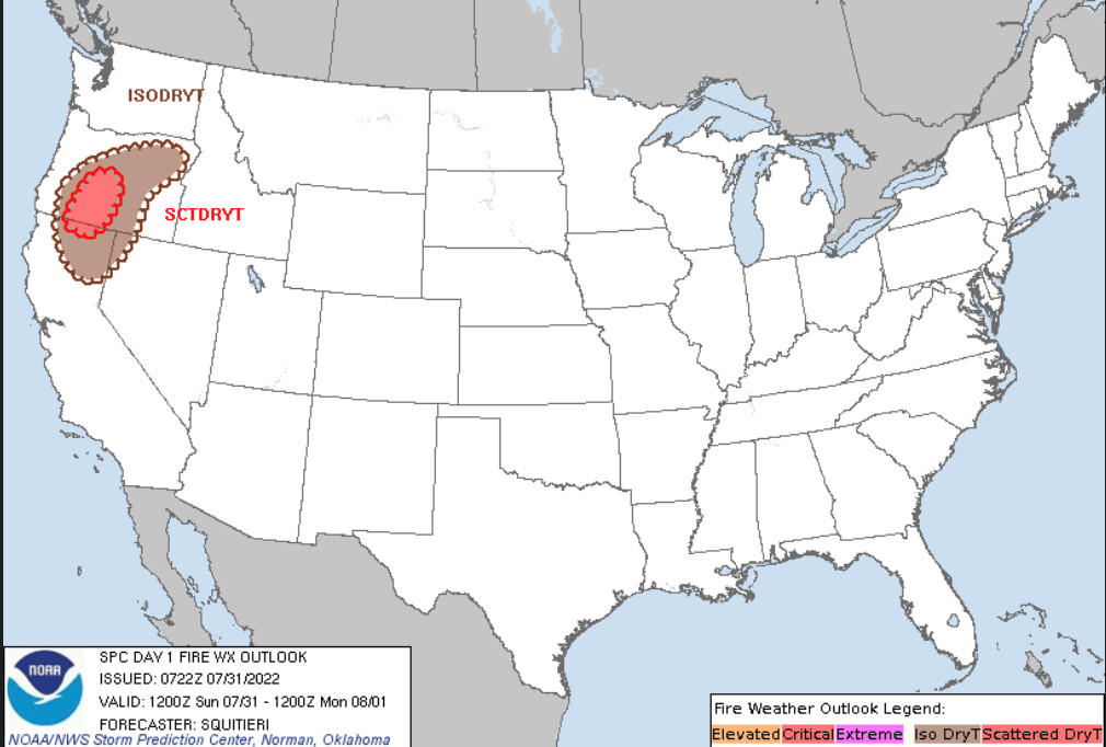
Red Flag conditions for lightning continue into Sunday 7/31
Projected Incident Activity:
12-24hrs - Point protection, structure defense operations continue along the Highway 96 corridor, Beaver
Creek community. Scouting opportunities for indirect/direct line construction as fire moves in 12 hours: all directions. Fire has progressed to Collins Badly lookout in the south, and Deadwood Baldy
Peak on the east flank. FIre will continue to move west towards Horse Creek and north into the 2014 Beaver Fire scar towards Round Mountain.
Critical Resource Needs:
7-Type 1 or 2IA crews, 7-Type 3 Engine Strike Teams, 7-DIVS, 7-TFLD, 9-HEQB, 4-FELB, 6-Type 2 dozers, 5-Watertenders
Strategic Discussion
FIre is located in area with no fire current fire history south of Highway 96 and is being driven by extreme fire weather conditions of Red Flag warnings for thunderstorm development and dry lightning, single digit RH and high temperatures. Strong outflow winds and diurnal winds up and down canyon have contributed to fire spread. Continue with structure defense while scouting for opportunities for effective direct and indirect lines construction. Beaver Fire (2014) scar continues to carry fire through the receptive fuel bed.
Planned Actions for Next Op Period:
Continue with point protection, and structure defense. Scout indirect line locations where resources can be effective. Look for opportunities to go direct where fuels, topography allow.
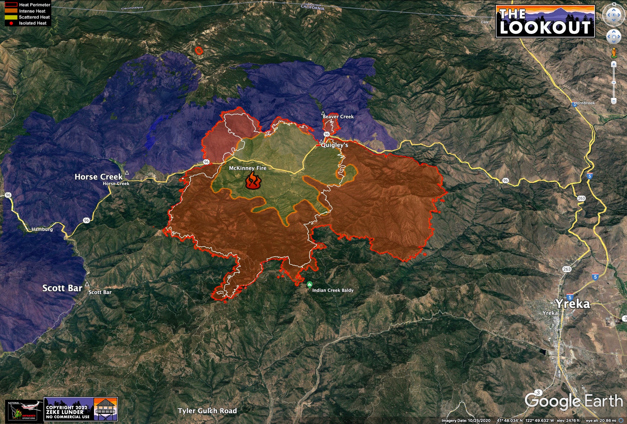
CalTopo MODIS+VIRS 1946hrs 7/30:
From NIROP log of last night IR the fire is at 51,791 Acres. That is an increase of 21,791 from their last flight.
New mapping from about 12:25 am. Details and commentary on The Lookout.
https://the-lookout.org/2022/07/31/mckinney-fire-7-31-2022
QR Code to Maps, IAP and Ops Breifing:

209 Info and mobile device/limited bandwidth friendly Maps for today:
51,468 Acres, 0% Contained, 648 Personnel Assigned
Remarks:
Transition from Klamath NF Type 3 organization to Unified Command with CIIMT 10 (Mack) and CALFIRE Siskiyou Ranger Unit (Laws) will occur at 0700 on 7/31/22. Accurate resource count will be adjusted as Team transitions today.
Critical Resource Needs:
7-Type 1 or 2IA crews, 7-Type 3 Engine Strike Teams, 7-DIVS, 7-TFLD, 9-HEQB, 4-FELB, 7-Type 2 dozers, 5-Watertenders.
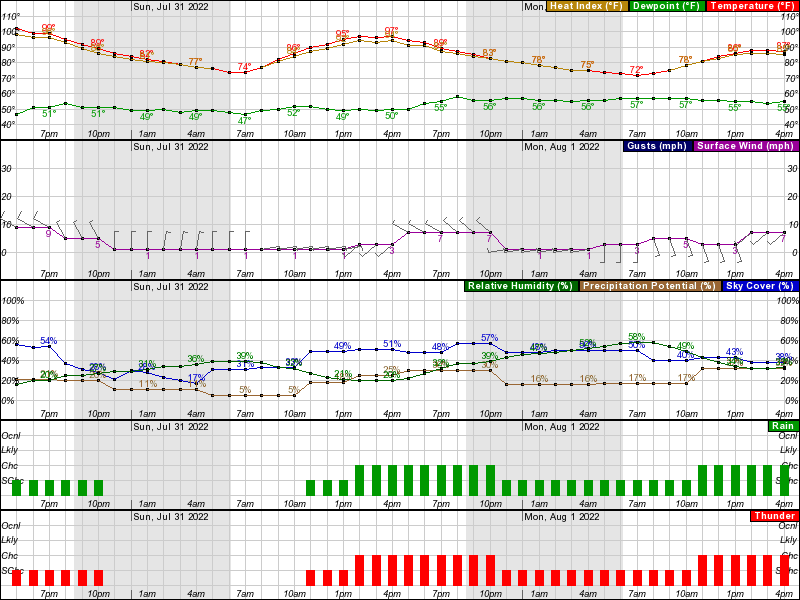
Weather Concerns:
Fire weather watch in effect from Sunday through Monday for abundant lightning on dry fuels. Gusty outflow winds of 30 to 50 mph will be possible near thunderstorm cells. LAL of 3. Above normal temperatures and low relative humidity will increase the drying of the receptive fuel bed. ERC above the 97th percentile and probability of ignition of 100%.
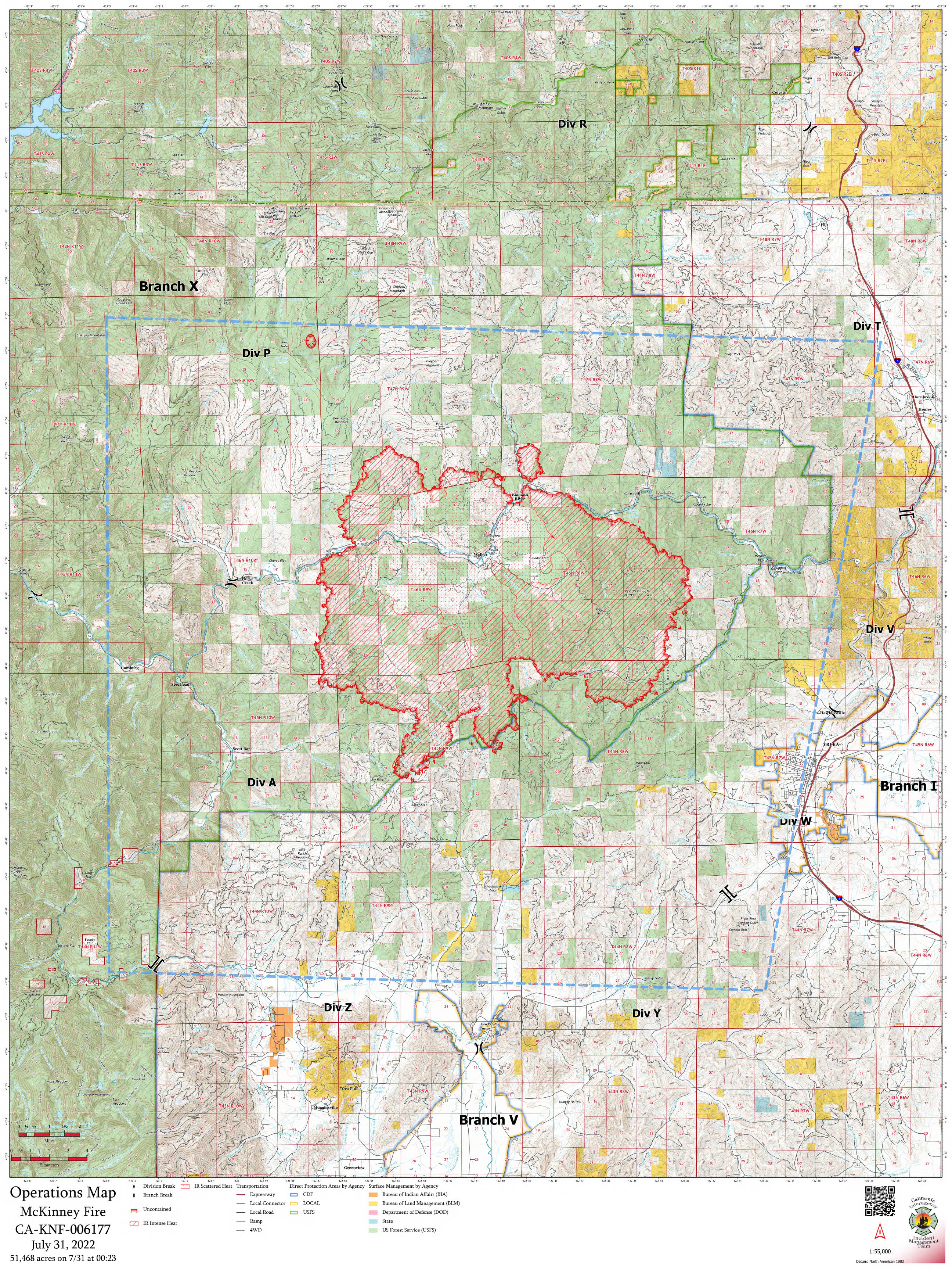
7/31 Ops Map:
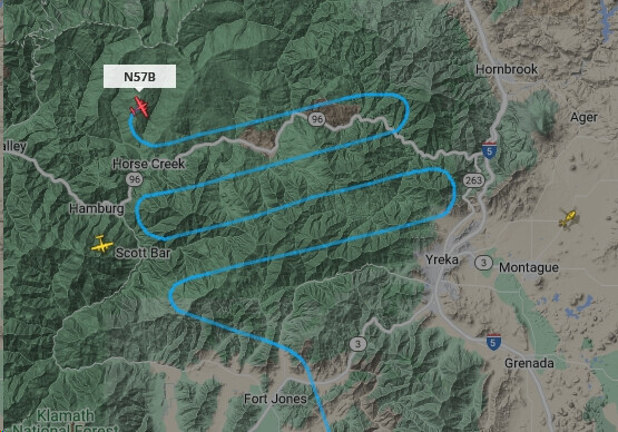
CalTopo Modis-Virs Map with China 2 on the left.
National Weather Service Medford OR
503 AM Sun Jul 31 2022
…Abundant Lightning On Dry Fuels Expected through Monday…
.Heat, instability, and increasing moisture along with multiple
low pressure impulses moving through Monday are expected to bring
scattered thunderstorms and abundant lightning on dry fuels to the
area.
Impacts: Lightning and high fire danger will likely result in
new fire starts. Gusty thunderstorm winds could contribute to
** fire spread.** Despite rainfall, initial attack resources could be
overwhelmed and holdover fires are possible.
Thunderstorms: Today into Monday, an approaching low pressure
system will bring a couple of rounds of scattered thunderstorms.
Rainfall: Today, thunderstorms may begin relatively dry and then
transition to a mix of wet and dry. Monday, thunderstorms are
more likely to produce wetting rainfall. Locally significant
** wetting rainfall will be possible** with some of the thunderstorms,
especially the slower moving ones.
WATCHOUT communications
Today’s 205 lists RX tones on the command nets. There are no RX tones on the command nets. 
COMMUNICATIONS WATCHOUT has been moved to Q&D.
Stay on topic regarding incident situation
In progress…
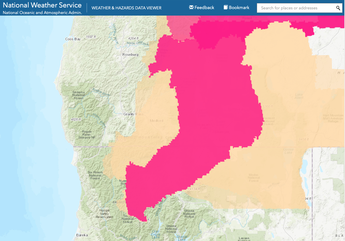
Evacs issued for yreka west of Fairchild street and Shasta street per Siskiyou SO