
One was posted in the South Ops Weather thread by FFviking.
2 Likes
that looks like more than 1500+ heading for 2K areas.
3 Likes
This is a message from the Tulare County Fire Department.
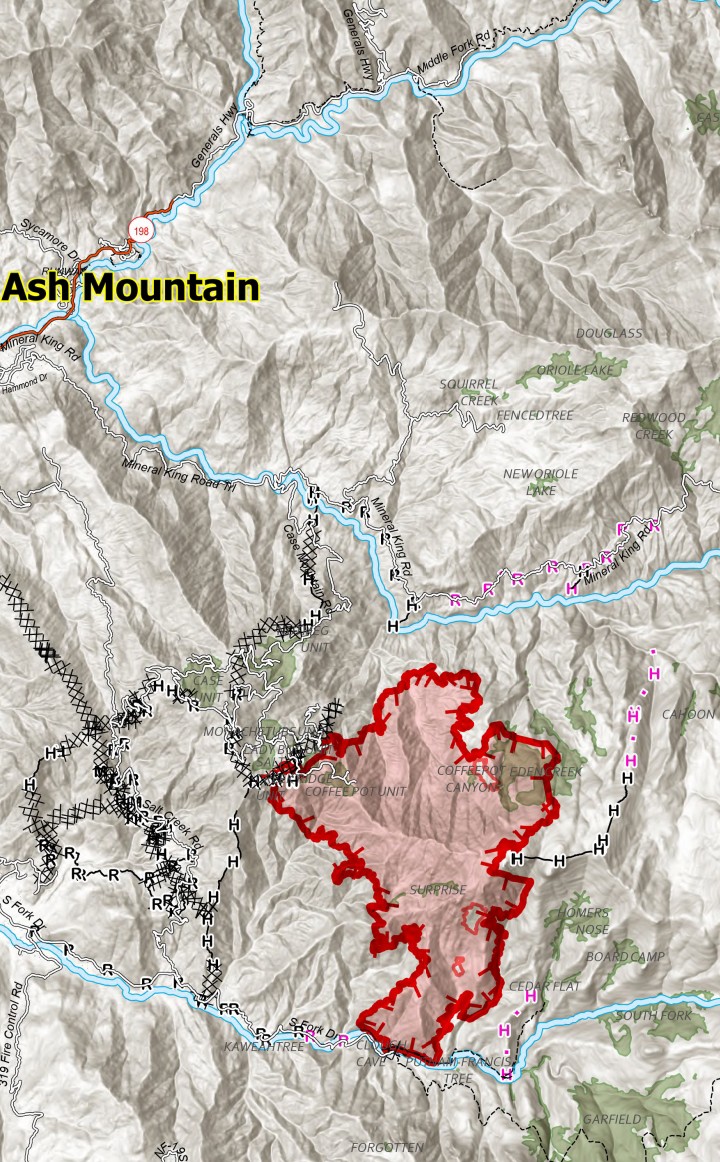
An Evacuation WARNING has been issued for TLC Zones TLC-E128-B and TLC-E094-B, area north of South Fork Drive, East of Skyline Drive (Salt Creek Fire Control Road), South of Mineral King Road, and West of the National Park Boundary.
An evacuation WARNING means you should prepare to evacuate the area should the fire approach your home or if ordered to do so. Please stay clear and out of the areas affected by the fire. If there is an emergency please dial 911.
For additional information, call the Fire Information line: 559-492-9988
please refer to http://inciweb.wildfire.gov/inciden…/caknp-coffee-pot-fire
5 Likes
1,526 Acres still 0% containment.
4 Likes
.post edited cancel
1 Like
The link to the IAP hasn’t updated I’m guessing?
1 Like
4 Likes
1,653 acres
2 Likes
Acreage this morning Aug.26th = 3434 +1781 since 5 days ago.
5 copters on the fire this afternoon.
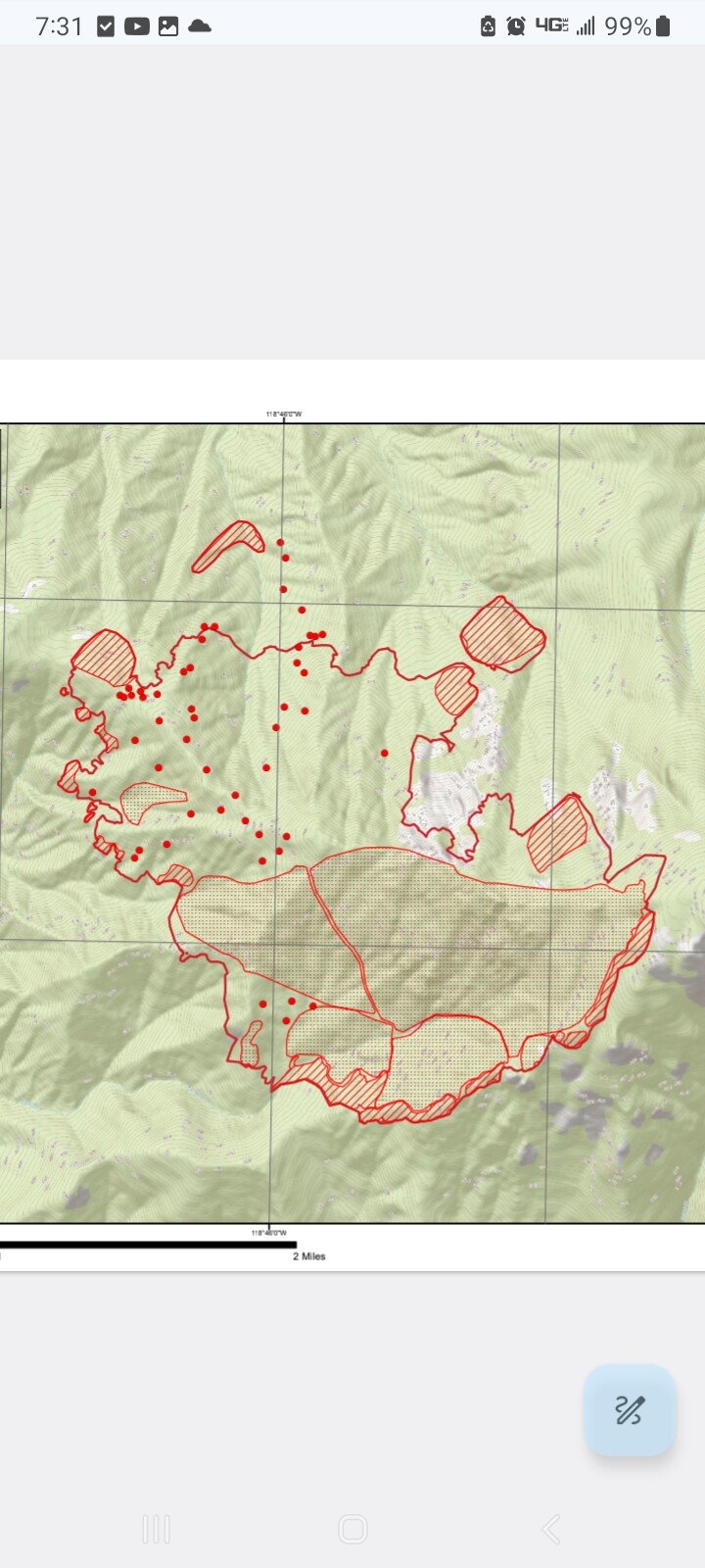
Noted this morning by FireWatch 51:
Intense fire were detected along the edges of the perimeter of the fire.
Isolated fires were generally within fairly close proximity to the main perimeters.
7 Likes
The 27th there were aerial fire ignition in Div.H and Branch 30. I haven’t looked at map to see the locations. However, there is good smoke production today.
5 Likes
Can confirm, a good friend of mine on an IHC mentioned the next few days will include lots of ignitions to fill in the box
5 Likes

2 Likes
You would think if ignition were going well some sort of containment would show? 1-3% any info?
5 Likes
Had rollout issues?
https://www.sfgate.com/bayarea/article/coffee-pot-fire-grows-sequoia-national-park-19728728.php
3 Likes
Nothing has crossed south fork drive, that’s a large area they are slowly firing off plus firing off cinnamon creek instead of the hand line they put in on the ridge east.
4 Likes
They fired down cinnamon creek to salt creek fire road and the dozer lines there, they’ll probably take fire down to south fork drive.
5 Likes
Do you believe evacuations are precautions in the event firing doesn’t go as planned rather than an event occurring that wasn’t expected?
Or were the evacuations from the article already in place and not due to the recent ignitions.
2 Likes
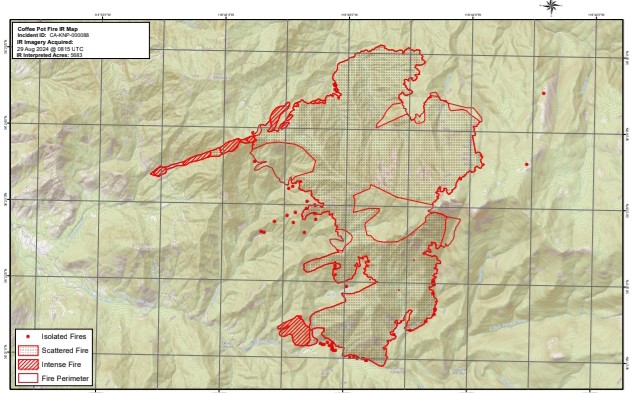
IR last night shows 5683
3 Likes
It’s the portion of south fork drive that will be getting ignitions soon. The zone with mandatory evacuations is inside the box. This was part of the plan and blown out of proportion by the article.
5 Likes