
2-3 miles.
1 Like
I’m sure the trigger point is coming soon!
1 Like
Are there ground resource orders going out for this or is it too far into no mans land?
1 Like
Wind pushing down canyon at 18:30 was like a wall coming thru
With north ops releasing more assets,there are multiple forest service crew buses and probably 10 to 15 dozers in Three Rivers tonight , they want to stop it at the SRA or at least before it gets to town , so much smoke ,hard to get it done with just air alone very steep country , be safe
4 Likes
Not even close to “too far into no mans land.” It’s right next to the 3 Rivers community and a National Park with Sequoia groves. SQF resources are assisting from the Hume Lake RD as able for planning / prep purposes; local fed resources are definitely taking it seriously in terms of spread potential. Fire history, as mentioned before, is sparse in the immediate area.
7 Likes
Wrapping the big tree seems ridiculous. Did anyone ask the tree with 10" thick bark how they felt about it? Humans are really weird.
21 Likes
Maybe a NP policy or political move?
2 Likes
#Hoping for the best! Hope isn’t a plan & that fire adapted tree species comes with its own fire adapted plan so no need for tinfoil. Call me crazy… A+ for effort tho!
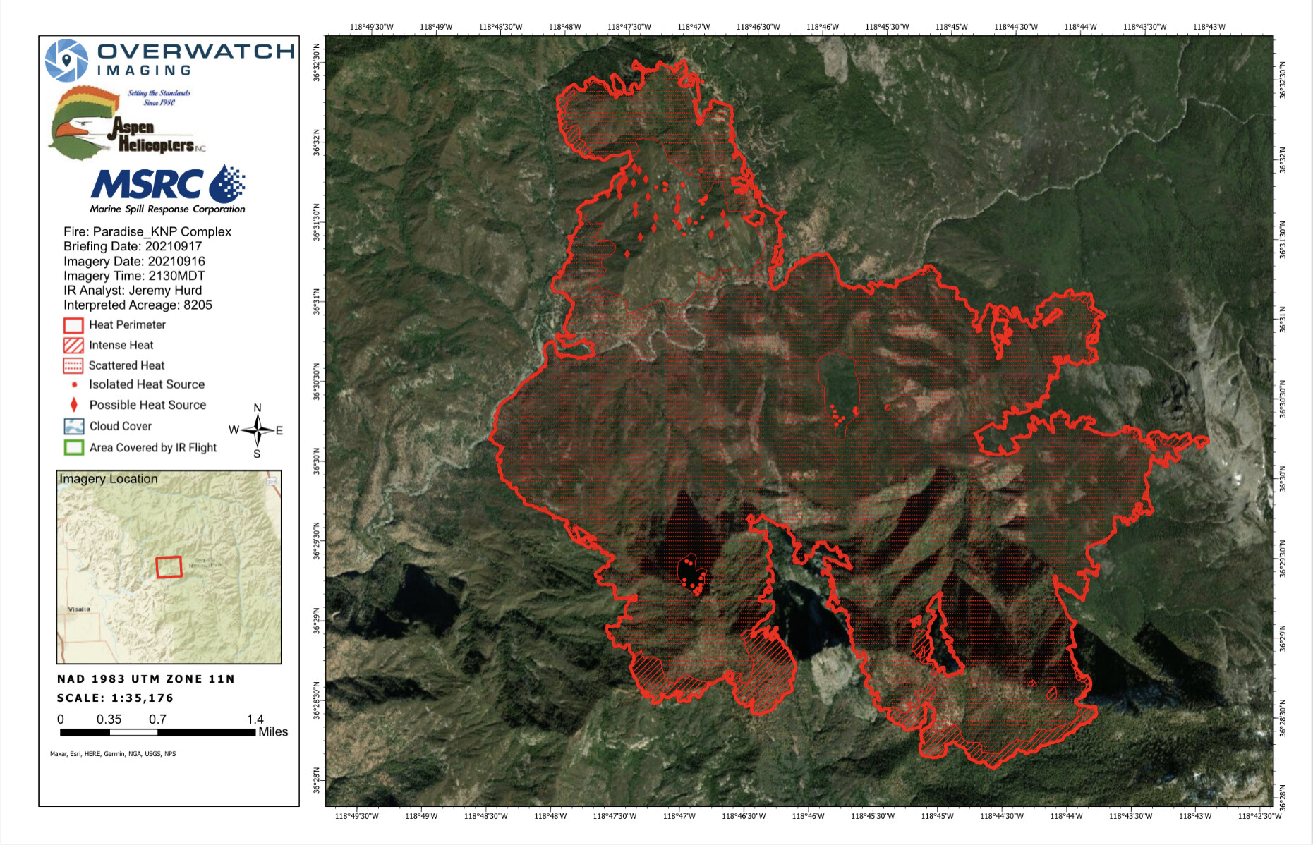
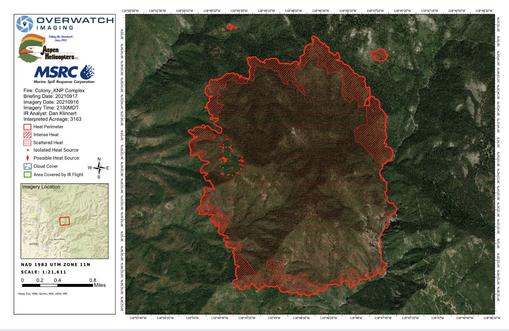
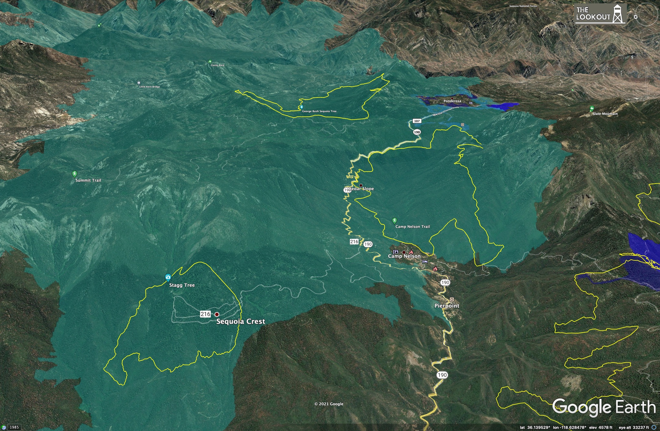
Looking for last nights IR map. Does the Blue Team have a Drop Box? Can’t find this incident on FTP.
Any IAPs for this fire yet? Seems odd that after 9 days I haven’t seen one.
Not all Fed Teams post their IAPs.
4 Likes
SBC 9322C enroute B11,E315,E314,E331,E332,E323
1 Like
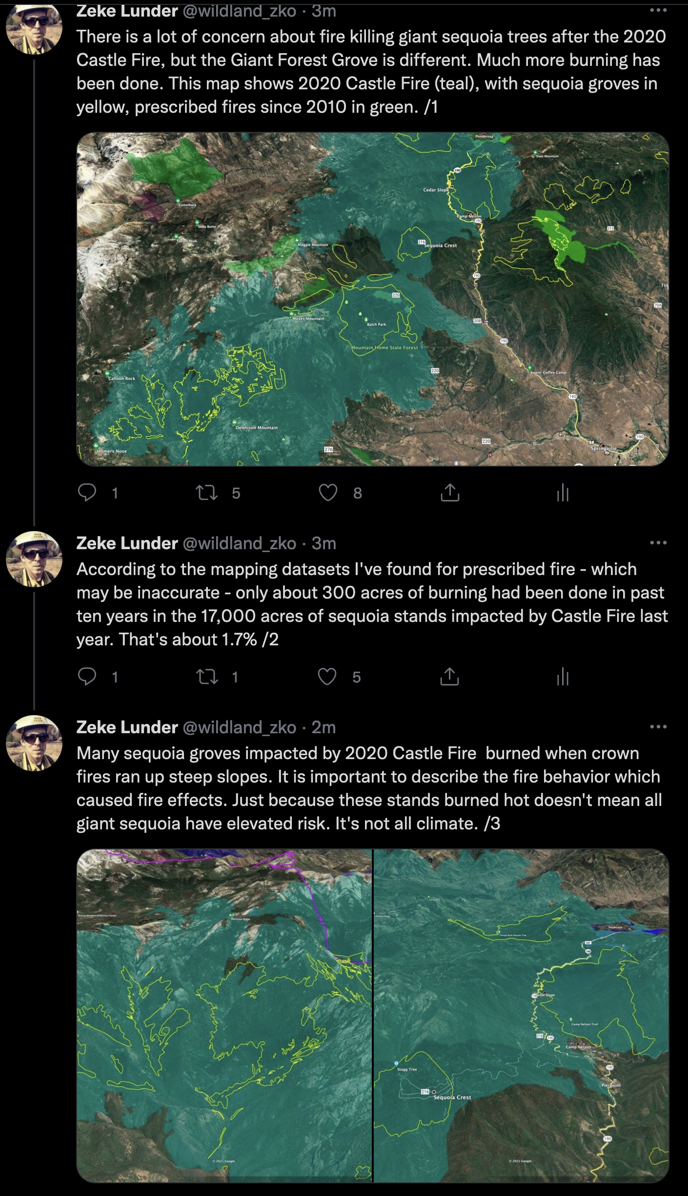
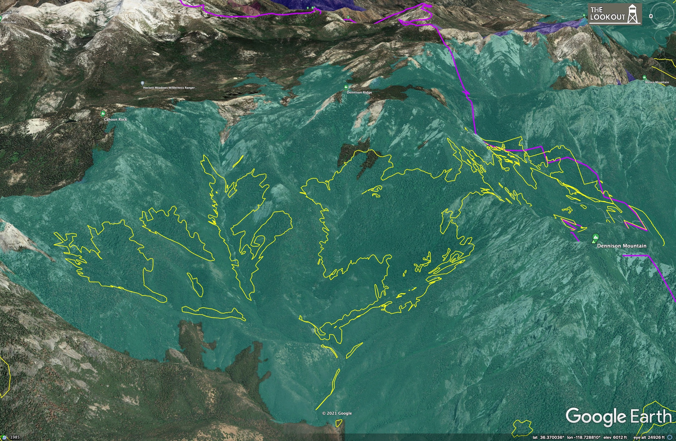
On another topic, I just wrote a little bit about sequoia mortality during Castle Fire. I don’t know the ground at all, and am not trying to become an instant sequoia expert, so I’d appreciate any feedback on this from people who know a lot more than I do. Just some observations based on maps.
5 Likes
The NPS has some excellent datasets on the SQX mortality using extrapolations and how they got their rough estimates on mortality for trees with >4’ diameter. Yet, slope, aspect and existing tree mortality did not seem to fit into the discussion. When the SQX approached Dennison it already seemed obvious which sections of groves would be the most impacted. The north side of Dennison faired the best, had healthier trees with far fewer fuels on the ground with a more closed canopy / more mature stands - with the exceptions of some brushy drainages. Freeman’s, parts of Dillonwood, and Homers Nose/ Board Camp are on steep South facing slopes with ladder fuels and some of the densest standing dead cedar and fir I’ve ever seen, in any forest. There’s an enormous degree of variability between groves.
5 Likes
In contrast, the sequoias of Giant Forest have seen regular prescribed burns for several decades now. The Muir Grove in GF is in a very different situation than, say, the ill-fated grove in Dillonwood.
2 Likes
I just looked at the IAP and there are no control objectives. Normally you have management and control objectives for a fire and it helps guide everyone. Without control objectives the IC/Park/Ops must be in management mode only with no real desire or hope to control the fire. Any ideas from the group?
5 Likes
I am on the fire. Briefings consist of “we are looking for options. And priorities. No box. ie, keep the fire f D out of, west of, etc. all I. An say is it’s a good thing it isn’t August, we would be losing a ton of structures.
7 Likes
Am I seeing the map wrong on the FB briefings? The divisions look like they’re backwards on the fire. And can anyone expand on the purpose of the “groups” listed on the map as well?
1 Like