
State ID: CA
3 letter designator: LMU
Fire name: GOLD
Location: Hwy 139 at County Road A2
Reported acres:
Rate of spread:
Report on Conditions: Now Per AA
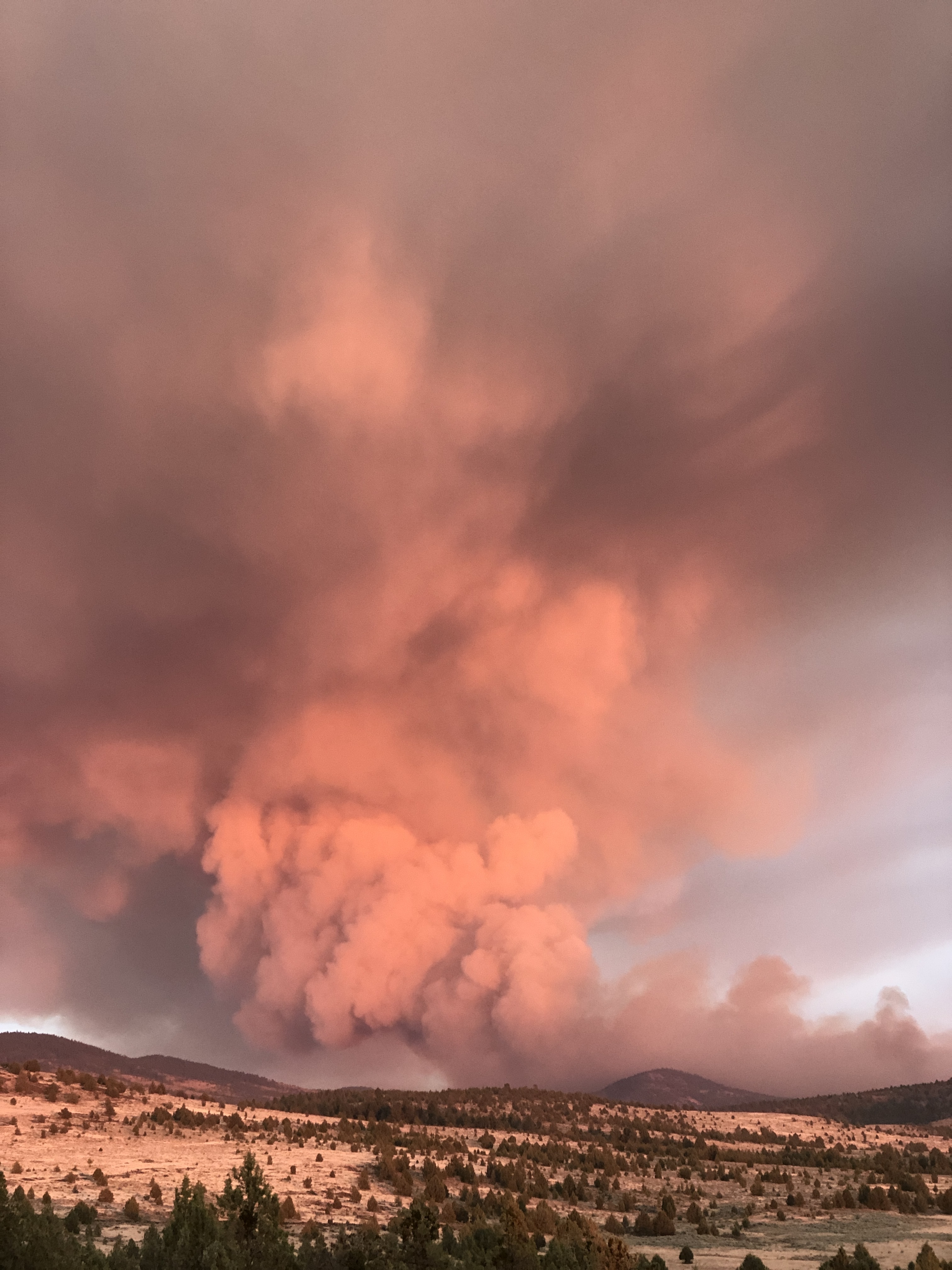
Northern Fire is 200-300 acres
Southern is 100 acres. “probably going to 1000”
Structure threat:
Resources:
Hazards:
Weather:
Radio channels:
Scanner link: https://www.broadcastify.com/listen/feed/33223
Webcam link: http://www.alertwildfire.org/northcoast/index.html?camera=Axis-ShafferMtn&v=81e003f
Agency Website: https://www.fire.ca.gov/incidents/
2 Likes
As of 1800 the fire is 2500 acres and Capping out.
5 Likes
T-161 out of Oregon and T-101 out of Nevada are now assisting with this fire.
3 Likes

4000 acres per AA
2 Likes
IMT4 activated
5 Likes
Fed or state?
It is the State IMT4.
4 Likes
4600 acres
5 Likes
Calfire Incident page 0700 update puts it at 4500 and 0% this morning.
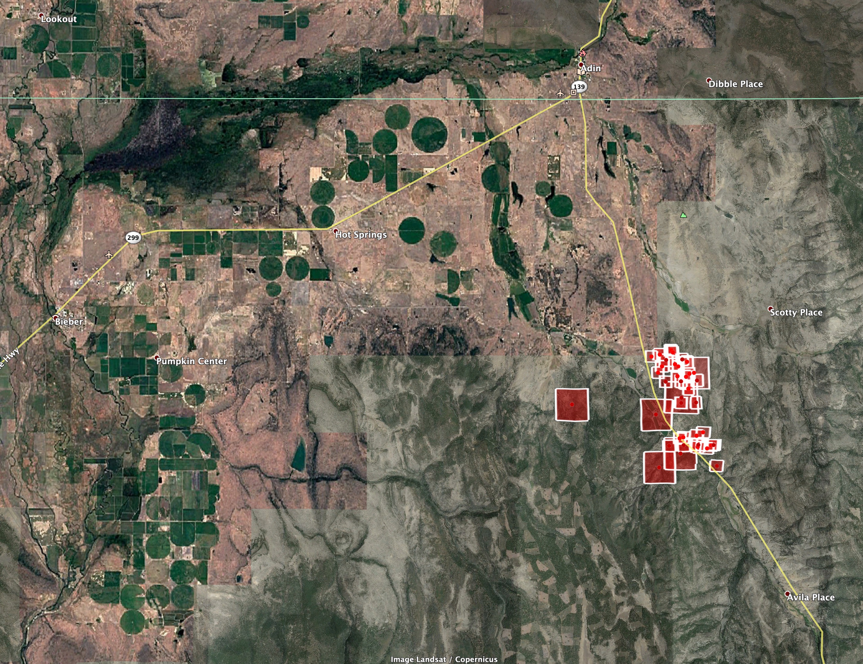
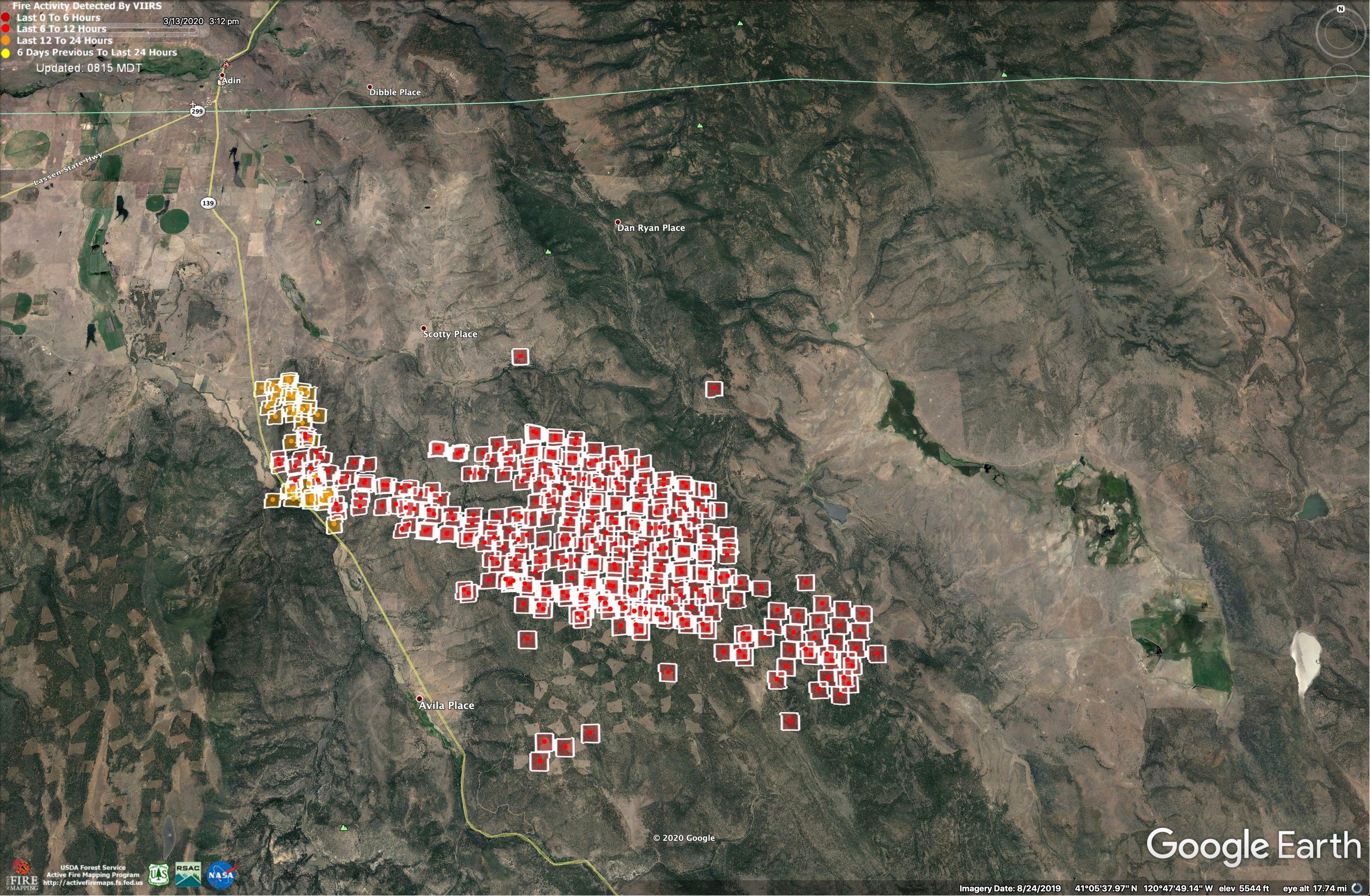
Here is VIIRS data for the fire from about 0300 on 7/21/2020.
It shows the fire being 9 miles long.
Accuracy is uncertain for any of the outlying pixels.
7 Likes
XAL 2003-C heading to the Gold Fire
3 Likes
Per North Ops News and Notes:
14,000 acres grass and timber, 5% contained. Fire burned actively overnight and made significant runs. There is a continued structure threat with evacuation orders and warnings in place. Cultural lands, Commercial timberlands, and Willow Creek Campground is threatened. HWY 139 is open with traffic control in place with other road closures in the area. The Red Flag Warning remains in effect for the fire area.
IR Map:
3 Likes
If you have ATAK running I have a Data Package built.
https://drive.google.com/drive/folders/1GuY-MVWnlo3vlM7FEiDn8Nd3H_AXMpKn?usp=sharing
3 Likes
New start near Div M, on the modoc NF
1 Like
Vlat tanker 944
4 Likes