Today’s Ops Map:
5 Likes
The amount of indirect line tells the story. Big box lots of heavy equipment must be on scene or on order.
2 Likes
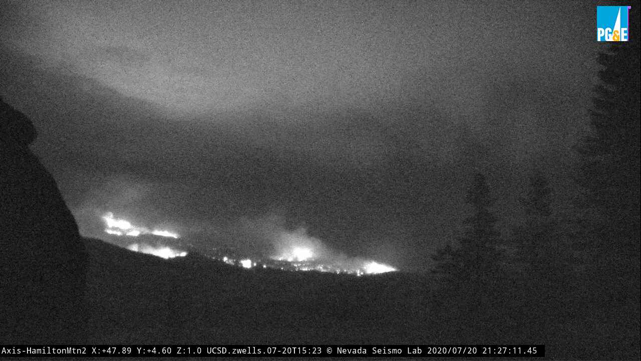
Report from the line saying there was an ugly wind shift on the southern end around midnight along Div C, that made a nice 1.25mile flank into a 1.25mile flame front, which then marched right up and over Little Fredonyer. Working towards 30N82 now with a 10acre spot this morning above Willard Ranch. This puts a large portion of Hwy36 into play.
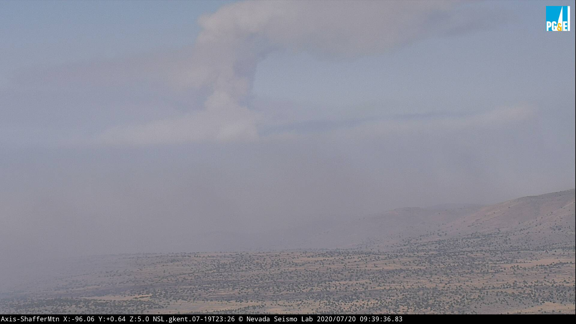
The Hamilton cameras would be 4.5miles SW of this front.
Also firing off the 36/44 corner it sounds like.
10 Likes
A post was merged into an existing topic: CA-LMU-Hog??

Projected max wind gusts over the fire today:
NAM: 16 MPH @ 11 PM
ICON: 21 MPH @ 5 PM
HRRR: 27 MPH @ 6 PM
GFS: 31 MPH @ 7 PM
ECMWF: 35 MPH @ 5 PM
NBM (Blend of all models): 18 MPH @ 7 PM
1 Like
A post was merged into an existing topic: CA-LMU-Hog??
T Storms comming the area and fire weather watches going into place. LCES!
6 Likes
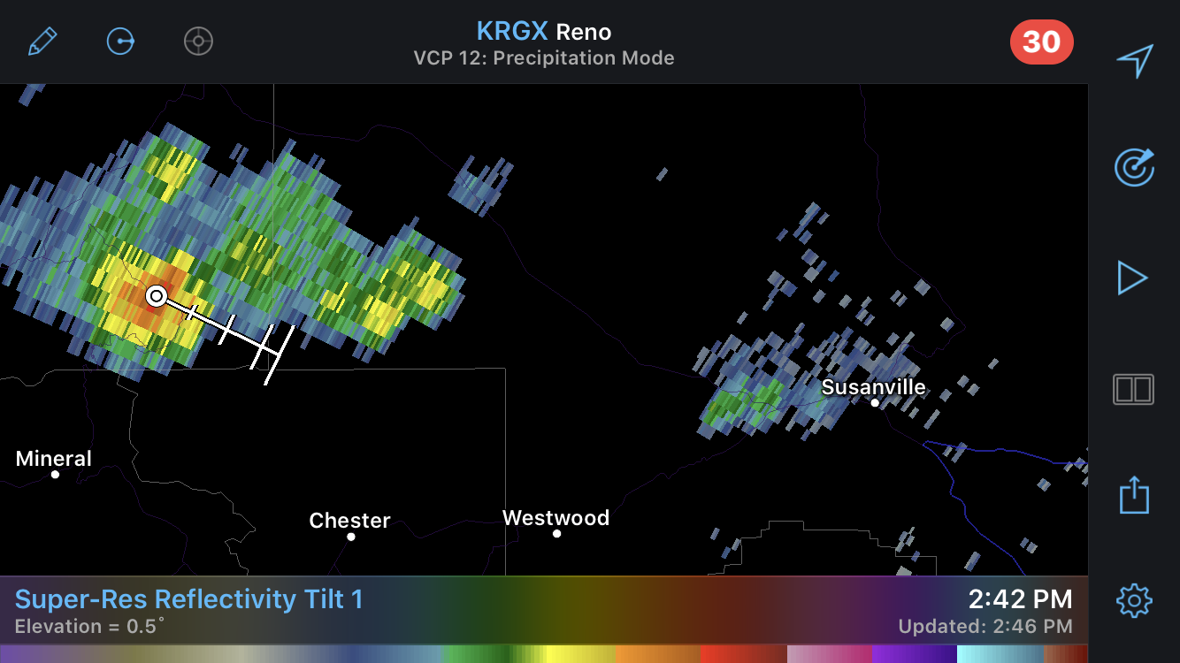
Based on radar there is a significant uptick in fire activity on the fire, also thunderstorms to the west.
Hamilton mtn cam is pointed away from the fire right now…
5 Likes
T-914 and T-137 northbound from SMX. I assume to one of the two fires in the Unit.
3 Likes
12,188 Acres - 0% Containment

Hamilton Mtn. Cam IR in the last hour shows quite a bit of wind drive activity.
Thunderstorms are bringing a lot of lightening all around the Honey Lake Valley.
3 Likes
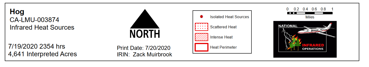
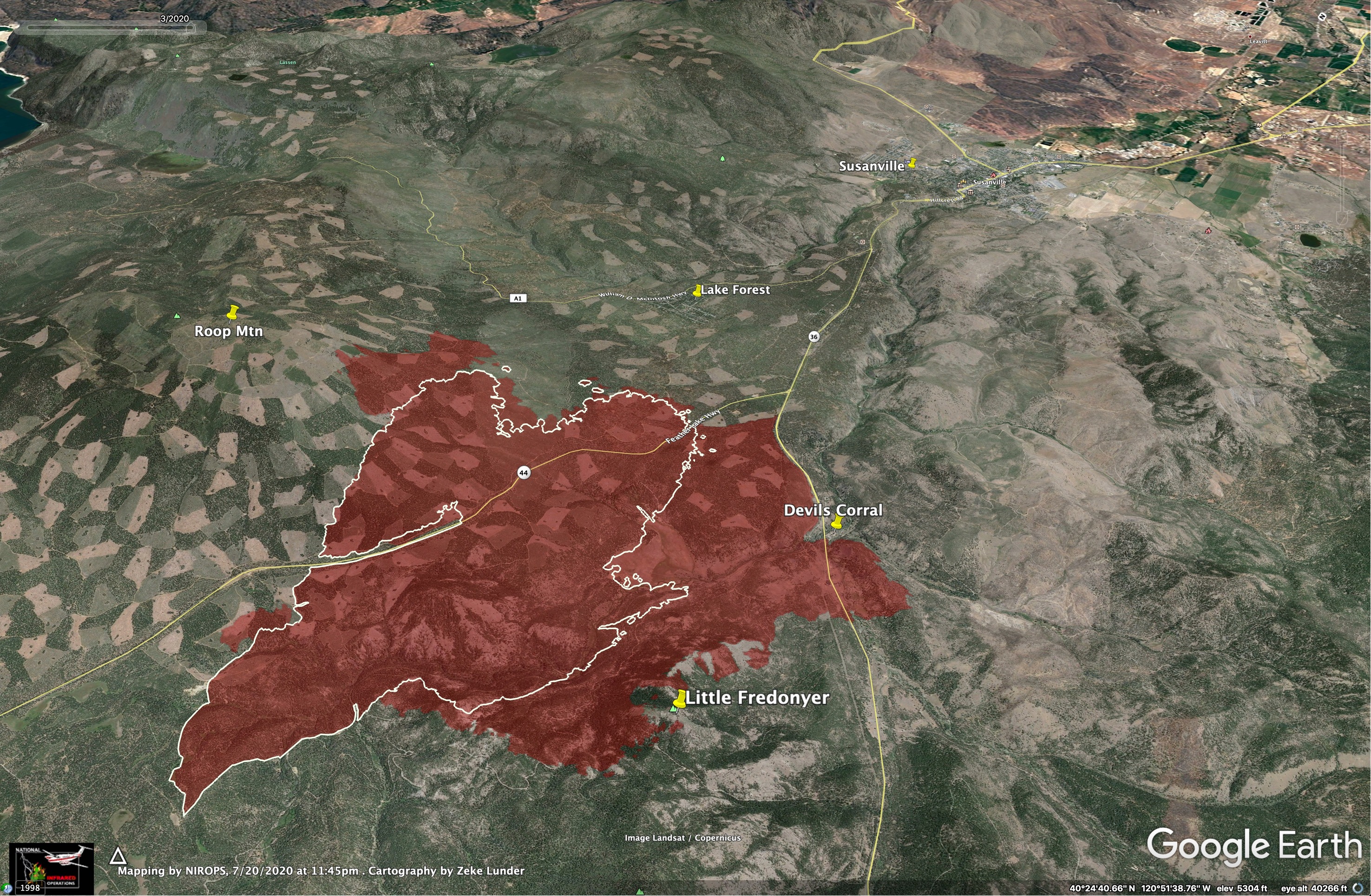
Here is last night’s IR for Hog, looking east, down the Susan River toward Susanville.
The fire crossed Highway 36 just west of Devils Corral yesterday evening.
The white line shows 24 hour growth.
There was minimal growth on the flank directly adjacent to Lake Forest in the 24 hours before this mapping.
The fire made a run farther up Roop Mountain yesterday, but the majority of fire growth has been on the south side.
7 Likes
XCC 2025C in route
Contra Costa County, San Ramon, Crockett and a fifth Type 3 Engine from Palo Alto
3 Likes
OES 2870/C and 2002/C from XAL sent out last night at midnight.
1 Like
from NOPS 7am update: 8,000 acres timber, 5% contained. Fire acreage has decreased due to better mapping of the incident. Structures remain threatened and Evacuation Orders remain in place. Highway 44 is closed east of Susanville. Roop Mountain Communication Site, private and Federal timberlands are also threatened. Cal Fire Incident Management Team 3 (See) is in command
3 Likes
Some video from Tim Walton on Twitter of the fire crossing HWY 36 last night.
7 Likes
[quote=“SierraDon, post:76, topic:12412”]
Highway 44 is closed east of Susanville.
[/quote] East??–shouldn’t it read west? (I realize Don just quoted the ONCC report, where it is listed as east.)
1 Like
Structure loss at the end of that video
I just got a scanner feed online. Lassen County Fire - Special
9 Likes