State ID: CA
3 letter designator: LNU
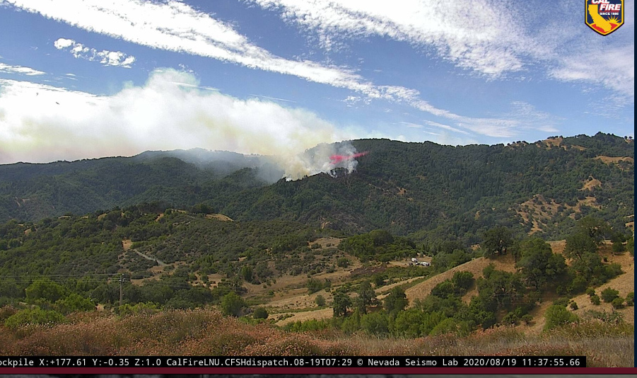
Fire name: Wallbridge
Location: West of Healdsburg, North of Forestville
Reported acres: 1,500
Rate of spread: Moderate to Rapid
Report on Conditions:
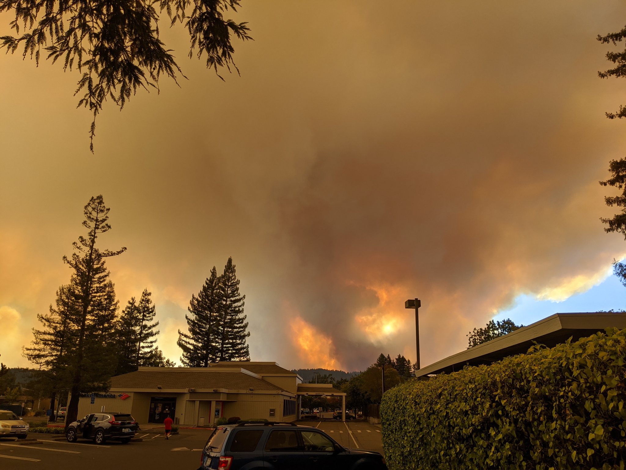
Structure threat: Structures are threatened; Evacuation Orders are in place
Resources:
Hazards:
Weather: Projected continued hot and dry with Northwest wind
Radio channels: Command: CDF Command 6; Tactical: CDF Tac 24, 26
Scanner link: https://www.broadcastify.com/webPlayer/14279
Webcam link: Geyser Peak
Agency Website:
5 Likes
On the Cal Fire website this fire is rolled in with the LNU lightning complex.
Current evacuation orders here -
https://experience.arcgis.com/experience/8ca8296b14384a468c72e63fd6de766a
I believe this is the Stewarts Fire, Dont know much about it but they are trying to keep it under 20 Acres
Sounds like they are having trouble filling ground requests. (like all fires).
Crews are prepping the Mt Jackson repeater for a repair crew to come in. Must have gotten damaged.
I think I heard three type one copters were headed to this fire
2 Likes
Active structure defense at the 10000 block of Mill Creek Rd…Crews requesting PGE to shut off power in the area
5 additional type 3 tankers headed to this fire
AA 140 has to land for pilot swap
1 Like
Judging by tactical traffic, and looking at the cams it’s starting to push to the East
1 Like
There were brief talks about extending evacuations orders to Healdsburg. Fire is currently at Big Ridge Rd making a push east. Limited resources.
1 Like

Diverting AA 140 to to assume Southern AA in Vacaville - Also diverted 2 tankers to a new start in Redwood Valley.
1 Like
Early this morning smoke was to the south. After lunch it had twisted to the east. Assume the push now would be towards Healdsburg and Windsor. Evacs are now up to their city limits.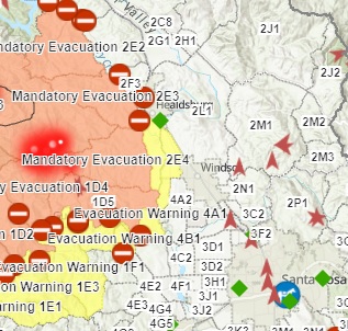
There is about a mile wide valley that is mostly vineyard in between the fire and Healdsburg, and Windsor it’s about 2 miles from the hill to town with Vineyards and a river
3 Likes
Healdsburg and Windsor sure have had their share of fires the past couple years.
1 Like
1/2 to 1/4 mile spotting along mill creek.
Yeah, well tell that to Vacaville. Plenty of plowed fields and whatnot along Pleasants Valley Rd.
2 Likes
Just heard they want to extend Evacs into Healdsburg. this will be up to the City of Healdsburg but it sounds like they are working on a plan. Unknown if it is a Warning or an Order.
2 Likes
The evacuation was expanding to a warning for the entire Dry Creek Valley, from Healdsburg to Lake Sonoma. The prior zone was the roads bordering the Valley to the West. If the fire reaches the road, it’s necessary to prepare Dry Creek to catch slopovers in the vineyards.
1 Like
How long do you guys think til the fire gets to these areas. Tough getting info. Might be able to make it to that area tomorrow to help
If you’re not ordered through the system, might not be a good idea to just show up “to help”.
9 Likes