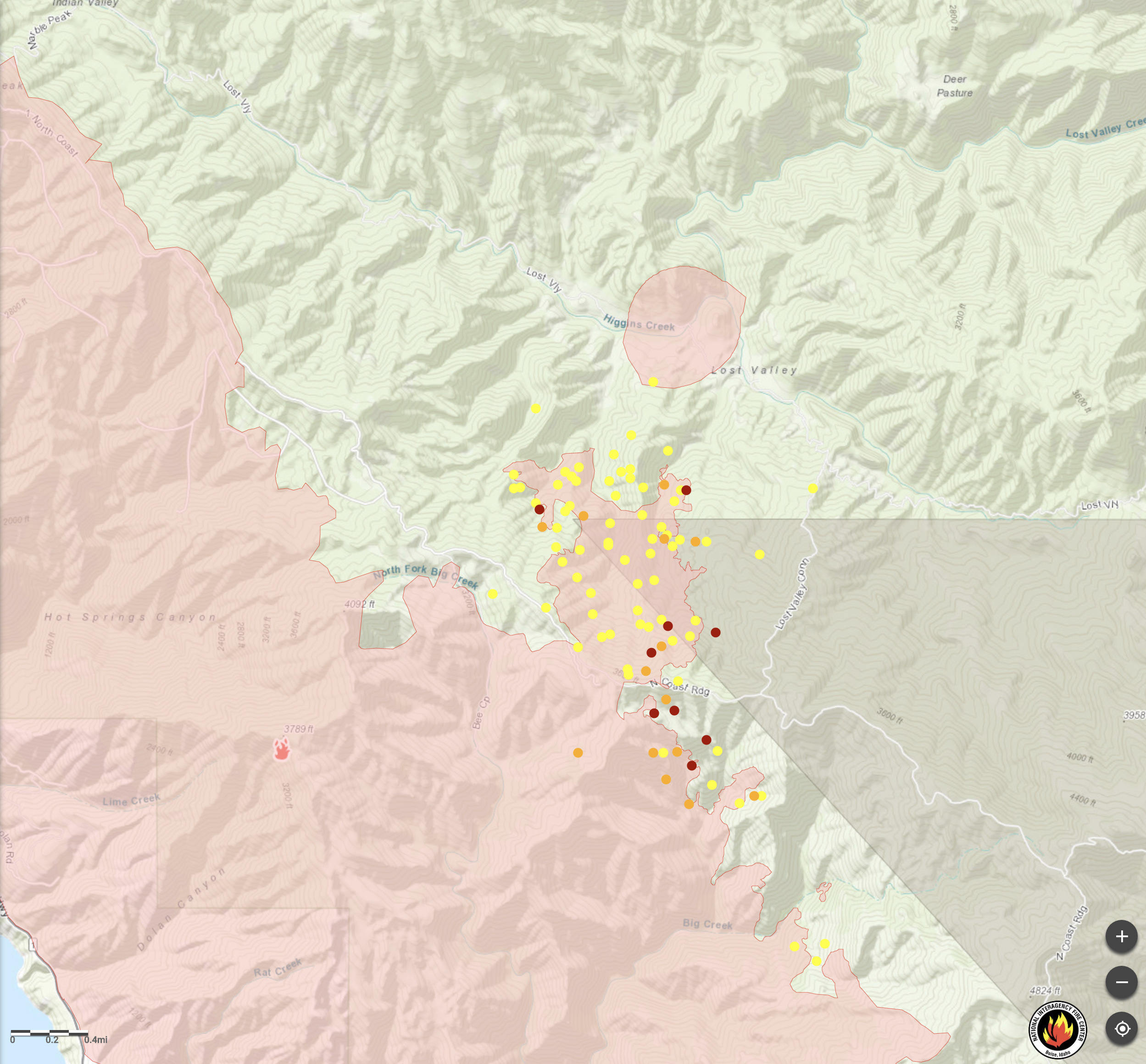
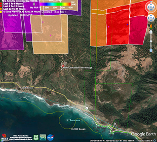
NWCG showing more heat today. Based on the terrain I’m going to agree that this is accurate. Division 1 texted me yesterday and said the fire had grown and was established over Ridge and into Lost Valley. https://maps.nwcg.gov/sa/#/%3F/%3F/36.1395/-121.5767/14
3 Likes
The slop over on the ridge is real. The spot at the bottom of Lost Valley now has “? NIROPS Error” written next to it on latest public information maps.
4 Likes
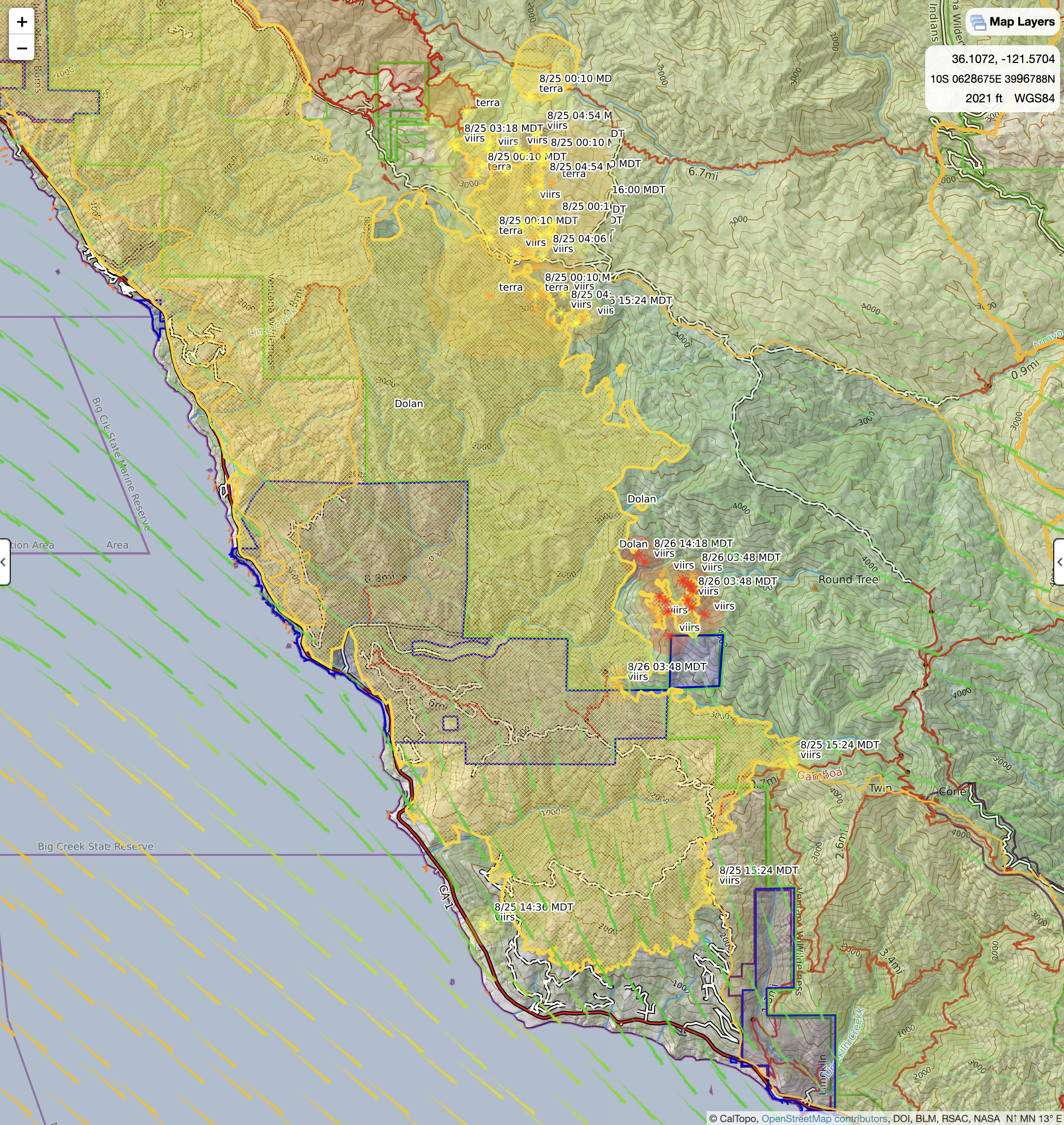
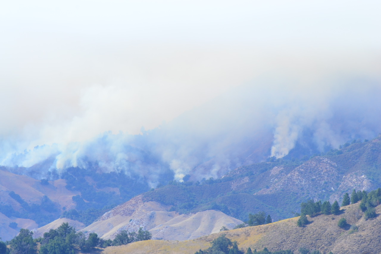
I subscribe to CalTopo. I look on NWCG and I also download MODIS from NWCG to Google Earth. I’ve seen two passes of satellite which both show heat on both Lost Valley and Upper Devils Canyon. Kate shared a column today on her page which showed a pretty decent column with no wind on it (topographical run). My guess is that it was Partington Ridge but I cannot confirm that. I did not read anything about doing any fireline burn ops for fire objectives. Hopefully we will get more info from the Dolan Incident.
1 Like
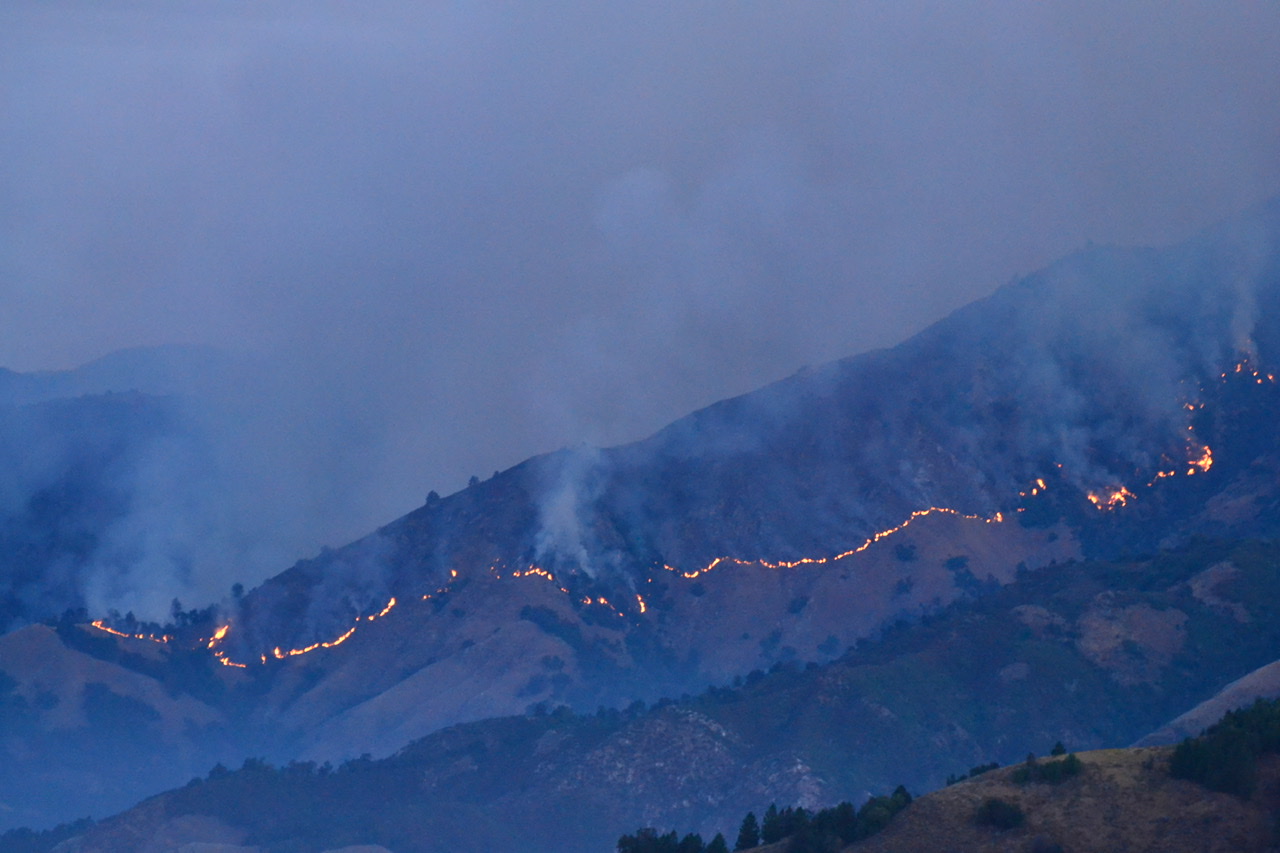
We watched it all night from the river fire, had a decent glow last night and a pretty early column building at 0600
2 Likes
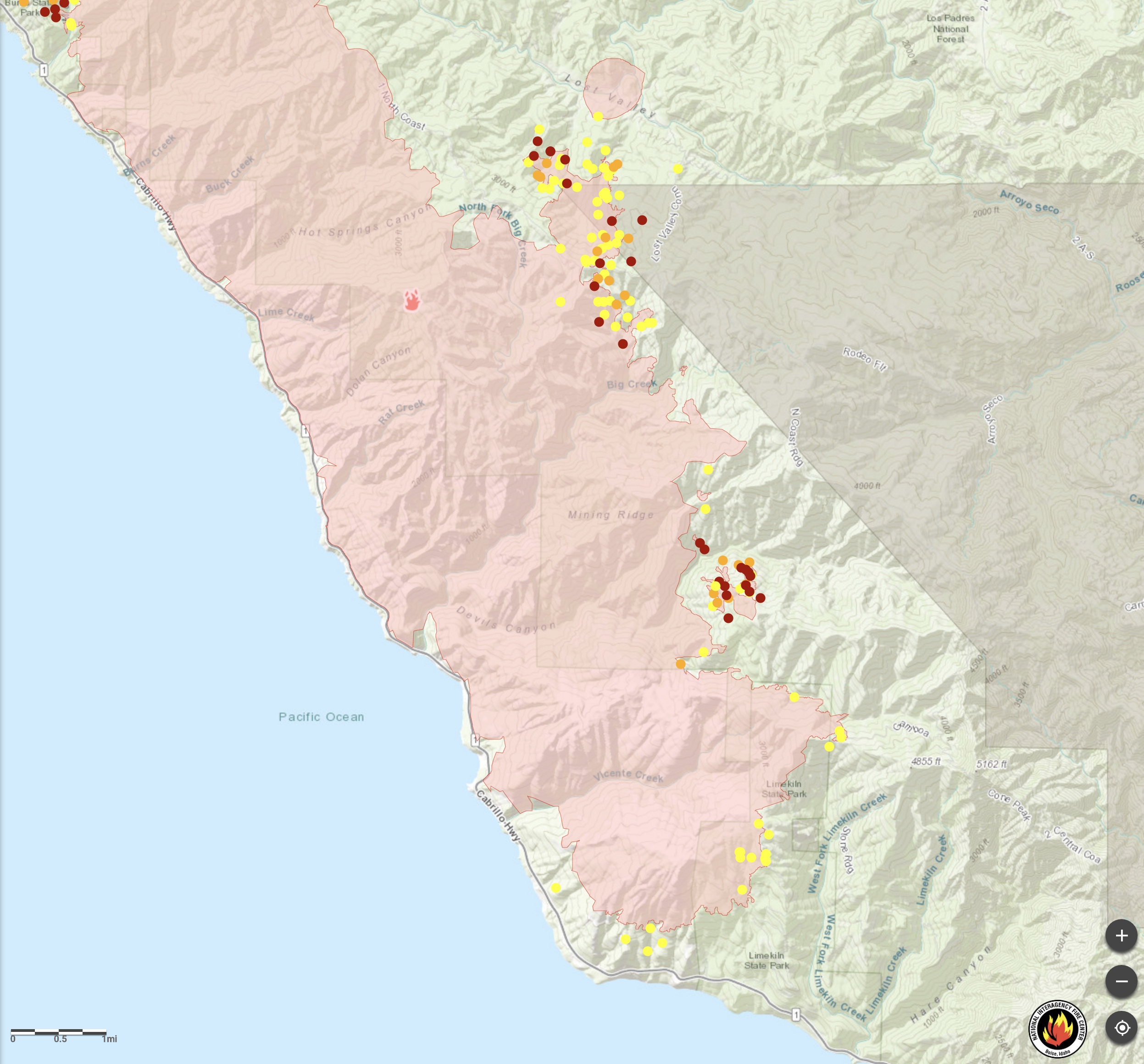
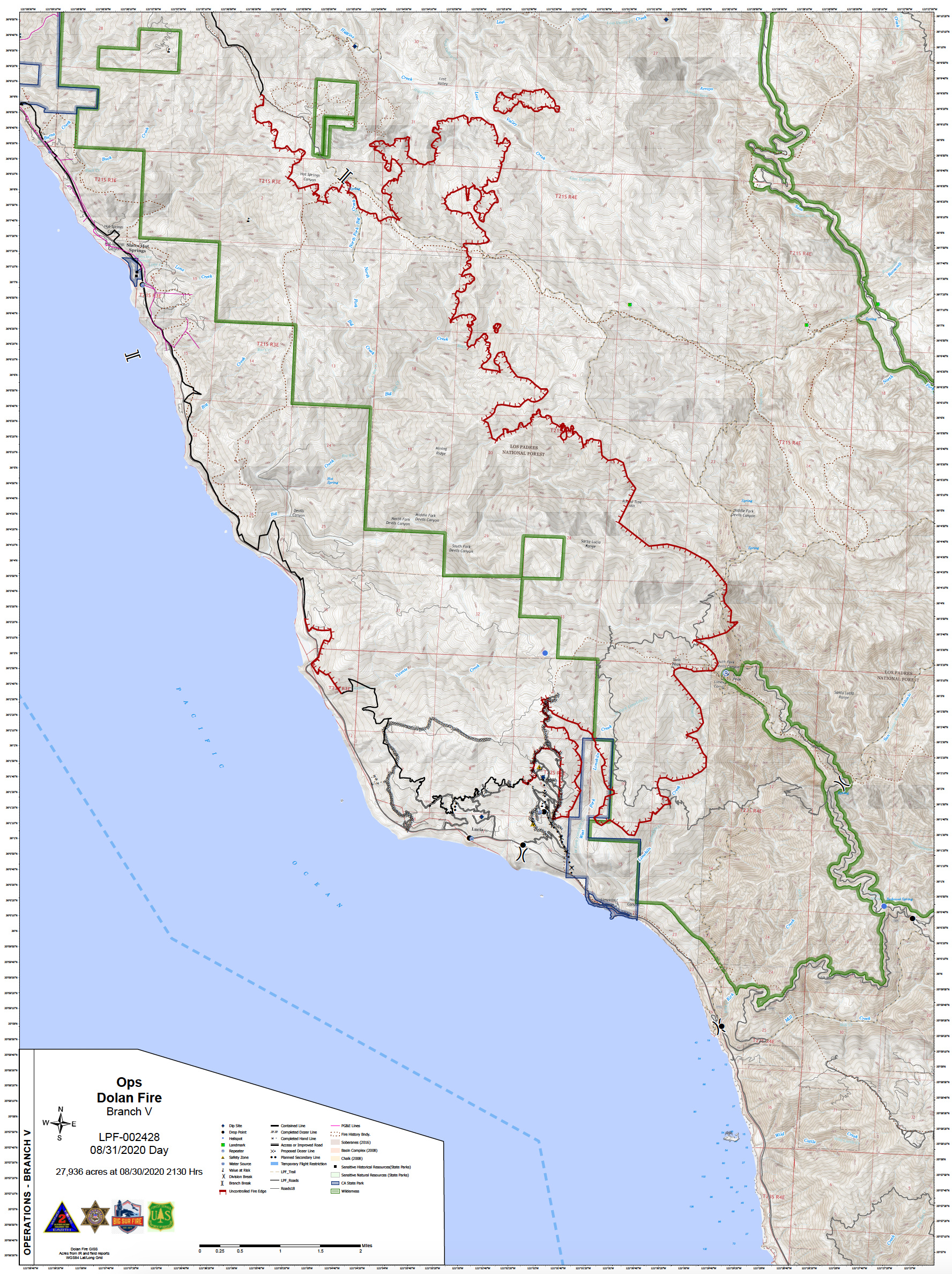
The south end of the fire has crossed Stone Ridge and is now burning in the Middle Fork Limekiln Creek drainage; “Limekiln Creek” on the map above. Fire lines have been built in the past along the south rim of Hare Canyon and that is probably the next feasible place to stop southward progress.
3 Likes
Big Sur Kate has some pretty impressive photos of the area BEUBackcountry is referring to. Hopefully she posts because her pictures confirm the fire established all over upper slopes of both sides (north and south) and backing down into Hare Canyon now. Also noted a large single wift of white smoke lower on a slope (West Fork Limekiln) with vehicles around it which puts it on a private road (maybe Hermitage) in or around Limekiln State Park. Unknown if they are firing or if there was a spot there.
4 Likes
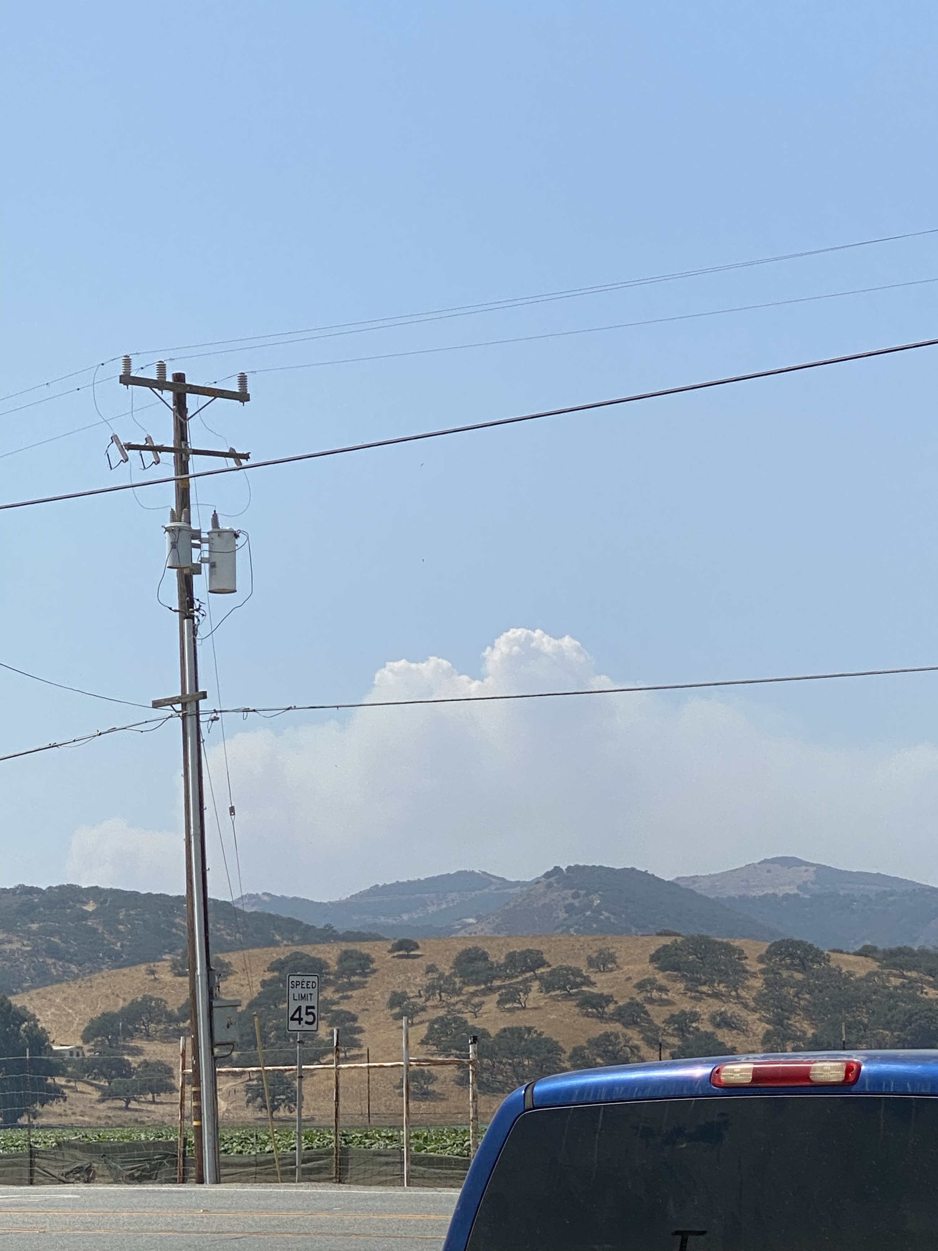
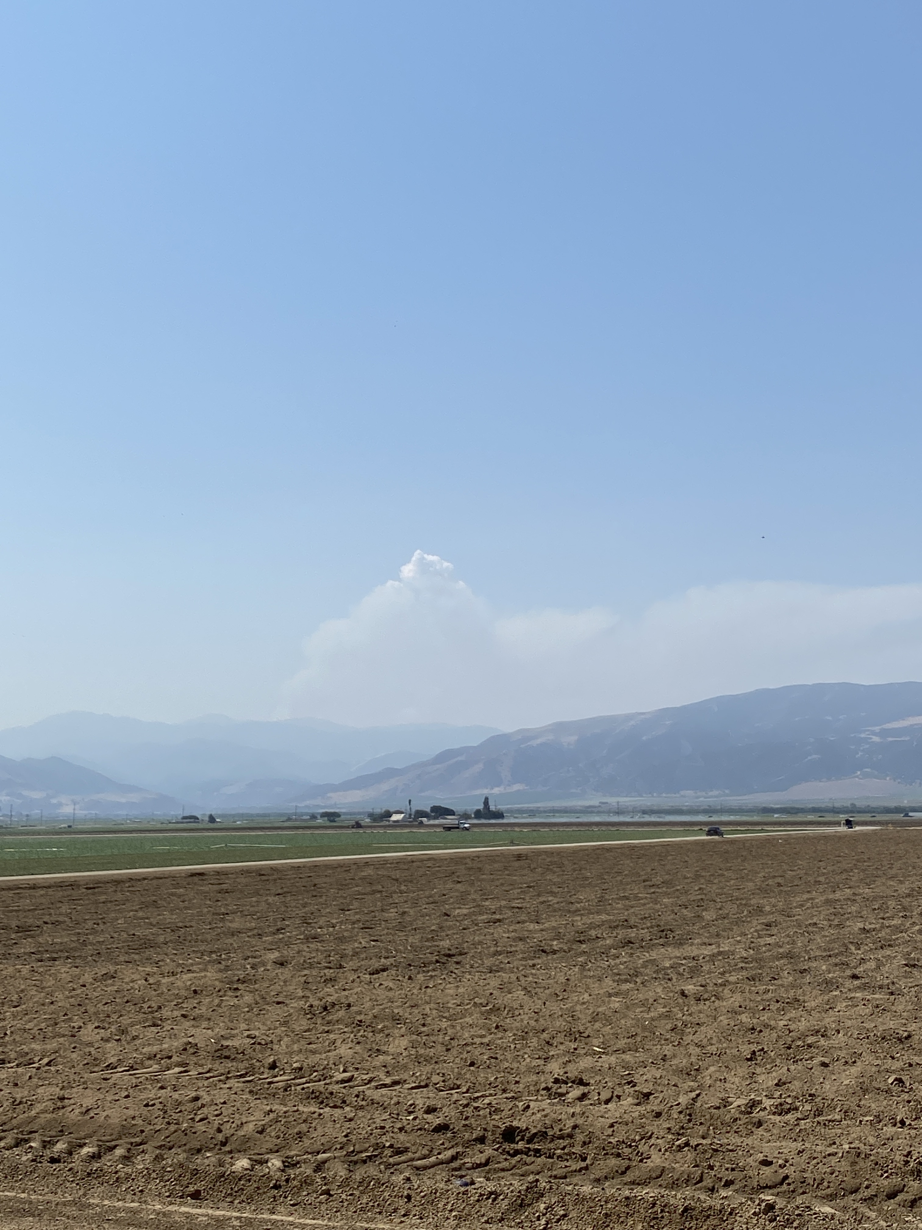
BEUBackcountry, here are a couple photos heart4paso asked me to post. I have eyes on it from my place.
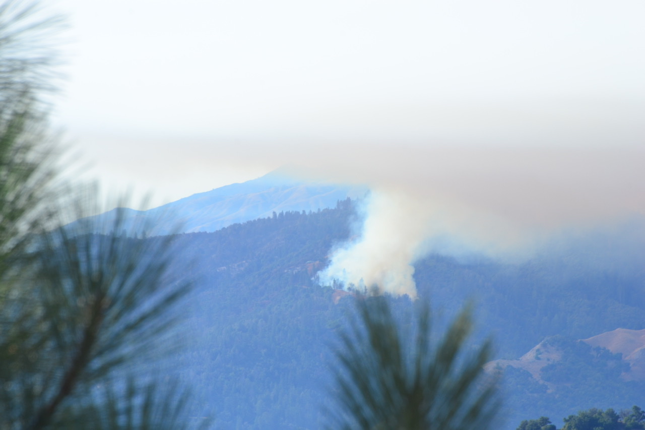
12 Likes
4 Likes
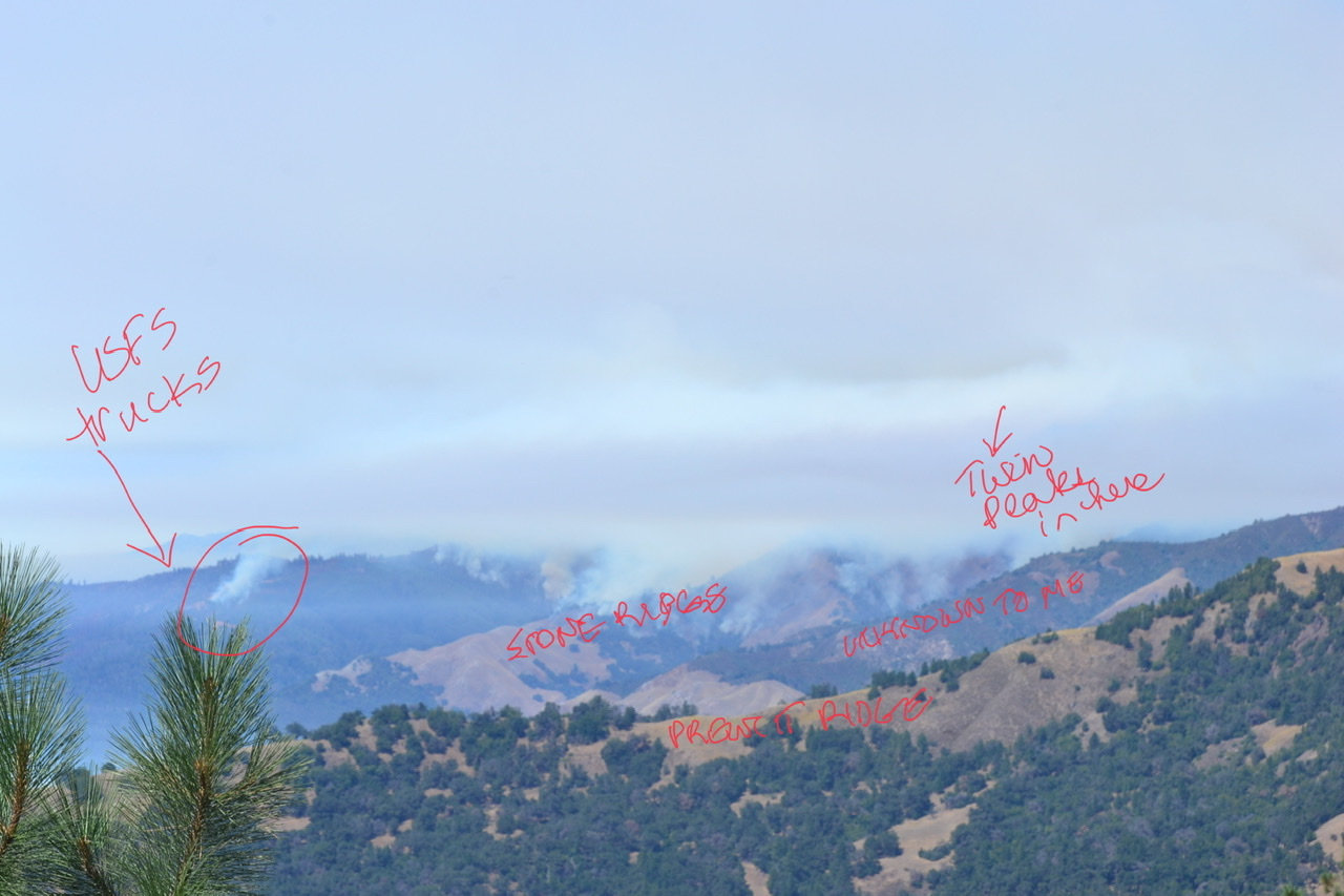
Thank you BigSurKate for sharing your photos. Looks like the fire is about 2-3 miles from you?? Be Safe, and thanks again.
2 Likes
A little further than that. I use a 300 mm lens. Wind shift just after sunset was a surprise. Completely consumed by smoke within a minute or two. Shift is out of the N-NE, which is not good for this section of the fire. Good for the northern section to blow away from Partington.
3 Likes
LPF sending strike team 1653C immediate need to the fire, reporting location pacific Valley Station any updates on fire?
3 Likes
IMT2-Pacific Northwest is taking over the fire Thursday. There is talk of a burn out today or tomorrow on the south end. My guess is along Nacimiento Ferguson and possibly Cone Peak road or portions of it. Lots of smoke in Paso Robles today. Branch I showed the line being pushed between DP10 and DP17 on OPs map. Branch V has a lot of open fireline on east side but the west side along hwy is looking mostly secure. Fire is still moving slowly northeast towards Arroyo Seco with a spot out front of the head. Have seen a little fixed wing support coming out of Paso Air Base throughout day. Nacimiento Ferguson has a hard close since two days ago. Possible evacuation order to the south coming soon.
6 Likes
Type I STEN demobed from this incident this morning and back in so cal.
1 Like
As you probably know, evacuation order came for south of Nacimiento and west of South Coast Ridge Rd. Specifically for Alm’s Ridge and Prewitt Ridge
4 Likes
Is this from Jolon?