You can only do what you can do with the resources you have. Best to secure what you have than to lose it all. Easy to come up with plans sitting on the sideline, I trust those out there punching that line in
6 Likes
Looks like there is a new start on the La Panza 1 camera at 236 degrees…
2 Likes

It that a calm b4 todays storm we’re seeing & if thats another start on the other LaPanza cam it certainly doesn’t help matters!?
5 Likes
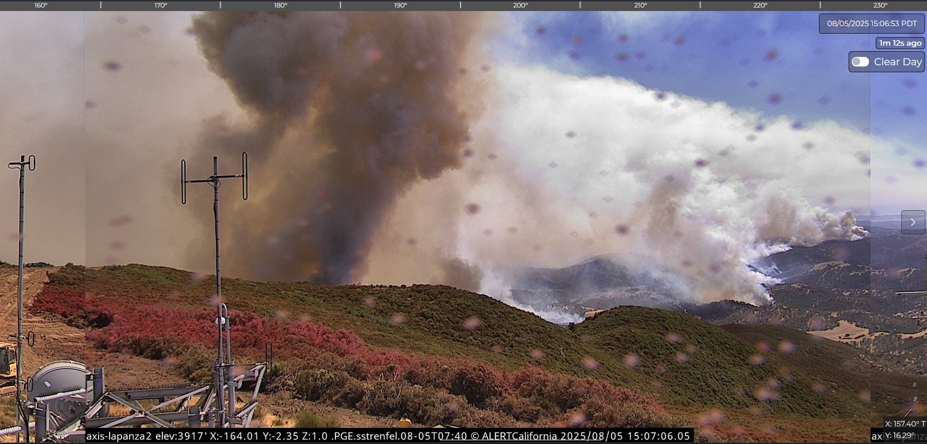
Both Pulsepoint and Watch Duty are reporting the smoke as a new start. Watch Duty reports forward progress stopped at 5 acres.
6 Likes
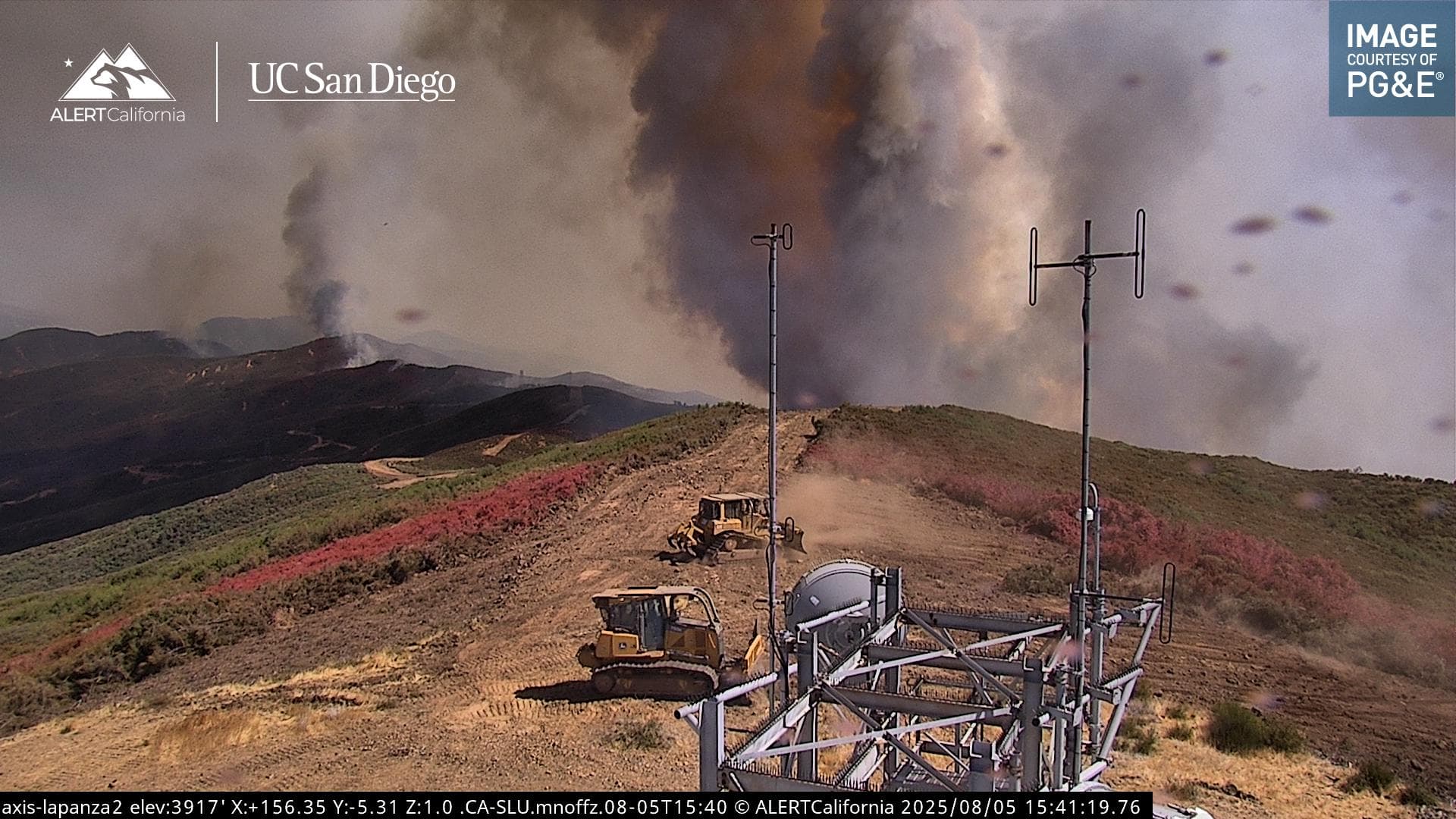
They came back up and started widening the site, one CF dozer has gone back around the access road and is working a new line North.
6 Likes
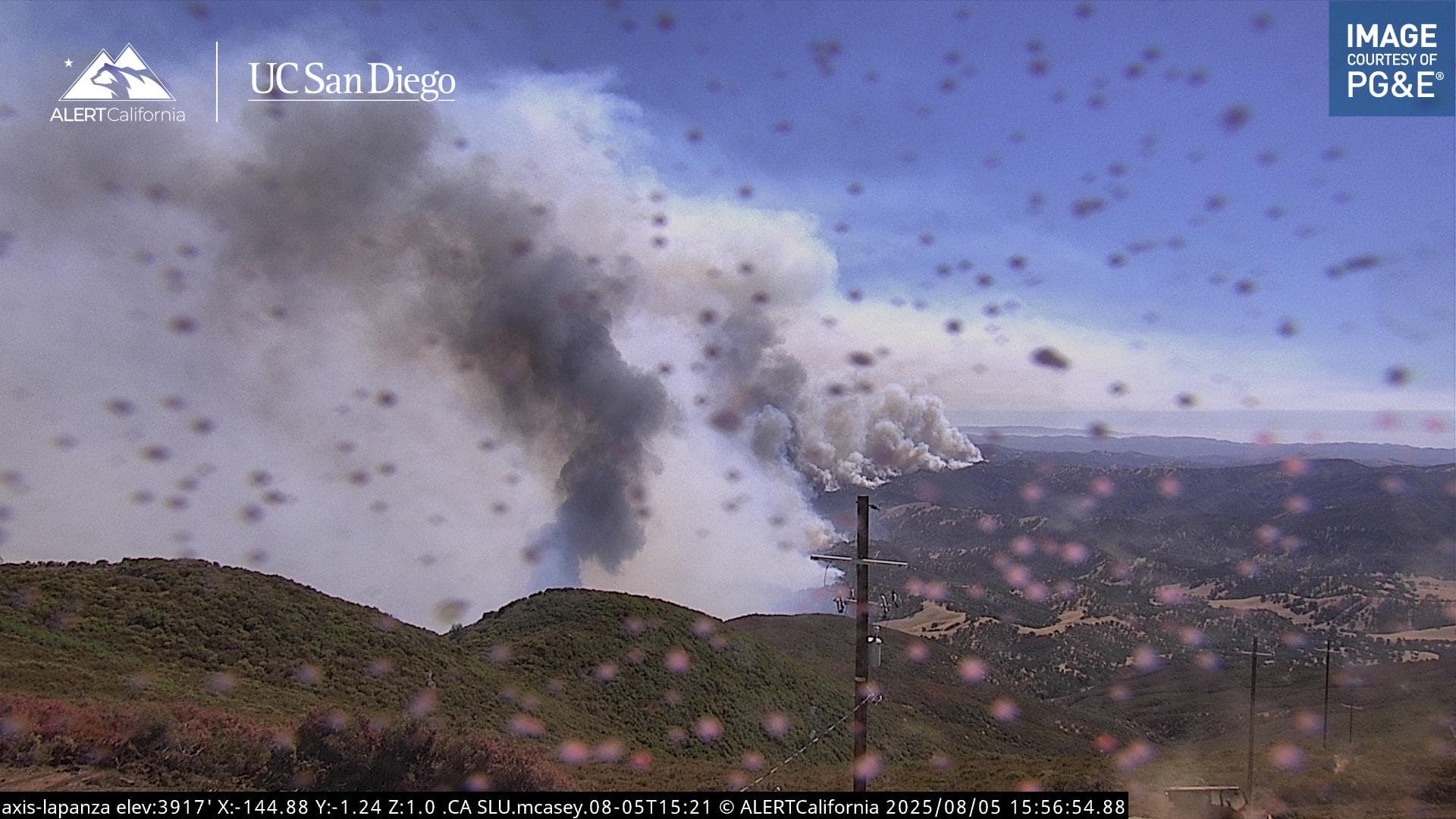
Is the fire still burning southeast towards the San Rafel Wilderness area?
1 Like
The lion is out of the den.
The fire is making a run at the dozer line constructed on the main ridge now:
6 Likes
Yes, the fire has entered the wilderness area.
2 Likes
The top of that knob looks to become a rather un-nice place to be soon. Hopefully the Catskinner’s & troops can pull back to a better place while the fire does what it’s trying to do..
2 Likes
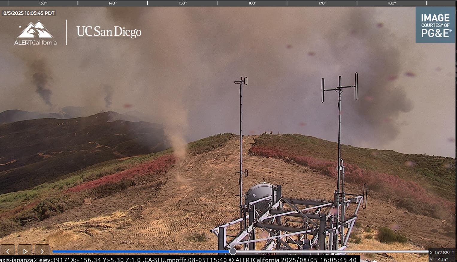
The ones that will come later will be filled with Fire. Very nice indicator of the “we might be too close” paradox.. ![]()
4 Likes
The fire has now been mapped at 83,932.5 acres by Intel aircraft. Their perimeter is visible on the Watch Duty map under the Active Fire Perimeters map layer.
3 Likes
That photo sequence made the hair on my neck stand up.
3 Likes
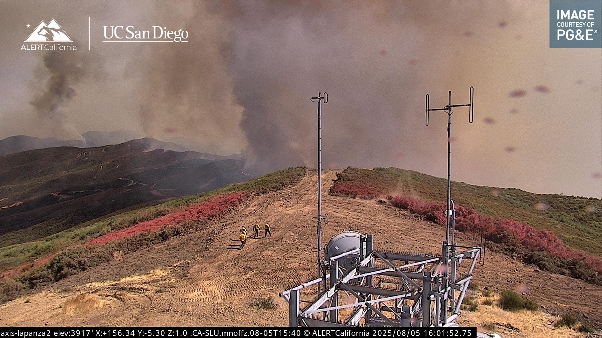
Looks like they are gonna ride it out at the tower, there’s 3 dozers, some tenders and a UTV in there
4 Likes
It breached their line on top there
6 Likes
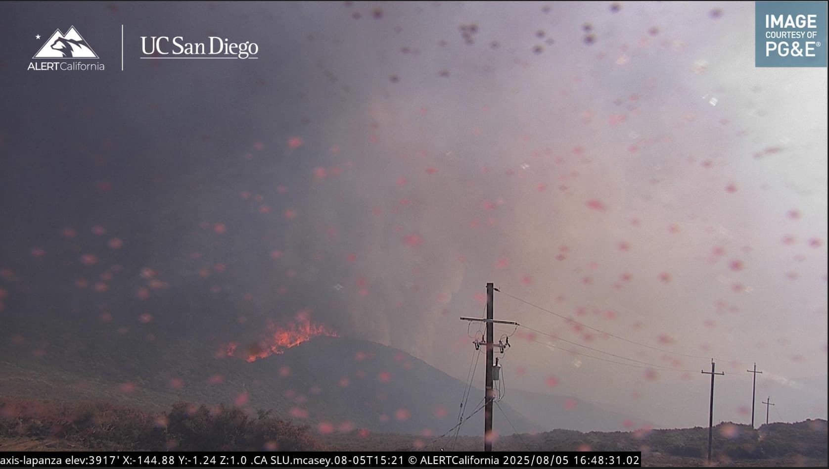
The 15 min time lapse is gnarly! You can see them retreat to the fresh-cut safety zone
7 Likes