That escalated quickly…
6 Likes
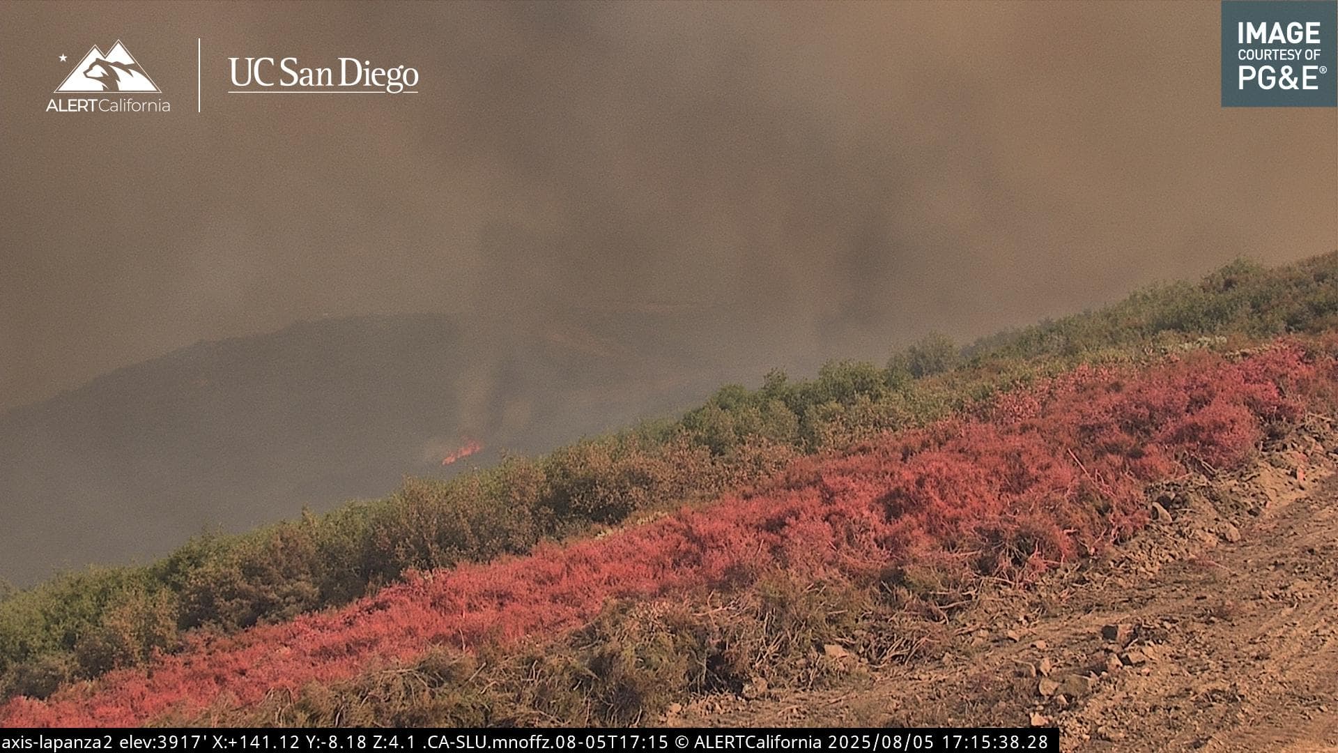
Watch the Cambria 2 cam replay which has a good view of the column and match that up to the fire behavior on the LaPanza 2. This will help link what the column is doing with the fire behavior on the ground. This isn’t something that we get to really document regularly
12 Likes
The CA Valley cam also provides a view from the East.
5 Likes
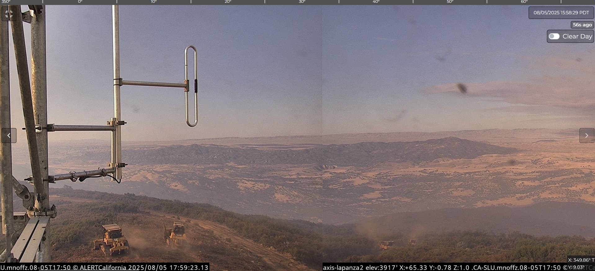
There was about 10 min (if that) from time dozers popped up out of the hole into camera view before flaming front overran that entire area and then some. #yikes!! #catskinnersarenuts!
2 Likes
Thank you Dozer Keith this goes back to the fire on fire effect I posted a couple of days ago. Couple the fact that the fire is generating a lot of smoke it takes longer for the solar radiation to reach the ground, once it does it’s off to the races. Just like folks thought the RRU fire was a done deal
8 Likes
Remember there is a time lag on that system, It wasnt as fast as the playback, but the folks in that UTV didnt use much brake on the way out of there
6 Likes
Copy that!
It felt sporty just watchin the loop of them crawlin up outta there.. #giddyup!
Edit: i was going by the minutes on the camera timestamp in the lower right corner just fyi..
3 Likes
Moving north, secondary fire camp in Santa Margarita. #calfireslo - Explore
5 Likes
Dozers diving off the North/East side
5 Likes
The webcams are adding a whole new element to the old rule about not sharing photos of people on the fireline without all of their PPE on, and we’re rapidly losing opportunities to enjoy a grand mountaintop vista whilst taking a leak.
46 Likes
I can’t help but think, after watching these cams, that SLO Co needs to update/expand their evacuation warnings and orders.
3 Likes
I can see these cameras being agency access only kinda deal in the future, But who knows.
3 Likes
They already are agency-access only, unless you mean CALFIRE agency only. PG&E, CalFire agencies, etc are only allowed to control these cameras.
5 Likes
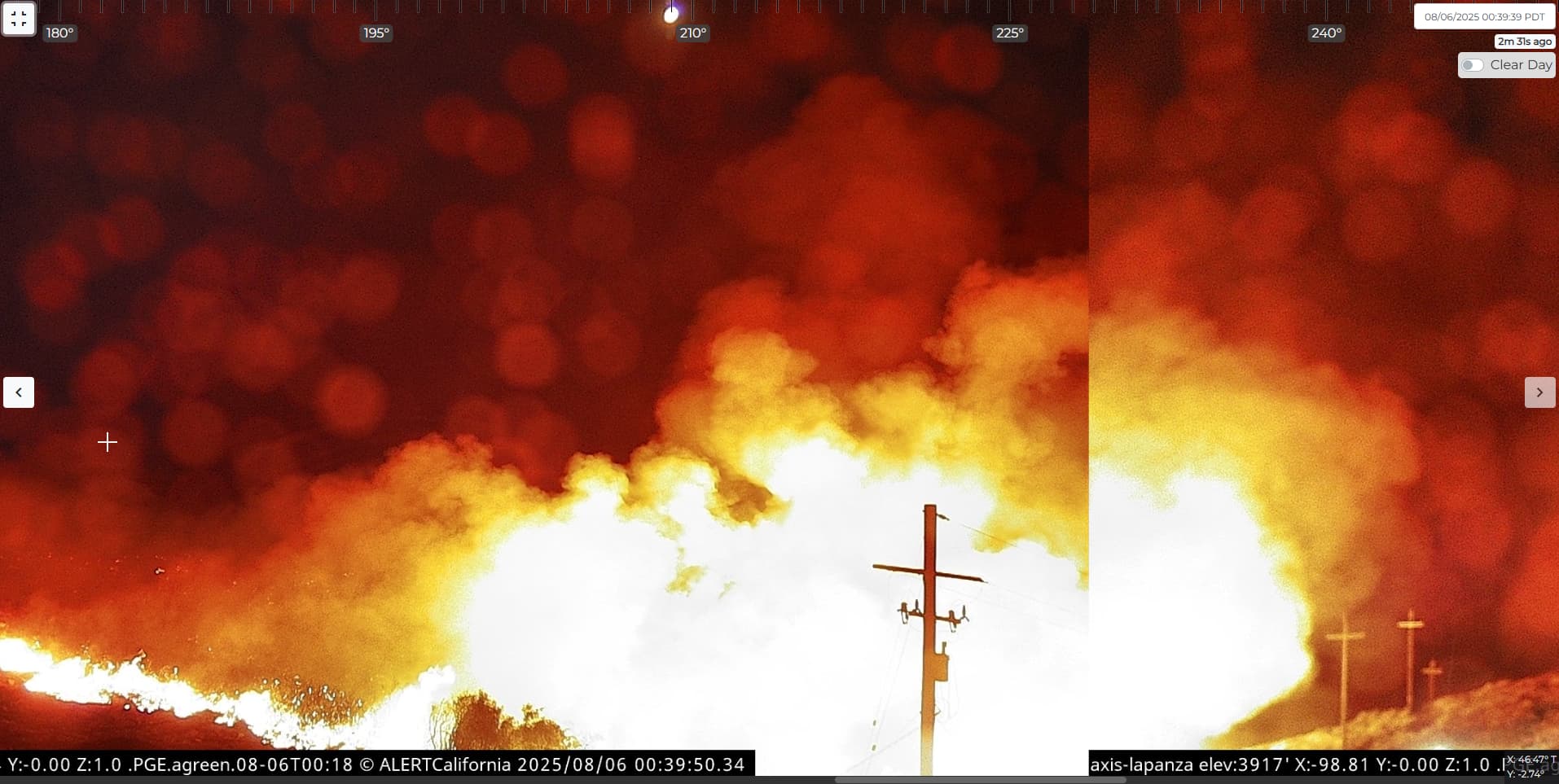
Irregardless from the above post: La Panza is starting to get impacted. I was very thankful and hopeful earlier that all of the amazing and great work CalFire had done earlier today was enough, but nothing will beat Mother Nature… (unless I am hopefully wrong and it’s holding at the retardant/dozer line)
4 Likes
I believe that’s a burn op going on. If you go back about 30 minutes, you can see the ignition.
6 Likes
I hope so. I’m worried about this site, but that view makes it look not so good. CalFire is always very surprising with their maneuverability and their volatile movements. I was watching them all day today and saw them set up dozer lines everywhere, but that flare-up in front of the camera is truly frightening.
Does look like a burn-op now that you mention it. Looks good on their end, then. Truly amazing work. Thanks for telling me.
5 Likes
You’re welcome! Still, it’s pretty impressive to see when the fire slowed down just a few hours earlier
4 Likes
Absolutely! With thhe fire slowing down… This surely will shut down the Northern flank of the fire that was greatly expanding. From what I can tell, that the La Panza communication site with the camera has plenty of defensible space and given the dozer lines constructed throughout the day, we should very much see decreased fire activity by the time morning comes. This is such a strong demonstration of what our heroic firefighters can do in the correct conditions like now, especially with very miminal wind activity. This very well could’ve been a different story if the Santa Ana winds were blowing at the moment.
3 Likes