Looks like it’s going to burn into the Madre
2 Likes
It’s about 3 miles west of the Madre footprint.
1 Like
Looks like this may now be in the drainage that runs up to Miranda Pine Mountain, if so that could influence witch way this thing goes
4 Likes
VNC Punching out a Charlie s/t.
4 Likes
MOD NOTE:
Please stay on track when posting. There is a thread that was already established regarding identifications of resources. I’ve included it below. Now, let’s get back to the fire.
12 Likes
A post was merged into an existing topic: Resource IDENTIFICATION / type : explanations
Wow . . .you pulled this one out of the ashes. From 2018!
7 Likes
Battalion 26 Battalion 28 Engine 322 Engine 333 Engine 343 Engine 351 Engine 357
2 Likes
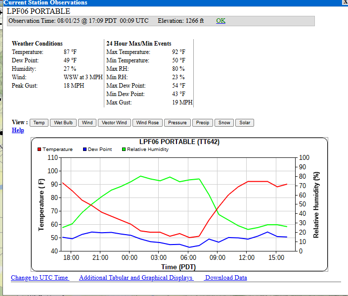
Per AA at least 5000 acres
7 Likes
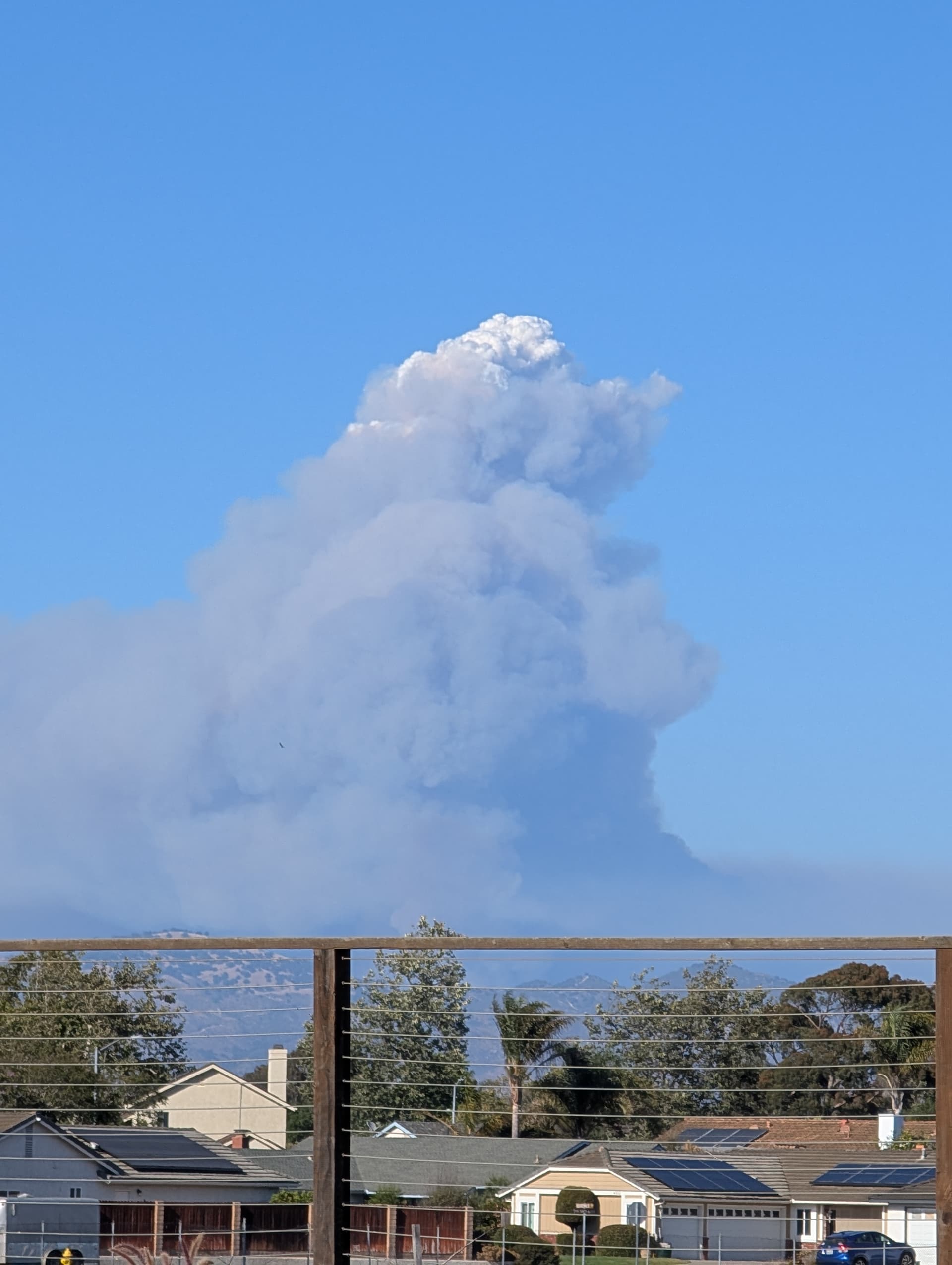
the fires that where further to the west the smaller ones, have definitely picked up.
Not to far a part and noticeable change
AA says well over 5000 acres.
7 Likes
I know 2807C is an ALCO area ST
2 Likes
CIMT 5 he’s already committed for going to the Orleans complex. It would be team 6
EDIT: Confirmed with someone on Team 5 they got moved over to Gifford.
4 Likes
South Ops Daily Report says CIMT5 is ordered for Gifford currently.
5 Likes
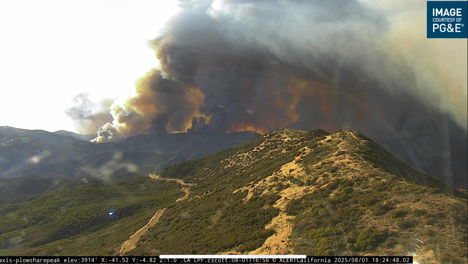
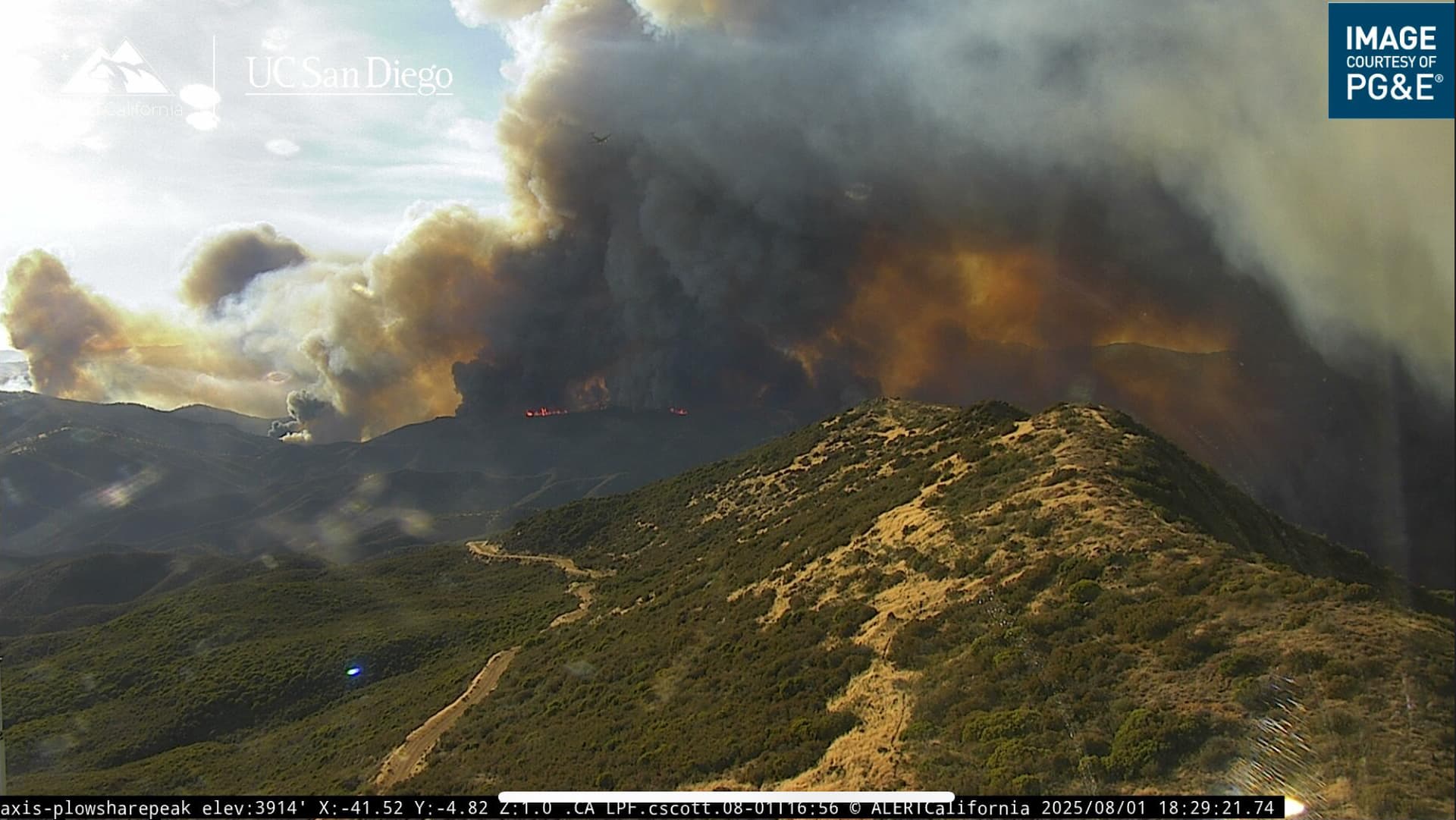
i have a feeling we’ll see plowshare get burned over tonight
edit: i see they’re dropping retardant around the camera now
6 Likes
If it does would put it about 1.5 miles as the crow flies from entering 2009 La Brea footprint. Im guessing plenty of fuel there now.
4 Likes
Per AA working retardant to the west no good anchor point fire keeps outflanking the retardant, will need to work on a plan for tomorrow. Trying to box around plowshare. For this evening trying to keep everything working the south end doesn’t want to abandon it yet.
12 Likes
Updates? Cant hear any traffic
1 Like
Any idea on where ICP will be?
1 Like