Looks like most of this early morning posts were lost
over 65K this morning.
5 Likes
66,985 on WD
3 Likes
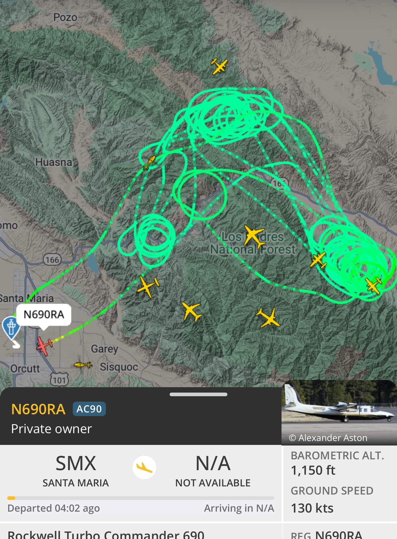
Fire Watch51 out of Lancaster flies this in the morning and late afternoon as a mapping (mostly) and can be asked for intel. I hear him check in with LPF every morning and afternoon on National Flight Following 168.650. He flies mapping on many Fed. fires.
4 Likes
Air show’s slangin’ some mud this morning — 911 just finished their second mission of the morning. Glad they’ve got some favorable conditions for the fixed wing crews to work in… Looked like the drops were just west of Cottonwood Canyon Road
3 Likes
Love an unplanned burn-op on the wrong side of the road /s. “Midway Fire”
5 Likes
A thread has been started
2 Likes

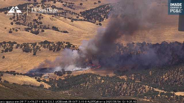
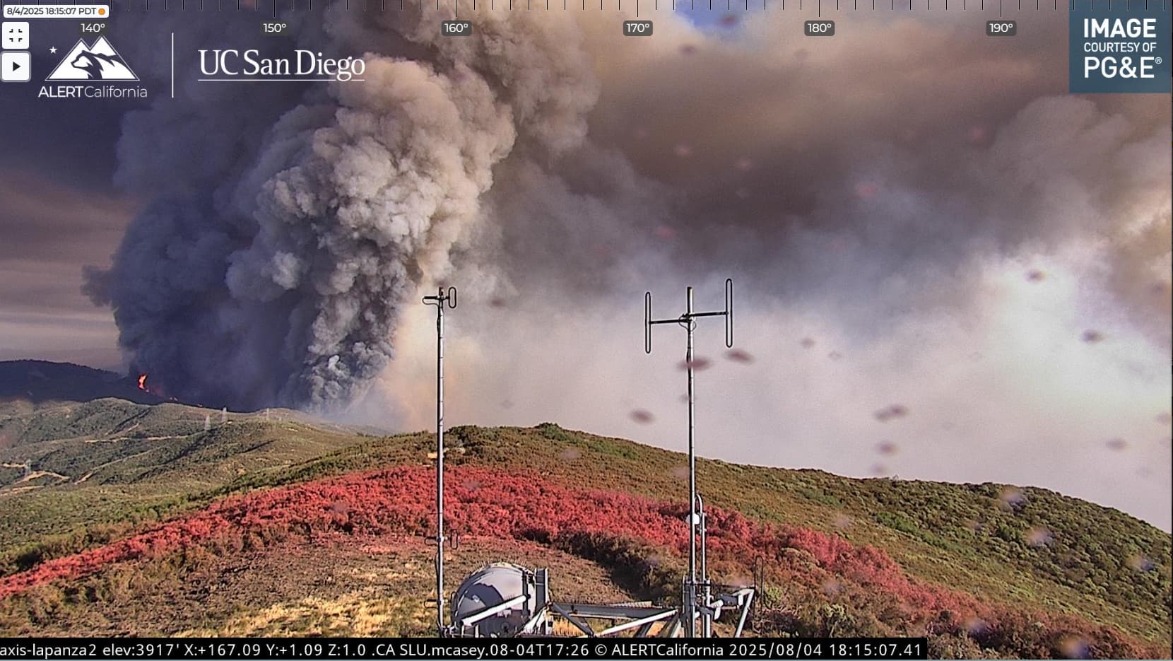
Another coat of paint might not hurt. It sure looks like it’ll impact the camera in the next few hours
3 Likes
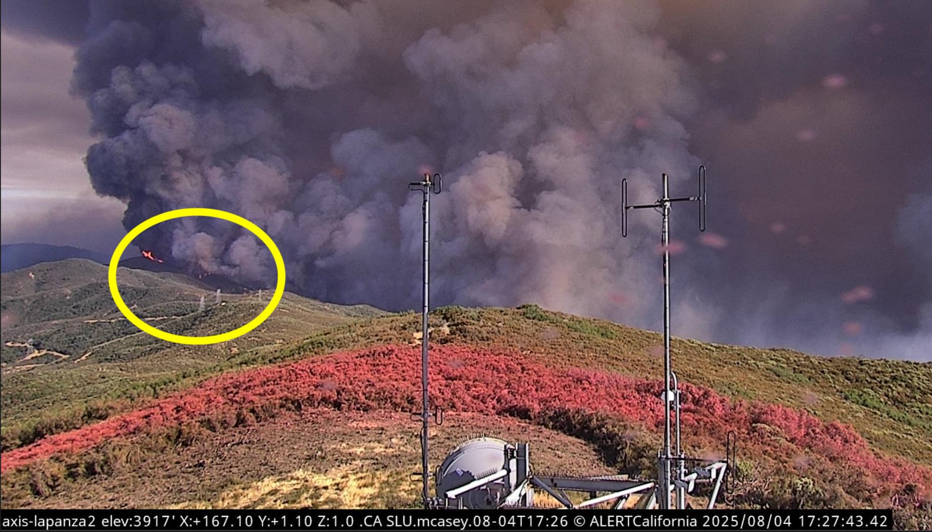
Anyone have an educated guess on that flame height? Am I crazy for thinking >50ft given the scale of towers???
5 Likes
shit, maybe it really will go all the way to hi mountain
4 Likes
You’re not wrong. My wife was at the Lake Fire just south of this last year and worked in the area. She said the brush was 10-15ft tall, so it wouldn’t be surprising to see 50ft flames.
8 Likes
There is at least one crew maybe two working around the comm site still, 15 minute playback and you can see the captain scouting the brush
4 Likes
For reference, the power lines are about 1.2 miles away from the cam site.
4 Likes
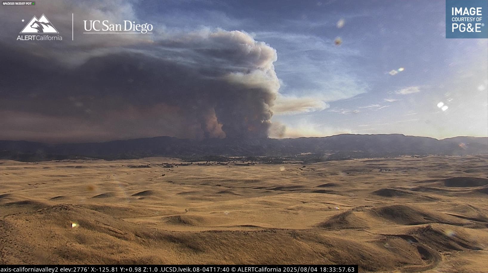
I am not going to post a video but the time lapse of this column from a zoomed out perspective on the California Valley 2 Camera is definitely worth watching at some point.
6 Likes
#yournotcrazy
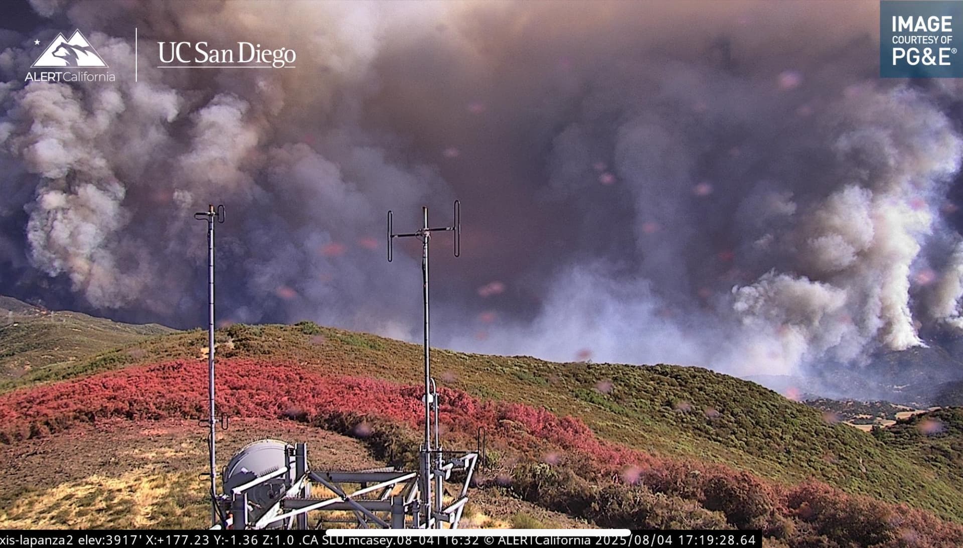
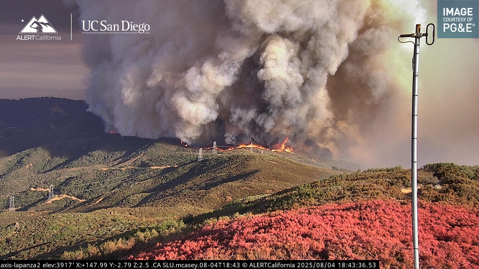
FH & FL at times are >50’ and then some.
6 Likes
That fire is EATING through that brush at fast speeds and at big heights, and headed straight for that La Panza tower. They’ve just panned it to show that flank of the fire and it’s an absolute monster. That fire is going to chew straight through the retardant line. This will be an interesting watch.
8 Likes