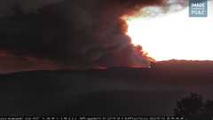
ABC7NEWS is over the fire

ABC7NEWS is over the fire
For those wanting the perimeters produced by both FIRIS patforms Intel 12 & 24 use this KML Link.
https://atak.s3.us-west-1.amazonaws.com/FIRIS_inputs.kml
This can be put in the geospatial tool of your preference; atak, google earth, caltopo, agol etc etc.
In the meta data of the perimeter is the time it was collected.
Spotting a mile ahead again
Darrah Rd has structures down… Trying to hold Darrah but not much hope for that. Now have multiple spots on the S side of Darrah
All type 1 helos have timed out
No divert has been lifted
Ya know I never have been in the fire service (many years LE - and spent many days on the evac routes), but I have been on these groups for decades now (before this one the Hotlist and before that the Yahoo Groups) - and watching this video it STILL amazes me that people in these areas do not keep defensible space around their structures.
ESPECIALLY given the last few years of fire activity in CA.
Wow.
I heard folks scouting the Mariposa Fairgrounds and some resources already showing up. It should be renamed to Mariposa Camp. It’s only used once a year for the fair, but so many times a year as a fire camp.
The fairgrounds makes a good camp, but can get really tight on a major incident
Well if it’s your summer home and you live in the concrete jungle… 
Animal Evac Information!!!
Large Animals - Mariposa Fair Grounds
Small Animals - Mariposa Elementary School
Heard them sending hose up to the county park

You can see spots well out in front.
CAL FIRE Incident Management Team (IMT) 5 has been activated to the #OakFire in the @CALFIREMMU
Does anyone know if this is in SRA or FRA?
Will we also be seeing a Fed team on this ? Or is it not into the FRA enough
Post #50 will give you your answer. It has a map of DPA. It’s heading SE so looks to be a majority of SRA
DPA - Green Fed - Red State - FIRIS perimeter from 1730. Based on reports and where equipment is probably about 3k acres.
4350 is new acreage update
Saw Courtney just left. unfortunately their data is not open source like the OES data. Oh and my guess when I drew the polygon I was looking at the average elevation of 3000 MSL not the acreage lol. Yeah I have 4100 acres…you got look at the right box.
thanks…I missed the 52…good ears and thanks for update