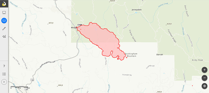
Jerseydale raws.
https://www.weather.gov/wrh/timeseries?site=JSDC1&hours=72
Fire has crossed Snow Creek, which is south of Triangle road, in multiple areas. Trigger for mandatory evacuations for everyone in Lush Meadows.
In Response to Emergency Traffic
Everyone is okay.
Remember, no guessing, no specifics, no names…
As a testament to how fast this is unfolding, it is at Snow Creek, midway between Triangle Road and Darrah Road.
Cal Fire IMT 5 being Activated
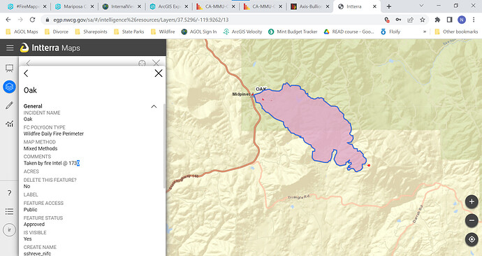
Here is some info on when it was taken. It was taken by fire intel @ 17:30 on 7/22/22. This info is taken from Interra Map, which is from the incident.
Wind gusting to 20 now.
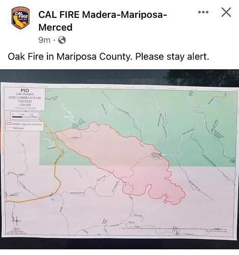
U.S. Forest Service - Sierra National Forest is responding in unified command with Cal Fire to the Oak Fire which started on Carstens Road near Highway 140 in the Midpines area of Mariposa County.
All local resources as well as resources from the Wahsburn Incident are responding
Residents are encouraged to sign up for emergency notifications at MSOAlert.com
For updates visit: Oak Fire Incident | Mariposa County, CA - Official Website
Photos of Oak Fire (by Daniel R. Patterson, USFS)
https://www.facebook.com/100064754623337/posts/422262429942241/
Spot fire Clouds Rest road being reported by ground crews… tankers see a spot, coming around to check fire eating through drops. Not sure air and ground are seeing the same issues…
CAL FIRE Incident Management Team (IMT) 5 has been activated to the #OakFire in the CAL FIRE Madera-Mariposa-Merced Unit (MMU).
All aircraft off the incident… Heel is well established… Right flank is the problem area… Moisture coming in tonight will help but still in for a long fight
From AA504
all aircraft off fire…not a real positive view from AA…his hope incoming temp/moist will help…heel of fire is backing down and right shoulder with spots are an issue to deal with.
be safe tonight
Jerseydale RAWS: 1900 7mph out of NW at 328 degrees. Air Temp: 84. Fuel moisture: 3.2. RH: 16%. Recovery: 32%rh in early morning hours. Not much of a recovery.
4350 acres
Latest evac map touching Highway 49 just south of Bootjack https://www.arcgis.com/apps/webappviewer/index.html?id=9cdac8da837f4ef3b9abd8d0a67ec7d4&extent=-13361262.4101%2C4505252.4658%2C-13324572.6365%2C4523004.9656%2C102100
Evacuation order issued for Cole and Silva road to 49(bootjack). The fire is established in snow creek/west fork Chowchilla river.


