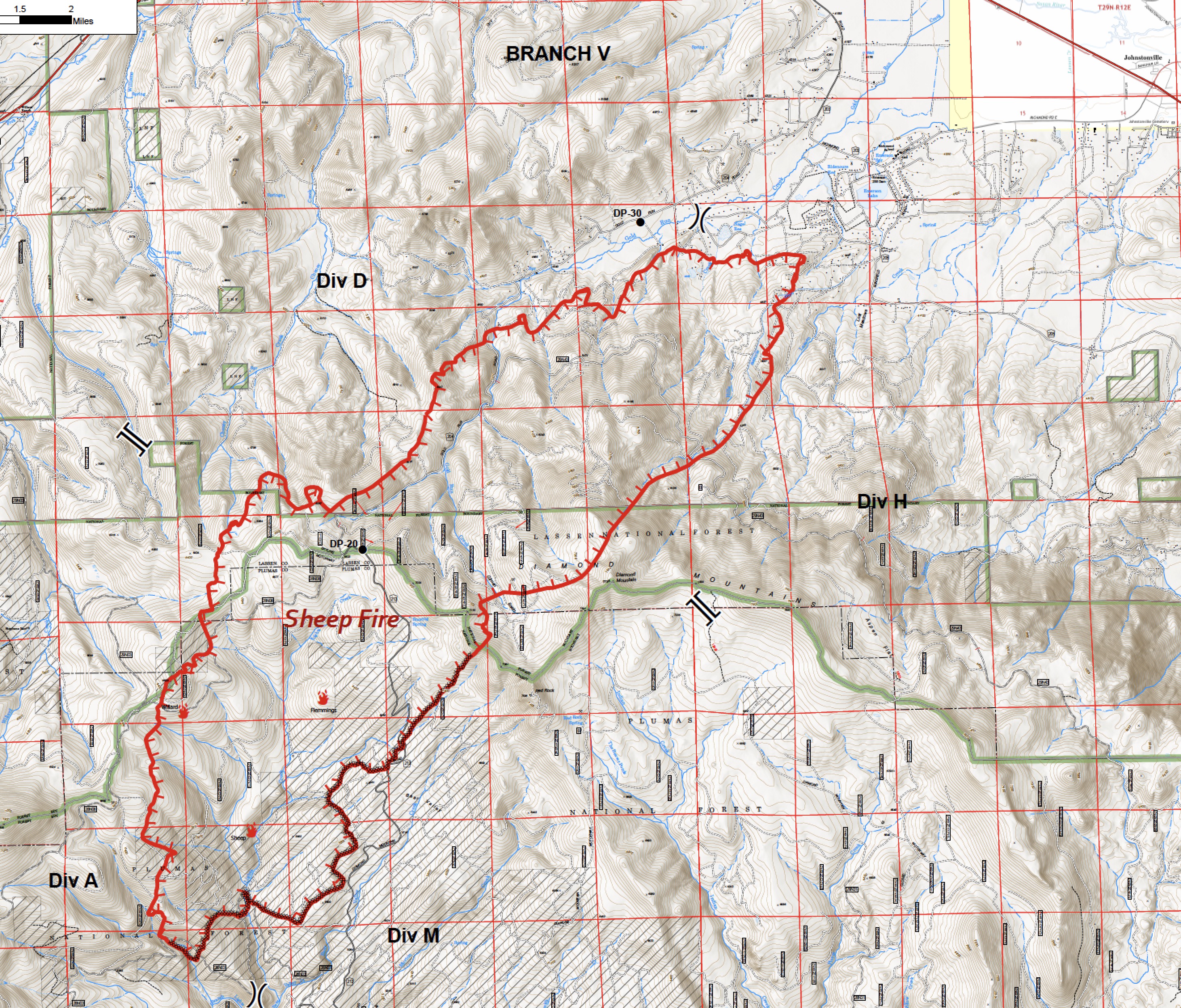
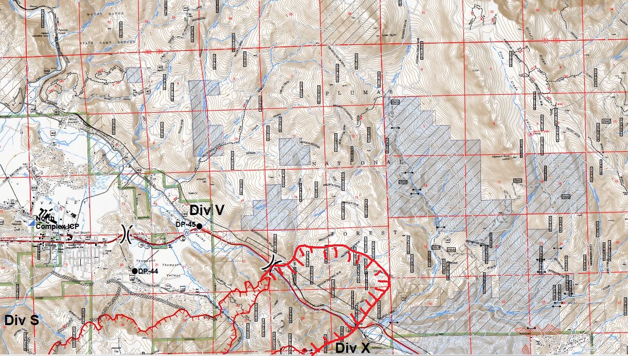
Today’s Ops map.
2 Likes
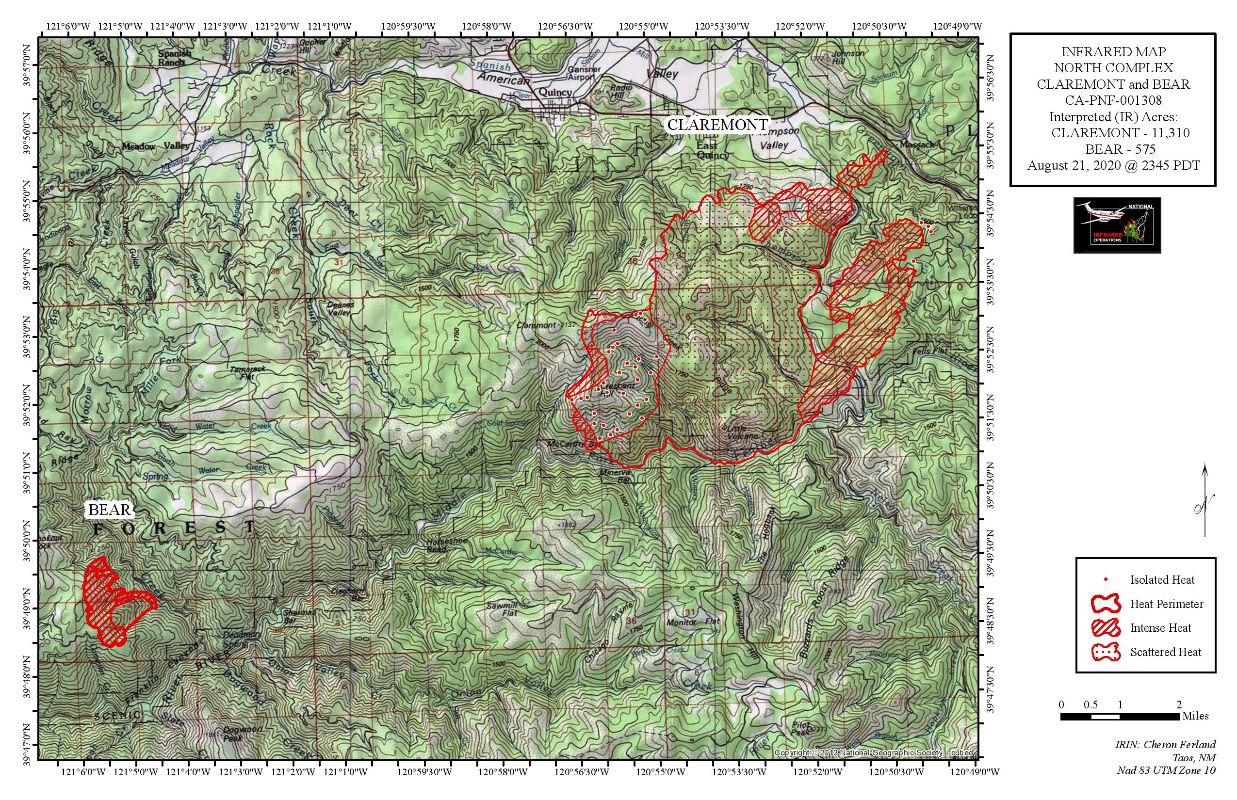
Claremont jumped 70. 70’s closed.
Big chunk of rugged forest ridges beyond that. Wonder how that’s going to be handled, especially with resources spread thin.
1 Like
It’s gonna take a BIG box!
1 Like
Wonder if it might eventually run into Walker, from last year.
Walker Fire in dark blue to NE of Claremont.

If anyone if scouting way out ahead of this one, here is a link to the 2019 Walker Fire Ops map.
Also, if anyone is working on the North side of the Sheep Fire, here is an ops map for the 2016 Willard Fire.
4 Likes
I think the weather is going to play a big role with that terrain the next couple days. We’ll see. 
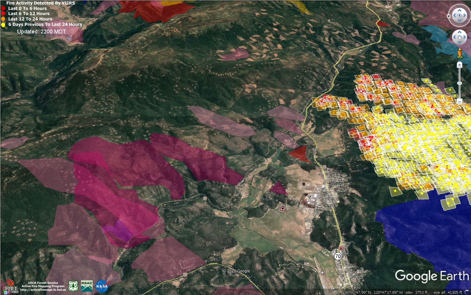
Here is the fire history, looking east along Hwy 70.
Under normal conditions, we have picked most fires up at the ridges, but I forget what normal looks like…
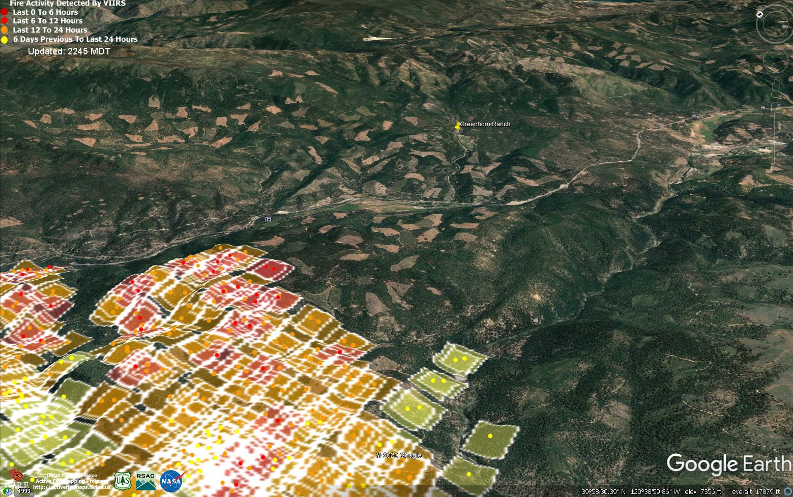
Greenhorn Ranch, in upper-center of the image, is a real death trap. We did a hazard assessment for Plumas County in 2005, and it was about 50% overgrown vacant lots, with one road in and out. I know there has been a bit of fuels work done there since then, but it gave me the heebie-jeebies, and on the aerial imagery there is still a shitload of dense fuels on the vacant lots.
A lot of parcels were subdivided in Plumas County in the 1980s, and elsewhere in the Sierras, after being high-graded (logged) for the biggest timber. This left dense stands of smaller trees, and created openings and soil-disturbance that led to a ton of seedlings becoming established. A lot of these thickets are now 30-40 years old. In most cases, the developers couldn’t sell even half of the new lots, and would go bankrupt or sell the project to a new investor. Most of the communities got set up with CSDs that because of all the un-bought lots barely have enough money to run the water and sewer, nevermind fix the roads or cut brush, and many of the absentee owners have never thinned the brush or timber on their lots.
It’s the same story all up and down the West Coast. Deathtraps, all of them. In my opinion, midslope, south-facing forest communities should not be built, anywhere.
This fire has the potential to scream through Greenhorn. It sounds like the sheriff thinks the fire is going to miss the community, and I hope he is right. Maybe these storms will bring some moisture, but just as likely they bring outflow winds and more chaos. Sketch City.
8 Likes
As of 1700 there was a 15 acre spot that was spotting ahead of itself across hwy 70. No resources to engage. When asked by Air Attack about ground troops making access he was told there weren’t enough resources and “we will stop it at Grizzly Ridge”. For those that know the area this just became a very big box
1 Like
The Sloat Mt. camera doesn’t show much activity…
http://www.alertwildfire.org/shastamodoc/index.html?camera=Axis-SloatMtn&v=81e002f
Columns from the Sheep Fire can be seen poking through the inversion as the sun rises… looks like it burned actively last night.
http://www.alertwildfire.org/shastamodoc/index.html?camera=Axis-DyerMtn1&v=81e002f
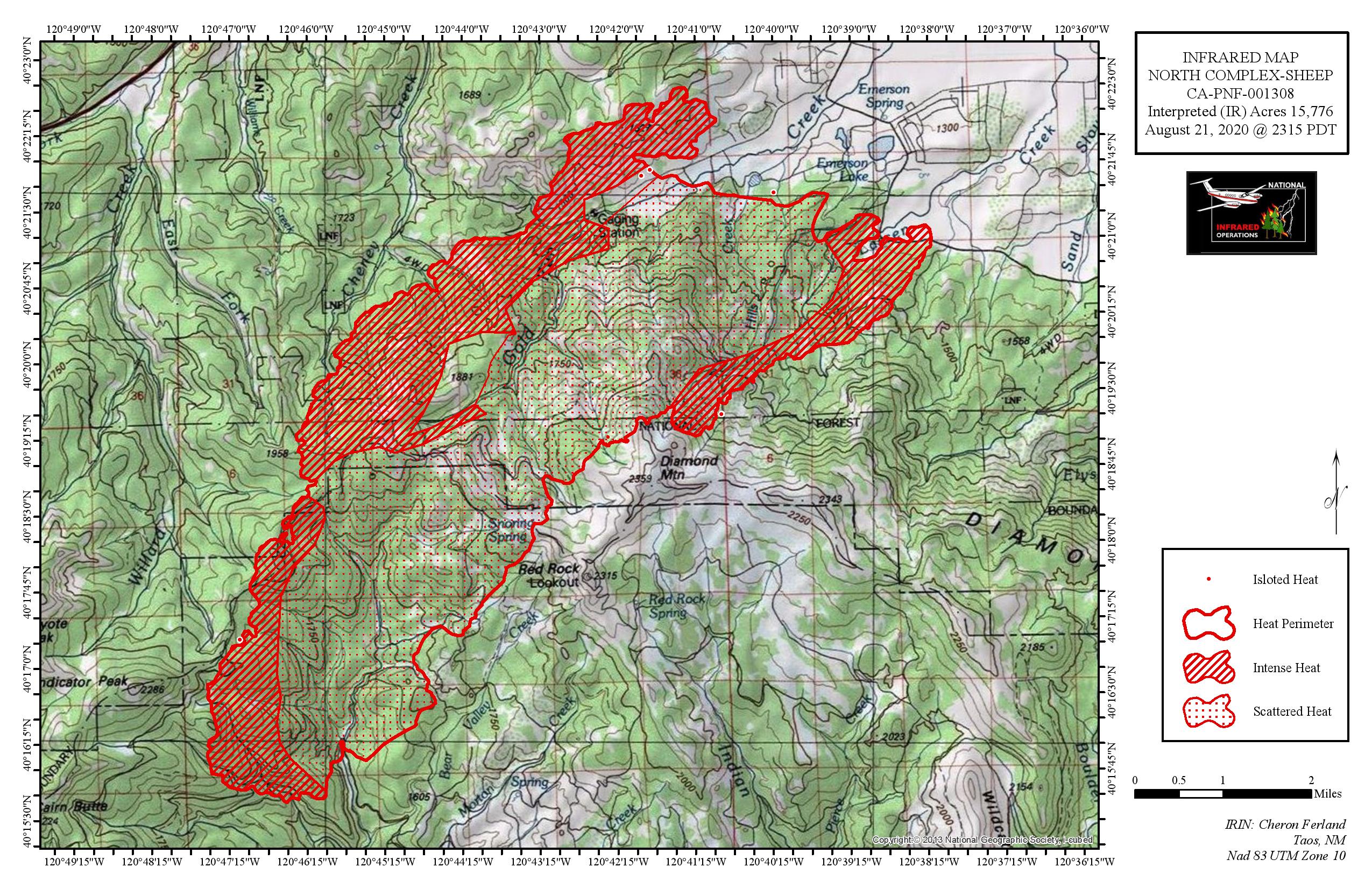
Edit: Just saw that the Sheep has been removed from the PNF North Complex and is now its own fire in unified command with PNF and CalFire. I can’t figure out where they have put it on the FTP server. Last night’s IR maps on the North Complex don’t include the Sheep, but there’s nothing in the Sheep folder or in the CalFire folder.
2 Likes
Hwy. 70 is closed from Spring Gardens to La Porte Road. Per Ops there is no estimated time of re-opening.
Anybody heard anything about the Hwy 70 slop-over since last night???

Union Pacific RR about to run a fire train along the tracks north of the fire to do whatever they can with operational personnel aboard…
7 Likes
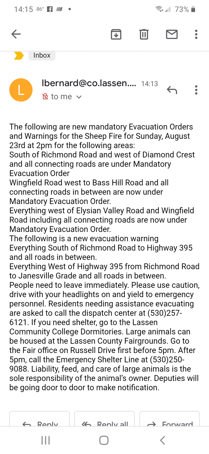
Mandatory evacs. for Green Horn Ranch area. Fire jumped Middle Fork of the Feather heading easterly…
3 Likes
Chandler Rd. to Squirrel Creek. Not Greenhorn Ranch yet, but if it were me…
XMR 2126A headed to CA-PNF North Complex. One hour out from the incident.