looking at the wildland cameras. they don’t show much when the smoke in the air is too thick. nothing like intel from boots on the ground and human eyes in the lookouts. my opinion. thoughts?
Claremont Fire:
UPDATED EVACUATION INFORMATION 08/23/20 at 6:15PM
MANDATORY Evacuation notice for the residents of SPRING GARDEN and GREENHORN RANCH. You should leave the area immediately!Emergency responders are currently going door to door making notifications.
5 Likes
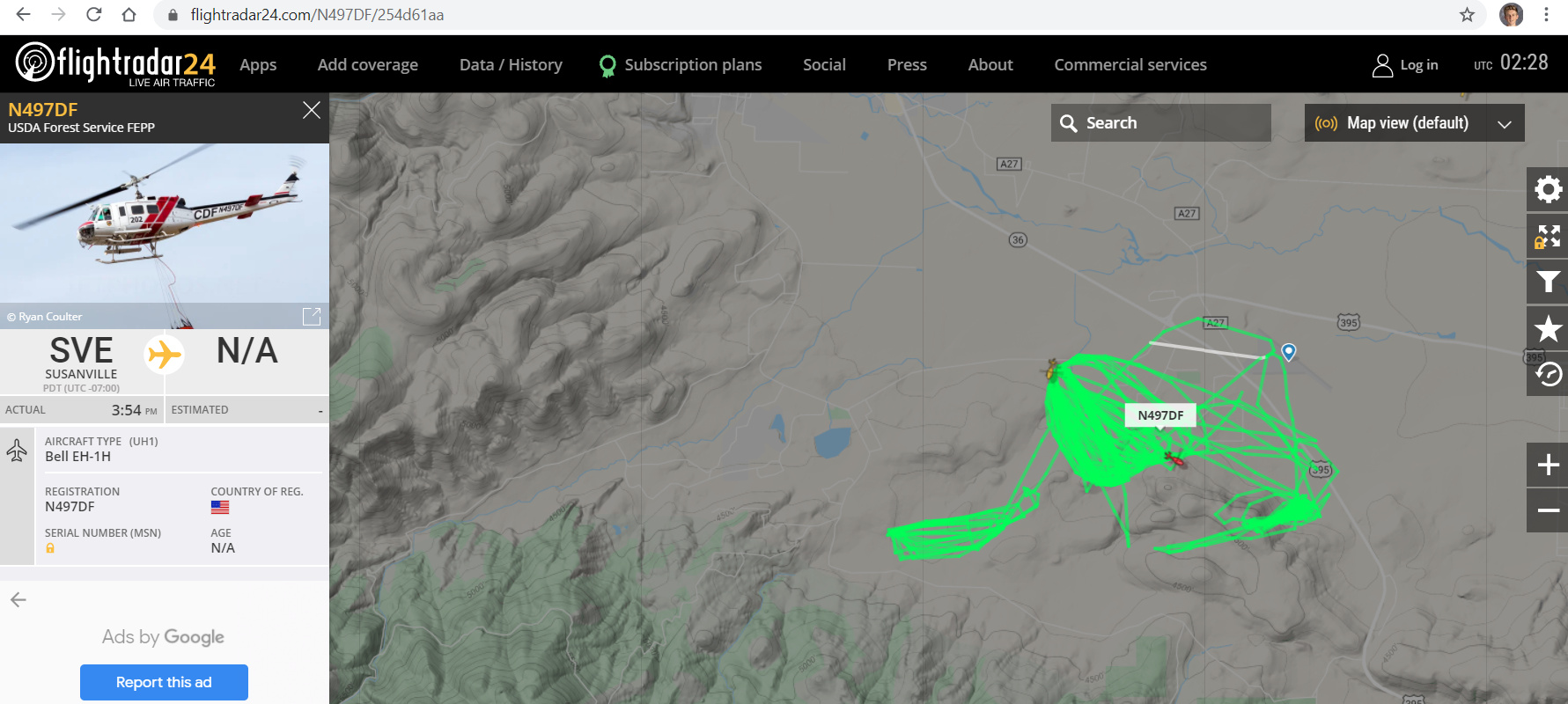
Yes, they are throwing everything at Claremont Fire. Flight radar just had the DC-10 on the east flank of the fire.
4 Likes
Bear Fire about 1K now and getting established in the Middle Fork as per AA prior to outbound…
2 Likes
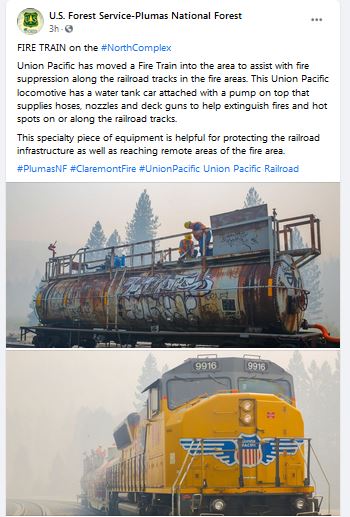
The Fire Train is very effective I’ve actually worked on the fire train before off the Feather River on Highway 70. It was during the the Butte Lighting Complex. We supported a burn operation. They are there to protect railroad infrastructure and the train has hand lines and a water monitor with 65,000 gallons. Very effective unit.
5 Likes
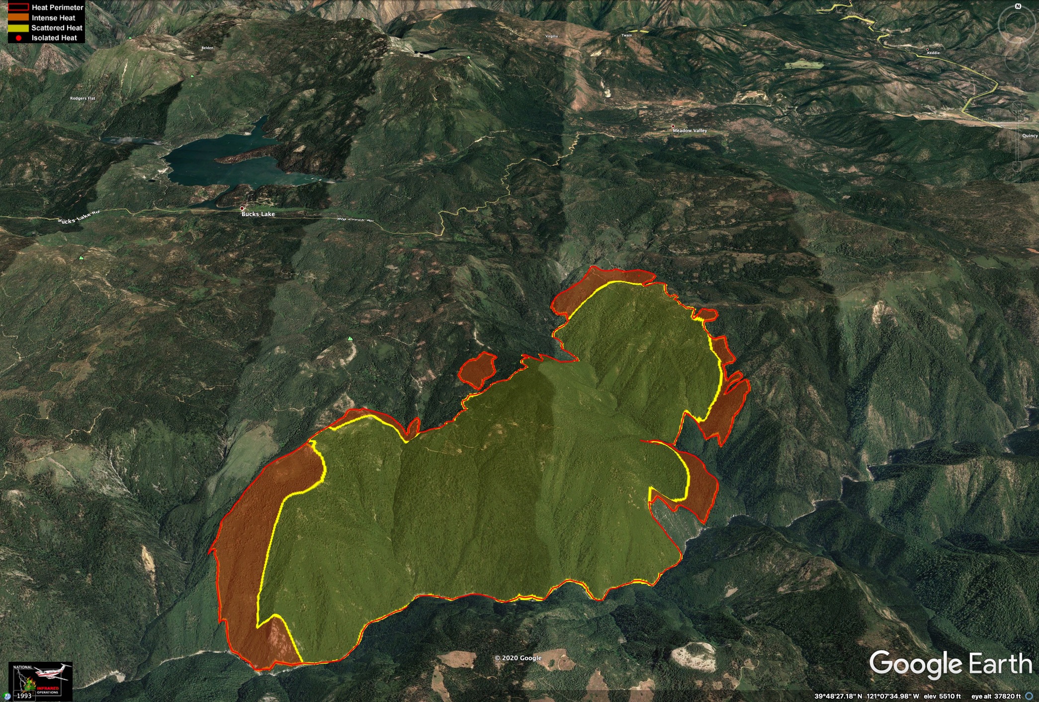
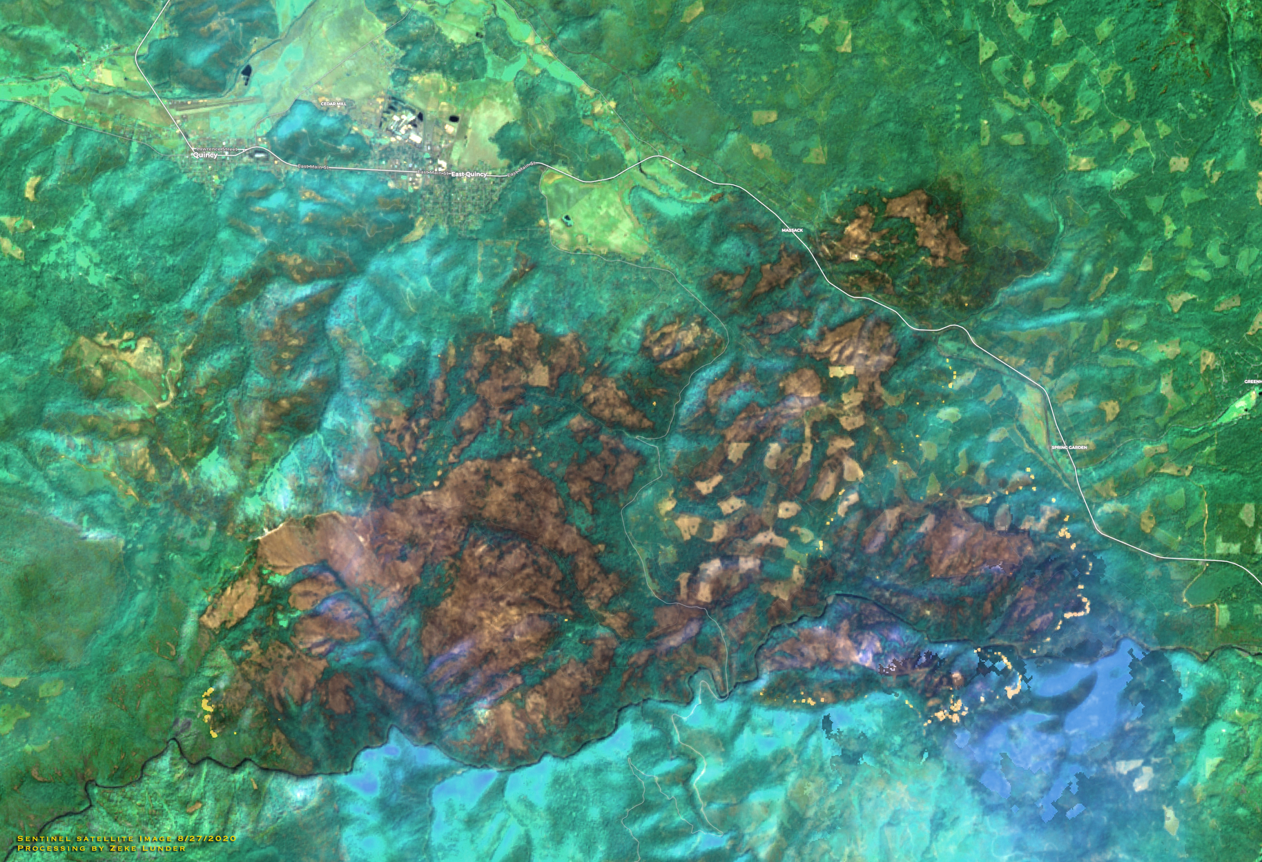
IR Maps for the Claremont and Sheep, from around midnight. Looks like they both burned actively through the night.
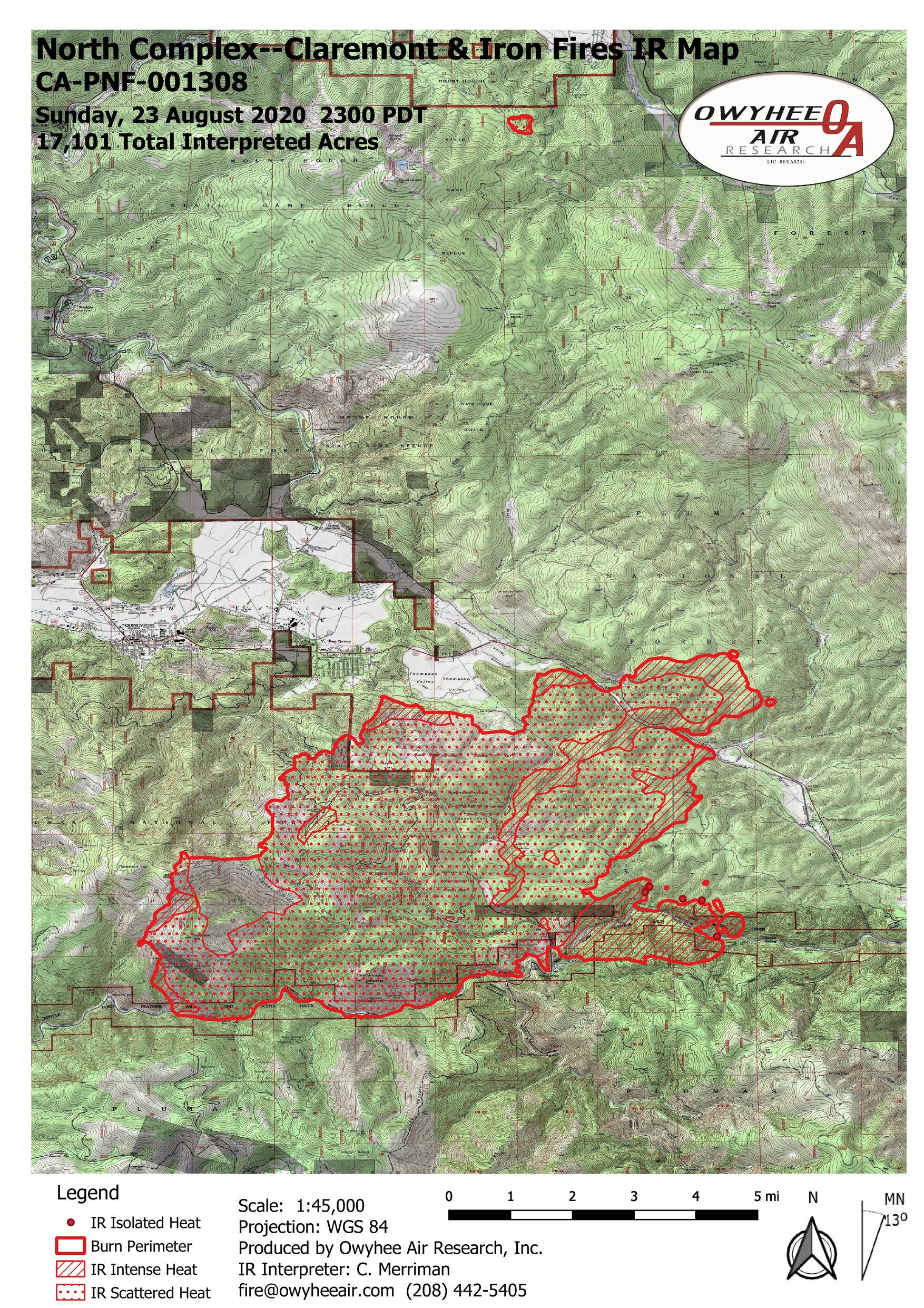
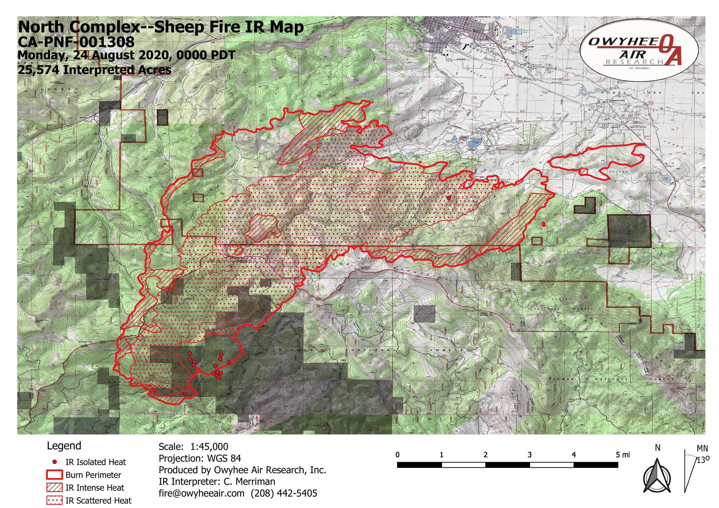
5 Likes
What a great tool. Would like to see those utilized more
4 Likes
3 posts were split to a new topic: Fire Train
Reduced mandatory evacs for East Quincy to Advisory only…
5 Likes
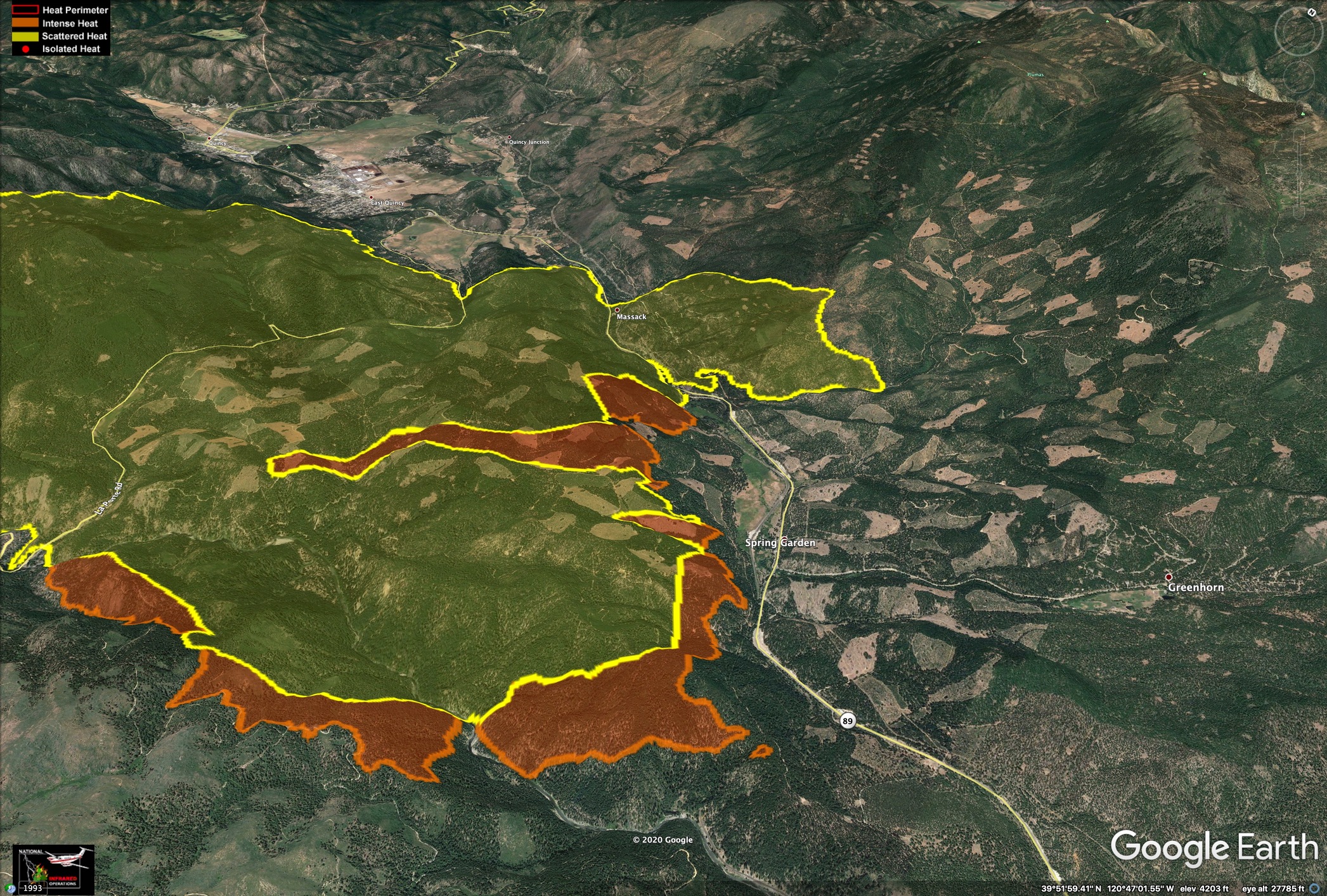
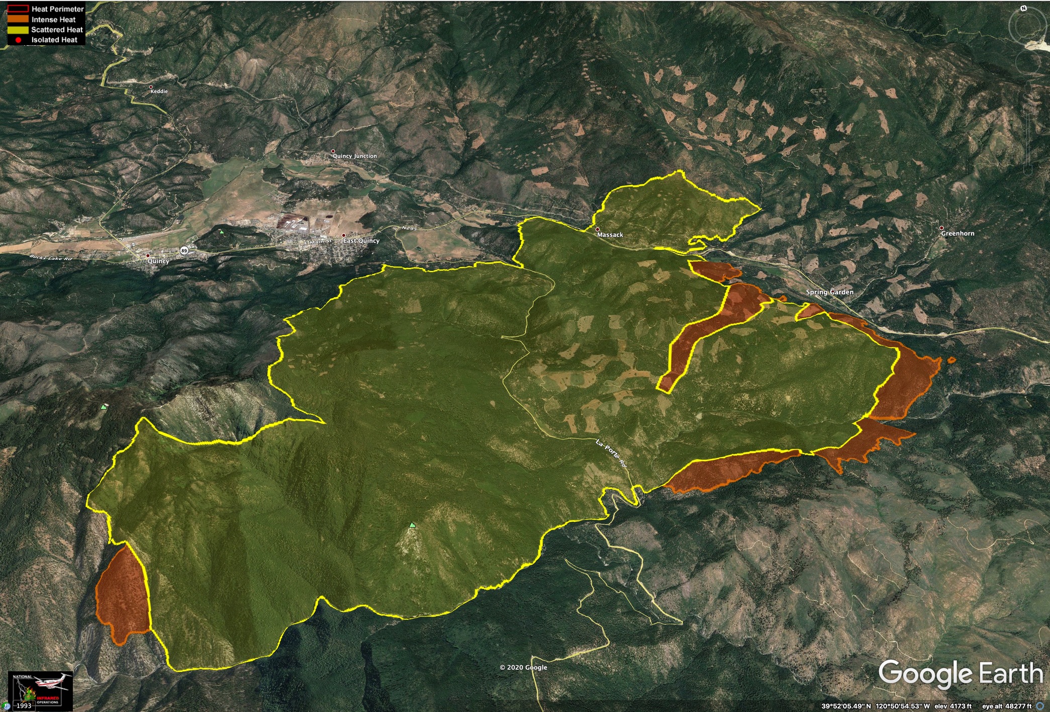
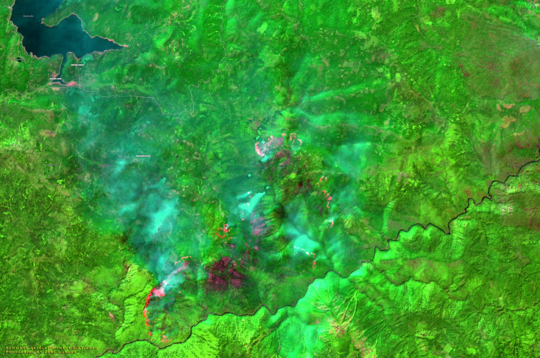
Here is imagery made from last night’s infrared flights. 8/27/2020 around 8pm. Yellow areas are scattered heat, and red areas are intense heat.
Data source: NIROPS.
3 Likes
One of the strategical possibilities mentioned by Operations of the North Complex was to let the Claremont and Bear burn together in the Middle Fork. Looking at the map I would tend to guess that strategy is being implemented…
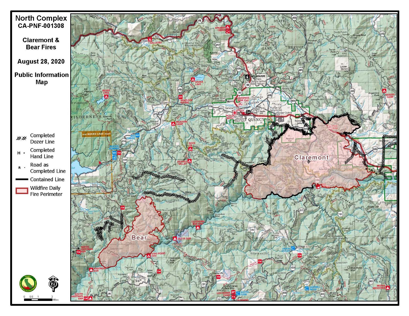
If that is the case, this incident will be ongoing until the rains come…
2 Likes
With all the backing and flanking, we should get some great fire effects.
2 Likes
Was looking OK down there from the last fire about 20 ears ago around Clegghorn Bar. Should clean it up quite well now…
1 Like
4 Likes
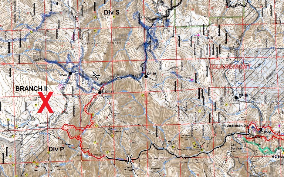
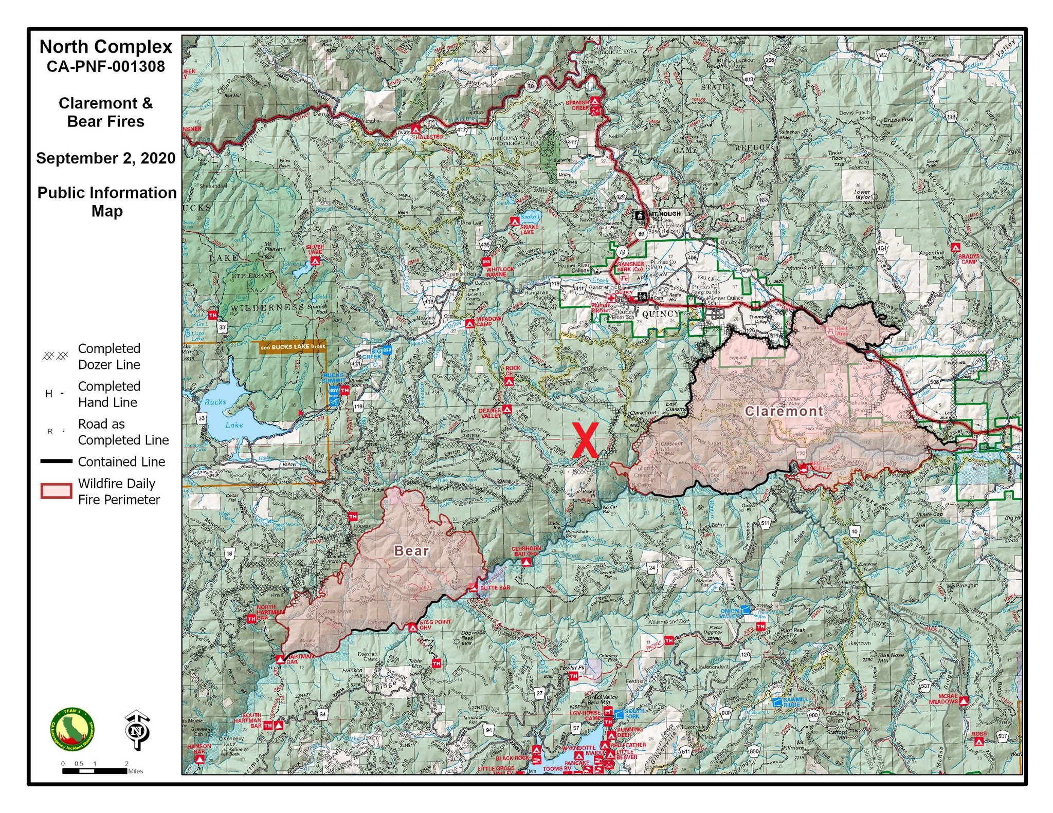
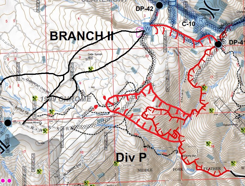
Claremont Fire pushed out to the West yesterday spotting 1/4 mi.+ over the lines. Trying to tie it in with the Dozer lines connecting to the Bear Fire. Area of concern marked with red X…
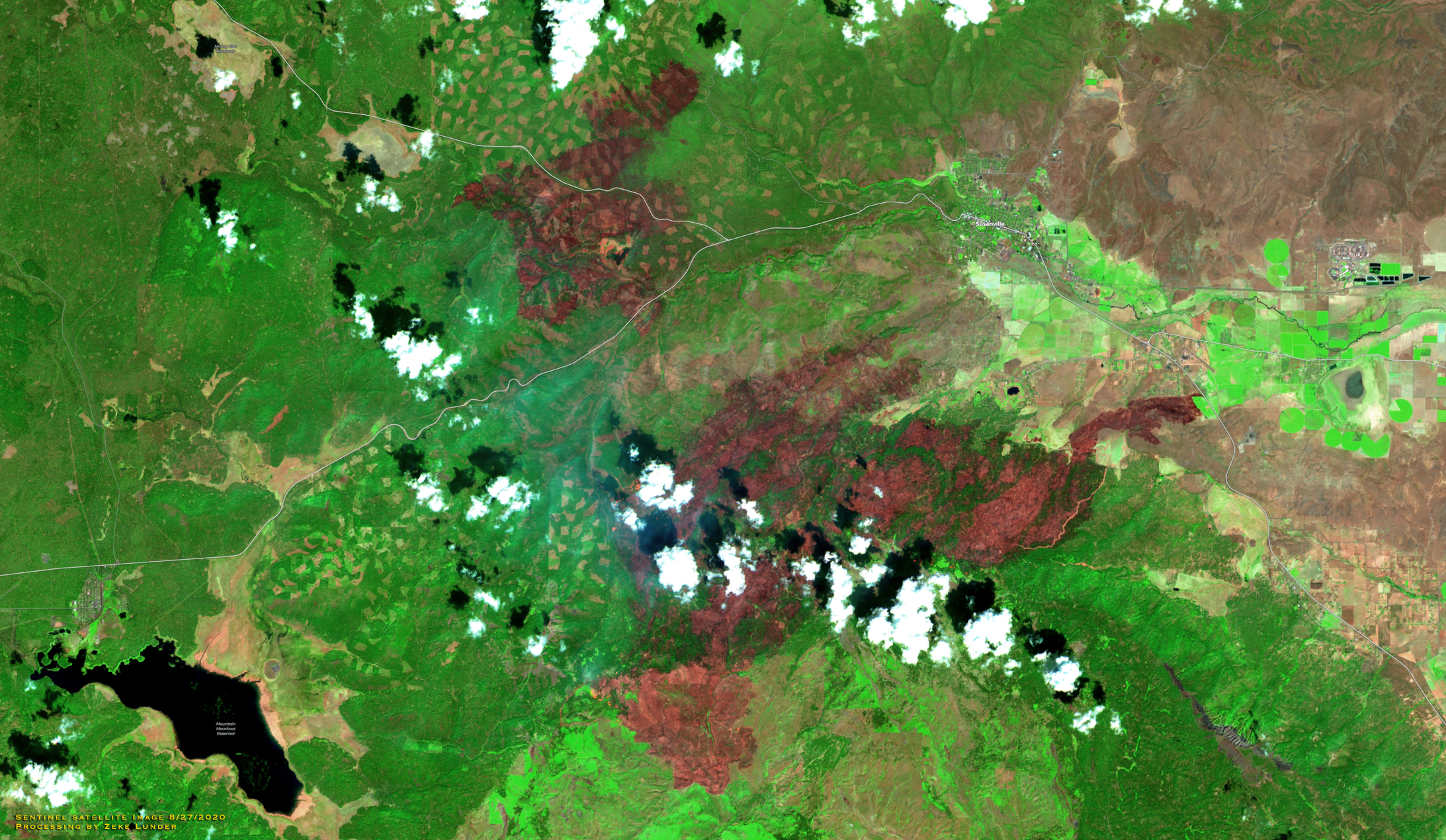
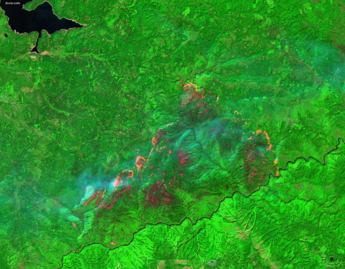
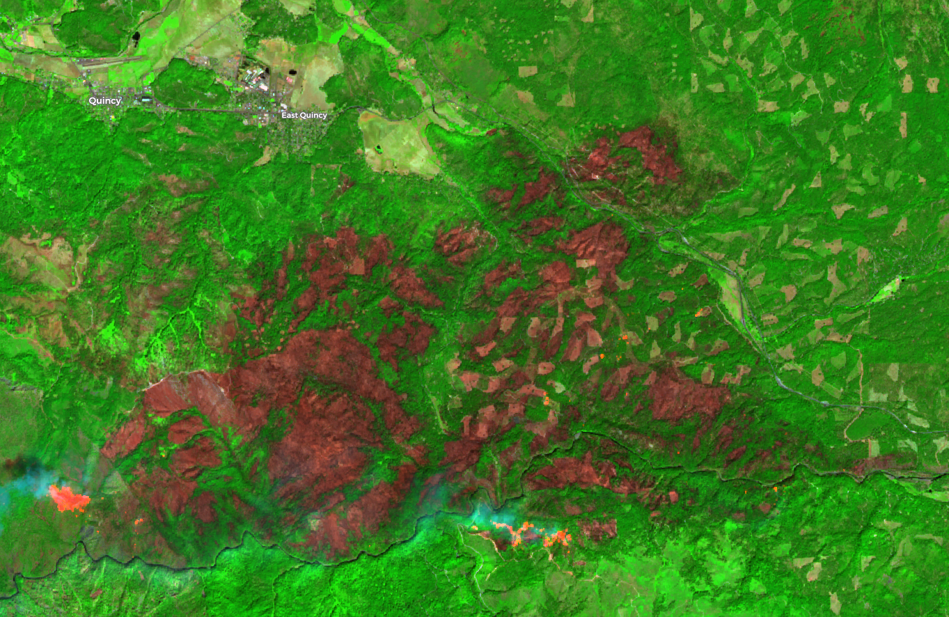
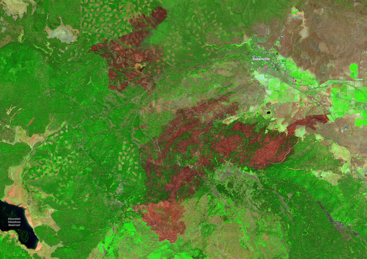
Here are some initial fire severity images for the North Complex Fires, plus the Hog Fire, in Lassen County, created from Sentinel satellite data captured 9/1/2020. These maps have not been ground-truthed. Green areas are generally unburned or low-moderate severity. Red areas generally have no living foliage remaining. Orange shows active burning.
Imagery credit Deer Creek GIS, Chico, CA.
10 Likes
Thanks for the simple explanation. For those of us that didn’t have satellite technology in our time, a quick explanation to get us up to speed is great. Thanks again for what you do.
5 Likes