Thank you. Having such quick turnaround on imagery is a treat. We used to have to wait a week or three for LANDSAT scenes to be available, and then spend half a day making the image. Having fresh imagery available every few days is amazing. The Sentinel bird goes over often enough sometimes you luck out and get a snapshot of something extraordinary like the Camp Fire’s initial run.
The LNU Complex is one of the first fires we have been able to use this imagery operationally. It was useful in planning firing ops and understanding where the big islands of unburned were.
5 Likes
The Bear/Claremont Fires are blowing up, big time.
Some modeling we have been looking at suggests the Bear Fire could reach Merrimac, near Brush Creek under severe conditions, which is what we’ve got. People in Berry Creek should also be keeping their eyes open. Sounds like La Porte is being evacuated, as are other towns on La Porte Road.
http://www.alertwildfire.org/shastamodoc/index.html?camera=Axis-LexingtonHill
http://www.alertwildfire.org/shastamodoc/index.html?camera=Axis-JarboGap
6 Likes
Zeke, Wish I could be there with you and go after those rascal fires.
Looking From Quincy:
http://www.alertwildfire.org/shastamodoc/index.html?camera=Axis-QuailRidge2
http://www.alertwildfire.org/shastamodoc/index.html?camera=Axis-MeadowValley
1 Like
Zeke, Looking at the Lexington Hill Camera it looks perhaps closer than the Bear. I’m hearing that LaPorte has a fire with Evacs ongoing. Wonder if that could be it?
The evacs in LaPorte are part of the Bear / Claremont complex.
1 Like
Jarbo Gap camera lines up pretty well with where Bear is buring.
1 Like
Thanks Seth,
1 Like
So the fire hopped the river near Horshoe Bend 3-4 hours ago, but due to terrain / wind, crews were not actively engaging today. Sounds like it already ran a couple of miles.
3 Likes
Seth, I’m trying to remember if Horse Shoe Bend is near Stag Point or Hartman Bar area?
Maybe 5ish miles upstream from Stag Point, just a little up from Cleghorn Bar.
2 Likes
Copy, thanks.
1 Like
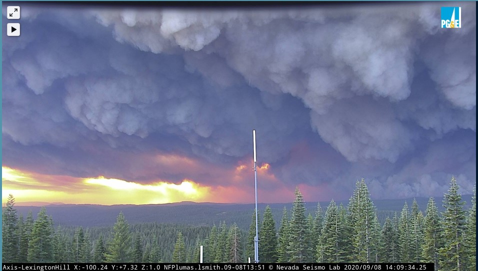
Looks like some crowning in the distance on the Lexington Cam…It just re-positioned itself.
http://www.alertwildfire.org/shastamodoc/index.html?camera=Axis-LexingtonHill
2 Likes
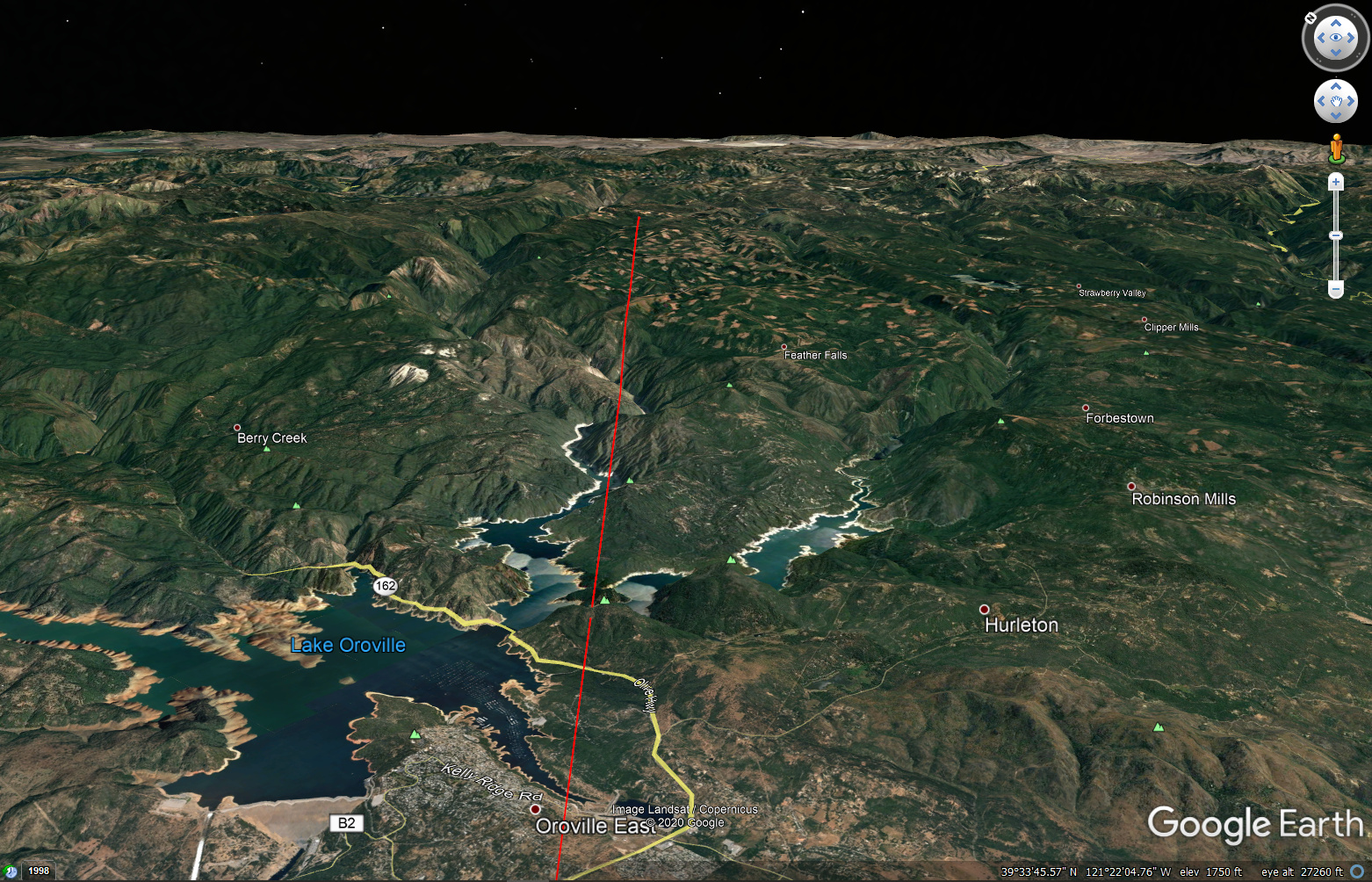
Here is the axis of fire spread, based upon the smoke column on GOES 17. The fire is still about 20 miles east of Lake Oroville.
3 Likes
http://www.alertwildfire.org/shastamodoc/index.html?camera=Axis-BaldMtnButte1
Goes bananas as well at about 1330hrs
Iit was into Hartman bar over a hour ago.
Awesomely scary…
1 Like
Was this the Bear and the Claremont Fires closing in on each other?