Update from Ops.
2 Likes
Readers digest:
Inversion most of day with good progress as result.
North side (west of 5)of Delta inc.
" Defensive firing on Middle ridge to
I-5" “slow going” south wind in the face of burn show
South (west of 5) direct I believe until it turns north, air attack said rotary checked it up on wildcat peak. But couldn’t see much on north end due to smoke conditions twd tamarack lake etc
North (east of 5) Iron working from cold black of hirz toward Hazel Creek as planned containment to I-5
South (east of 5) spot south of main fire edge. Troops gave it heck but unable to get around. Planned containment to south, Fenders Ferry road
Just a guess, @pyrogeography or @norcalscan might have those pencil lines and potential acreage on maps for us tomorrow  .
.
5 Likes
47,110 acres per IR @ 0028 PST 9/10
1 Like
1 Like
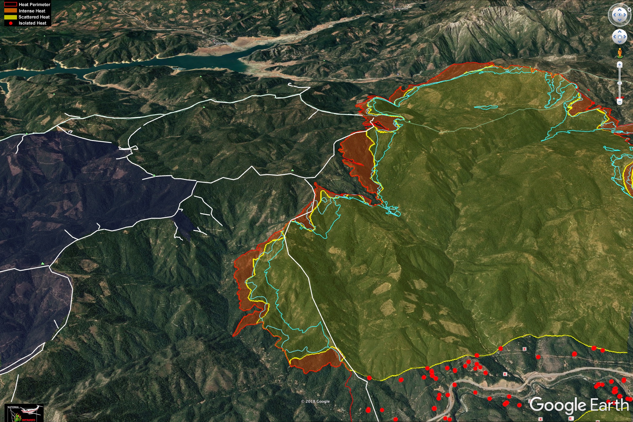
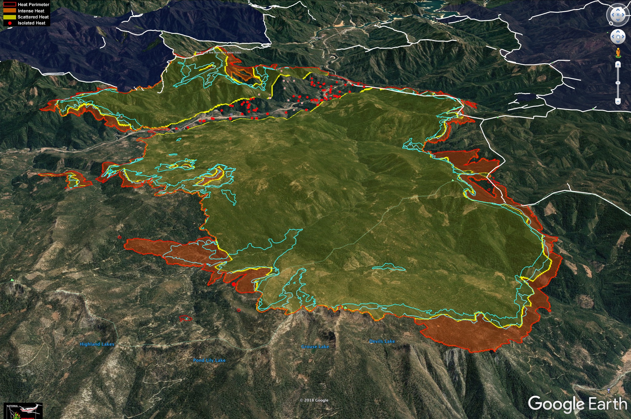
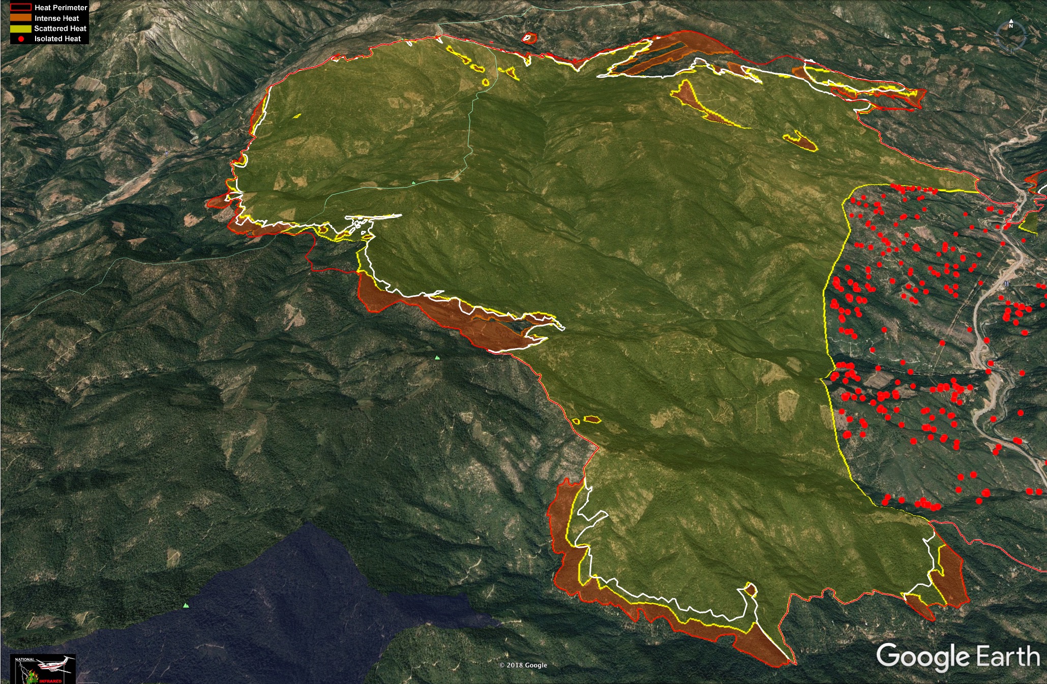
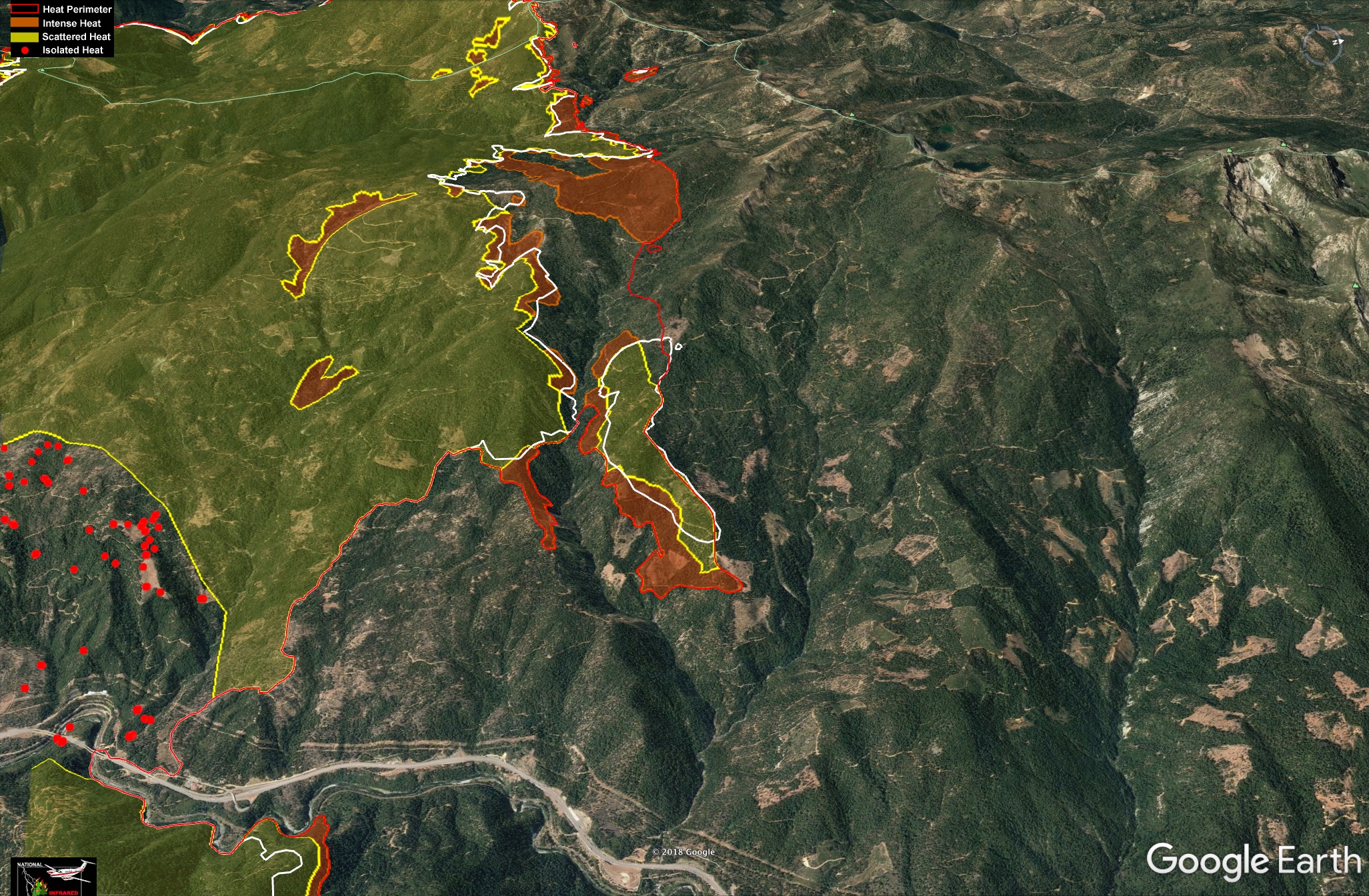
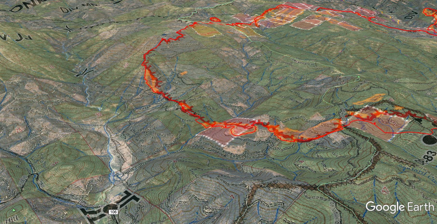
9.10.2018 #deltafire maps.
Light blue lines show past 24 and 48 hours of growth.
White lines are dozer lines from Carr and Hirz Fires.
Carr and Hirz shown in Dark Blue.
Looks like the firing on the North flank is going well, it has spotted over Carr contingency lines on the SW corner, and Hirz line on SE.
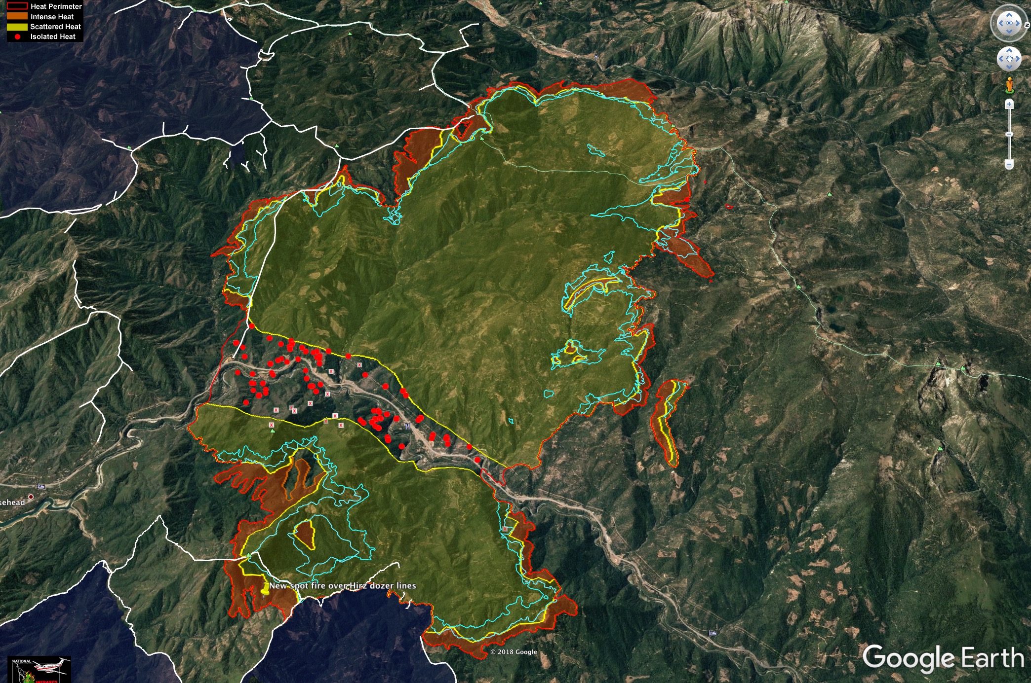

I got a message on FB from a guy who pointed out one of my calls was off two days ago - he said what I thought was long range spotting onto Middle Ridge was the start of their firing operations.
3 Likes
Caltrans reoppened I-5 through fire zone, logging, hay, and wood chip trucks not allowed, screening traffic in Mountaingate.
9/10/18, 0900- 47,110 acres, 5% containment, 2380 personnel.
1-5 open with one line in each direction for 17 miles.
CIIMT - Team 4 took over from team 5 in Unified Command with Cal Fire this AM.
53,311 acres
5% contained
1 Like
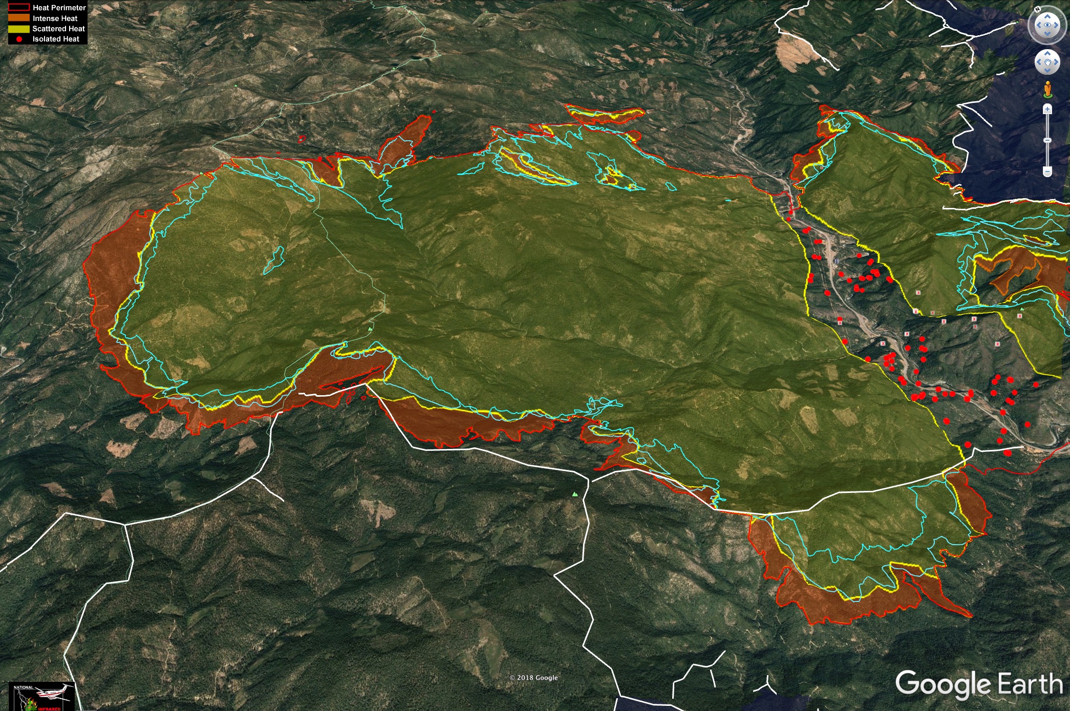
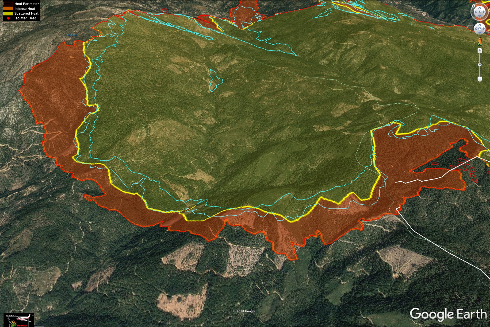
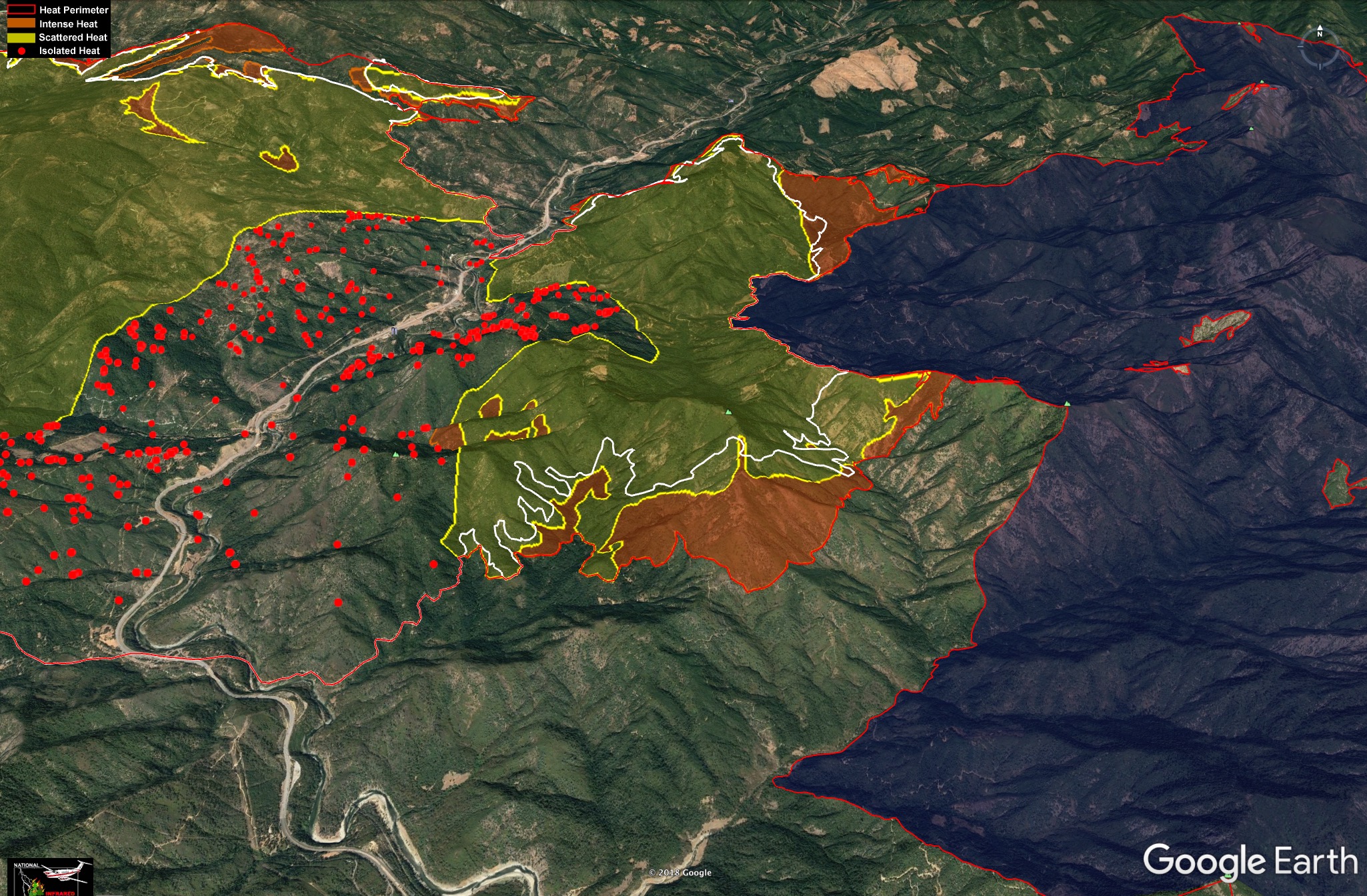
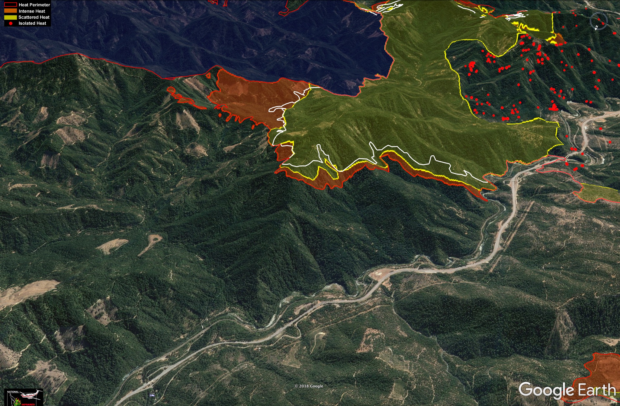
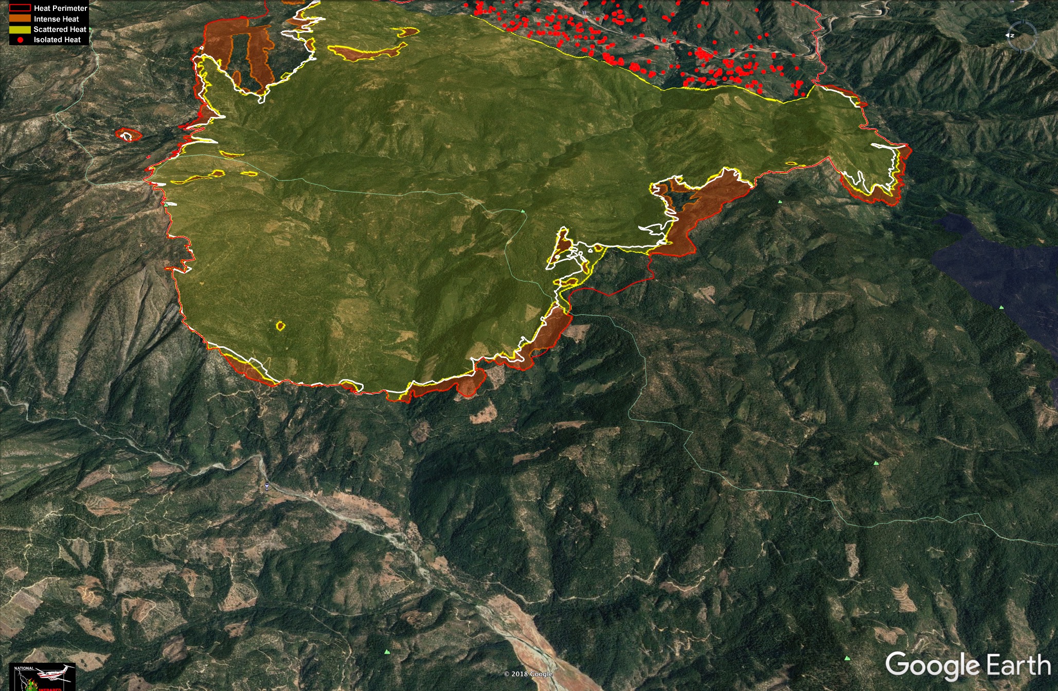
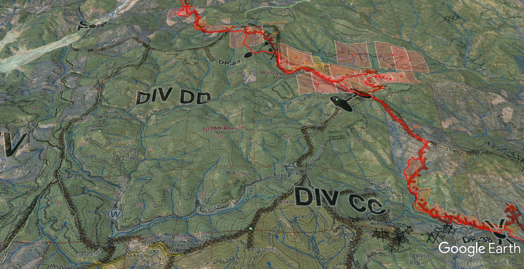
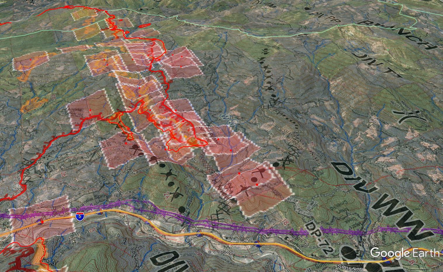
I georectified today’s Ops map onto Google Earth, last night’s IR perimeter and the latest MODIS/VIIRS hits. Most of the fire front is now well beyond my scope and intel so this might be it for me unless something real significant changes.
Delta fire overview, IR perimeter 9/10 night, MODIS/VIIRS 9/11 morning, Ops map 9/11
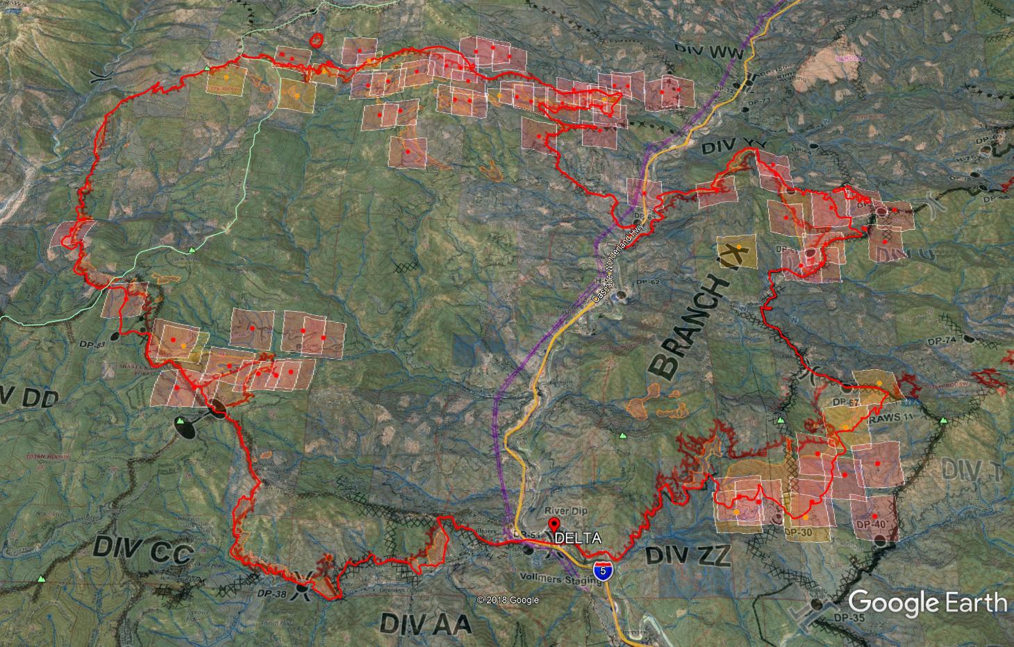
DIV ZZ on the southeast corner. Some firing ops, as well as a slop over the Hirz line near DP67 contributed to what appears to lose the entire bowl of Nawtawaket Creek drainage east of Crane Mtn down to DP40. The west side of this piece and the firing ops all appear to be holding off Fenders Ferry Road up over the ridge and down into the bowl. Not quite part of their initial plan, but there is dozer line out ahead of this piece from Hirz line tying into Fenders Ferry road.

DIV CC on the southwest corner (looking to the SE), it appears to be holding on the Dog Creek Road right below the Carr perimeter. I don’t want to imagine the miles of straight black if Delta runs into the Carr perimeter.

DIV DD, looking at drop point 83 it looks like from IR perimeter it slopped over the line. Hope they can hook that and not have to fall back to the Carr and lose a lot of that.
DIV GG/JJ the entire west side of the fire above the East Fork Trinity. Not sure of their plan here. There’s some hand line and road it appears to be hung up on, but from this Ops map, looks pretty open and wild country out there. Monday had four Scoopers working GG/JJ hard most of the day out of Trinity Lake.
DIV PP/TT/WW on the north end (looking west), good firing ops to try and tie this thing into the freeway before Mears Creek Road in Shotgun Creek drainage. Impressive job keeping it out of Highland Lakes area with large structure impact.
3 Likes
53,837 Acres with 11% containment as of 22:00 on 9/11/2018.
https://inciweb.nwcg.gov/incident/6191/

View from Trinity Lake Today: Courtesy KRCR-TV
1 Like
IR looks good. Still spreading slowly and steadily, but no major runs outside of their box.
6 Likes
One of Kern County’s copters is up here and doing a night recon of the fire currently.
2 Likes
Let’s hope they had good air for their work. Its clear now, but we had a reasonably wetting rain this evening in Mt Shasta. Should be good conditions for flight operations this week.
3 Likes
Current Situation
Total Personnel 3,188
Size 58,427 Acres
Percent of Perimeter Contained 17%
Estimated Containment Date Saturday September 22nd, 2018 approx. 12:00 AM
Fuels Involved
Timber (Litter and Understory)
Diminished winds will see the return of fuel and slope driven fire spread. The burn periods will be shortened by increased relative humidity.
We’re pretty much into prescribed burning conditions up there now, and it’s a little cool and moist this morning even for that!
https://www.wrh.noaa.gov/mesowest/timeseries.php?sid=TT081&num=72&banner=NONE
3 Likes
I5 is closed again.
1 Like
Bringing in 2 scoopers to try to cool it down and keep it from crossing 5.
That’s great except they are relying on emergency equipment to support it. Time and place- right now is not it…
1 Like
Open now, both directions.