
My rudimentary mapping of the fireline on Google Maps pegs it well over 6,500 acres. But we’ll offically know soon enough.

12 Likes
So, looking at the map you made, it’s hopefully going to parallel HWY 97? I only ask cause I have family evacuating shastina as we speak.
2 Likes
Thank you for the update , have a friend that evacuated . Seen how close it getting to the house
4 Likes
I believe it will likely parallel lake Shastina and go north north-east, yeah. Although I believe it’ll likely jump the 97 north of Bolam. Im very concerned for anyone living in or east of the Whitney Creek area tho. This thing looks like it’s gonna barrel right down to that subdivision shortly if conditions don’t stabilize.
I wish you family all the best!!
3 Likes
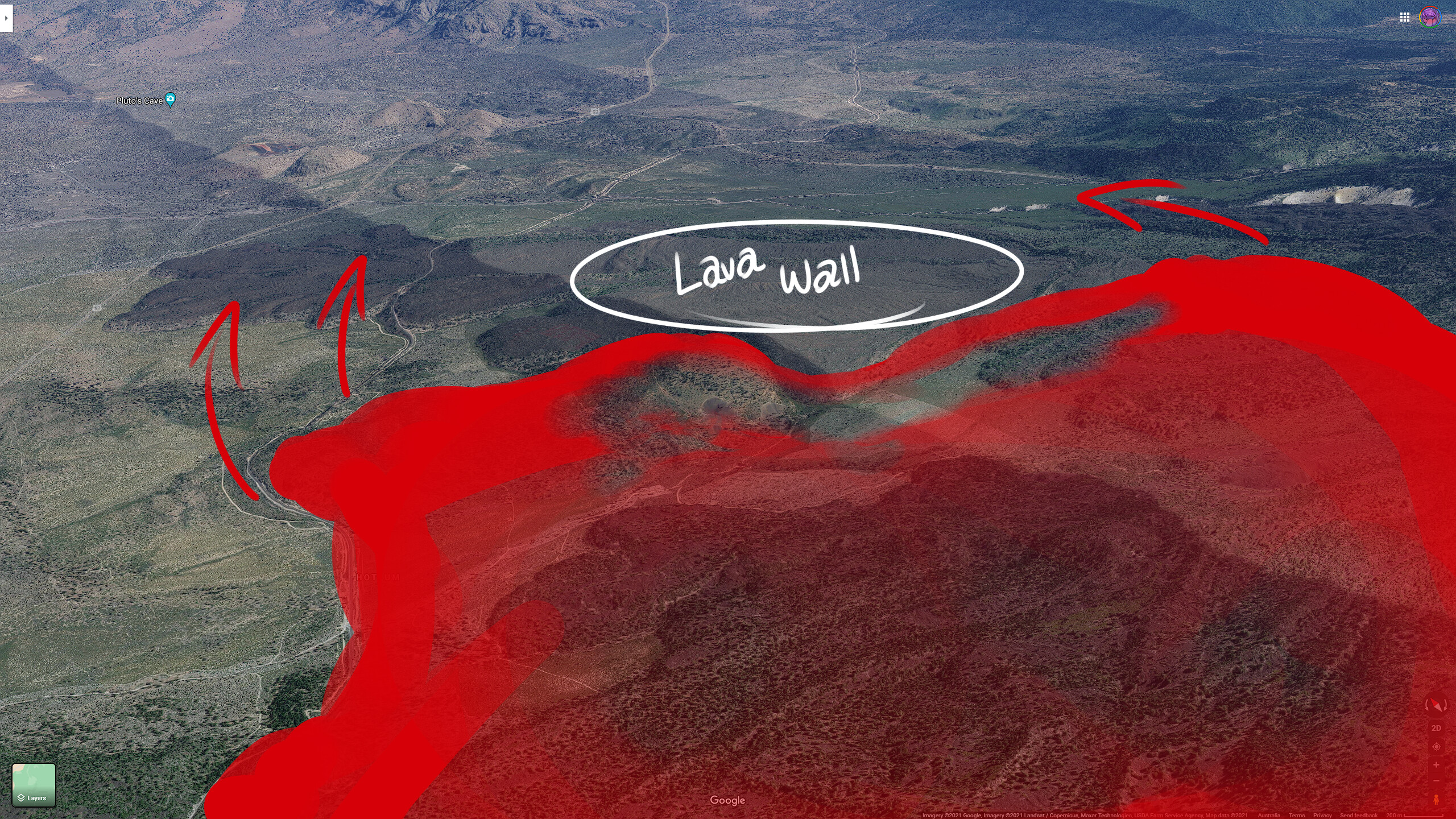
Does the Lava Wall have the potential to slow this down a little or will the fire blow right over it. Not familiar with this area.
Let’s keep to the facts all. There are people families being affected by this. Prayers for all fighting this beast!
1 Like
The lava wall seems to have stalled the main push of the fire, but it looks to be burning around the wall…
6 Likes
Copy, thanks!!!
1 Like
http://www.alertwildfire.org/shastamodoc/index.html?camera=Axis-Weed1&v=fd40729
Weed fire cam 1 has been repositioned to show hwy 97. Looks like fires getting ready to bump it.
4 Likes
I agree with the NE push all day today, vs the earlier thoughts of a more northerly push. At 1620, with the zoomed in cameras it’s looking like it’s impacting 97 closer to and just past 42N15 forest road.
5 Likes
Indeed… getting confirmed reports of the main head of the fire now well-established north of the 97…
That and a wall of flames is roaring toward the 97 on the eastern most side as well. This is an August firestorm burning in June!

5 Likes
That’s about 1.5mi of flame flank/shoulder there from where it came off the lava shelf and to the left edge of camera view. Running. At least it’s open land in that lava cap area, Quarry Lane and Quarry Road. But not for long.
4 Likes
Mike Daly live on 97 https://m.facebook.com/story.php?story_fbid=10222767245363137&id=1635196043&sfnsn=mo
Damn nature, you scary.

In all seriousness this is a horrifying event and my thoughts go out to all of the people on the line + residents and animals involved.
10 Likes
Has anyone heard of the potential on this one? I’m assuming an IMT activation will be soon.
2 Likes
Team 14 type 2 has it
2 Likes
Thanks. This is no place to divert attention.
2 Likes
We’re doing our best with updates on Siskiyou Alerts
In addition to Lava, a vehicle fire into the vegetation in Tennant has jumped 97 and prompted evacuation warnings for Bray and Tennant.
A new fire is reported in Montague on Ager-Beswick x Desavado. Reported as multiple fires now, burning north. Just heard them requesting ODF.
11 Likes
Thank you Shannon for your efforts.
3 Likes
Anyone have a QR code for this incident?