Anyone have any updates on lake Shastina community?
Any updates on the south end of the fire? Div H and Div M
Anyone have any updates on lake Shastina community?
Any updates on the south end of the fire? Div H and Div M
As of 6/30 17951 acres and 19 percent contained.
Anyone able to view the updated GACC Fire information summary . They usually post a 209 summary but I don’t see anything listed since 2020. Did they stop updating it ?
Any structures lost?
According to the 209, no.
Yes. Many photos on Facebook of burned structures. This area has a lot of illegal marijuana farms with thousands of greenhouses and many people living in small sheds an shanties on the properties.
So mainly Shasta vista and not lake Shasta or juniper valley?
There will be an assessment team that will go in and count and determine the kind and amount of property lost or damaged.
Looking at the Shastina Cam it looks like they have dozers cutting line on the Juniper Valley side of Big Springs RD. Any word on if they are going the length of Big Springs or possibly cutting it up Quarry?
Mostly in the Shasta Vistas that I’m aware, between Big Springs and the A-12. There’s some maps floating around of fire progress through the neighborhood but I’m not sure of their accuracy and they’re 24 hrs old at this point.
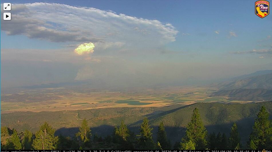
Is that a spot fire well ahead to the southwest ( Mt Bradley 2) or dozer dust ?
South side of the fire on Mt Shasta looks like it’s starting to bump the edge of tree line, with the eastern edge putting up a nice column and starting to break through the inversion layer.
Any whispers of LG equipment being ordered for any of these fires since the big teams are taking over?
I think there’s been quite a few LG s/t ordered but I think a vast majority of them got punched out on OES rigs.
Sometime after midnight you’ll find out 
Kind of mind-blowing how much cannabis farming is going on out there. Looks like a more desert version of Trinity Pines. And it looks like they got really lucky with the winds. A couple degrees different wind direction either way and it would have caused a lot more structure (and crop) loss.
Check both out on this map (Satellite view). Look at all those greenhouses!
https://maps.nwcg.gov/sa/#/%3F/%3F/41.5472/-122.3195/16
ITs a huge issue out there, water-wise. Before the growers moved in, there were scattered people here and there. Now, its got tons (literally) of marijuana and almost no water. Causing lots of angst.