
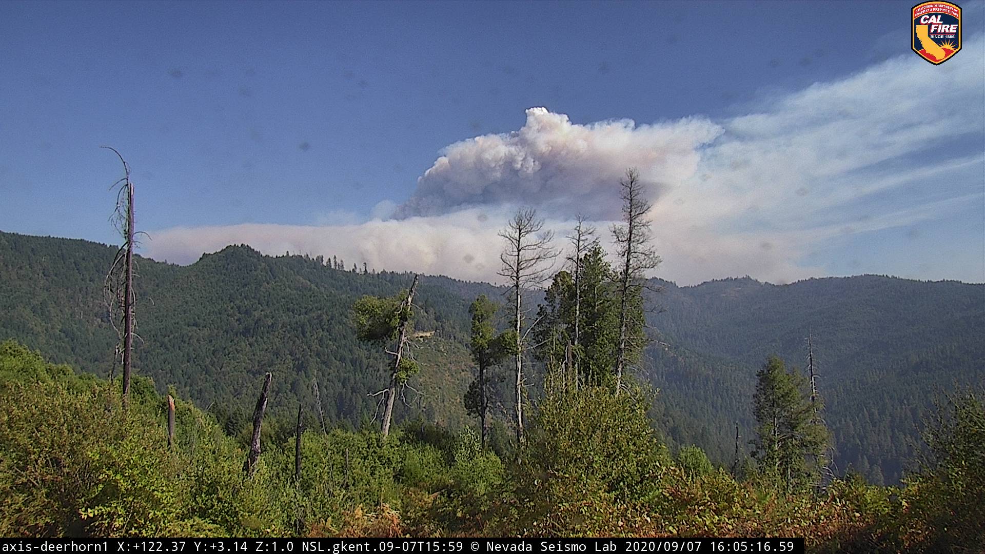
44,945 acres, gained about 5000 yesterday, still calling it 19% contained. RFW for the fire area tonight. RH projected to drop to 10%, winds to 10 mph this afternoon, then tonight into tomorrow morning winds increase to 15 gusting to 30 out of the northeast. Definitely concerning for Hoopa. For some reason I am unable to post the IR map this morning.
3 Likes
2 Likes
Enough said.
3 Likes
Is the Hobo fire part of this complex?
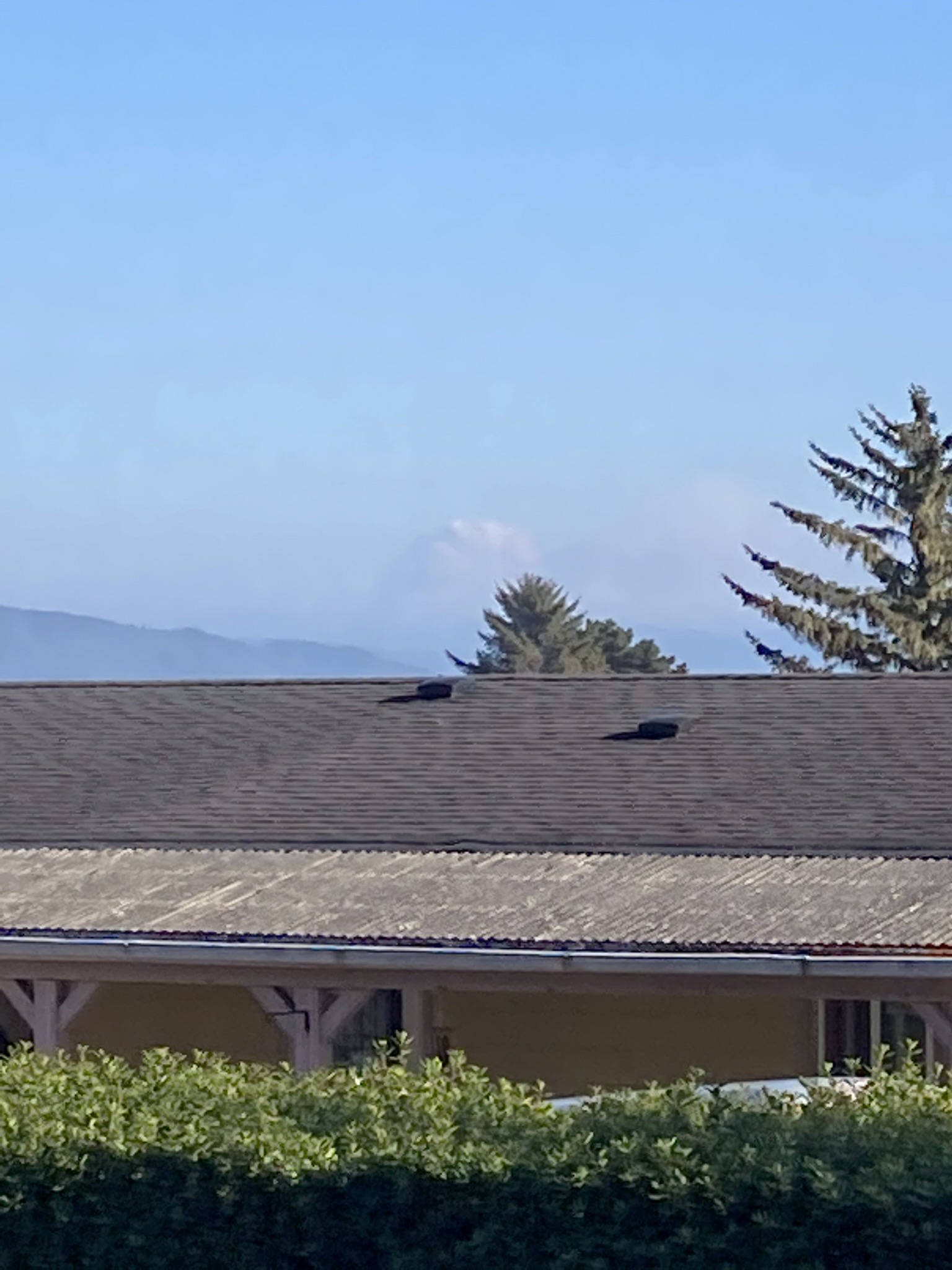
Header showing well from Brookings.
1 Like
Nope.
(But post must be 10 characters long apparently.)
1 Like
Pictures…?
Does anyone know if this is the feed for the “Red Salmon Complex”? I have personnel just ordered up to the Red Salmon Complex in SRF and this feed is SHF.
This is it.
1 Like
Thank you, so many cant keep it straight.
77000 acres, evac advisories issued for Forks of Salmon area this afternoon.
1 Like
82, 746 acres. Link to IAP: https://ftp.nifc.gov/public/incident_specific_data/calif_n/!2020_FEDERAL_Incidents/CA-SRF-000656_Red_Salmon_Complex/Current%20IAP/Red%20Salmon_IAP_09_11_20.pdf

2 Likes
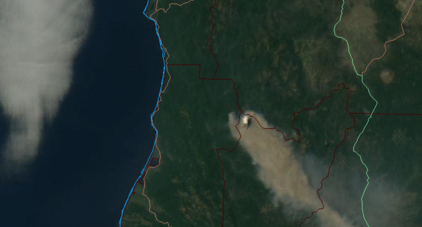
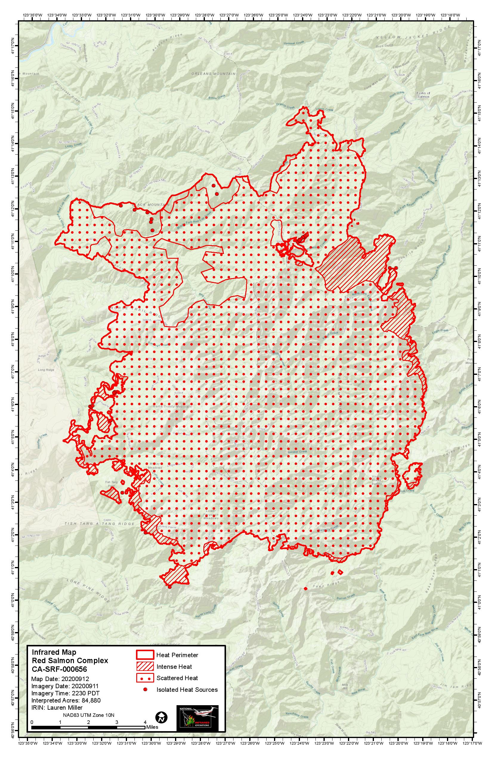
84,880 acres as of last night’s IR flight. The firing op on the west side is visible on the map, as is the active fire on the northeast side that is working its way down the Knownothing Creek drainage toward Forks of Salmon. A strong inversion is in place, but ridgetop winds are projected to be 10-15 mph with gusts near 20 from the south today. Chance of rain on Tuesday.
7 Likes
Thx for keeping us updated, Fishcop!
2 Likes
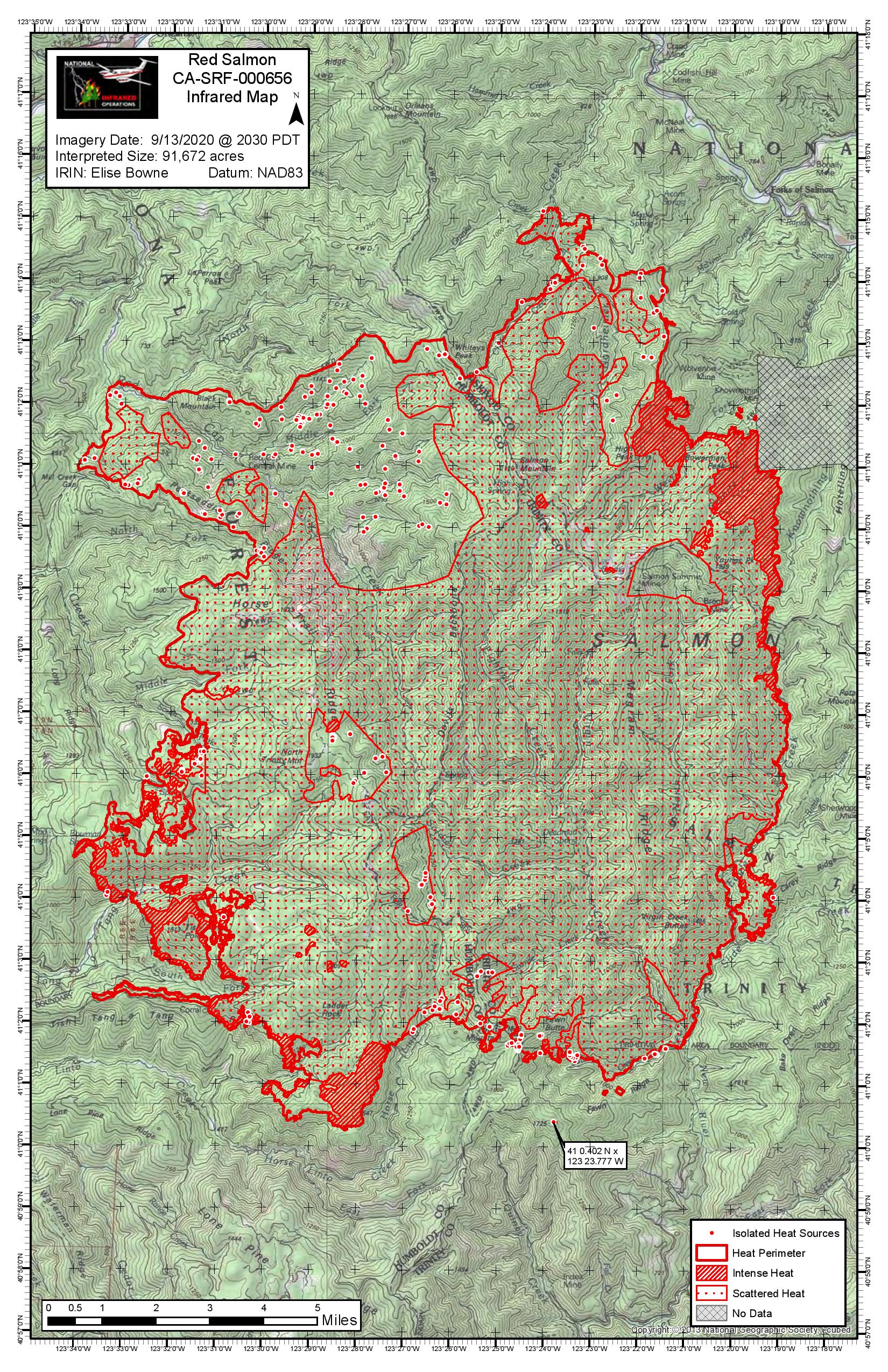
Mandatory evac order was issued for the Forks of Salmon area yesterday afternoon. Per south ops, “87,849 acres brush and timber 16% contained. Fire behavior was active today due to increased southwest wind and low humidity.”
3 Likes
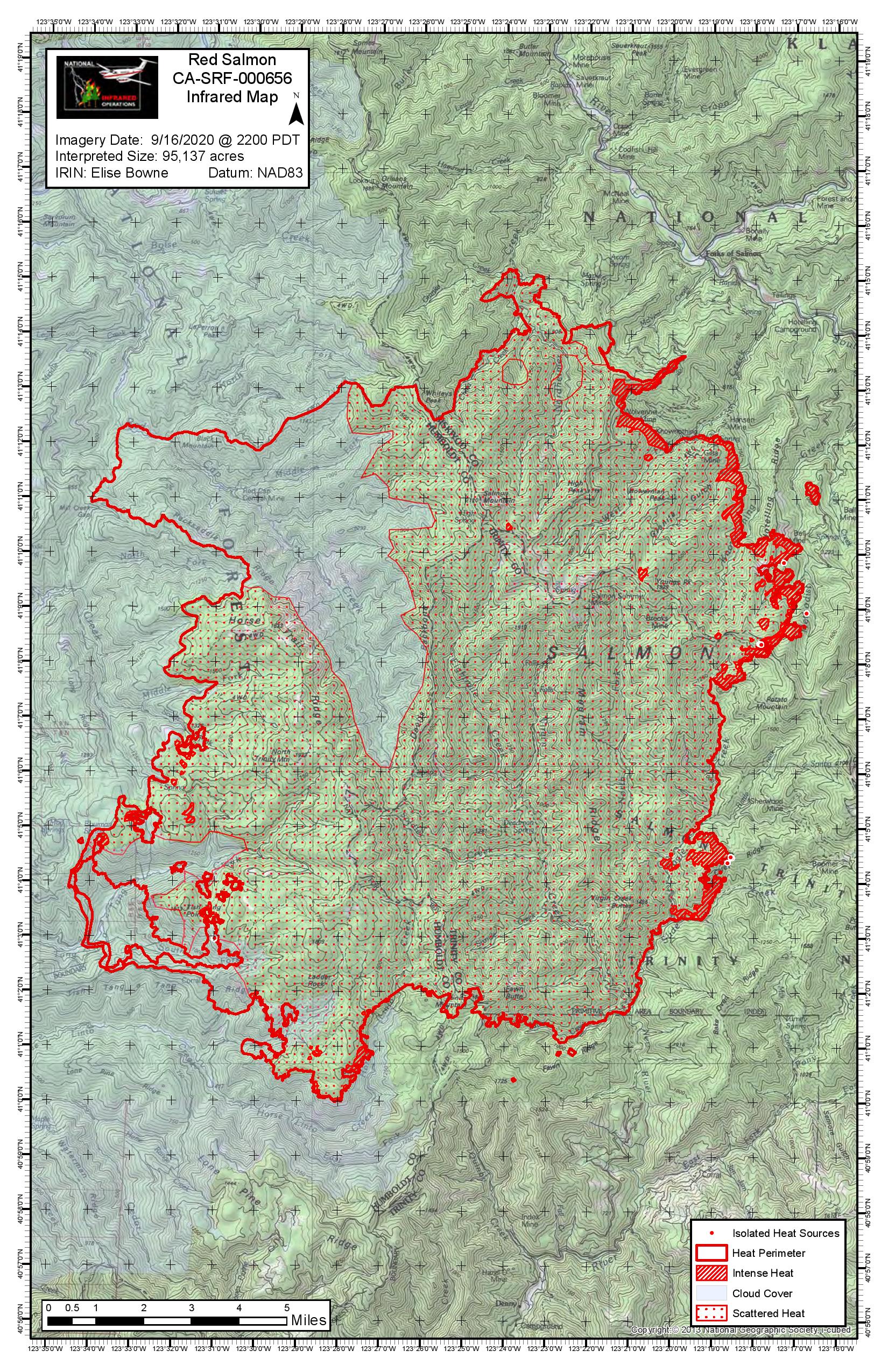
95,137 acres. The burn op between McNeal and Knownothing Creeks is progressing, as well as the one near Tish Tang Creek on the west side of the fire. If they can get those two pieces secured, it should just be a matter of waiting for the snow to fly.
4 Likes
IAP 19-20
1 Like