No ?? 
1 Like
David Cooper is still working as deputy IC, glad he’s still sharing that wealth of knowledge he has.
2 Likes
4 Likes
8126 Acres, gain of about 1000 acres yesterday. Appears to be going according to the plan.
ir_11x17_land_20200811_0521_Red_Salmon_Complex_CASRF0656_0811Day.pdf (2.1 MB)
1 Like
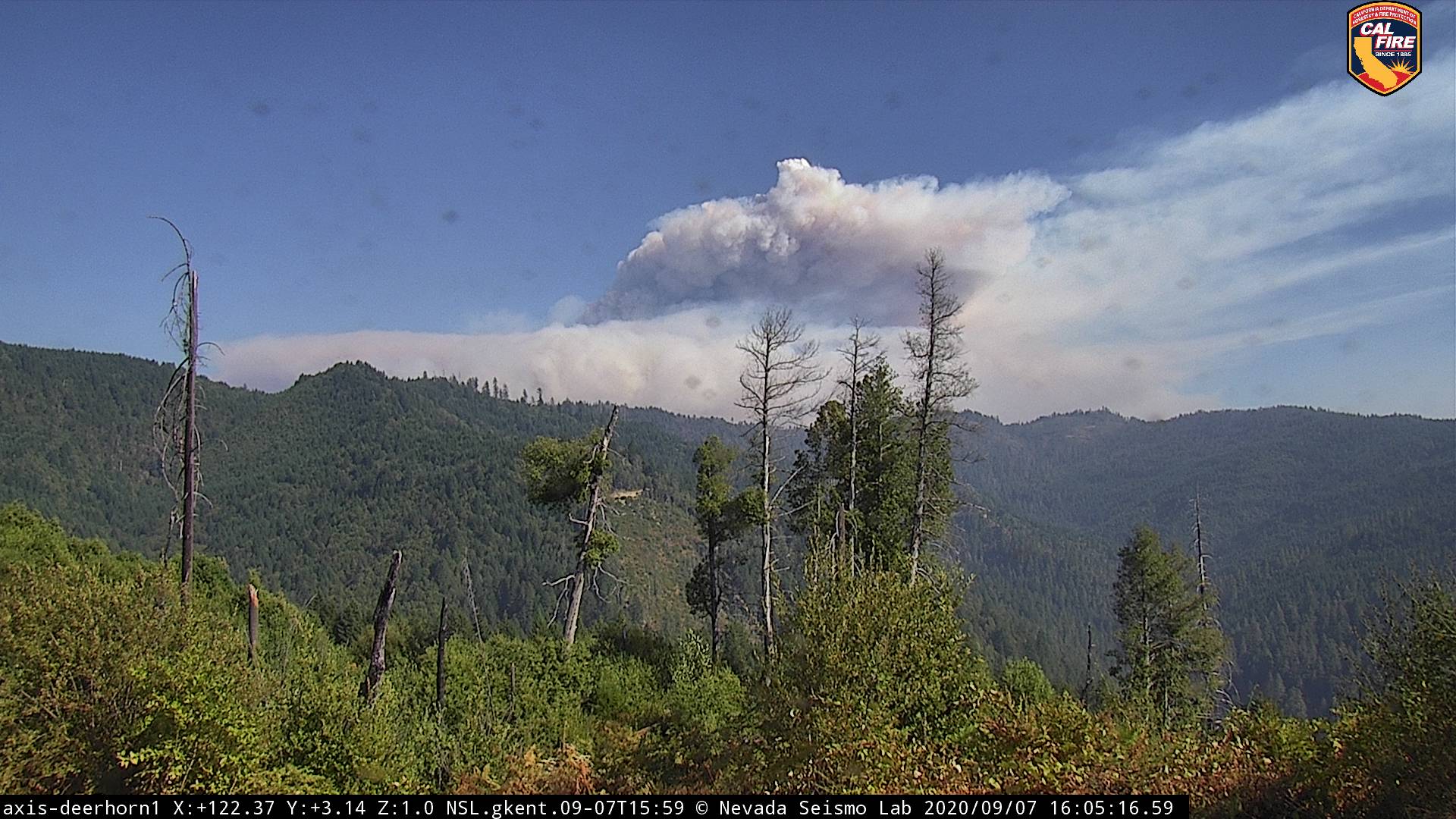
IR this morning shows a well established spot in the China Creek drainage NE of the Red fire. Looks like the box may be getting bigger on this incident.
2 Likes
I saw a couple of VIIRS satellite heat detections there yesterday morning, and I was hoping they were false detections. Lets hope they can catch that spot, the next set of containment lines around that spot would add about 20 sections or 12,000 acres by my rough calculations.
Weather from the NWS Medford Area Forecast Discussion: “All model guidance has been trending hotter for the next heat wave which should last from Friday through Tuesday. We can characterize the days in that 5-day period as hot, very hot, very hot, hot, and hot…The latest forecast reflects daily record or near-record high temperatures on Saturday for Medford, Roseburg, Yreka, and North Bend. It looks like the greatest heat impacts will be west of the Cascades, but temperatures will still be 10 to 15 degrees above east of the Cascades. Some moisture from the remnants of a tropical cyclone off the coast of Baja California will make its way northward toward our forecast area this weekend. This could bring enough cloud cover to keep high temperatures down a bit, but any cloud shield would keep overnight low temperatures even warmer than typical in this type of pattern. Therefore, little relief from the heat is expected overnight. The bottom line is this heat wave is definitely the most significant in the past 2 years, and the magnitude of this hot air mass generally only occurs once every 5 years.”
There was no IR flight last night (UTF), but it looks like there was significant growth on the spot north of the Red fire. Lots of smoke rolled into Scott Valley last night. The thunder storms that hit the bay area this morning are expected to arrive over the fire area this afternoon, and NWS has issued a Red Flag Warning.
2 Likes
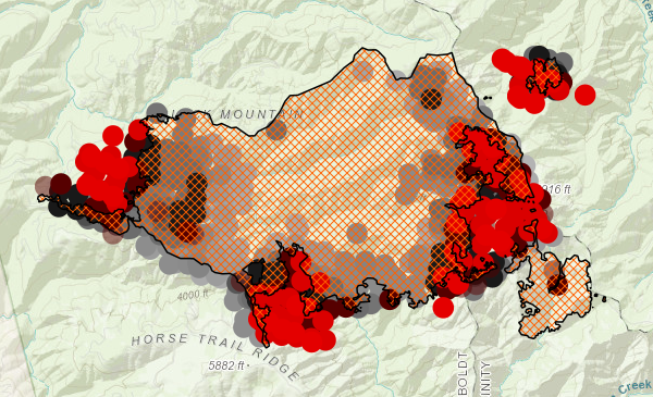
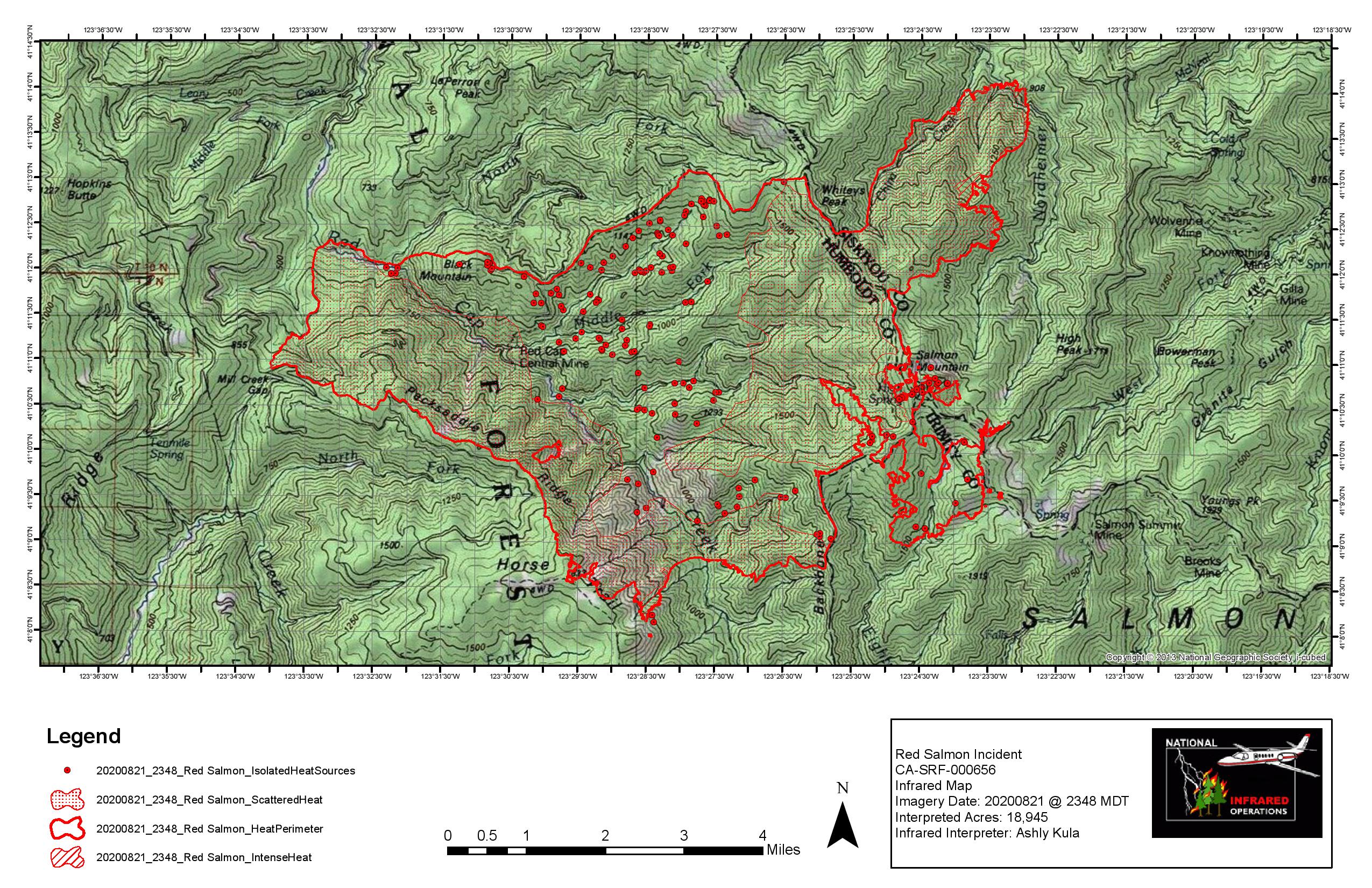
18,945 Acres. They’ve started burnouts to put a box around the “spots” on the NE corner of the fire. With all the other fires in the state, this one isn’t really on the radar anymore, but this is extremely remote, tough country and there’s a ton of potential for growth.
Edit 9/1, since I can’t create a new post… It looked like they were close to wrapping this one up and then yesterday it jumped outside the box on the south side of the fire. Ran a couple of miles before the IR flight, which was flown at 2330. From the heat signature on GOES, looks like it burned hot all night last night.
4 Likes
Thanks for the update
1 Like
I wondered about that. Thanks for the update!
1 Like
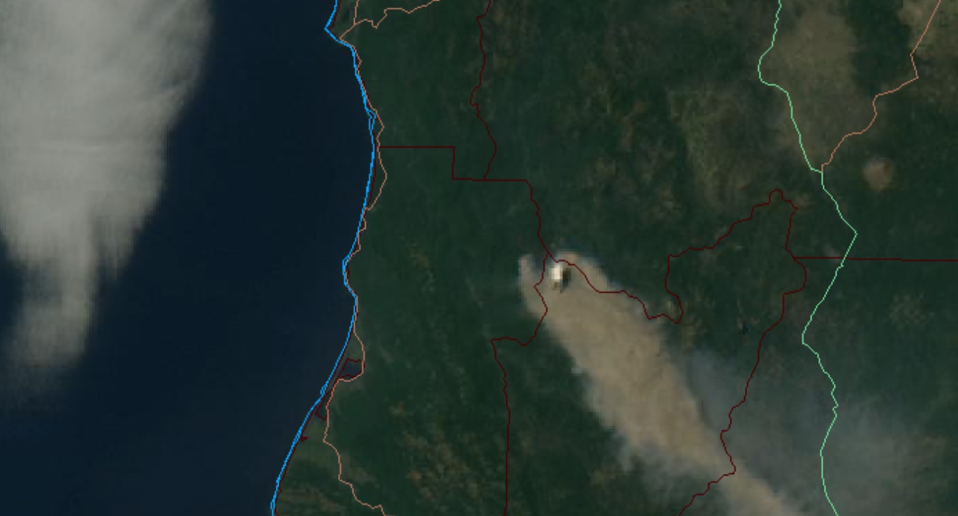
Orange area is fire perimeter on 09/01/2020 at 1436, red area is additional growth between that time and 0920 this morning.
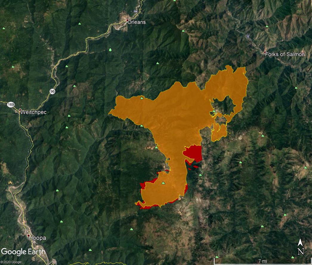
The fire was shown as 28195 acres this morning, 42% contained.
4 Likes
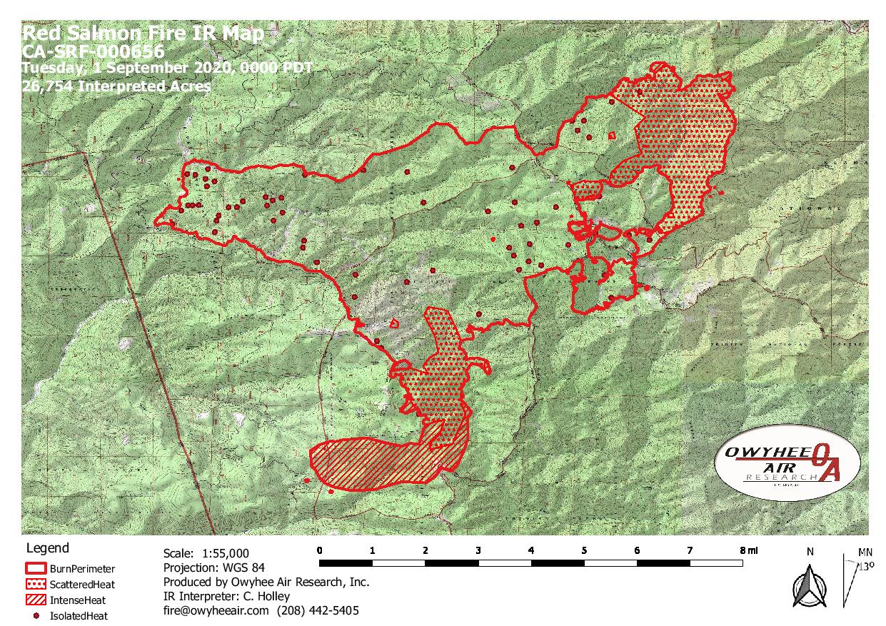
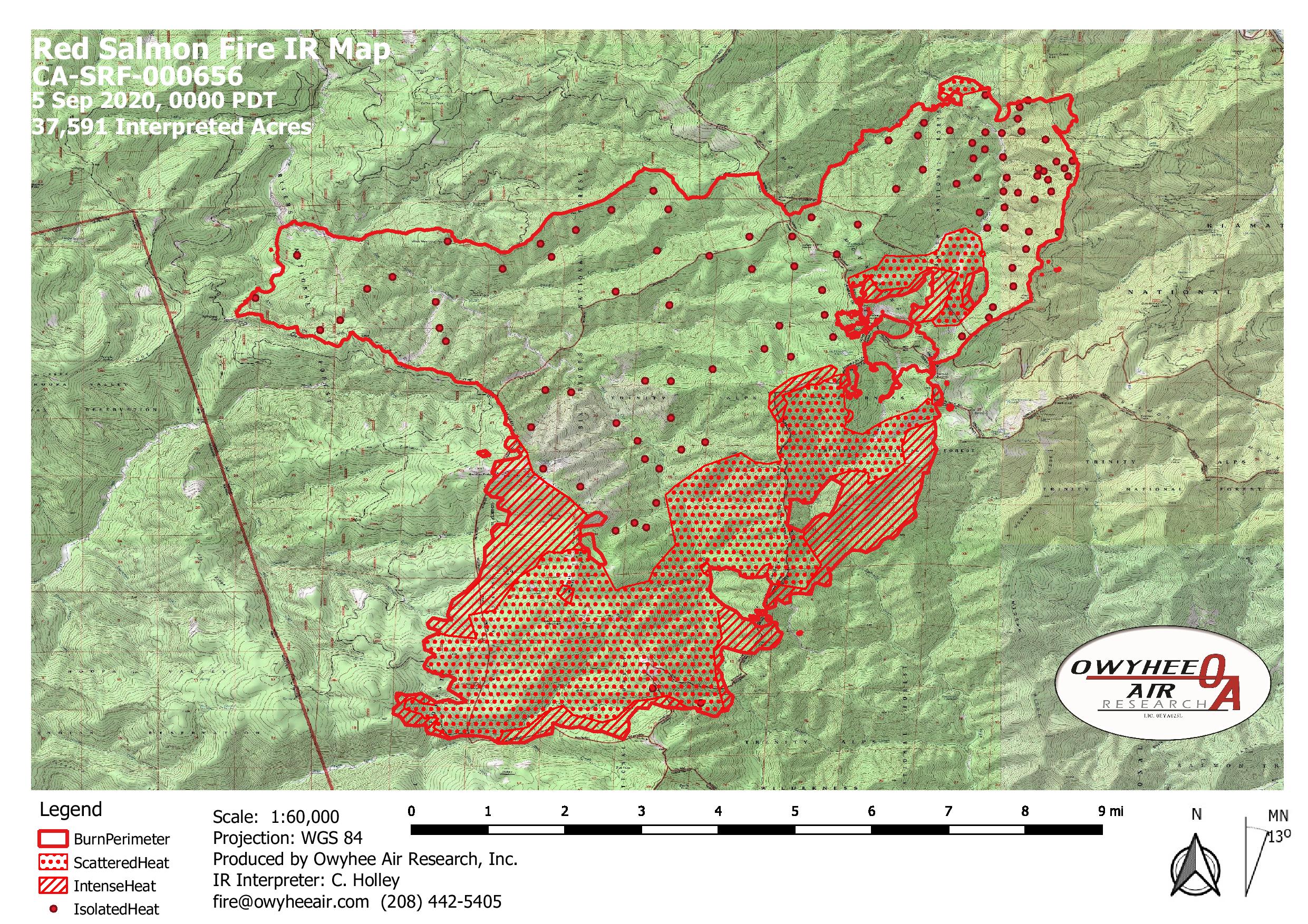
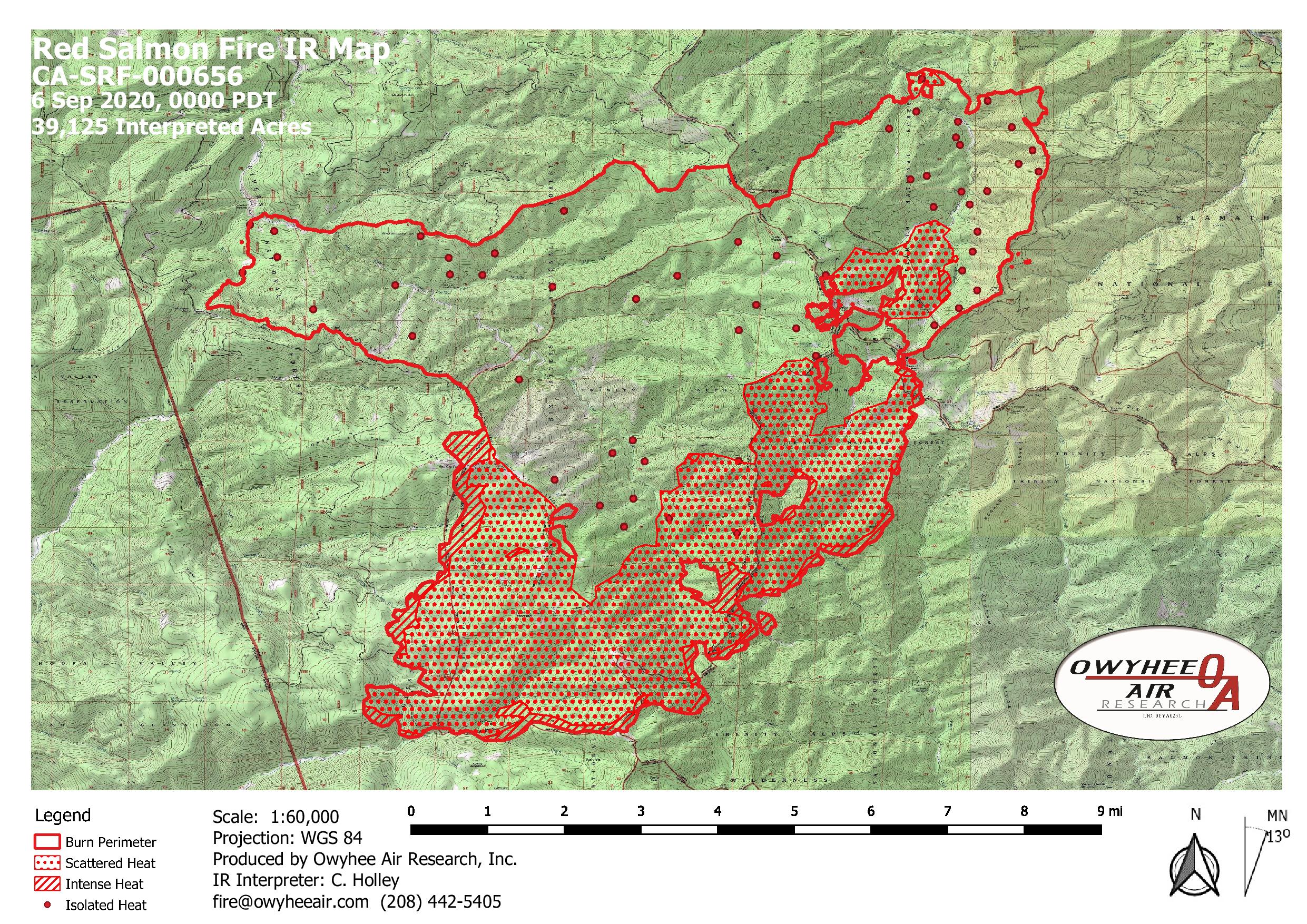
37,591 acres per last night’s IR, 30% contained (down from 42% 3 days ago). Big growth on the southwest and east sides of the fire over the last couple of days. Hot and breezy with low RH predicted for this weekend.
5 Likes
Thanks for the update.
1 Like
Update - North Ops now shows it only 19% contained.
4 Likes
Oscar came to play with Kilo last night out of Eightmile creek
3 Likes
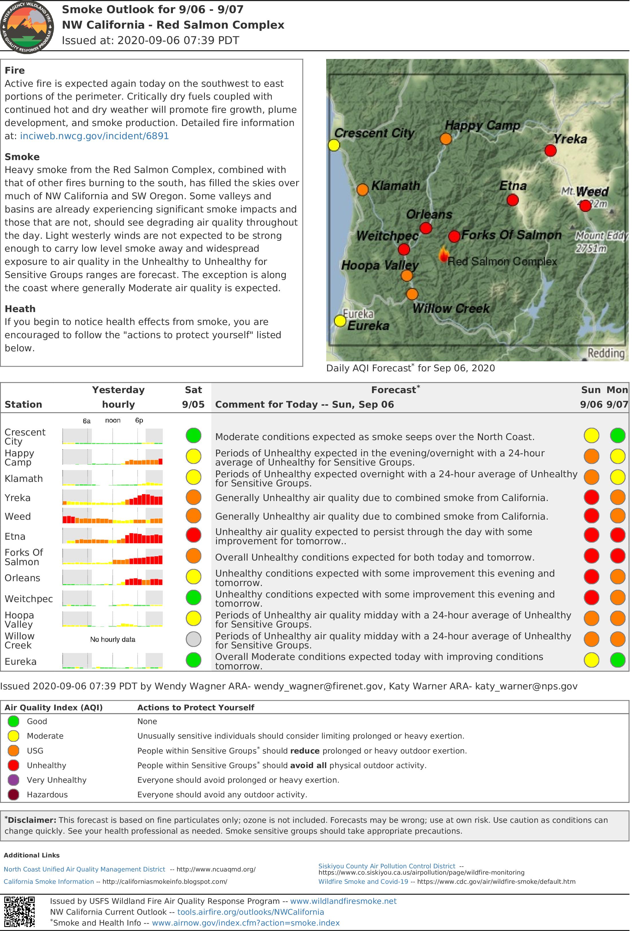
Does anyone assigned to the fire or familiar with the area have any idea of the smoke production that this fire is putting off and the primary wind pattern/direction from this area? I am supposed to be backpacking at grizzly lake next weekend and was wondering what type of smoke drift might impact the area. Trailhead is near Summerville. I’ve looked at some air quality metrics on the USFS website but they don’t have a location listed that is near the trail.
44,945 acres, gained about 5000 yesterday, still calling it 19% contained. RFW for the fire area tonight. RH projected to drop to 10%, winds to 10 mph this afternoon, then tonight into tomorrow morning winds increase to 15 gusting to 30 out of the northeast. Definitely concerning for Hoopa. For some reason I am unable to post the IR map this morning.
3 Likes
2 Likes