
Enough said.
3 Likes
Is the Hobo fire part of this complex?
Header showing well from Brookings.
1 Like
Nope.
(But post must be 10 characters long apparently.)
1 Like
Pictures…?
Does anyone know if this is the feed for the “Red Salmon Complex”? I have personnel just ordered up to the Red Salmon Complex in SRF and this feed is SHF.
This is it.
1 Like
Thank you, so many cant keep it straight.
77000 acres, evac advisories issued for Forks of Salmon area this afternoon.
1 Like
82, 746 acres. Link to IAP: https://ftp.nifc.gov/public/incident_specific_data/calif_n/!2020_FEDERAL_Incidents/CA-SRF-000656_Red_Salmon_Complex/Current%20IAP/Red%20Salmon_IAP_09_11_20.pdf

2 Likes
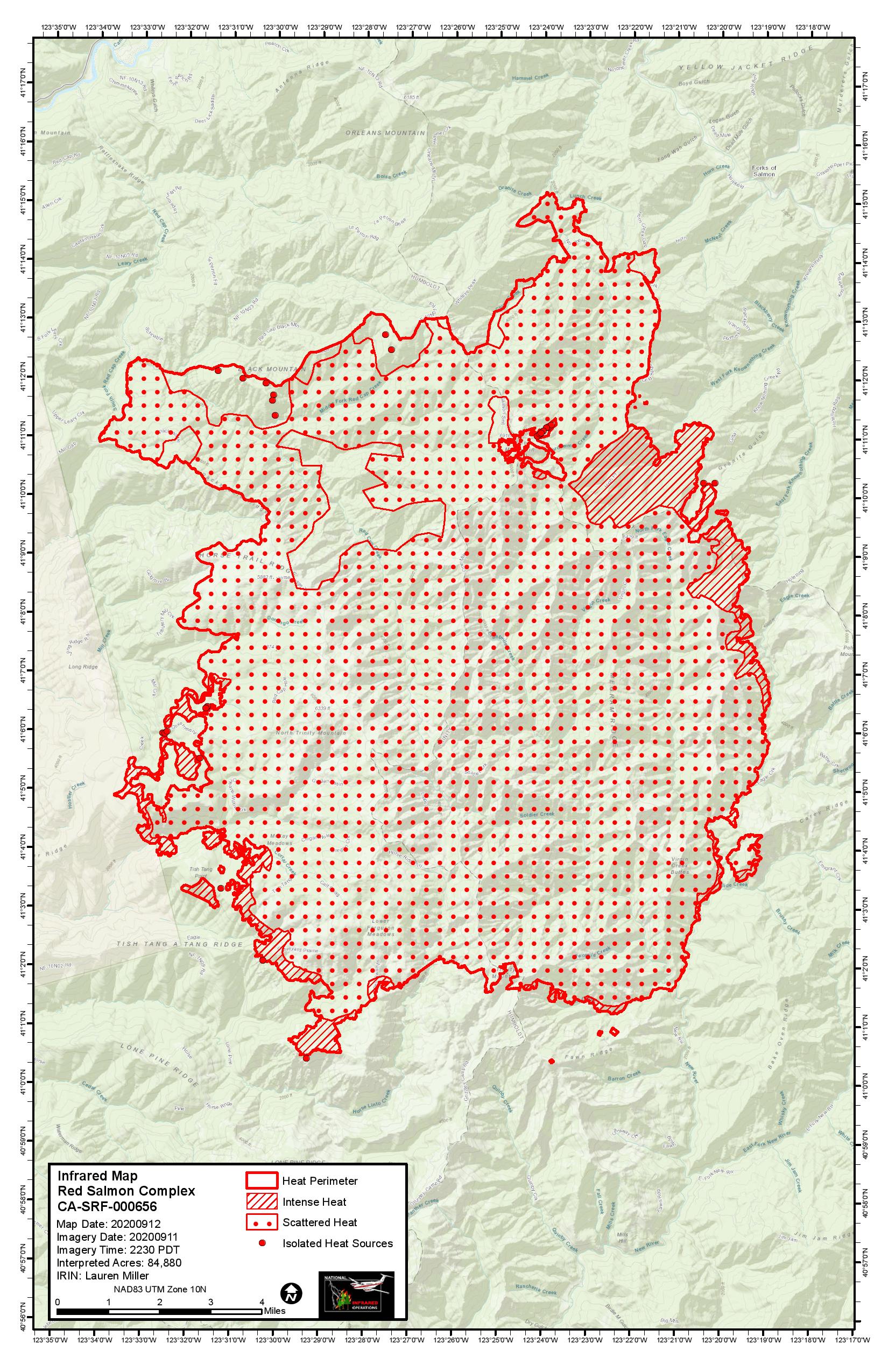
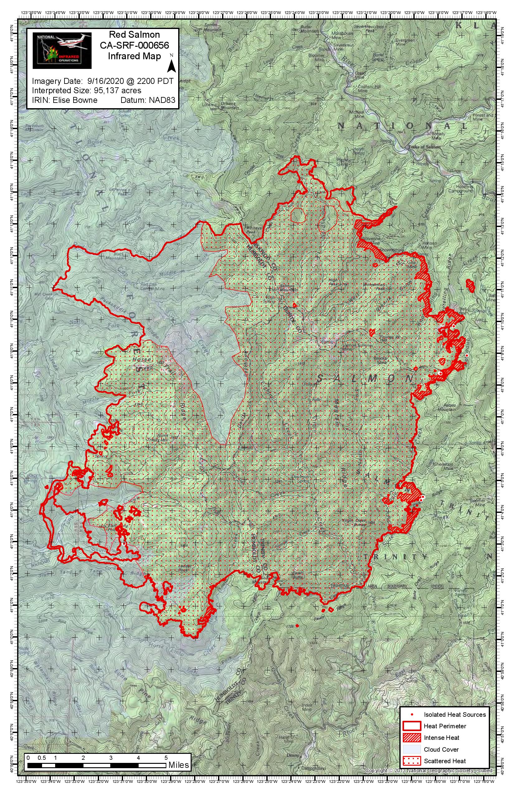
84,880 acres as of last night’s IR flight. The firing op on the west side is visible on the map, as is the active fire on the northeast side that is working its way down the Knownothing Creek drainage toward Forks of Salmon. A strong inversion is in place, but ridgetop winds are projected to be 10-15 mph with gusts near 20 from the south today. Chance of rain on Tuesday.
7 Likes
Thx for keeping us updated, Fishcop!
2 Likes
Mandatory evac order was issued for the Forks of Salmon area yesterday afternoon. Per south ops, “87,849 acres brush and timber 16% contained. Fire behavior was active today due to increased southwest wind and low humidity.”
3 Likes
95,137 acres. The burn op between McNeal and Knownothing Creeks is progressing, as well as the one near Tish Tang Creek on the west side of the fire. If they can get those two pieces secured, it should just be a matter of waiting for the snow to fly.
4 Likes
IAP 19-20
1 Like
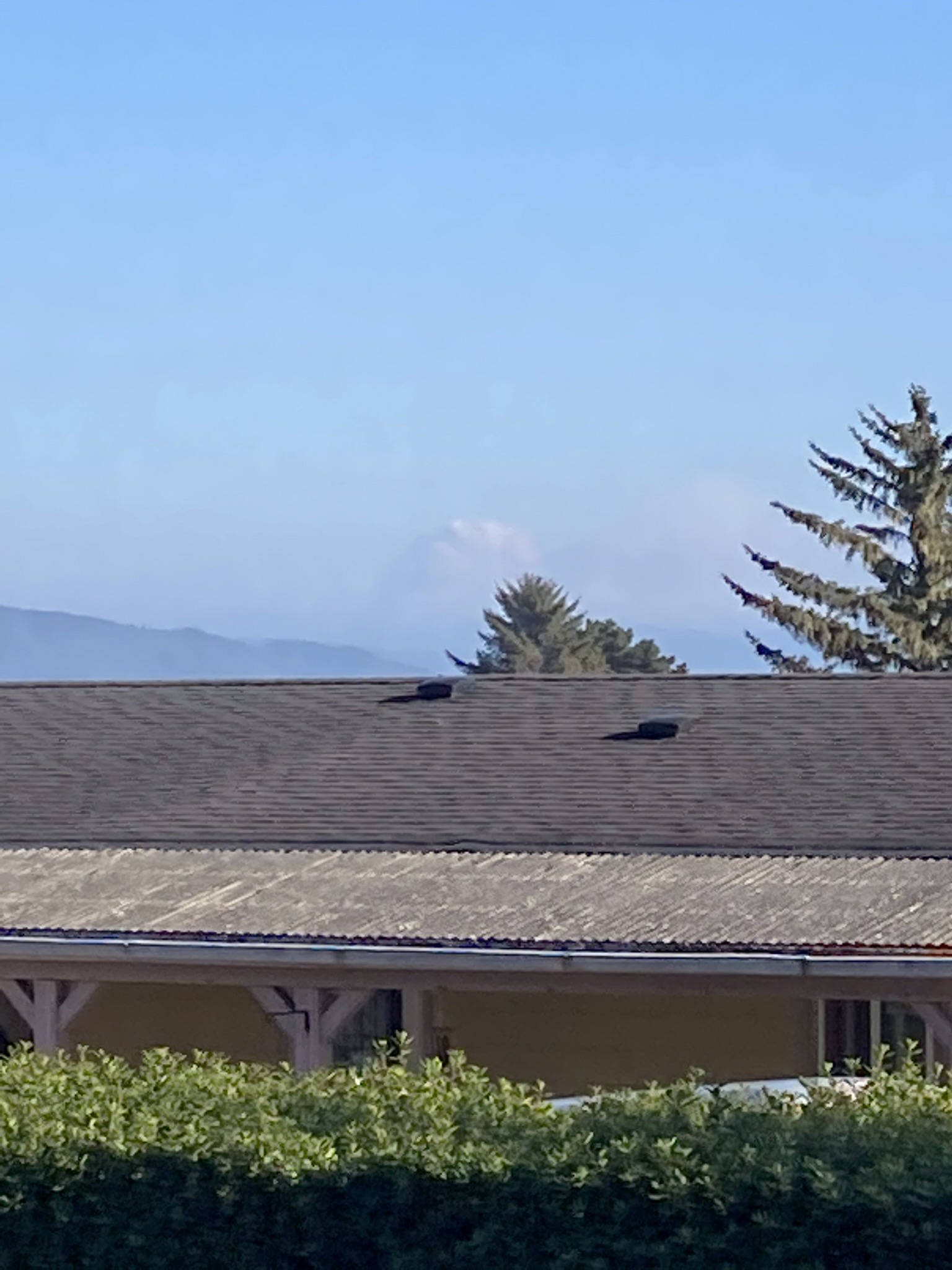
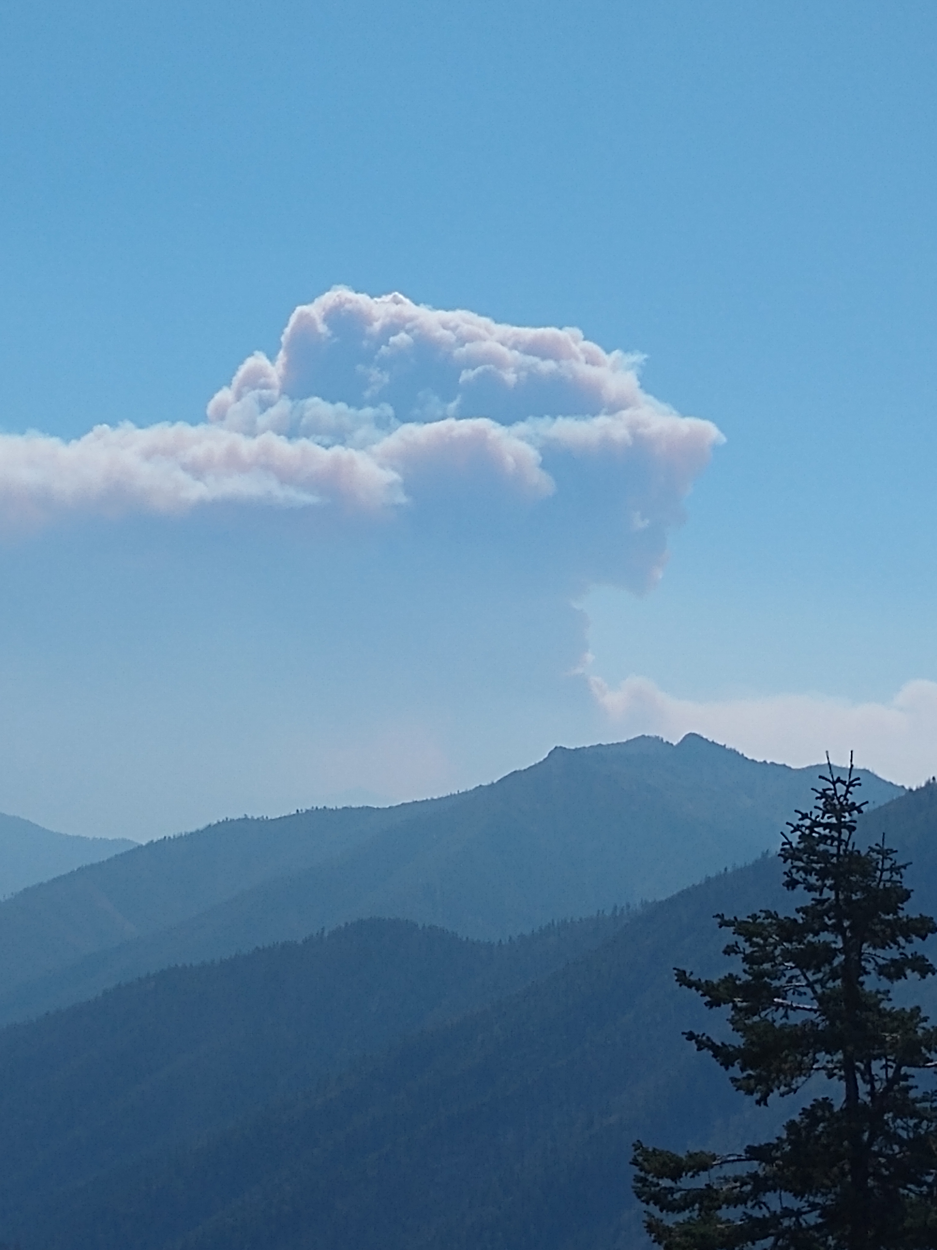
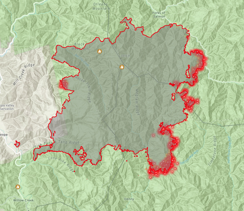
From the satellite IR, looks like the east side of this fire made a big run today. I could see the column from Forest Mountain summit on Highway 3 this evening. Not much threat to life or property at this point, but it could definitely become a threat to Denny/Burnt Ranch/Salyer in the near future if this wind event continues for several days as predicted.
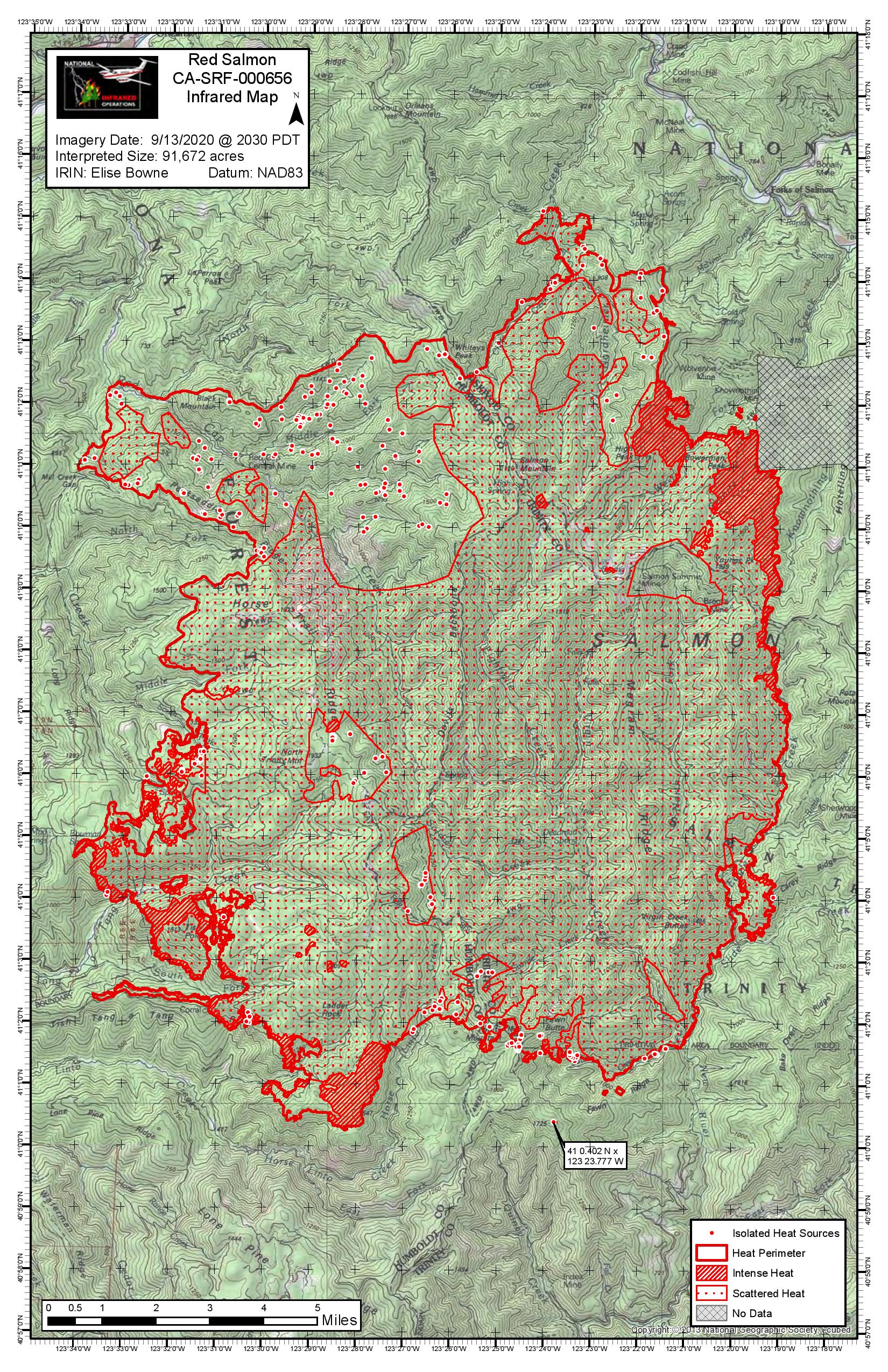
Here’s last night’s IR map (111063 acres, 31% contained):

3 Likes
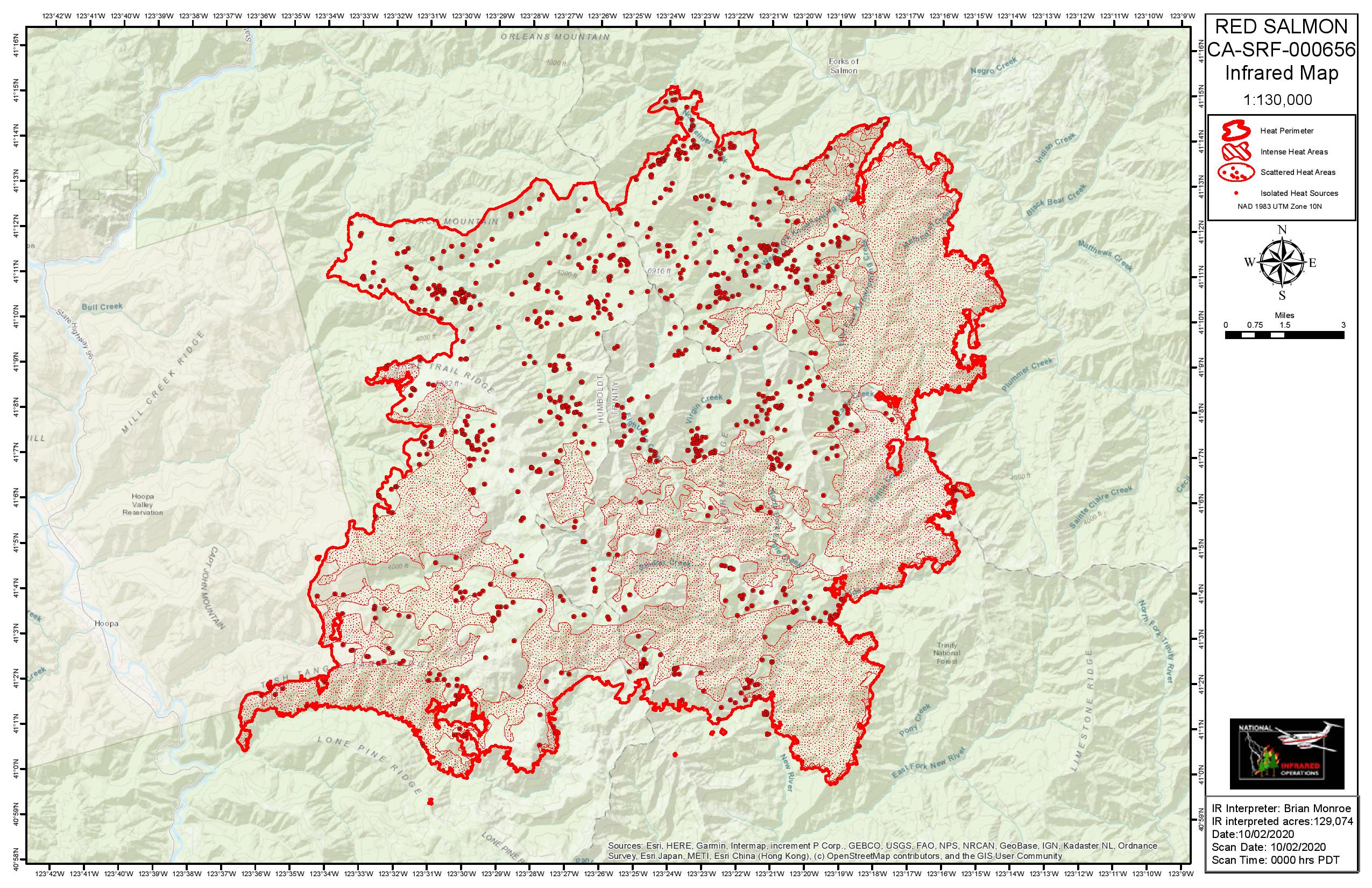
129,074 acres, 31% contained. On the NE side, the fire should start bumping the S. Fork Salmon River soon. Hopefully they can hold it there, if it get established on the north side of the river, it’s a whole new ball game. On the SW side, burnout ops continue in the Tish Tang/Lone Pine Ridge area.
2 Likes
High pressure has broken down and onshore flow will continue through the end of the week. This will result in some possible mist or drizzle near the coast tomorrow morning, while dry conditions will exist everywhere else for the next two days. Temperatures will also cool with this flow pattern, and near to slightly below normal temperatures are expected today through Saturday. A weather system is then expected to bring unsettled weather this weekend, with the threat of rain on Friday decreasing, and the threat on Saturday exiting mainly across northern Humboldt and the Shasta Trinity region. As the system exits the region Sunday, breezy northerly winds will develop, and may become offshore Sunday night into Monday. Meteorology will continue to closely monitor this wind threat. Fire danger remains seasonably high as live fuel moisture values are at critical levels in the lower and middle elevations and dead fuel moisture values are at seasonal minimums.
Yesterday, crews were successful in conducting defensive burning operations in both the Colgrove Branch of Mill Creek and north of New River near Miller Ranch. Crews also began wrapping historic structures near Cabin Peak in the Trinity Alps Wilderness. Crews continued to carefully bring fire down to the South Fork of the Salmon River along the Cecilville Road and protect structures along South Fork of the Salmon and East Fork of the New Rivers.
4 Likes