Please use this for Q & A
1 Like
Sounds like it’s headed up towards the mine northwest of town possibly? Have family working there.
My husband is working at the mine.i talked to him and all personnel got out. They are working their way to Highway 5 at Vollmer, north of Lakehead. It is very slow going and will still take quite a while.
1 Like
The heavies are heading to Chico now. Anybody know why?
Redding was getting pretty backed up with aircraft
1 Like
Just judging by the growth and conditions this afternoon anyone what to put money on what time the Team order goes out tonight
Not sure what CF Team is up this week
But i hope they are packing
2 Likes
Listening to the scanner link and watching the flight tracker… there seems to be a big lag with the scanner. Im showing 914 near Chico returning to MCC, but Lead plane on scanner is just now talking about making their drop? Any way to refresh the scanner link?
@norcalscan
Affirm, “head” is heading NW or left . But right flank div x and w has wind blowing back to West but topography driven spread overpowering airmass.
AA now going direct in w and x to 299 to set up Tim to open old dozer lines towards whiskey creek.
Large cells independent of incident just sheared and shadowed the incident but shearing east towards the Inc . Will see effect of outflow if any in an hour or so.
1 Like
That’s what I’m hearing too. Glad to see my mental picture matches your eyes. Radar showing that cell over Hwy3 Douglass City right now, with a line of cells building south to north along that line, south Chanchelulla and north over the western side of Trinity Lake.
@firetraveler29 the scancal live scanner will have roughly a 1-2 min delay depending on the buffer and server load. I think what you were hearing was another LAT being lined up. The scanner didn’t get much of 914’s drop as I was focusing on some command traffic for a second. By the time I was trying to see if he was lining up on victor or FM he was back over the valley as well.
1 Like

roger that
Any acreage update? I know the official word is 1,500, but it has to be more than that by now
Team 1 (Gouvea) started their week rotation today.
Today’s Ops Map:
IAP:
Spot weather forecast from yesterday:
https://www.weather.gov/spot/php/forecast.php?snumunum=1813337.0&lat=40.03649408248822&lon=-126.7205101853438&z=7
Edit:
I meant to post this in IA, not q and d. Insufficent coffee…
edit 2:
Slightly newer spot forecast:
https://www.weather.gov/spot/php/forecast.php?snumunum=1813348.0&lat=40.79208125124944&lon=-122.11070191031251&z=8
4 Likes
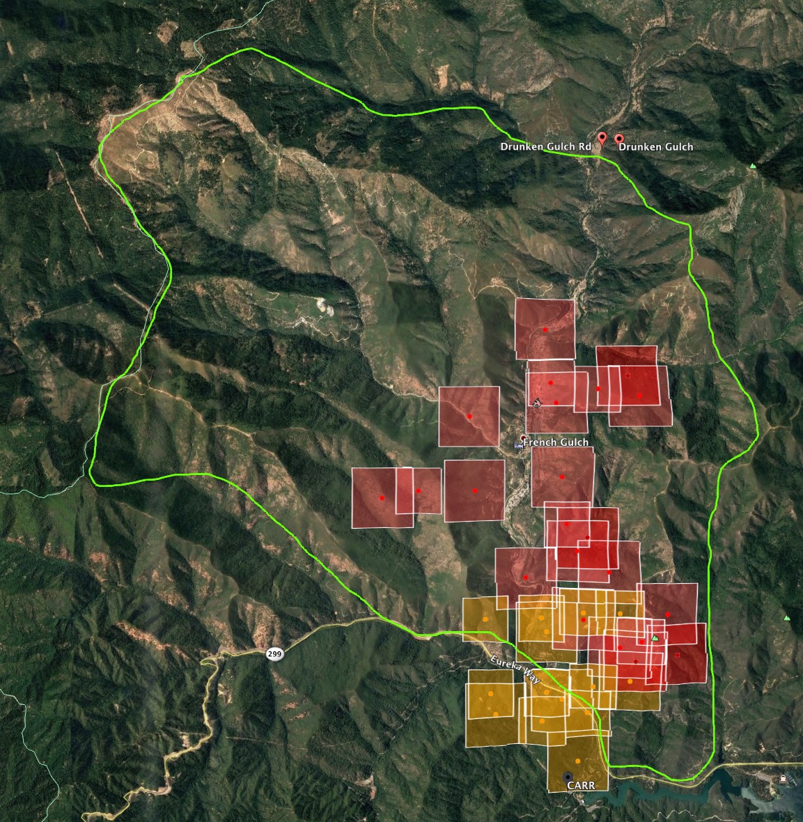
The box they identify in their objectives in the IAP is about 20,000 acres.
Keep fire West of Grizzly Gulch
East of Lewiston Turnpike Road
South of Drunken Gulch
North of 299.
4 Likes
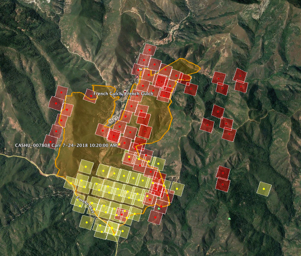
I am not sure either, but the heat signature has gotten much stronger in the last couple hours on satellite.
4103C just being deployed from NEU, consisting of Nevada City, Nevada County consolidated, Ophir Hill, Rough & Ready, and Peardale Chicago Park Fire departments.
.
1 Like
4103C??? correct designator? Type of resource?
That would be a type 3 engine strike team, judging by the designator.
It’s XNE 4103C. Not NEU. It’s a local government type 3 engine strike team.
1 Like