A shot from Brunswick Drive - an old image, but gives a good snapshot of natural fuel loads in the area. https://www.google.com/maps/@40.5862268,-122.4898335,3a,75y,44.23h,89.84t/data=!3m6!1e1!3m4!1szy8RDjoCAJhJX1O60xg30w!2e0!7i13312!8i6656
1 Like
Anyone have a radio good feed for Carr?
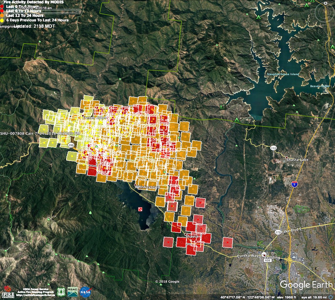
Has anybody seen an updated perimeter map?
From Twitter in the last hour.
1 Like
Still spotting and established on both sides of 299. Little town of Keswick is evacuated as well as Old Shasta. Local news and Calfire PIO stated over 28,000 acres. Its near Redding City limits (Swayze Dr, west side) Placer St. also hard closure. Winds were variable but now steadily out of the west (like the last two nights). Lots of manzanita and rolling hills and plenty of draws and chimneys near some large housing subdivisions. I just learned Red Bud Dr. has been evacuated. Red Bud is inside Redding City limits.
1 Like
That’s truly incredible
100 foot wall of fire running down to snow ln
I’m seriously scared for these people.
1 Like
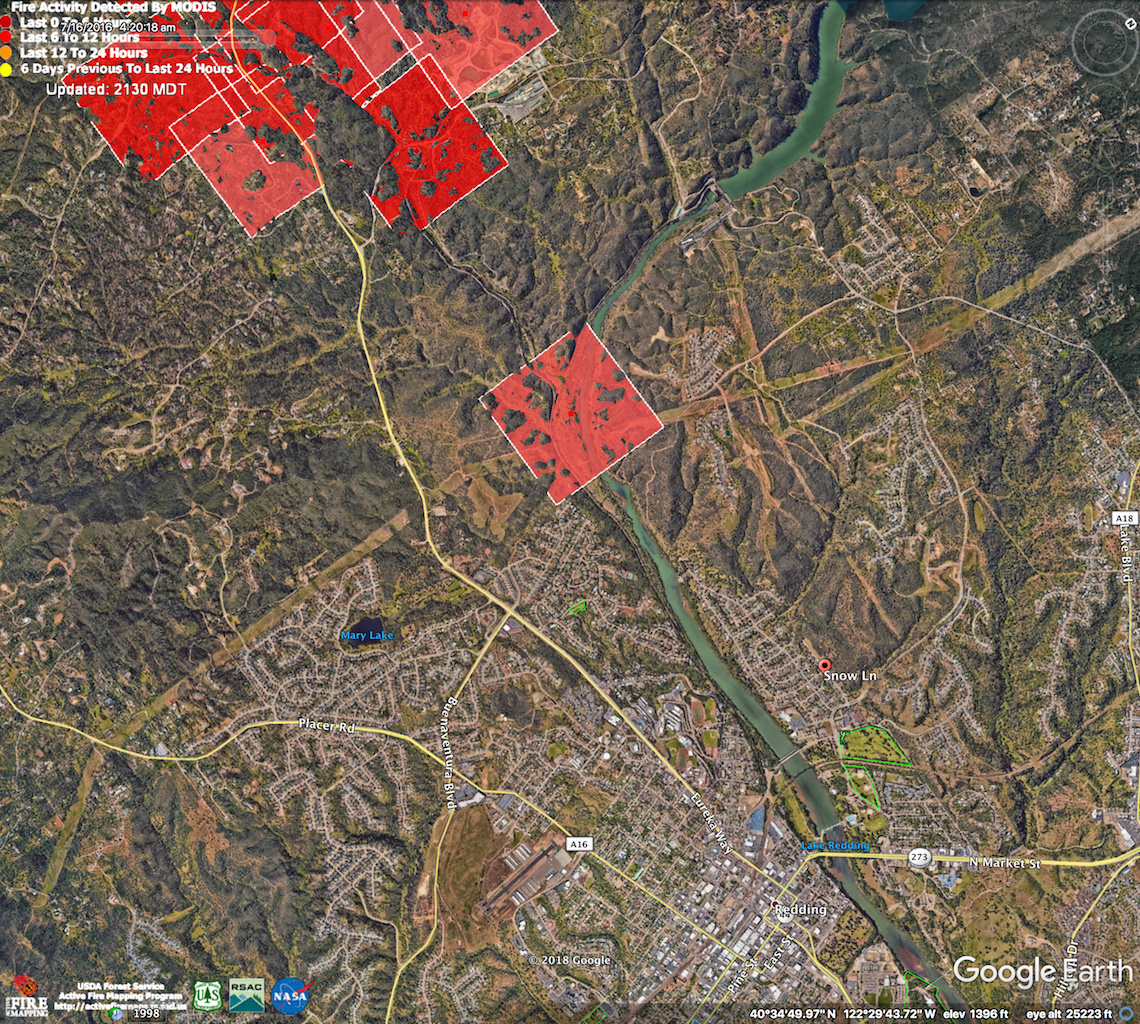
More homes than I care to count. Urban interface. Note: Per earlier report Snows Lane in relation to this IR from earlier today. Fire is most likely much farther into city now.

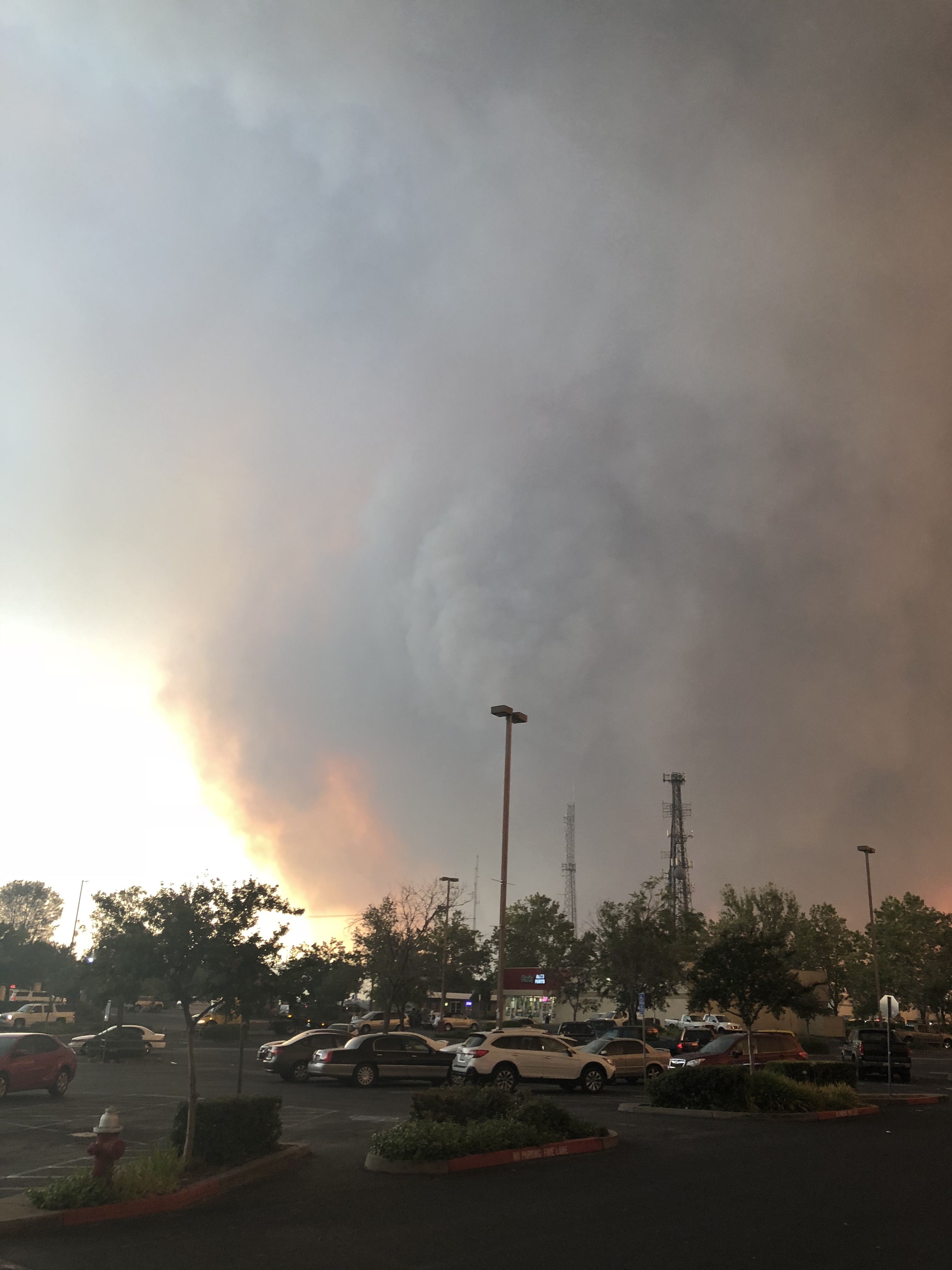
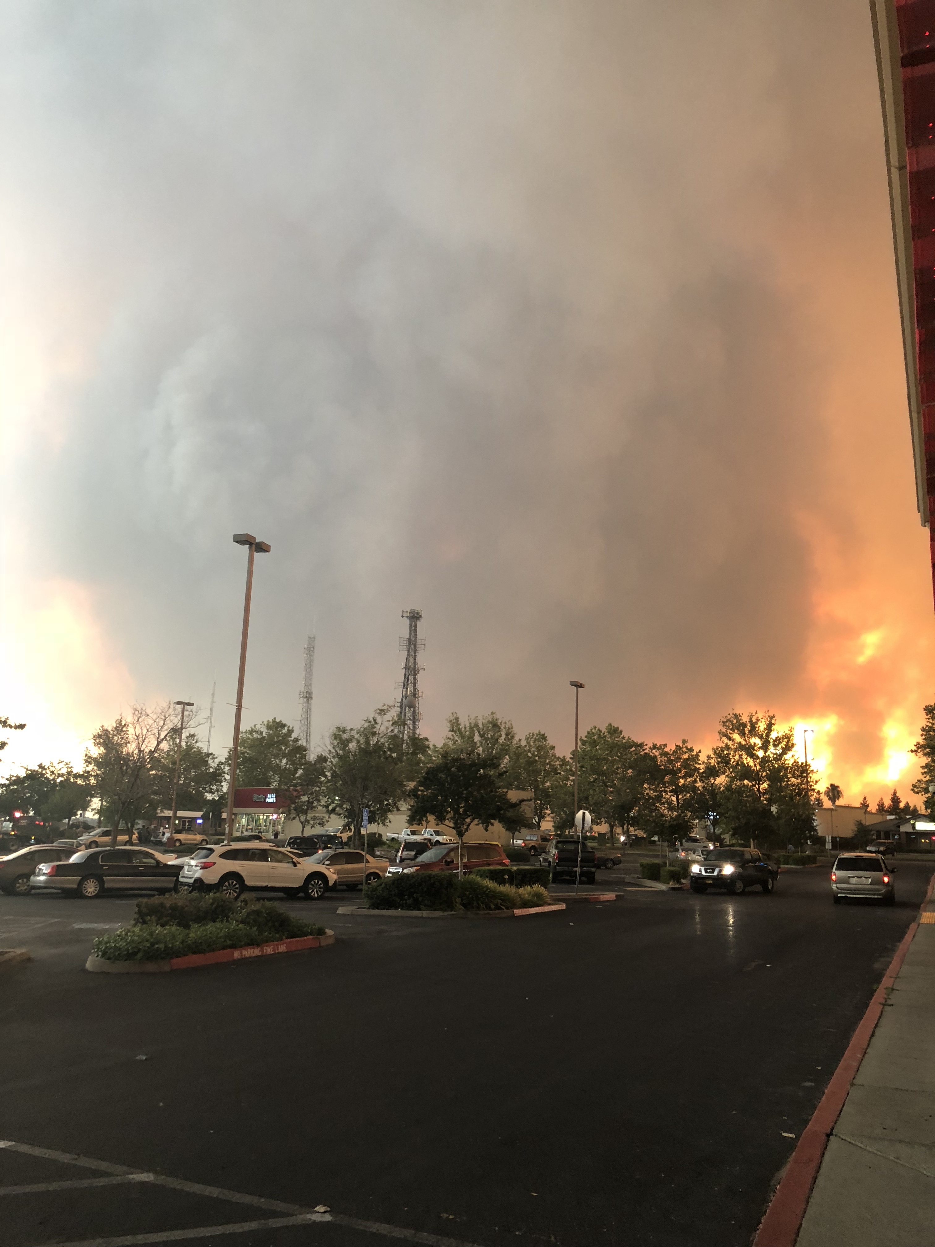
West Redding is about to look like Santa Rosa did last fall unless something changes in a hurry…
5 Likes
Anyone have a spot weather forecast for redding?
KRCR Ch 7 on live with evac info.
dan…do you have a link?
1 Like
No. But they are on line. Im watching on tv. Google them.
1 Like
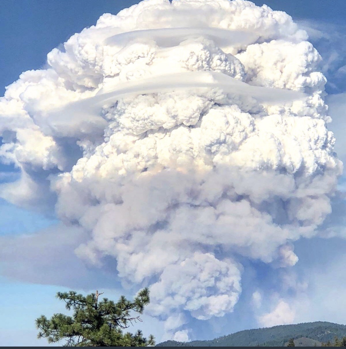
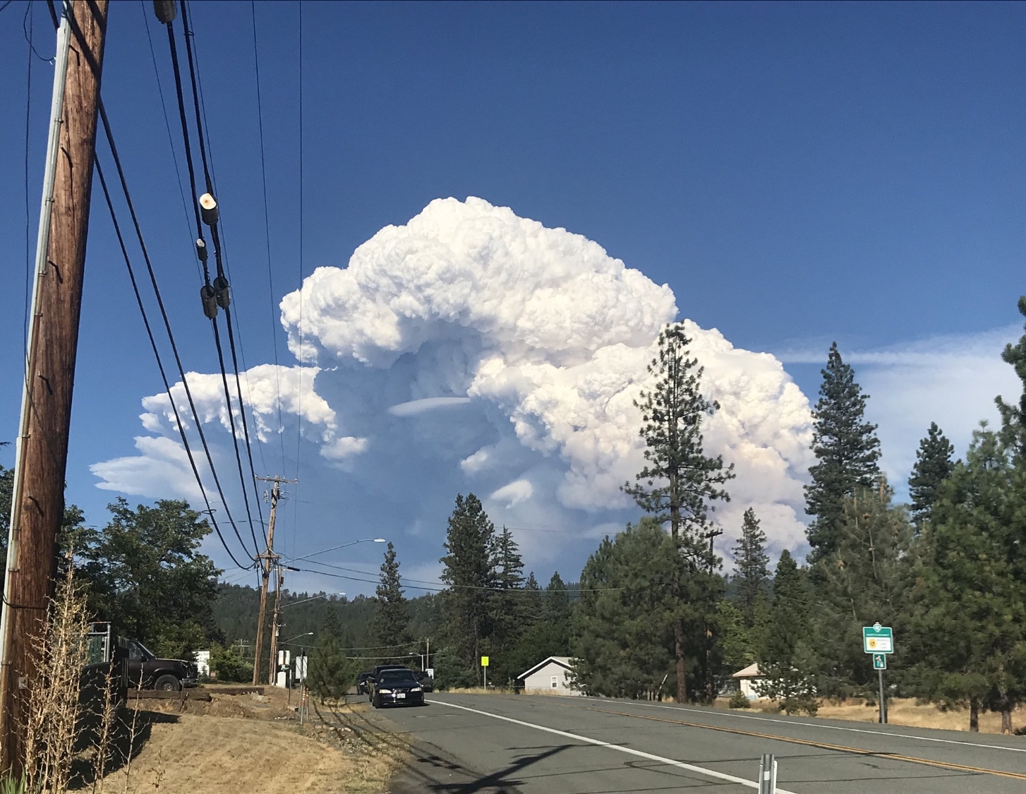
This sort of fire behavior at 2200 local is… astounding. We might have to consider this the new normal.
1 Like