Thank Chief, Great to see your still out there and involved. My Diablo was always safer when you were here. Miss ya!
If you are comfortable in Google Earth, the IMT is uploading daily firelines and fire points as Google Earth overlays on this incident. There is an impressive, but not surprising, amount of dozer line on this fire!
https://ftp.nifc.gov/public/incident_specific_data/calif_n/!CALFIRE/2018_Incidents/CA-SHU-007808_Carr/GIS/IncidentData/20180802/
(Google Earth files end with .kmz or .kml)
If you don’t have Google Earth installed, you can download it for free at earth.google.com - truly the best free mapping platform out there, IMHO!
10 Likes
I saw the notes about F, H and M and O pulling back. Any other updates?
1 Like
Yes, update please. Son worked Div H.
1 Like
Lots of smoke visible tonight from basecamp.
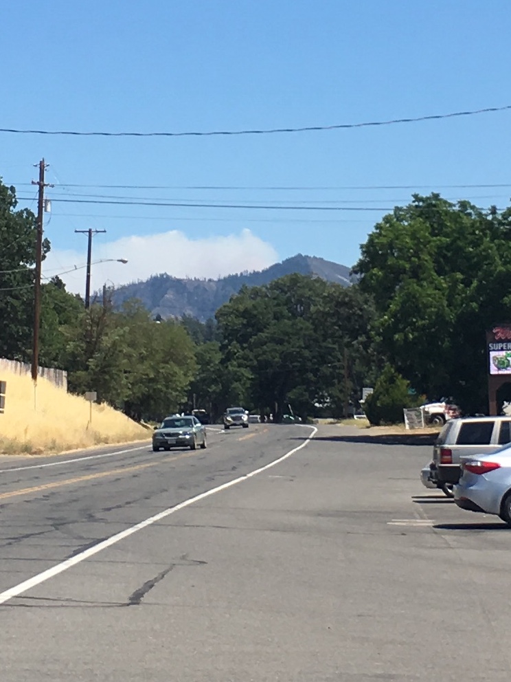
Sounds like it’s heating up on Fox trot, and from the looks of the column I would say that’s an understatment. This was taking from base camp in Anderson at around 2000hrs. image|666x500
The image won’t open

Is that looking from Trinity Lake?
1 Like
Yes. From the overlook, near Stuart Fork boat ramp.
1 Like
Evening update from Lewiston
From Katie Quinn
Sorry that is so late to you, but the power was out for several hours, so no internet. Your Lewiston Sparkies worked hard today- we didn’t feed too many of the fire crew this morning as so many were still out on the fire line. We fed over 75 tonight at the new station. Many thanks to Jim & Gretchen Deichler, Terry & Carol Gustine, Lenore Stancyk and Michael McAlister. Great crew of folks helping out.
Here is the message from your Fire Chief, Mel Deardorff. He just got home a few minutes ago.
Today was a tough day here in Lewiston. The firefighters really worked their butts off and we could see how tired they are. We put in two hose lays, each about 20,000 feet in length…never have done one so long! There were multiple pumps along the lay to keep the water pressure up.
One branch of the fire took off and is moving north east, away from Lewiston. The other fire headed south east at a slow rate. We dumped 100,000 gallons of retardant on it via the sky cranes. The fire has laid down for the night and the plan is to start again in the morning with the Helicopter drops.
There are more dozers and strike teams in Lewiston than I can count. their priority is the full protection of Lewiston. We have had limited fixed wing air craft today due to other fires throughout the state. The red glow that many of you saw tonight is from the fire that is moving away from Lewiston
Thank you all for your support and kind thoughts for all our firefighters on this most difficult operation. Mel
Folks – this is a seriously huge fire and is taking many, many resources to help stop it. It may be a few more days before you all can come home. I cannot imagine how difficult and stressful this is for you. Please talk to friends and family to help you thru this scary time. Help one another – that’s who we are.
8 Likes
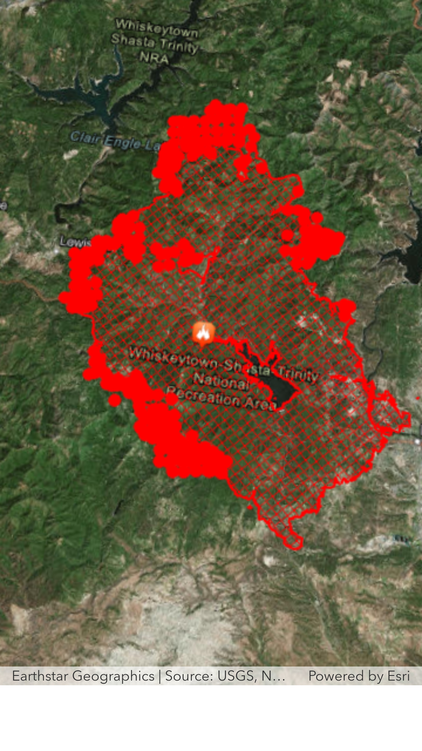
From last night’s IR map, it looks like the north end of the fire has crossed the dozer lines that had been put in place in Div M/O. On the Ops map, there is a “Management Action Point” line about 3 miles north of the current fire perimeter. I assume this is some sort of trigger point - anyone have an idea what new “management actions” might take place when the fire reaches that line?
More or less spi/feds are or have pushed a dozer line from somewhere on Interstate 5 at volmers or dog creek to the west. This trigger point I think sets in motion a plan to use that as the box!
2 Likes
Looking from the sidelines;
Between @pyrogeography IR posts and this simplistic overall IR image, and the forcast for the next 48 hours

In the next 36-48 hours the wind will be defined
starting out of the north today at 10 mph this evening gusts to 25 from SW
Then around the dial tomorrow NW,W,SW back to SW, respectively at 10-15.
That forcast can REALLY move this thing around on many fronts, given where there is active fire basically from 270* to 90* on a compass bearing.
Of interest to watch, the pocket of heat west of Shasta dam.
Safe out there gang
5 Likes
2 Likes
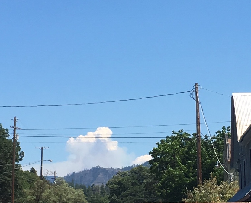
Not seeing anything about a new start east of Hayfork. Should be the Carr Fire.
2 Likes
Yes I’m thinking near lewiston, I just didn’t think I would be able to see that clearly from Hayfork town square!