These are back to back frames from the Bear Mtn cam. I believe the flames are in the shadow of the water falling.

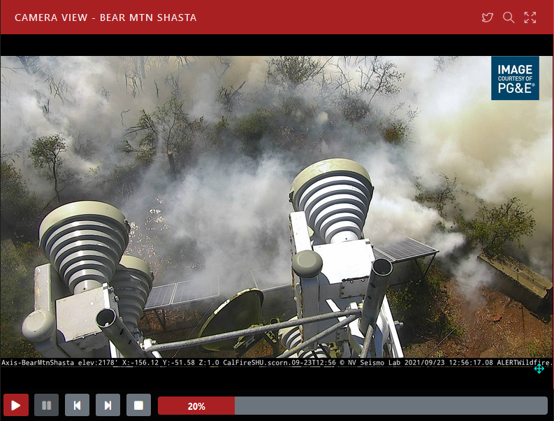
4 Likes
2 posts were merged into an existing topic: CA-SHU-Fawn???
Looks like Bear Mountain and Highline feeds are both dead as of 13:10
5 Likes
3 posts were merged into an existing topic: CA-SHU-Fawn???
Shasta College began evacuation at approx 12:48 pm.
3 Likes
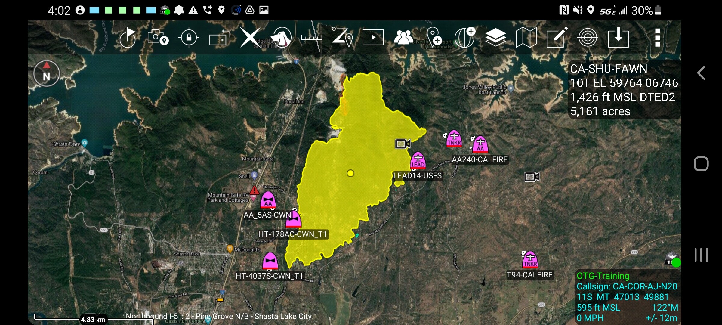
Fire started to push harder to west in past hour. Here is a SWAG map at 1pm, with 1200 perimeter in white.
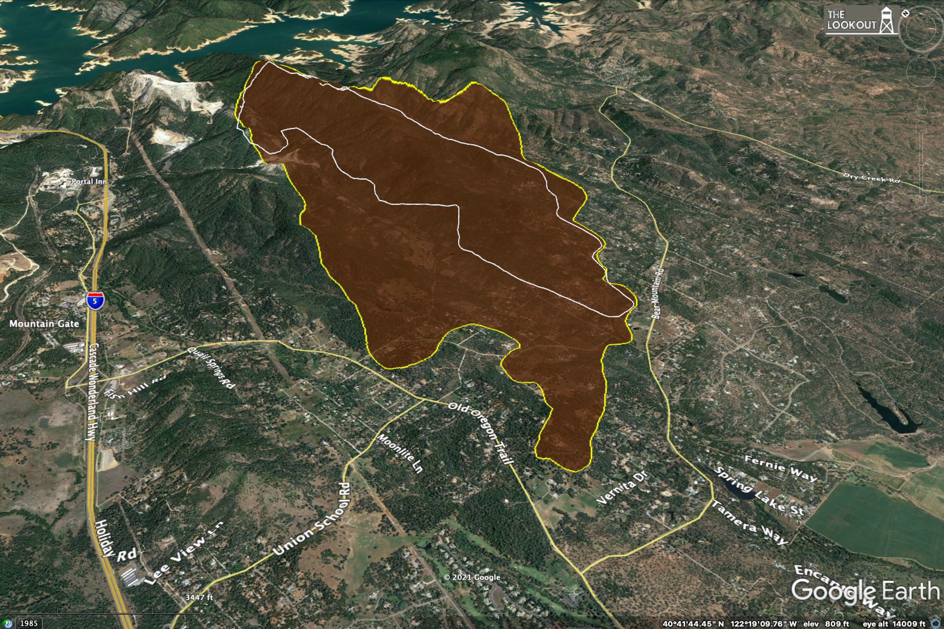
10 Likes
That’s a lot of movement.
Latest evac warning issued at approx 1:46 pm:
@ShastaSheriff
#FawnFire The Shasta County Sheriff’s Office is issuing an Evacuation WARNING for all roads west of Interstate 5 to the railroad tracks, south of Bass Dr to Old Oregon Trail. Please gather important belongings, medications, and pets and be prepared to evacuate.
5 Likes
Cal Fire Team 4 being activated
7 Likes
Really looks like they might be losing structures. The Shasta Lake 2 cam has multiple stationary dark columns that appear might be structures.
ALERTWildfire | Shasta Modoc
6 Likes
1 Like
There’s a real traffic jam of tankers working this thing. All 4 DC-10s at one point.
5 Likes
And three VLAT’s are off the screen in this shot since they are to/from reloading!
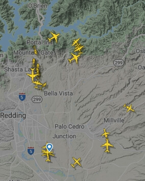
10 Likes
XSA assembling the T3 OES ST…
7 Likes
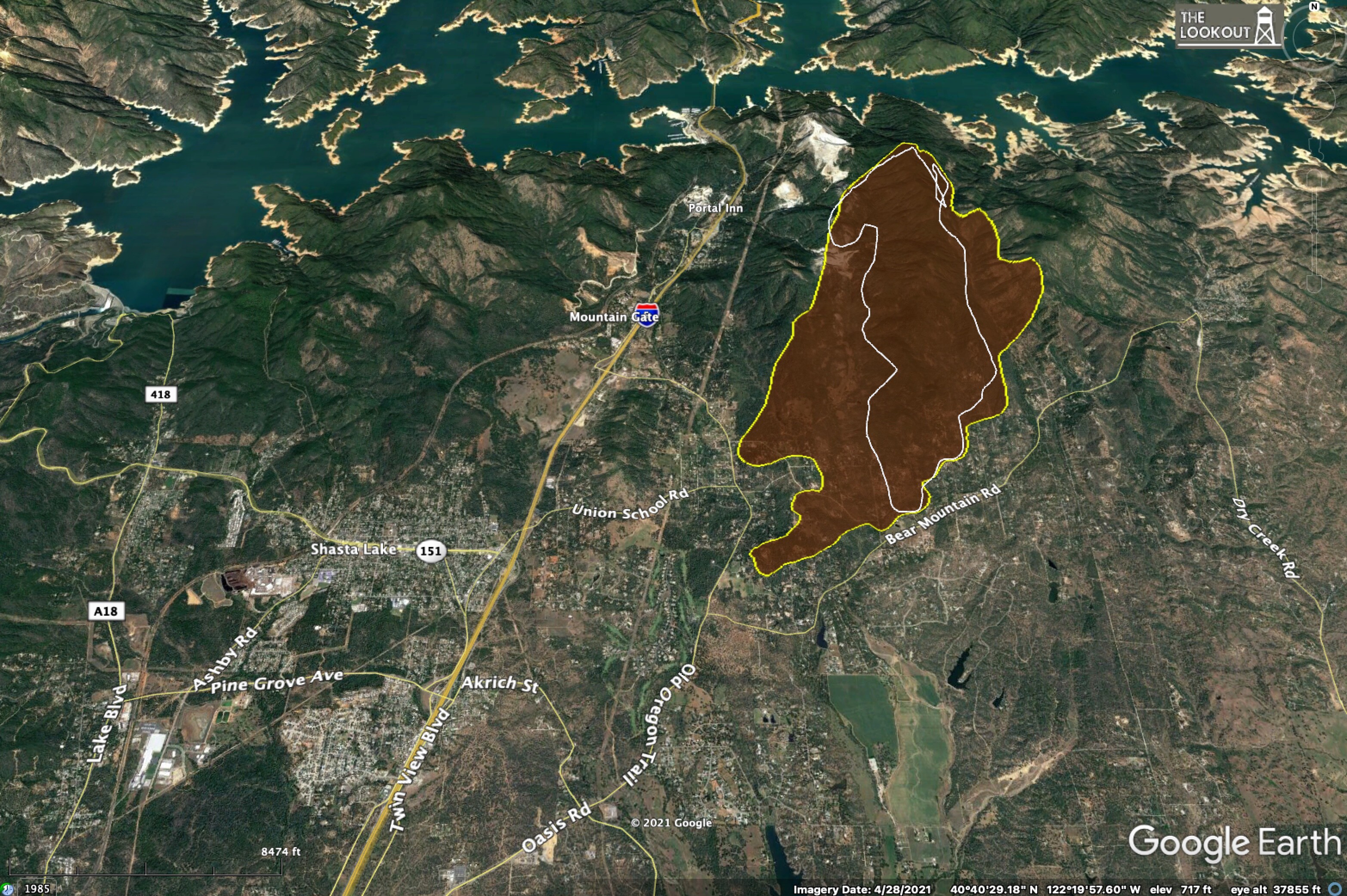
Using 334pm IR, fire has stayed north the entirety of Bear Mtn Road and is certainly moving to the WSW with the ENE push we’ve been seeing as the fire gets out of the aligned canyons and more exposed flats.
Fire has crossed west over Old Oregon Trail, between Bear Mtn and Union School Rds. It’s in the Little Acres and Hanna Way area and north. That fits the darker smoke columns seen from the Shasta Lake cams just south of Fish Mtn. It’s coming right up to the east side of Old Oregon Trail north of Union School Rd. up to Sunrise.
The right heel of this, NW corner near the quarry is still backing/flanking since it’s sheltered from the ENE wind influence the head is seeing. Air Attack seemed optimistic I5 will be the hold for this piece if not sooner.
Air Attack also now focusing on the Jones Valley side to pretreat ridges and the box while the air is clear and aircraft available and ground resources are following up with line.
6 Likes
Reported as 1,200 acres, 5% contained as of 3:24 pm but that acreage seems low even for that time of day compared to more recent reports.
https://www.fire.ca.gov/incidents/2021/9/22/fawn-fire/
One minute earlier a report says 2,000 structures threatened
https://www.fire.ca.gov/incidents/2021/9/22/fawn-fire/updates/30cd8c26-0e5d-43d0-b561-c44be910e840/
and…
Engines: 53
Water Tenders: 14
Helicopters: 6
Air Tankers:
Dozers: 14
Hand Crews: 18
Other: 555
2 Likes
It’s about 5,000 acres now
7 Likes
Here is a link to the City of Redding interactive evacuation map. It covers the Shasta Lake City area for this fire. ArcGIS Web Application
4 Likes
XYO putting together T3 ST.
2 Likes