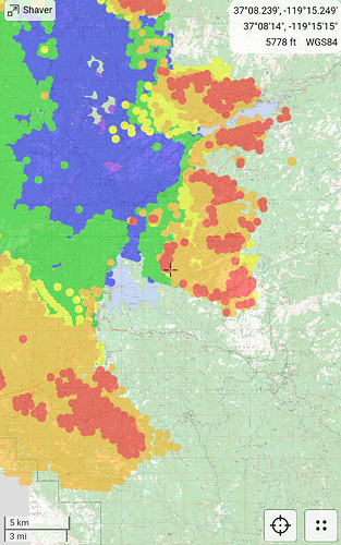
Is there an evacuation map for the north side? Specifically Oakhurst? Could only find Mariposa county maps, not Madera.
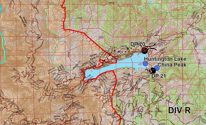
Fire is at China Peak Ski Resort.
Three strike engines and a water tender sent to ski resort. structures impacted.
75 acre spot west of courtwright reservoir. AA15 sighted it. Bringing tankers in from south. High winds are driving into a crown fire. Going to try drive it into a rocky area to slow it.
He’s got clear air to work it, unlike the main fire smoke. This spot plume is topping at 18k feet.
143,929 a/o 1738L via Inciweb
Spot by Courtright Reservoir now is ~150 acres per AA. Got about 6 retardant drops in @ the bottom of it.
Fingers crossed that the granite slabs throughout the area around Shaver helped with at least some of the homes up there
Creek South Zone IAP 9-9-2020 to 9-10-2020
Fire crossed the Lerona Fuel Break in Jose Basin. Div.29 requests 20 engines to Auberry rd. above the casino up to meadow lakes. Have not heard a plan for the engines. Fire is already approaching meadow lakes from the south. The mile high area might already be inside the fire. It has been creeping from the south given the meadow cam’s view.
FKU sending a IA response to hwy 168 bottom of 4 lane. There calling it a new fire, per S.O. report. Maybe a spot?
The fire was in mile high the night before and early yesterday morning and a few structures were lost.
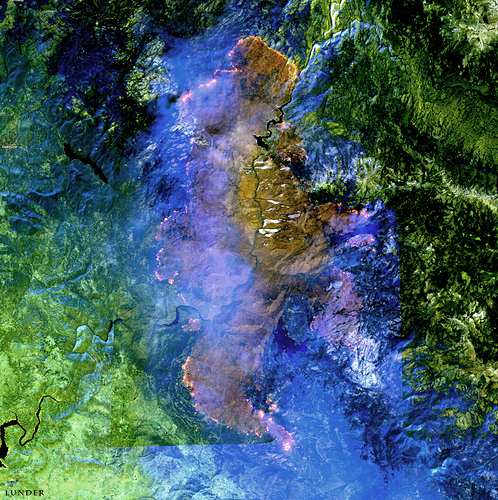
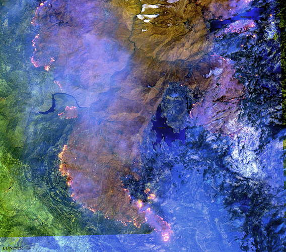
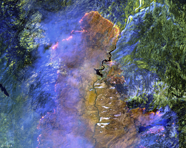
We got a Sentinel satellite orbit over the fire yesterday, 9/8/2020 at about 1100 hrs.
Here are some images I made from it - a great snapshot of the big picture on the fire.
Thanks for sharing the awesome sat images, and enhancements. Very fortunate to have the bird passing over the area.
Cal Topo Pics today: https://drive.google.com/drive/folders/1C34GsBdTbQN40F0SGbR3axMcFSStt3ga?usp=sharing
944 and 911 are round robin out of Mc Clellan supporting dozer line in Jose basin area. Anchoring at Sugar Loaf Mtn. Might be some other tankers in the mix. MODIS shows heat through out.
There were 6 S2 tankers working in the round robin load and return. Painted red along a line approximately from Mile High (south of meadow lakes) through meadow lakes (painted many structures), out into Jose Basin, near sugar loaf mtn and finishing at the san joaquin river. This was supporting dozer lines and engine crews through out those areas. They ran that up to cut off time.
Plans for tomarrow, if clear air again, is to bring the 2 VLATS and 4 LATS. Didn’t catch where they desired to use them. Something about heavy fuels and we need a lot of LATS.

