ICO is at Avocado Lake. They are setting up a Spike camp at Dinkey Cr campground
7 Likes
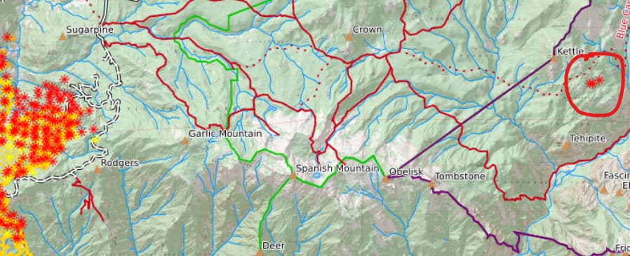
That’s the kettle fire, discovered last night or this morning. Its inside the park.
11 Likes
The fixed wing airshow is just AA, it’s burning hot right now.
6 Likes
Is the Teakettle Experimental Forest boiling over, today?
5 Likes
Significant activity
2 Likes
AA released the fixed wing once the north and south ends of the retardant line along side the dozer line were tied in around 1400. Believe that was mostly Div. T but probably some of Div. Q. Time enough to get out before it starts running away.
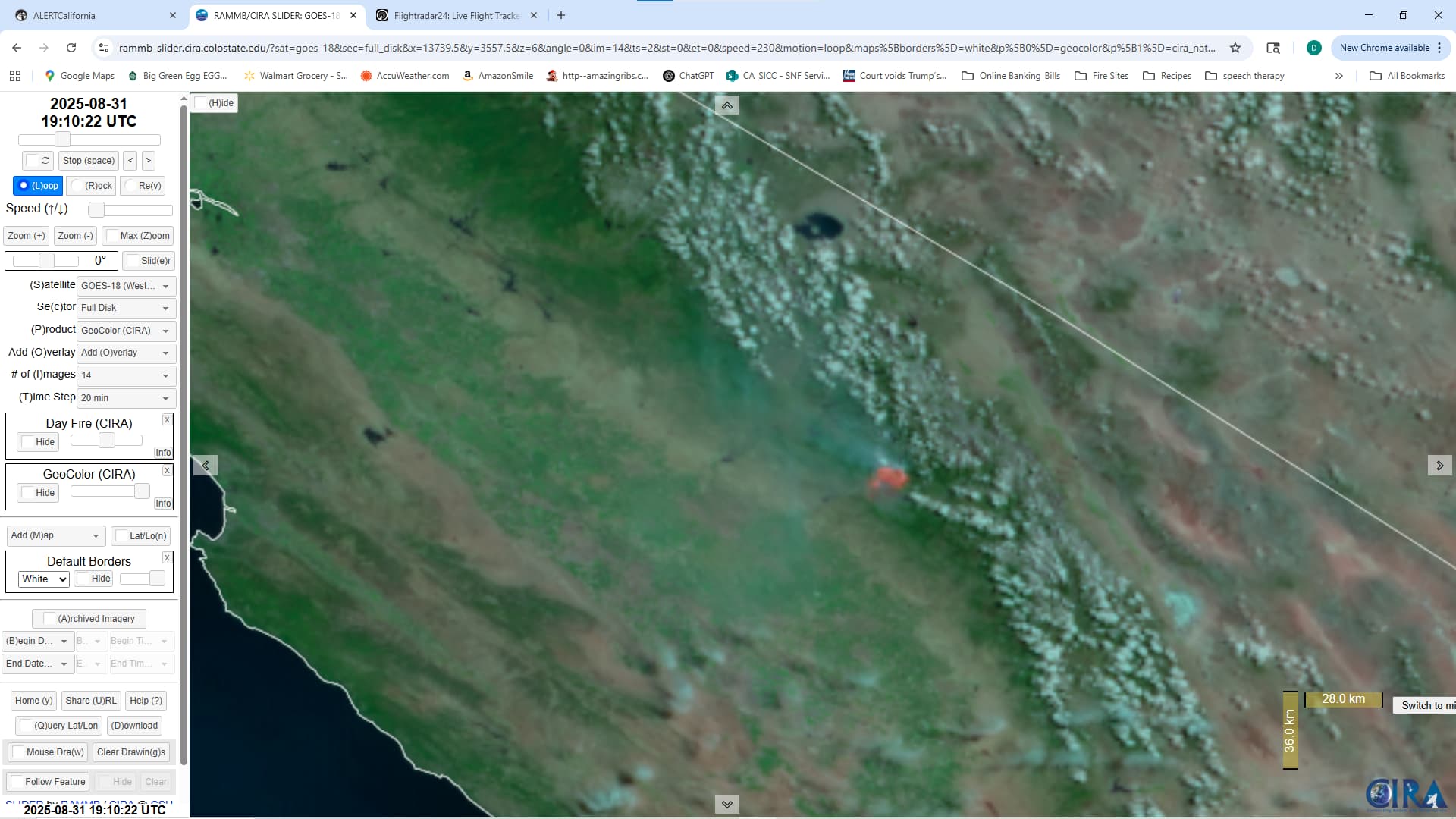
GOES-18 is hot.
There’s about 3 sky cranes out there.
Update 17:30, AA requests both scoopers, however one has no staffing. It’s that like using a buck rather then LAT’s. He’s just getting the one.
It will be at Fence Meadow Cam site in a day or two. Lot of lookers parked up there, get to work.
7 Likes
5 Likes
Its been full “throttleup” all day on this rascal - incoming/ongoing Wx not going to help any time soon! #staysafe #wildlanders
5 Likes
Hope all goes well for you up there and you don’t have to many bystanders.
Earlier AA reported a 5 acre spot near the Patterson mountain repeater that was running through the crown.
4 Likes
AA requested early up for 6 LAT’s and Lead Plane at 8am tomorrow. I suspect to knock down the spots and slop over’s.
Since Helco traffic is on AM I don’t have any proper receivers to hear that traffic from a long distance. But, Helco went off station late tonight from Div.Q area. There is a helibase/spot at Chandler Airport (West side of Fresno, quite the historical place).
9 Likes
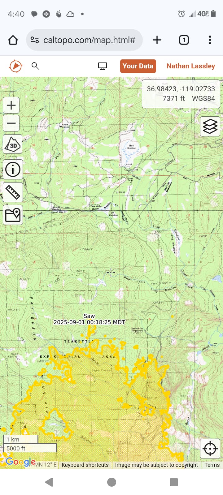
The teakettle has boiled over, it’s reached the Saw fire at sawmill flat(suppressed a few days ago)and spotted a mile up Crabtree trail.
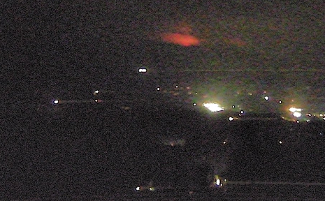
From goat mountain near bass lake.
8 Likes
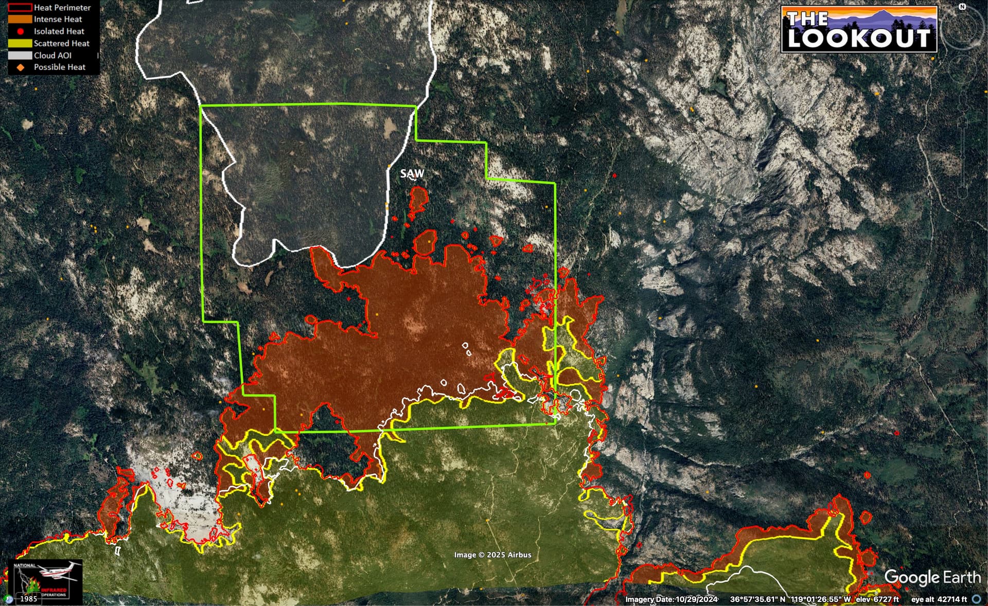
About 1,000 acres of the 3,000 acre Teakettle Experimental Forest (green outline) burned yesterday, largely under a big column. Lower white line is 24 hours of spread. Fire was mapped around 22:30 last night. Upper white line is cloud cover/no mapping.
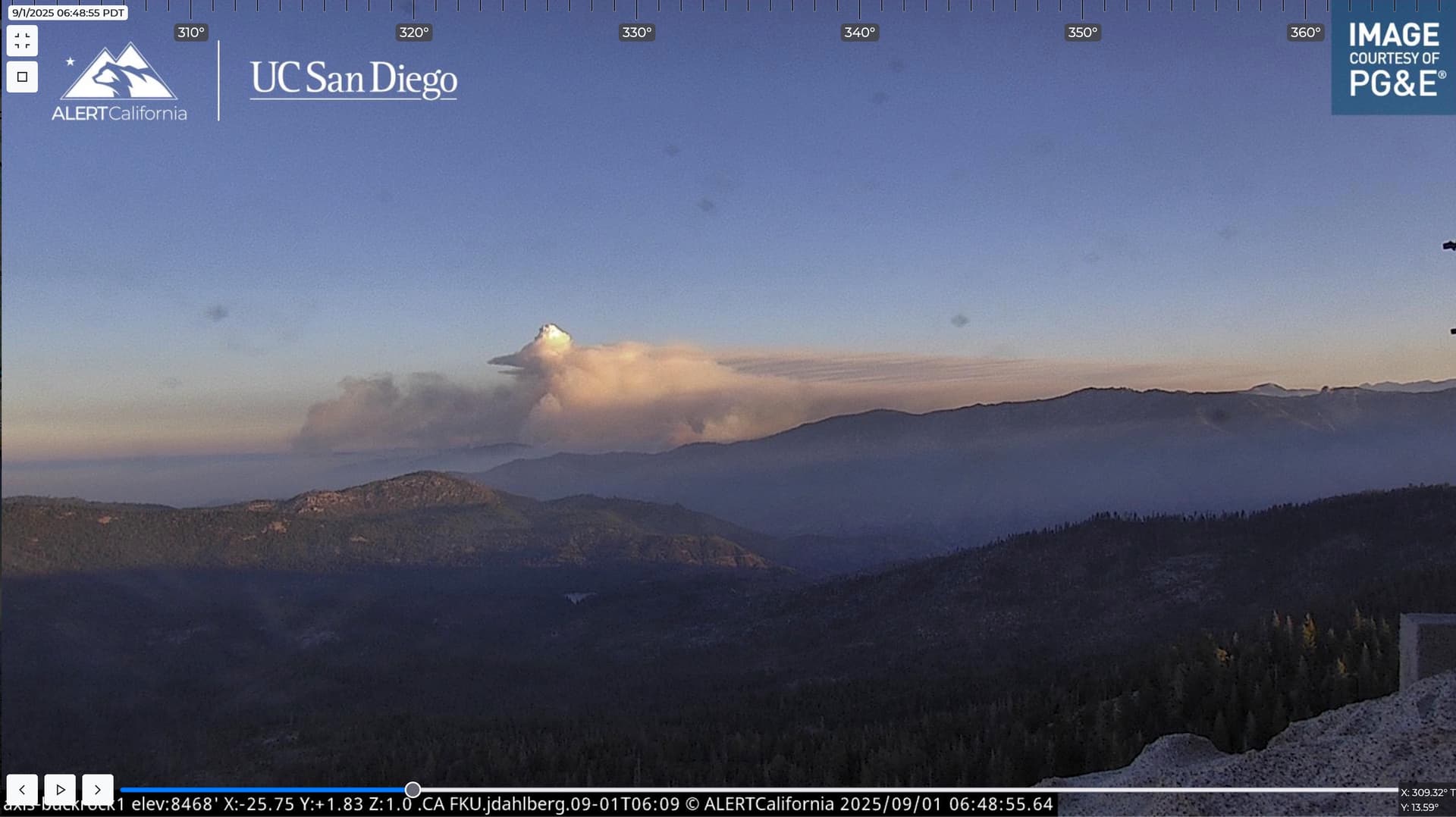
And now the fire is trying to cap out, before 7am. Gonna be a long couple weeks on the Sierra NF.
10 Likes
Forgive my ignorance here, but what is the teakettle experimental forest?
2 Likes
Update 14:40 Firewatch 51 mapped 26,943 acres. That’s a over night increase of 5k acres in 16 hours !
6 Likes
The new perimeter is a bit cheaty because they are including the island of unburned grass in the Basin Fire scar above the Kings River that was not included in prior perimeters.
5 Likes
Not surprised. Many years ago when FOBS walked the fire lines with a GPS to bring a perimeter to the GIS trailer, I was assigned to YNP and brought them a smaller fire then the copters had mapped it as. They were upset at me.
8 Likes
Back in the day, often we’d have over-mapped the fire with a loose helo flight or WAG on a topo, so when we got a new NIROPS (tight mapping) flight that showed a smaller fire, they’d just hold off reporting new growth for a couple days until the fire got to the number we already had put out there… You’d have a whiteboard in the GIS trailer with current ‘209/PIO acres’ vs ‘GIS acres’. Hard to get away with that now, what with FIRIS and WatchDuty getting a near realtime acreage 3 times a day.
5 Likes
And right on cue, new NIFC perimeter circa 23:44 last night is 24,851.1 acres (-2,131 acres from the last Intel perimeter) and properly shows the large unburnt areas east of Balch Camp. Would attach an image but the forum software is still hung up on that.
4 Likes